Sudden Valley, Washington

Last updated

Sudden Valley, Washington
Whatcom County Washington Incorporated and Unincorporated areas Sudden Valley Highlighted.svg
Location of Sudden Valley, Washington
Coordinates: 48°43′13″N122°20′25″W / 48.72028°N 122.34028°W / 48.72028; -122.34028
CountryUnited States
State Washington
County Whatcom
Area
  Total8.1 sq mi (21.0 km2)
  Land6.2 sq mi (16.1 km2)
  Water1.9 sq mi (4.8 km2)
Elevation
673 ft (205 m)
Population
 (2020)
  Total6,354
  Density780/sq mi (300/km2)
Time zone UTC-8 (Pacific (PST))
  Summer (DST) UTC-7 (PDT)
Area code 360
FIPS code 53-68200 [1]
GNIS feature ID1514482 [2]
Website http://suddenvalley.com/
Rufus Creek Falls in Lookout Mountain Preserve, which is within Sudden Valley. Rufus Creek is a tributary to Beaver Creek, which flows to Lake Whatcom. Rufus Creek Falls in Lookout Mountain Preserve, Sudden Valley, WA.jpg
Rufus Creek Falls in Lookout Mountain Preserve, which is within Sudden Valley. Rufus Creek is a tributary to Beaver Creek, which flows to Lake Whatcom.

Sudden Valley is a census-designated place (CDP) just outside of Bellingham in Whatcom County, Washington. The population was 6,354 at the 2020 census, down from 6,441 at the 2010 census. [3]

Contents

Sudden Valley is the second-largest homeowner association in western Washington, with over 7,000 residents.[ citation needed ] There are eleven neighborhood parks, miles of hiking trails in woodlands and along Lake Whatcom, beaches, two pools, sports fields, tennis courts, a basketball court, a recreation center with full gym, an 18-hole golf course, a library, a marina and more.

History

The Community Association of Sudden Valley began as "the Ranch". The original owner of the area was Banning Austin. In 1949, Austin sold the land to Glen and Betty Corning, who named it "the Ranch" and lived there with their children until in 1968 they sold 1,200 acres of property for $1.8 million. The new owner was Ken Sanwick of Sudden Valley Inc. Sanwick envisioned the land as "Sudden Valley Undevelopment" and wanted to preserve the natural surroundings while still incorporating homes into the wilderness. By 1969, the County Commissioners approved the first plan for 158 lots west of Lake Whatcom Boulevard. The first property owner was Mae Schatz, who bought Division 1 Lot 112 in May 1969.

In the 1970s, the Valley changed ownership a few times. SunMark Inc. bought out the Sanwick Corporation in 1973, and in 1975 Continental Mortgage Investors took over from SunMark as the developer. This was short-lived, as CMI declared bankruptcy not long after. In December 1976, ownership and control was transferred to the newly named Sudden Valley Community Association. The owner of SunMark, Roger Ufkes, who happened to be the son of the first property owner, formed the original Board of Directors for the new Community Association. Ufkes served on the Board for two years in the early 1970s and is credited for urging property owners to buy the golf course and all its subsidiaries for $1.4 million. The one‐time assessment fee of $4,000 was voted on and passed by the residents. From this point on, the SVCA held the title to all the roads, parks, greenbelt, recreation facilities, marina, airstrip, and the country club. Sudden Valley was well on its way to becoming the community it is today.

Ever since its conception in the late 1960s, over 7,000 residents, plus an abundance of wildlife call it home. Sudden Valley offers activities for all ages and abilities, including a marina, library, parks, playgrounds, miles of hiking trails, and an 18-hole golf course designed by the architect Ted Robinson.

The community center recreation area includes a state‐of‐the‐art fitness center and an outdoor 25 yard swimming pool. A "quiet pool" is also available near the library. [4] [5]

Demographics

As of the census [1] of 2000, there were 4,165 people, 1,675 households, and 1,185 families residing in the CDP. The population density was 668.8 people per square mile (258.1/km2). There were 1,984 housing units at an average density of 318.6/sq mi (123.0/km2). The racial makeup of the CDP was 92.24% White, 0.79% African American, 1.61% Native American, 1.97% Asian, 0.12% Pacific Islander, 0.91% from other races, and 2.35% from two or more races. Hispanic or Latino of any race were 3.03% of the population.

There were 1,675 households, out of which 31.4% had children under the age of 18 living with them, 61.5% were married couples living together, 6.1% had a female householder with no husband present, and 29.2% were non-families. 20.7% of all households were made up of individuals, and 4.9% had someone living alone who was 65 years of age or older. The average household size was 2.49 and the average family size was 2.87.

In the CDP, the age distribution of the population shows 23.5% under the age of 18, 8.2% from 18 to 24, 30.5% from 25 to 44, 28.3% from 45 to 64, and 9.6% who were 65 years of age or older. The median age was 38 years. For every 100 females, there were 105.7 males. For every 100 females age 18 and over, there were 102.2 males.

The median income for a household in the CDP was $51,843, and the median income for a family was $60,250. Males had a median income of $45,568 versus $33,565 for females. The per capita income for the CDP was $24,563. About 4.3% of families and 6.4% of the population were below the poverty line, including 6.0% of those under age 18 and 4.0% of those age 65 or over.

Related Research Articles

<span class="mw-page-title-main">Sun City, Arizona</span> Retirement community city in Arizona, United States

Sun City is an unincorporated community and census-designated place in Maricopa County, Arizona, United States, that is located within the Phoenix metropolitan area.

<span class="mw-page-title-main">Sun City West, Arizona</span> City in Arizona, United States

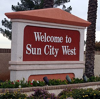
Sun City West is an unincorporated community and census-designated place (CDP) in Maricopa County, Arizona, United States. The population was 25,806 at the 2020 census.

<span class="mw-page-title-main">Green Valley, Arizona</span> CDP in Pima County, Arizona

Green Valley is an unincorporated community and census-designated place (CDP) in Pima County, Arizona, United States. The population was 22,616 at the 2020 census.

<span class="mw-page-title-main">Hot Springs Village, Arkansas</span> Census-designated place in Arkansas, United States

Hot Springs Village is a census-designated place (CDP) in Garland and Saline counties in the U.S. state of Arkansas. As it is situated in two counties, it is also part of two metropolitan statistical areas. The portion in Garland County is within the Hot Springs Metropolitan Statistical Area, while the portion extending into Saline County is part of the Little Rock–North Little Rock–Conway Metropolitan Statistical Area. The population was 12,807 at the 2010 census. It is the largest gated community in the United States.

<span class="mw-page-title-main">El Dorado Hills, California</span> Census-designated place in California, United States

El Dorado Hills is an unincorporated town and census-designated place in El Dorado County, California. Located in the Greater Sacramento region of Northern California, it had a population of 50,547 at the 2020 census, up from 42,108 at the 2010 census.

<span class="mw-page-title-main">Bear Valley Springs, California</span> Place in California, United States

Bear Valley Springs is a guarded-gate community in Kern County, California, United States. The unincorporated community is in the Tehachapi Mountains and is part of the greater Tehachapi area. The elevation ranges from 4,121 feet (1,256 m) to 6,934 feet (2,113 m). The population fluctuates between a low during the winter months when snow is common, to a high in the summer months when its elevation keeps it much cooler than surrounding areas and major cities. The population was 5,172 at the 2010 census, up from 4,232 at the 2000 census. For statistical purposes, the United States Census Bureau has defined Bear Valley Springs as a census-designated place (CDP). The census definition of the area may not precisely correspond to local understanding of the area with the same name.

<span class="mw-page-title-main">Hidden Valley Lake, California</span> Census-designated place in California, United States

Hidden Valley Lake is a census-designated place (CDP) and gated subdivision in Lake County, California, United States. The population was 6,235 at the 2020 census, up from 5,579 at the 2010 census. Today, it is a CID known as Hidden Valley Lake Association (HVLA).

<span class="mw-page-title-main">Tamalpais-Homestead Valley, California</span> Census-designated place in California, United States

Tamalpais-Homestead Valley is a census-designated place (CDP) in Marin County, California, United States. The population was 11,492 at the 2020 census.

<span class="mw-page-title-main">Alta Sierra, California</span> Census-designated place in Nevada County, California, U.S.

Alta Sierra is a census-designated place (CDP) in Nevada County, California, United States. The population was 6,911 at the 2010 census, up from 6,522 at the 2000 census.

<span class="mw-page-title-main">Oak View, California</span> Place in California, United States

Oak View is an unincorporated community in Ventura County, California, United States. The community is located along the Ventura River in a narrow valley between the towns of Casitas Springs (south) and Mira Monte (north). Lake Casitas and the community of Ojai are also nearby. At the 2010 census, the population of Oak View was 4,066, down from 4,199 at the 2000 census, making it the third largest community between Ojai and the city of Ventura. For statistical purposes, the United States Census Bureau has defined Oak View as a census-designated place (CDP). The census definition of the area may not precisely correspond to local understanding of the area with the same name.

<span class="mw-page-title-main">Spring Creek, Nevada</span> CDP in Nevada, United States

Spring Creek is a census-designated place (CDP) in central Elko County, in northeastern Nevada in the western United States. It mainly serves as a bedroom community for the businesses and industries in and around the nearby city of Elko. It is part of the Elko Micropolitan Statistical Area. The population was 12,361 at the 2010 census.

<span class="mw-page-title-main">Staatsburg, New York</span> Hamlet and CDP in New York, United States

Staatsburg is a hamlet and census-designated place (CDP) in Hyde Park, a town in Dutchess County, New York, United States. The population was 703 at the 2020 census. It is part of the Poughkeepsie–Newburgh–Middletown, NY Metropolitan Statistical Area as well as the larger New York–Newark–Bridgeport, NY-NJ-CT-PA Combined Statistical Area.

<span class="mw-page-title-main">Garden Home–Whitford, Oregon</span> CDP in Oregon, United States

Garden Home-Whitford is a census-designated place (CDP) consisting of the neighborhoods of Garden Home and the smaller Whitford area in Washington County, Oregon, United States. They are located in the southwest hills of Portland, near Beaverton. As of the 2020 census, the CDP population was 7,081.

<span class="mw-page-title-main">Treasure Lake, Pennsylvania</span> Census-designated place in Pennsylvania, United States

Treasure Lake is a census-designated place (CDP) in Clearfield County, Pennsylvania, United States. The population was 5,460 at the 2020 census. Treasure Lake is a semi-private, gated community centered around its namesake.

Fairfield Glade is a resort, retirement community and census-designated place (CDP) in Cumberland County, Tennessee, United States. The population was 9,152 at the 2020 census, up over 3,000 from the 2010 census.

<span class="mw-page-title-main">Lake Kiowa, Texas</span> Census-designated place in Texas, United States

Lake Kiowa is a census-designated place (CDP) in Cooke County, Texas, United States, the majority of which consists of the gated community of the same name.

<span class="mw-page-title-main">Rose Hill, Fairfax County, Virginia</span> Census-designated place in Virginia, United States

Rose Hill is a census-designated place (CDP) in Fairfax County, Virginia, United States. The population was 20,226 at the 2010 census. Built in the mid-1950s, Rose Hill is the largest of the subdivisions that make up the CDP, which is just southwest of Alexandria; others include Wilton Woods, Burgundy Village, and Winslow Heights. Street addresses are in Alexandria ZIP codes 22310, 22303 and 22315.

<span class="mw-page-title-main">Montclair, Virginia</span> Census-designated place in Virginia, United States

Montclair is a census-designated place (CDP) in Prince William County, Virginia, United States. The population was 22,279 in the 2020 census. An affluent residential community surrounding a man-made lake and golf course, development began in the late 1960s and new home construction ended during the 1990s.

<span class="mw-page-title-main">Acme, Washington</span> Census-designated place in Washington, United States

Acme is a rural unincorporated community, and census-designated place in Whatcom County, Washington, United States. There is a general store, post office, gas station, diner, elementary school and two churches located there. Acme is also included in, and the source-name for, a larger census-designated place (CDP). The Census Bureau no longer tracks the population for the village itself, but for the entire CDP the population was 229 at the 2020 census, down from 246 at the 2010 census.

<span class="mw-page-title-main">Glacier, Washington</span> CDP in Washington, United States

Glacier is a census-designated place in the North Fork Nooksack River Valley, at an elevation of 906 ft., just 10 miles northwest of the Mount Baker Summit towering nearly 10,000 ft above it, in Whatcom County, Washington, United States. The population was 300 at the 2020 census.

References

  1. 1 2 "U.S. Census website". United States Census Bureau . Retrieved January 31, 2008.
  2. "US Board on Geographic Names". United States Geological Survey. October 25, 2007. Retrieved January 31, 2008.
  3. "Census Bureau profile: Sudden Valley, Washington". United States Census Bureau. May 2023. Retrieved May 9, 2024.
  4. "About Sudden Valley - Sudden Valley Community Association". suddenvalley.com. Archived from the original on October 3, 2018.
  5. "Sudden Valley Amenities".