Marietta-Alderwood, Washington

Last updated
Marietta-Alderwood, Washington
Whatcom County Washington Incorporated and Unincorporated areas Marietta-Alderwood Highlighted.svg
Location of Marietta-Alderwood, Washington
Coordinates: 48°46′51″N122°32′38″W / 48.78083°N 122.54389°W / 48.78083; -122.54389 Coordinates: 48°46′51″N122°32′38″W / 48.78083°N 122.54389°W / 48.78083; -122.54389
CountryUnited States
State Washington
County Whatcom
Area
  Total7.4 sq mi (19.2 km2)
  Land6.0 sq mi (15.5 km2)
  Water1.4 sq mi (3.7 km2)
Population
 (2010)
  Total3,906
  Density601.6/sq mi (232.3/km2)
Time zone UTC-8 (Pacific (PST))
  Summer (DST) UTC-7 (PDT)
FIPS code 53-43491 [1]

Marietta-Alderwood is a census-designated place (CDP) in Whatcom County, Washington, United States. The population was 3,906 at the 2010 census. Parts of Marietta-Alderwood were annexed into Bellingham in 2019. [2]

Contents

Geography

Marietta-Alderwood is located at 48°46′51″N122°32′38″W / 48.78083°N 122.54389°W / 48.78083; -122.54389 (48.780895, -122.544015). [3]

According to the United States Census Bureau, the CDP has a total area of 7.4 square miles (19 km2), of which, 6.0 square miles (16 km2) of it is land and 1.5 square miles (3.9 km2) of it (19.54%) is water.

Climate

This region experiences warm (but not hot) and dry summers, with no average monthly temperatures above 71.6 °F. According to the Köppen Climate Classification system, Marietta-Alderwood has a warm-summer Mediterranean climate, abbreviated "Csb" on climate maps. [4]

Climate data for Marietta
MonthJanFebMarAprMayJunJulAugSepOctNovDecYear
Record high °F (°C)66
(19)
68
(20)
78
(26)
83
(28)
86
(30)
101
(38)
99
(37)
98
(37)
91
(33)
83
(28)
67
(19)
67
(19)
112
(44)
Average high °F (°C)43.5
(6.4)
47.7
(8.7)
52.7
(11.5)
59.5
(15.3)
65.7
(18.7)
70.1
(21.2)
73.9
(23.3)
73.9
(23.3)
68.7
(20.4)
60.2
(15.7)
51.4
(10.8)
45.9
(7.7)
59.4
(15.2)
Average low °F (°C)30.5
(−0.8)
32.4
(0.2)
35.1
(1.7)
38.8
(3.8)
43.6
(6.4)
48.7
(9.3)
50.9
(10.5)
50.3
(10.2)
45.6
(7.6)
41
(5)
35.8
(2.1)
32.9
(0.5)
40.5
(4.7)
Record low °F (°C)−1
(−18)
0
(−18)
11
(−12)
23
(−5)
26
(−3)
33
(1)
36
(2)
33
(1)
27
(−3)
22
(−6)
6
(−14)
6
(−14)
−1
(−18)
Average precipitation inches (mm)4.24
(108)
2.98
(76)
2.95
(75)
2.1
(53)
1.49
(38)
1.55
(39)
0.9
(23)
0.94
(24)
1.86
(47)
3.4
(86)
4.3
(110)
4.81
(122)
31.53
(801)
Average snowfall inches (cm)3.3
(8.4)
2.6
(6.6)
1.5
(3.8)
0.1
(0.25)
0
(0)
0
(0)
0
(0)
0
(0)
0
(0)
0
(0)
0.3
(0.76)
2.7
(6.9)
10.5
(27)
Average precipitation days1714141198458121617135
Source: [5]

Demographics

As of the census [1] of 2000, there were 3,594 people, 1,517 households, and 929 families residing in the CDP. The population density was 601.6 people per square mile (232.3 people/km2). There were 1,606 housing units at an average density of 268.8 per square mile (103.8/km2). The racial makeup of the CDP was 84.20% White, 1.11% African American, 3.84% Native American, 5.04% Asian, 0.39% Pacific Islander, 2.84% from other races, and 2.59% from two or more races. Hispanic or Latino of any race were 5.98% of the population.

There were 1,517 households, out of which 28.7% had children under the age of 18 living with them, 45.5% were married couples living together, 11.6% had a female householder with no husband present, and 38.7% were non-families. 27.4% of all households were made up of individuals, and 6.8% had someone living alone who was 65 years of age or older. The average household size was 2.37 and the average family size was 2.90.

In the CDP, the age distribution of the population shows 23.0% under the age of 18, 12.2% from 18 to 24, 30.2% from 25 to 44, 23.8% from 45 to 64, and 10.8% who were 65 years of age or older. The median age was 35 years. For every 100 females, there were 101.1 males. For every 100 females age 18 and over, there were 97.9 males.

The median income for a household in the CDP was $39,902, and the median income for a family was $43,194. Males had a median income of $35,875 versus $27,167 for females. The per capita income for the CDP was $21,322. About 11.3% of families and 15.6% of the population were below the poverty line, including 25.5% of those under age 18 and 8.2% of those age 65 or over.

Related Research Articles

<span class="mw-page-title-main">Hornbrook, California</span> Census-designated place in California, United States

Hornbrook is a census-designated place (CDP) in Siskiyou County, California, United States. Its population is 266 as of the 2020 census, up from 248 from the 2010 census. It was named by the Southern Pacific Railroad in 1886, derived from the brook that ran through David Horn's property.

<span class="mw-page-title-main">Hazel Dell North, Washington</span> Former CDP in Washington, United States

Hazel Dell North was the name of a census-designated place in Clark County, Washington, United States. The population was 9,261 at the 2000 census. For the 2010 census the U.S. Census Bureau combined Hazel Dell North and South to form a single CDP named "Hazel Dell".

<span class="mw-page-title-main">Whidbey Island Station (CDP), Washington</span> Census-designated place in Washington, United States

Whidbey Island Station is a census-designated place (CDP) in Island County, Washington, United States. The population was 1,541 at the 2010 census. It is the primary location of Naval Air Station Whidbey Island. Prior to 2010 the CDP was known as Ault Field.

<span class="mw-page-title-main">Hobart, Washington</span> Census-designated place in Washington, United States

Hobart is an unincorporated community and census-designated place (CDP) in King County, Washington, United States. The population was 6,767 at the 2020 census.

<span class="mw-page-title-main">Lakeland South, Washington</span> Census-designated place in Washington, United States

Lakeland South is a census-designated place (CDP) in King County, Washington, United States. The population was 11,574 at the 2010 census.

<span class="mw-page-title-main">Parkwood, Washington</span> CDP in Washington, United States

Parkwood is a census-designated place (CDP) in Kitsap County, Washington, United States. The population was 7,126 at the 2010 census.

<span class="mw-page-title-main">Clear Lake, Skagit County, Washington</span> CDP in Washington, United States

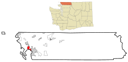
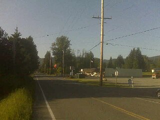
Clear Lake is a census-designated place (CDP) in Skagit County, Washington, United States. The population was 1,002 at the 2010 census. It is included in the Mount Vernon–Anacortes, Washington Metropolitan Statistical Area.

<span class="mw-page-title-main">Alderwood Manor, Washington</span> CDP in Washington, United States

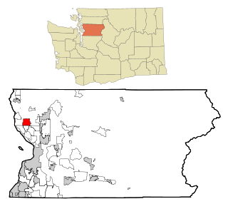
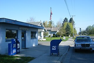
Alderwood Manor is a census-designated place (CDP) in Snohomish County, Washington, United States. The population was 10,198 at the 2020 census. Prior to the 2000 census, Alderwood Manor was counted as part of the Alderwood Manor-Bothell North CDP.

<span class="mw-page-title-main">Lake Goodwin, Washington</span> Former CDP in Washington, United States

Lake Goodwin is a former census-designated place (CDP) in Snohomish County, Washington, United States. The population was 3,354 at the 2000 census. The CDP was discontinued at the 2010 census.

<span class="mw-page-title-main">Lake Ketchum, Washington</span> CDP in Washington, United States

Lake Ketchum is a census-designated place (CDP) in Snohomish County, Washington, United States. The population was 930 at the 2010 census.

<span class="mw-page-title-main">North Marysville, Washington</span> CDP in Washington, United States

North Marysville is a census-designated place (CDP) in Snohomish County, Washington, United States. The majority of the community and its 20,000 residents were annexed into the city of Marysville in 2009. The population was 108 at the 2010 census.

<span class="mw-page-title-main">Custer, Washington</span> CDP in Washington, United States

Custer is a census-designated place (CDP) in Whatcom County, Washington, United States. The population was 366 at the 2010 census.

<span class="mw-page-title-main">Deming, Washington</span> CDP in Washington, United States

Deming is a census-designated place (CDP) in Whatcom County, Washington, United States, along the Nooksack River. It is named for its first postmaster, George Deming. The community population was 353 at the 2010 census.

<span class="mw-page-title-main">Geneva, Washington</span> CDP in Washington, United States

Geneva is an unincorporated area and census-designated place (CDP) in Whatcom County, Washington, United States. The population was 2,321 at the 2010 census.

<span class="mw-page-title-main">Kendall, Washington</span> CDP in Washington, United States

Kendall is a census-designated place (CDP) in Whatcom County, Washington, United States. The population was 191 at the 2010 census.

<span class="mw-page-title-main">Maple Falls, Washington</span> CDP in Washington, United States

Maple Falls is a census-designated place (CDP) in Whatcom County, Washington, United States. The population was 324 at the 2010 census.

<span class="mw-page-title-main">Nooksack, Washington</span> City in Washington, United States

Nooksack is a city in Whatcom County, Washington, 8 km (5.0 mi) south of the border with Canada. The population was 1,338 at the 2010 census. Despite the name, it is actually located right next to the upper stream of the Sumas River, and is 2 km (1.2 mi) northeast of the nearest bank of the Nooksack River.

<span class="mw-page-title-main">Boaz, West Virginia</span> CDP in West Virginia, United States

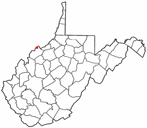
Boaz is a census-designated place (CDP) in Wood County, West Virginia, United States. It is part of the Parkersburg-Marietta-Vienna, WV-OH Metropolitan Statistical Area. As of the 2020 census, the CDP population was 1,321.

<span class="mw-page-title-main">Washington, West Virginia</span> CDP in West Virginia, United States

Washington is a census-designated place (CDP) in Wood County, West Virginia, United States, situated along the Ohio River. It is part of the Parkersburg-Marietta-Vienna, WV-OH Metropolitan Statistical Area. The population was 1,175 at the 2010 census. The community was named after George Washington.

Box Elder is an unincorporated community and census-designated place (CDP) in Hill County in the U.S. state of Montana. The population was 87 at the 2010 census. The population was 794 at the 2000 census, but before 2010 the Box Elder CDP was split into the current much-smaller Box Elder CDP, while most of the former CDP area went into the new Rocky Boy West CDP. Box Elder is the headquarters of the Chippewa-Cree tribe.

References

  1. 1 2 "U.S. Census website". United States Census Bureau . Retrieved 2008-01-31.
  2. Teehan, Joe (March 27, 2019). "Bellingham city limits expanding through annexations". KGMI . Retrieved July 13, 2021.
  3. "US Gazetteer files: 2010, 2000, and 1990". United States Census Bureau. 2011-02-12. Retrieved 2011-04-23.
  4. Climate Summary for Marietta-Alderwood, Washington
  5. "MARIETTA, WASHINGTON (455028)". Western Regional Climate Center. Retrieved November 18, 2015.