The village was laid out by John Park in 1841 and named Marion after the Revolutionary War hero General Francis Marion. The Indiana Register first advertised lots for sale on September 1, 1841. Marion became incorporated as a borough in June 1869. The post office used a name distinct from the town (Brady Post Office) until December 26, 1890 when both were changed to Marion Center.
In 1885, New York banker Adrien Iselin purchased the Buffalo, Rochester, and Pittsburgh Railway. A branch near the Jefferson-Indiana County Line (Indiana Junction) led south into Indiana County ending at Vintondale. The tracks from Jefferson County into Indiana County were first laid near Juneau in October 1902. Trains ran through Marion Center by April 1903. The first passenger train stopped at Marion Center on May 3, 1904. The last train, the Hoodlbug, left on June 10, 1950.[4]
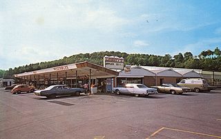
Marion Center had a vibrant community life in the late 19th and early 20th centuries. Two hotels were erected on Main Street in the 19th century. Hotel Marion, built in 1879 by Alexander Adams, had 15 rooms and was three stories tall. It burned in the 1920s. The second hotel, Mahoning House, at the corner of Main and Manor Streets, occupied the site of the former general store operated by McLaughlin, Kinter, and Company. Horatio Simons converted it to a hotel on June 1, 1904. It was torn down in the 1930s to make way for Harry Black's service station. A dentist office (operated by Dr. L. N. Park) and a pharmacy (operated by William Griffith) were located on Main Street near the store of H. P. Wetzel (located at Craig and Main Streets). By 1887, Wetzel had built a store measuring 20- by 40 feet (12m). He later added an additional 40 feet (12m) to the store. He was succeeded by Frank Wetzel who operated a grocery store on the site until the 1940s.[4]
A summer normal school operated in the borough in the early 20th century. Joseph Weaver instructed students during the approximately 12-week course. Passing the superintendent's exam upon completion of the program licensed one to teach in the county's common schools. The first school in Marion Center, a log building on North Manor Street, burned in 1834. Its first teacher was William Work. A second school was built on the same site in 1848. A third building was erected in the 1860s. The North Manor Street site became home to the area's high school (1916–1929).[4] It was torn down in the late 2000s to make way for a public park (named after famous local artist, Linton Park).
According to the United States Census Bureau, the borough has a total area of 0.8 square miles (2.1km2), all land.
Pennsylvania Route 403 runs through the center of Marion Center, entering from the south where it becomes Manor Street at the borough line. It then turns west onto Main Street and reaches its northern terminus just west of the borough at U.S. Route 119. The two main streets of the borough run perpendicular to one another: Manor Street, north-south, and Main Street, east-west. Both streets are broken up by short, one-block alleys.
Main Street in Marion Center as viewed from US 119. Marion Center Area High School is located on the left and the East Mahoning Community Park is on the right.
Marion Center is connected to the villages of Deckers Point (via Deckers Point Road, concurrent with Main Street to the borough line), Dixonville (via South Manor Street, concurrent with PA-403 to the borough line), and Rochester Mills (via Richmond Road). Though US-119 does not pass through the borough, it connects the town to the micropolitan area of Indiana to the south and the larger borough of Punxsutawney to the north.
One unnamed tributary of Pine Run flows through the borough. It runs generally east-west and flows just south of Park Avenue, connecting to Pine Run west of the borough line and east of U.S. Highway 119. This stream has two in-flows. The first is very narrow, being small enough to easily step across, and drains the east side of the hill in the southeast section of the borough. The second drains the west side of the same hill and connects to the main flow behind the post office near its intersection with South Manor Street. All three minor water flows are perennial (though the very narrow one does dry up when rainfall is low) and have sources within the borough limits. Pine Run connects to Crooked Creek (a tributary of the Allegheny River) about five miles (8km) south of the borough.
Education
The borough is part of the Marion Center Area School District. The high school (Marion Center Area High School) and elementary school (W.A McCreery Elementary School) are located west of the borough between the borough line and U.S. Route 119. There are no institutions of higher education in the borough.
On June 21, 2002, Sam Erwin walked into the school district office with a .32-caliber pistol. One secretary was injured attempting to escape over an embankment wall outside the office building, and the assistant to the superintendent was non-fatally wounded in the right leg after being shot by the assailant in the lobby of the district office. Indiana County police said the incident concerned a dispute Erwin had with the district over his wife, Nancy Erwin (formerly Mogle), an eighth grade algebra teacher, losing her teaching position in 2001 after teaching for 21 years. Sam Erwin pleaded guilty to one count of attempted criminal homicide and one count of aggravated assault. Nancy Erwin pleaded guilty to one count of complicity to aggravated assault. As a result, she lost her teaching license.[6]
Industry
Marion Center exports concrete and cement products through its supplier, Marion Center Supply. The central offices of Marion Center Supply are located in Marion Center.
Finance
Marion Center Bank, a state-chartered bank formerly named Marion Center National Bank, opened in the summer of 1905. In 1933, Marion Center Bank earned the reputation of "the bank that did not close during the Depression" after President Franklin D. Roosevelt ordered all banks to close for a Bank Holiday on March 4. Instead of closing, Marion Center Bank pulled its screen down half-way and continued to operate.
In 1958, Marion Center Bank added a drive-thru window to its current facility. This was the first of its kind in Indiana County. A second lane was added in 1979. Marion Center Bank expanded to a second location in Clymer on December 6, 1984. Today, the bank has seven locations across Indiana, Jefferson, Armstrong, and Cambria counties: Dayton (1997), Big Run (1997), and Punxsutawney (2000).[7] In June 2011, Marion Center Bank moved to its new headquarters in Indiana.[8] On November 8, 2012, Marion Center Bank opened its eighth branch in Hastings, PA, its first branch in Cambria County.
Marion Center Bank's corporate headquarters is located at 1271 Indian Springs Rd in Indiana, PA.
As of the census[10] of 2010, there were 451 people, 173 households, and 129 families residing in the borough. The population density was 605.3 inhabitants per square mile (233.7/km2). There were 194 housing units at an average density of 256.4 per square mile (99.0/km2), with 173 occupied and 21 vacant. Of the occupied units, 113 were owner-occupied, or 66.1% of the total population. The racial makeup of the borough was 98.9% White, 0.44% African American, 0.22% Asian, 0.22% American Indian and Alaska Native, and 0.22% listed as "other". There were no individuals of Hispanic descent in the borough.
There were 173 households, out of which 41% had children under the age of 18 living with them, 58.4% were married couples living together, 13.3% had a female householder with no husband present, and 24.9% were non-families. 21.4% of all households were made up of individuals, and 11.0% had someone living alone who was 65 years of age or older. The average household size was 2.61 and the average family size was 3.07.
In the borough the population was spread out, with 31.9% under the age of 19, 5.8% from 20 to 24, 14.4% from 25 to 34, 18.2% from 35 to 49, 17.9% from 50 to 64, and 11.5% who were 65 years of age or older. The median age was 37 years. Males comprised 46.3% of the population and females comprised 53.7% of the population.
The median income for a household in the borough was $27,625, and the median income for a family was $31,875. Males had a median income of $23,125 versus $20,625 for females. The per capita income for the borough was $12,048. About 15.5% of families and 16.6% of the population were below the poverty line, including 18.4% of those under age 18 and 12.2% of those age 65 or over.
Government
The municipality type is borough. The borough office is located at 1000 North Manor Street. The borough council holds meetings on the first Monday of each month at 7:30p.m. in the municipal building. The current mayor is John Walker.
The borough is part of the 41st state senate district, represented by Republican Joe Pittman and the 66th state house district, represented by Republican Brian Smith. The borough is located within the 15th congressional district of the United States House of Representatives, currently represented by Republican Glenn Thompson. Current senators for Pennsylvania are Democrat Bob Casey, Jr. and Democrat John Fetterman.
Indiana County is a county in the Commonwealth of Pennsylvania. It is located in the west central part of Pennsylvania. As of the 2020 census, the population was 83,246. Its county seat is Indiana. Indiana County comprises the Indiana, PA Micropolitan Statistical Area, which is also included in the Pittsburgh-New Castle-Weirton, PA-WV-OH Combined Statistical Area.
Marion County is located in the U.S. state of Indiana. The 2020 United States census reported a population of 977,203, making it the largest county in the state and 51st most populated county in the country. Indianapolis is the county seat, the state capital, and largest city. Marion County is consolidated with Indianapolis through an arrangement known as Unigov.
Morgantown is a town at the intersection of Indiana state routes 135 and 252 in Jackson Township, Morgan County, in the U.S. state of Indiana. The population was 1,014 at the 2020 census.
Carnegie is a borough in Allegheny County, Pennsylvania, United States, and is part of the Pittsburgh metropolitan area. The population was 8,134 in the 2020 census.
Hyndman is a borough in Bedford County, Pennsylvania, United States. As of the 2020 census, the population was 859.
Birdsboro is a borough in Berks County, Pennsylvania, United States. It is located along the Schuylkill River 8 miles (13 km) southeast of Reading. As of the 2010 census, it had a population of 5,163. Birdsboro's economy had historically been rooted in large foundries and machine shops, none of which remain in operation today.
Hamburg is a borough in Berks County, Pennsylvania, United States. The population was 4,270 at the 2020 census. The town is thought to have been named after Hamburg, Germany, but this is likely to have been a corruption of Bad Homburg.
Newry is a borough in Blair County, Pennsylvania, United States. The population was 231 at the 2020 census. It is part of the Altoona, PA Metropolitan Statistical Area and one of the communities comprising the Altoona Urban Area.
Williamsburg in Morrisons Cove, is a borough in Blair County, Pennsylvania, United States. The population was 1,241 at the 2020 census. It is part of the Altoona, PA Metropolitan Statistical Area.
Oxford is a borough in Chester County, Pennsylvania, United States. Oxford is the closest town to Lincoln University. The population was 5,733 at the 2020 census.
Brady Township is a township in Clearfield County, Pennsylvania, United States. The population was 1,942 at the 2020 census.
Clearfield is a borough and the county seat of Clearfield County, Pennsylvania, United States. As of the 2020 census the population was 5,962 people, making it the second most populous community in Clearfield County, behind DuBois. The borough is part of the DuBois, PA Micropolitan Statistical Area, as well as the larger State College-DuBois, PA Combined Statistical Area. The settled area surrounding the borough consists of the nearby census-designated places of Hyde and Plymptonville, which combined with Clearfield have a population of approximately 8,237 people.
Upland is a borough in Delaware County, Pennsylvania, United States. Upland is governed by an elected seven-member borough council. The population was 3,239 at the 2010 census, up from 2,974 at the 2000 census.
Rices Landing is a borough in Greene County, Pennsylvania, United States. The population was 426 at the 2020 census.
Homer City is a borough in Indiana County, Pennsylvania, United States. The population was 1,746 at the 2020 census. Homer City is located in the Indiana metro area. The community was named for the famous Greek poet Homer by founder William Wilson in 1854. It was incorporated as a borough on Thursday, September 26, 1872.
Dickson City is a borough in Lackawanna County, Pennsylvania, 4 miles (6 km) north of Scranton. Coal mining was an important industry in the past. The borough's population peaked at 12,395 in 1930 and was 6,051 at the 2020 census.
Fredonia is a borough in central Mercer County, Pennsylvania, United States. The population was 435 at the 2020 census. It is part of the Youngstown–Warren metropolitan area.
Hatboro is a borough in Montgomery County, Pennsylvania, United States. The population was 8,238 at the 2020 census.
Turbotville Borough is a borough in Northumberland County, Pennsylvania, United States. The population was 705 at the 2010 census.
Delmont is a borough in Westmoreland County, Pennsylvania. The population was 2,592 at the 2020 census.
This page is based on this Wikipedia article Text is available under the CC BY-SA 4.0 license; additional terms may apply. Images, videos and audio are available under their respective licenses.