Masonboro, North Carolina

Last updated

Masonboro, North Carolina
City of Wilmington
Masonboro Loop Road (December 2022).jpg
Masonboro Loop Road in Wilmington (originally located in Masonboro before annexation)
NCMap-doton-Masonboro.PNG
Location of Masonboro, North Carolina
Coordinates: 34°10′12″N77°52′16″W / 34.17000°N 77.87111°W / 34.17000; -77.87111
Country United States
State North Carolina
County New Hanover
City Wilmington
Area
  Total6.6 sq mi (17.2 km2)
  Land6.0 sq mi (15.5 km2)
  Water0.6 sq mi (1.7 km2)
Elevation
23 ft (7 m)
Time zone UTC-5 (Eastern (EST))
  Summer (DST) UTC-4 (EDT)

Masonboro was a census-designated place (CDP) in New Hanover County, North Carolina. The last census count in 2000 was 11,812. Masonboro was located southeast of Wilmington near the Atlantic coast.

Contents

History

The Grand Lodge of Ancient Free and Accepted Masons of North Carolina lists the existence of a Masonic Lodge in Masonborough, New Hanover county. The name is "Solomon" which was chartered by England in 1735. A post office called Masonboro operated from 1890 until 1891. [1] A large share of the early settlers being Masons caused the name to be selected. [2]

In 2000, it was fully annexed into the city limits of Wilmington. [3]

Geography

Masonboro was located at 34°10′12″N77°52′16″W / 34.169953°N 77.871134°W / 34.169953; -77.871134 . [4]

According to the United States Census Bureau, the CDP had a total area of 6.6 square miles (17 km2), of which 6.0 square miles (15.5 km2) is land and 0.6 square miles (1.6 km2) (9.65%) is water.

Demographics

At the 2003 census, [5] median household income in Masonboro was 78,913, compared to median state income of 45,906. At the 2000 census, [6] there were 11,812 people, 4,253 households and 3,474 families residing in the CDP. The population density was 1,970.5 inhabitants per square mile (760.8/km2). There were 4,452 housing units at an average density of 742.7 per square mile (286.8/km2). The racial makeup of the CDP was 93.62% White, 3.35% African American, 0.28% Native American, 1.32% Asian, 0.02% Pacific Islander, 0.32% from other races, and 1.09% from two or more races. Hispanic or Latino of any race were 1.17% of the population.

There were 4,253 households, of which 42.3% had children under the age of 18 living with them, 73.0% were married couples living together, 6.9% had a female householder with no husband present, and 18.3% were non-families. 14.3% of all households were made up of individuals, and 4.6% had someone living alone who was 65 years of age or older. The average household size was 2.78 and the average family size was 3.08.

28.8% of the population were under the age of 18, 5.0% from 18 to 24, 30.3% from 25 to 44, 26.7% from 45 to 64, and 9.2% who were 65 years of age or older. The median age was 38 years. For every 100 females, there were 96.0 males. For every 100 females age 18 and over, there were 92.8 males.

The median household income was $65,110 and the median family income was $68,005. Males had a median income of $51,707 compared with $34,740 for females. The per capita income for the CDP was $27,519. About 2.9% of families and 4.3% of the population were below the poverty line, including 5.8% of those under age 18 and 2.5% of those age 65 or over.

Related Research Articles

<span class="mw-page-title-main">Wilmington Manor, Delaware</span> CDP in Delaware, United States

Wilmington Manor is a census-designated place (CDP) in north-eastern New Castle County, Delaware, United States. The population was 7,889 at the 2010 census.

<span class="mw-page-title-main">North Weeki Wachee, Florida</span> Census-designated place in Florida, United States

North Weeki Wachee is a census-designated place (CDP) in Hernando County, Florida, United States. The population was 8,524 at the 2010 census, up from 4,253 at the 2000 census.

<span class="mw-page-title-main">Fairfield Harbour, North Carolina</span> Census-designated place in North Carolina, United States

Fairfield Harbour is an unincorporated community and census-designated place (CDP) in Craven County, North Carolina, United States. The population was 2,952 at the 2010 census, up from 1,983 in 2000. It is part of the New Bern, North Carolina Metropolitan Statistical Area.

<span class="mw-page-title-main">Westport, North Carolina</span> Census-designated place in North Carolina, United States

Westport is an unincorporated community and census-designated place (CDP) located in Lincoln County, North Carolina, United States. The population of the CDP was 4,026 at the 2010 census, up from 2,006 at the 2000 census. The community's name comes from its location on the west side of Lake Norman.

<span class="mw-page-title-main">Bayshore, North Carolina</span> CDP in North Carolina, United States

Bayshore is a census-designated place (CDP) in New Hanover County, North Carolina, United States. The population was 3,393 at the 2010 census. It is part of the Wilmington Metropolitan Statistical Area.

<span class="mw-page-title-main">Carolina Beach, North Carolina</span> Town in North Carolina, United States

Carolina Beach is a beach town in New Hanover County, North Carolina, United States, situated about 12 miles (19 km) south of Wilmington International Airport in southeastern coastal North Carolina. As of the 2020 census, the city population was 6,564. It is part of the Wilmington metropolitan area. The community of Wilmington Beach was annexed by the town in 2000.

<span class="mw-page-title-main">Castle Hayne, North Carolina</span> CDP in North Carolina, United States

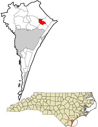
Castle Hayne is a census-designated place (CDP) in New Hanover County, North Carolina, United States. The population was 1,202 at the 2010 census, up from 1,116 in 2000. It is part of the Wilmington Metropolitan Statistical Area.

<span class="mw-page-title-main">Hightsville, North Carolina</span> CDP in North Carolina, United States

Hightsville is a census-designated place (CDP) in New Hanover County, North Carolina, United States. The population was 739 at the 2010 census. It is part of the Wilmington Metropolitan Statistical Area.

<span class="mw-page-title-main">Kings Grant, North Carolina</span> CDP in North Carolina, United States

Kings Grant is a census-designated place (CDP) in New Hanover County, North Carolina, United States. The population was 8,113 at the 2010 census, up from 7,738 in 2000. It is part of the Wilmington Metropolitan Statistical Area.

<span class="mw-page-title-main">Kirkland, North Carolina</span> CDP in North Carolina, United States

Kirkland, more commonly known as Porter's Neck, was a census-designated place (CDP) in New Hanover County, North Carolina, United States. Redesignated as Porters Neck CDP for the 2010 census, the population was 6,204. It is part of the Wilmington Metropolitan Statistical Area.

<span class="mw-page-title-main">Murraysville, North Carolina</span> CDP in North Carolina, United States

Murraysville is a census-designated place (CDP) in New Hanover County, North Carolina, United States. The population was 14,215 at the 2010 census, up from 7,279 in 2000. It is part of the Wilmington Metropolitan Statistical Area.

<span class="mw-page-title-main">Myrtle Grove, North Carolina</span> CDP in North Carolina, United States

Myrtle Grove is a census-designated place (CDP) in New Hanover County, North Carolina, United States. The population was 8,875 at the 2010 census. It is part of the Wilmington Metropolitan Statistical Area.

<span class="mw-page-title-main">Ogden, North Carolina</span> CDP in North Carolina, United States

Ogden is a census-designated place (CDP) in New Hanover County, North Carolina, United States. It is both a suburb of the city of Wilmington and part of the Wilmington Metropolitan Statistical Area. The population was 6,766 at the 2010 census, up from 5,481 in 2000.

<span class="mw-page-title-main">Sea Breeze, North Carolina</span> CDP in North Carolina, United States

Sea Breeze is a census-designated place (CDP) in New Hanover County, North Carolina, United States. The population was 1,969 at the 2010 census, up from 1,312 in 2000. It is part of the Wilmington Metropolitan Statistical Area.

<span class="mw-page-title-main">Seagate, North Carolina</span> Former census-designated place in North Carolina, United States

Seagate was a census-designated place (CDP) in New Hanover County, North Carolina, United States. The last census count in 2000 was 4,590. It was annexed by the city of Wilmington in 1998.

<span class="mw-page-title-main">Silver Lake, North Carolina</span> CDP in North Carolina, United States

Silver Lake is a census-designated place in New Hanover County, North Carolina, United States. The population was 5,598 at the 2010 census, down from 5,788 in 2000. It is part of the Wilmington Metropolitan Statistical Area.

<span class="mw-page-title-main">Skippers Corner, North Carolina</span> CDP in North Carolina, United States

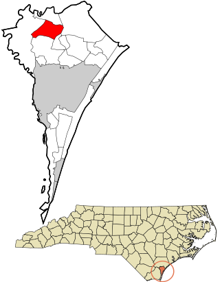
Skippers Corner is a census-designated place (CDP) in New Hanover County, North Carolina, United States. The population was 2,785 at the 2010 census, up from 1,246 in 2000. It is part of the Wilmington Metropolitan Statistical Area.

<span class="mw-page-title-main">Wrightsboro, North Carolina</span> CDP in North Carolina, United States

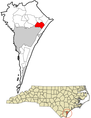
Wrightsboro is a census-designated place (CDP) in New Hanover County, North Carolina, United States. At the 2010 census, the population was 4,896, up from 4,496 in 2000. It is part of the Wilmington Metropolitan Statistical Area.

<span class="mw-page-title-main">East Gaffney, South Carolina</span> Census-designated place in South Carolina, United States

East Gaffney is a census-designated place (CDP) in Cherokee County, South Carolina, United States. The population was 3,085 at the 2010 United States Census.

Hanover is a census-designated place (CDP) and the main village in the town of Hanover in Grafton County, New Hampshire, United States. The population of the CDP was 9,078 at the 2020 census, out of 11,870 in the entire town. The CDP includes the campus of Dartmouth College.

References

  1. "New Hanover County". Jim Forte Postal History. Retrieved November 1, 2015.
  2. Proffitt, Martie (April 17, 1983). "Local history offers tasty tidbits". Star-News. pp. 8C. Retrieved November 1, 2015.
  3. "ONLY ON 3: 12 years after annexation, some Masonboro residents still waiting for city services". WWAYTV3. April 11, 2012. Retrieved August 17, 2022.
  4. "US Gazetteer files: 2010, 2000, and 1990". United States Census Bureau. February 12, 2011. Retrieved April 23, 2011.
  5. "Masonboro, North Carolina (NC) income map, earnings map, and wages data". www.city-data.com. Retrieved January 23, 2017.