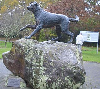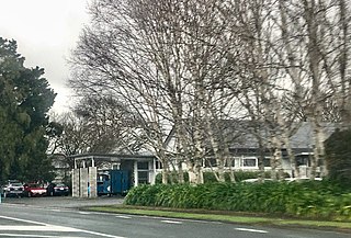
Berhampore is a suburb of Wellington, New Zealand. It lies towards the south of the city, four kilometres from the city centre, and two kilometres from the coast of Cook Strait. It is surrounded by the suburbs of Vogeltown, Newtown, Melrose, Island Bay, Kingston, and Mornington. The suburb was named after Berhampore in Bengal, one of the battlefields at the start of the Battle of Plassey of 1757. Also surrounding Berhampore is the Berhampore Golf Course as well as a very extensive green belt with many walkways and tracks connecting outlying areas. The suburb also boasts some of Wellington's best all weather sports fields, on Adelaide Road and the national hockey stadium. Alongside the golf course there is a skateboard/bmx park, right by a kids mountain bike track. Berhampore School opened in 1915.

Mount Victoria is a suburb of central Wellington, New Zealand, named after the 196 metres (643 ft) hill Mount Victoria to the east. Mount Victoria's residential area is on its north-western slopes.

Martinborough is a town in the South Wairarapa District, in the Wellington region of New Zealand. It is 65 kilometres east of Wellington and 35 kilometres south-west of Masterton. The town has a resident population of 2,000.

Cape Runaway is the eastern extremity of the Bay of Plenty in New Zealand's North Island. It is located 157 kilometres northeast off Whakatāne and 65 kilometres west of East Cape.

Hunterville is a small community on State Highway 1, in the Rangitikei district of the North Island of New Zealand. It is located halfway between Taupo and Wellington and has a population of 408.

Seatoun, an eastern suburb of Wellington, the capital city of New Zealand, lies on the east coast of the Miramar Peninsula, close to the entrance to Wellington Harbour, some seven kilometres southeast of the CBD. The suburb sits on an exposed promontory close to Barrett Reef, a dangerous area of rocky shallows upon which many ships have foundered, most notably the inter-island ferry TEV Wahine in 1968.

Belmont, a suburb of Lower Hutt, to the north of Wellington in the North Island of New Zealand, lies on the west bank of the Hutt River, on State Highway 2, the Wellington-Hutt main road, and across the river from the centre of Lower Hutt.
Te Horo and Te Horo Beach are two localities on the Kapiti Coast of New Zealand's North Island. Te Horo Beach is the larger of the two settlements and, as its name implies, is located on the Tasman Sea coast. Te Horo is located to the east, a short distance inland. They are situated between Peka Peka and Waikanae to the south and Ōtaki to the north. "Te Horo" in the Māori language means "the landslide".
Heretaunga is a suburb of the city of Upper Hutt, located in the lower (southern) North Island of New Zealand. The settlement, one of the older suburbs in the Hutt Valley, dates from the 1840s when European settlers sought country sections. A prime example of a "leafy" suburb, Heretaunga includes quiet tree-lined streets. It is characterised by large houses, often Edwardian or from the mid-20th century.

Ōmokoroa is a small urban area in the Western Bay of Plenty District of New Zealand. The suburb is considered part of Greater Tauranga, and is within the Coromandel electorate. Ōmokoroa began as a small rural holiday village, but is expanding to be a commuter town, with a 25-minute drive to Tauranga City.
Ascot Park is a suburb of Porirua City approximately 22 kilometres (14 mi) north of Wellington in New Zealand.
Waitangirua is a suburb of Porirua City approximately 22km north of Wellington in New Zealand.

Waiwhetū is an eastern suburb of Lower Hutt in the Wellington Region situated in the south of the North Island of New Zealand.

The suburb of Newtown lies in the southern part of Wellington in New Zealand. It lies east of Vogeltown, between Mount Cook and Berhampore. The main thoroughfares of Newtown are Riddiford St, leading from Mount Cook to Berhampore and Melrose, and Constable St, leading from Newtown to Kilbirnie.

Linden is a part of Tawa, the northernmost suburb of Wellington, New Zealand. Linden lies at the northern end of Tawa, just south of the city of Porirua.

Strathmore Park is a suburb of Wellington City, New Zealand. It is located at the southern end of the Miramar Peninsula to the south of the suburb of Miramar, and due east of the airport. A hill suburb, it overlooks Lyall Bay, Evans Bay and several bays along the Seatoun coast close to the mouth of Wellington Harbour, which lies to the east.
Pongakawa is a rural community in the Bay of Plenty of New Zealand's North Island. State Highway 2 runs through it.

Ngāhinapōuri is a rural community in the Waipa District and Waikato region of New Zealand's North Island. It is located on State Highway 39, between Whatawhata and Pirongia.
Ōpaki is small rural settlement in the Masterton District and Wellington Region of New Zealand's North Island.

Waitohu is a settlement in the Kapiti Coast District of the Wellington Region of New Zealand's North Island. It is located east of Ōtaki, separated by the North Island Main Trunk railway line. Waitohu Valley Road runs southeast from State Highway 1 along the Waitohu Stream, and then leaves the stream and turns northeast.


