National routes in South Africa are a class of trunk roads and freeways which connect major cities. They form the highest category in the South African route numbering scheme, and are designated with route numbers beginning with "N", from N1 to N18. Most segments of the national route network are officially proclaimed National Roads that are maintained by the South African National Roads Agency (SANRAL), but some segments are maintained by provincial or local road authorities.[1]
The system was mostly built during the 1970s by the National Party government of South Africa, although construction of new roads and repairs of existing stretches continue today. The system was modeled on the United States Interstate Highway network, an idea first brought into effect by US PresidentDwight D. Eisenhower during the 1950s, based on the German Autobahn, which he experienced when touring Germany after the Second World War.
Although the terms National Road and National Route are sometimes regarded as synonymous, they have distinct meanings, and not all national routes are National Roads, while some "R"-numbered routes are proclaimed National Roads.[1]
Definition
National routes are defined and numbered by the Route Numbering and Road Traffic Signs Sub Committee within the Roads Co-ordinating Body,[2] an organisation which contains representatives from road authorities in national, provincial and local government. The term "national road" is frequently used to refer to a national route, but technically a "national road" is any road maintained by the South African National Roads Agency (SANRAL) and need not necessarily form part of a national route, and there are "R" routes that are proclaimed National Roads.[1] There are also road segments of the national route network that are maintained by provincial or local authorities rather than SANRAL, and are thus not National Roads.[3]
Table of routes
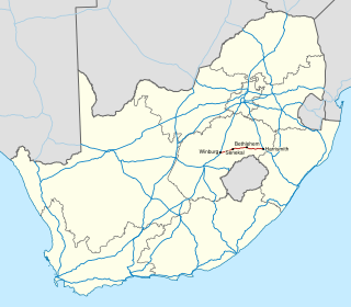
National Routes are denoted with the letter N followed by a number indicating the specific route. On maps and some signage, national routes are shown by a pentagon with the number of the road inside. There are fifteen declared national routes, which are listed below.[4]
An earlier scheme, deviating considerably from the current numbering, is described in the 1970 Shell Road Atlas of South Africa and other contemporaneous sources:
N1 - equivalent to the current N9 from George to Colesberg, and then the current N1 from there to Beitbridge (with deviations as some newer parts had yet to be built)
N2 - equivalent to the section of the current N2 from Cape Town to Durban
N3 - equivalent to the current N3 from Durban to Ladysmith, then following the current N11 to Volksrust, and the current R23 from there to Heidelberg, and then continuing equivalent to the N3 until its end in Johannesburg
N4 - equivalent to the section of the current N4 from Pretoria to Komatipoort
N5 - equivalent to the current N5 but from Winburg past Harrismith to Ladysmith (the latter part now signed as the N3)
N6 - equivalent to the current N6, except that it begins from King William's Town, the section from there to Stutterheim now being the R346, and ending in Reddersburg.
N7 - equivalent to the section of the current N10 from Ncanaha to just past Middelburg
The N3 is a national route in South Africa that connects Johannesburg and Durban, respectively South Africa's largest and third-largest cities. Johannesburg is the financial and commercial heartland of South Africa, while Durban is South Africa's key port and one of the busiest ports in the Southern Hemisphere and is also a holiday destination. Durban is the port through which Johannesburg imports and exports most of its goods. As a result, the N3 is a very busy highway and has a high volume of traffic.
The N1 is a national route in South Africa that runs from Cape Town through Bloemfontein, Johannesburg, Pretoria and Polokwane to Beit Bridge on the border with Zimbabwe. It forms the first section of the famed Cape to Cairo Road.
Colenso is a town in KwaZulu-Natal, South Africa. It is located on the southern bank of the Tugela River on the R103 road. The original settlement was contained within a loop on the river, but it subsequently expanded southwards and eastwards. It lies on the main Durban - Johannesburg railway line some 190 km (118 mi) north-west of Durban.
Bergville is a small town situated in the foothills of the Drakensberg mountains, KwaZulu-Natal, South Africa. It was established as Bergville Mountain Village in 1897 and is now the commercial centre for a 2,500 km2 dairy and cattle ranching area. A blockhouse was built by the British soldiers in the town during the Second Boer War
Harrismith is a large town in the Free State province of South Africa. It was named for Sir Harry Smith, a 19th-century British governor and high commissioner of the Cape Colony. It is situated by the Wilge River, alongside the N3 highway, about midway between Johannesburg, about 300 km to the north-west, and Durban to the southeast. The town is located at the junction of the N5 highway, which continues westward towards the provincial capital Bloemfontein, some 340 km to the south-west. This important crossroads in South Africa's land trade routes is surrounded by mesas and buttes. It is located at the base of one of these called Platberg.
The R24 is a major East-West provincial route in the Gauteng and North West provinces that links OR Tambo International Airport with Rustenburg via Johannesburg, Krugersdorp and Magaliesburg. The process of renaming the streets and freeway that form the route from Krugersdorp eastward to OR Tambo International after anti-apartheid stalwart Albertina Sisulu was completed in 2013.
Regional routes are the third category of road in the South African route numbering scheme. They are designated with the letter "R" followed by a three-digit number. They serve as feeders connecting smaller towns to the national and provincial routes. Designation as a regional road does not necessarily imply any particular size of road; they range from gravel roads to multi-lane freeways.
The R61 is a long provincial route in South Africa that connects Beaufort West with Port Shepstone via Graaff-Reinet, Komani, Mthatha and Port Edward.
The N2 is a national route in South Africa that runs from Cape Town through George, Gqeberha, East London, Mthatha and Durban to Ermelo. It is the main highway along the Indian Ocean coast of the country. Its current length of 2,255 kilometres (1,401 mi) makes it the longest numbered route in South Africa.
The N12 is a national route in South Africa which runs from George through Beaufort West, Kimberley, Klerksdorp and Johannesburg to eMalahleni.
The N4 is a national route in South Africa that runs from Skilpadshek on the Botswana border, past Rustenburg, Pretoria, eMalahleni and Mbombela, to Komatipoort on the Mozambique border. It forms the South African section of the Trans-Kalahari Corridor, which runs from Walvis Bay to Maputo, meaning that it links the east and west coasts of Southern Africa. Since the completion of the A2 through Botswana, the entire Corridor is now a world-class standard highway; it features at least one carriageway in each direction of high-speed traffic plus a paved shoulder for its entire length.
The N5 is a national route in South Africa that connects the N1 at Winburg with the N3 at Harrismith, via Senekal, Paul Roux and Bethlehem.
The N11 is a national route in South Africa which runs from the Botswana border at Groblersbrug, through Mokopane, Middelburg, Ermelo and Newcastle to end at the N3 just after Ladysmith.
The N17 is a national route in South Africa which runs from Johannesburg to Oshoek (Ngwenya) on the border with Eswatini. It passes through Springs, Bethal and Ermelo.
De Beer's Pass is located in the KwaZulu-Natal province of South Africa. It is situated on an unmarked road between Ladysmith and Harrismith in the neighbouring Free State province.
The South African National Roads Agency SOC Ltd or SANRAL is a South African parastatal responsible for the management, maintenance and development of South Africa's proclaimed National Road network which includes many National ("N") and some Provincial and Regional ("R") route segments.
In South Africa some roads are designated as numbered routes to help with navigation. There is a nationwide numbering scheme consisting of national, provincial and regional routes, and within various urban areas there are schemes of metropolitan route numbering.
Provincial routes are the second category of road in the South African route-numbering scheme. They are designated with the letter "R" followed by a number from 21 to 82, formerly with the letter "P" followed by a number from 66. They serve as feeders to the national routes and as trunk roads in areas where there is no national route.
KwaZulu-Natal South Coast is a region on the southern coast of KwaZulu-Natal, South Africa. It stretches from Scottburgh in the north to Port Edward in the south and Harding in the west. The coast is governed by the Ugu District Municipality.
There are a number of ring roads found in South Africa.
This page is based on this Wikipedia article Text is available under the CC BY-SA 4.0 license; additional terms may apply. Images, videos and audio are available under their respective licenses.