New Chicago, Indiana

Last updated

New Chicago, Indiana
Lake County Indiana Incorporated and Unincorporated areas New Chicago Highlighted 1852776.svg
Location of New Chicago in Lake County, Indiana.
Coordinates: 41°33′31″N87°16′18″W / 41.55861°N 87.27167°W / 41.55861; -87.27167
Country United States
State Indiana
County Lake
Township Hobart
Plated1893
Area
[2]
  Total0.69 sq mi (1.75 km2)
  Land0.69 sq mi (1.75 km2)
  Water0.00 sq mi (0.00 km2)
Elevation
[1]
637 ft (194 m)
Population
 (2020)
  Total1,999
  Density2,961.48/sq mi (1,142.91/km2)
Time zone UTC-6 (Central (CST))
  Summer (DST) UTC-5 (CDT)
ZIP code
46342
Area code 219
FIPS code 18-52776 [3]
GNIS feature ID2396801 [1]
Website https://newchicagoin.gov/

New Chicago is a town in Hobart Township, Lake County, Indiana, United States. The population was 2,035 at the 2010 census.

Contents

History

New Chicago was platted in 1893. [4] A post office was opened at New Chicago in 1907, and remained in operation until it was discontinued in 1917. [5]

Geography

According to the 2010 census, New Chicago has a total area of 0.67 square miles (1.74 km2), all land. [6]

Demographics

Historical population
CensusPop.Note
1910 105
1920 300185.7%
1930 48160.3%
1940 466−3.1%
1950 92197.6%
1960 2,312151.0%
1970 2,231−3.5%
1980 2,58115.7%
1990 2,066−20.0%
2000 2,063−0.1%
2010 2,035−1.4%
2020 1,999−1.8%
Source: US Census Bureau

2010 census

As of the census [7] of 2010, there were 2,035 people, 763 households, and 487 families living in the town. The population density was 3,037.3 inhabitants per square mile (1,172.7/km2). There were 866 housing units at an average density of 1,292.5 per square mile (499.0/km2). The racial makeup of the town was 81.0% White, 2.2% African American, 0.7% Native American, 0.7% Asian, 10.0% from other races, and 5.3% from two or more races. Hispanic or Latino of any race were 27.4% of the population.

There were 763 households, of which 35.1% had children under the age of 18 living with them, 38.7% were married couples living together, 17.3% had a female householder with no husband present, 7.9% had a male householder with no wife present, and 36.2% were non-families. 29.0% of all households were made up of individuals, and 8.9% had someone living alone who was 65 years of age or older. The average household size was 2.67 and the average family size was 3.29.

The median age in the town was 33.9 years. 27.5% of residents were under the age of 18; 8.1% were between the ages of 18 and 24; 29% were from 25 to 44; 24.4% were from 45 to 64; and 11.1% were 65 years of age or older. The gender makeup of the town was 50.0% male and 50.0% female.

2000 census

As of the census [3] of 2000, there were 2,063 people, 826 households, and 532 families living in the town. The population density was 3,071.3 inhabitants per square mile (1,185.8/km2). There were 876 housing units at an average density of 1,304.2 per square mile (503.6/km2). The racial makeup of the town was 87.64% White, 0.53% African American, 0.73% Native American, 0.24% Asian, 8.92% from other races, and 1.94% from two or more races. Hispanic or Latino of any race were 16.72% of the population.

There were 826 households, out of which 31.2% had children under the age of 18 living with them, 43.7% were married couples living together, 13.2% had a female householder with no husband present, and 35.5% were non-families. 29.8% of all households were made up of individuals, and 10.2% had someone living alone who was 65 years of age or older. The average household size was 2.50 and the average family size was 3.06.

In the town, the population was spread out, with 26.0% under the age of 18, 11.0% from 18 to 24, 30.0% from 25 to 44, 22.1% from 45 to 64, and 11.1% who were 65 years of age or older. The median age was 32 years. For every 100 females, there were 95.2 males. For every 100 females age 18 and over, there were 93.5 males.

The median income for a household in the town was $32,759, and the median income for a family was $36,852. Males had a median income of $36,400 versus $22,045 for females. The per capita income for the town was $16,342. About 10.6% of families and 14.2% of the population were below the poverty line, including 18.9% of those under age 18 and 6.8% of those age 65 or over.

Education

Residents are zoned to River Forest Community School Corporation. [8] The district's sole comprehensive high school is River Forest High School.

Public libraries

Lake County Public Library operates the Lake Station - New Chicago Branch at 2007 Central Avenue in nearby Lake Station. [9]

Related Research Articles

<span class="mw-page-title-main">Hazelton, Idaho</span> City in Idaho, United States

Hazelton is a city in Jerome County, Idaho, United States. The population was 807 at the 2020 census. It is part of the Twin Falls, Idaho Micropolitan Statistical Area.

<span class="mw-page-title-main">Deer Park, Illinois</span> Village in Illinois, United States

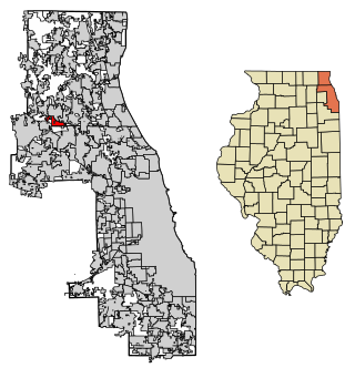
Deer Park is a village in Lake and Cook Counties, Illinois. Per the 2020 census, the population was 3,681. The village is one of the few left in the Chicago area that enjoy a green belt which is bordered by two large natural areas providing outdoor recreation and open space. The village is home to popular shopping and dining destinations: Deer Park Town Center and the Town Center Promenade. The town is also home to the Vehe Farm, an Illinois Centennial Farm.

<span class="mw-page-title-main">Spring Lake, Indiana</span> Town in Indiana, United States

Spring Lake is a town in Sugar Creek Township, Hancock County, Indiana, United States, along Sugar Creek. The population was 218 at the 2010 census.

<span class="mw-page-title-main">Prince's Lakes, Indiana</span> Town in Indiana, United States

Prince's Lakes is a town in Nineveh Township, Johnson County, Indiana, United States. The population was 1,312 at the 2010 census.

<span class="mw-page-title-main">Silver Lake, Indiana</span> Town in Indiana, United States

Silver Lake is a town in Lake Township, Kosciusko County, in the U.S. state of Indiana. The population was 915 at the 2010 census.

<span class="mw-page-title-main">Winona Lake, Indiana</span> Town in Indiana, United States

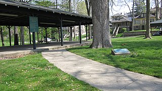
Winona Lake is a town in Wayne Township, Kosciusko County, in the U.S. state of Indiana, and the major suburb of Warsaw. The population was 4,908 at the 2010 census.

<span class="mw-page-title-main">Clear Lake, Indiana</span> Town in Indiana, United States

Clear Lake is a town located in the northeast corner of Steuben County, Indiana, in Clear Lake Township. As such, is the northeasternmost community in the State of Indiana. The population was 339 at the 2010 census.

<span class="mw-page-title-main">Goose Lake, Iowa</span> City in Iowa, United States

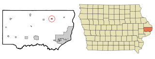
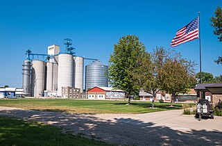
Goose Lake is a city in Clinton County, Iowa, United States. The population was 239 at the time of the 2020 census.

<span class="mw-page-title-main">Woodbine, Iowa</span> City in Iowa, United States

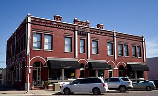
Woodbine is a city in Harrison County, Iowa, United States, along the Boyer River. The population was 1,625 at the time of the 2020 census.

<span class="mw-page-title-main">Eagle Lake, Maine</span> Town in the state of Maine, United States

Eagle Lake is a town in Aroostook County, Maine, United States. The population was 772 at the 2020 census. The town was named by a body of troops heading from Bangor to the Aroostook War for the many eagles that they saw around the lake. A total of 49.0% of the population speaks French, reflecting a trend in Northeastern Maine.

<span class="mw-page-title-main">Portage Lake, Maine</span> Town in the state of Maine, United States

Portage Lake is a town in Aroostook County, Maine, United States. The population was 359 at the 2020 census.

<span class="mw-page-title-main">Eagle Lake, Minnesota</span> Town in Minnesota, United States

Eagle Lake is in Blue Earth County, Minnesota, United States. The population was 3,278 at the 2020 census. It is part of the Mankato-North Mankato Metropolitan Statistical Area.

<span class="mw-page-title-main">Heron Lake, Minnesota</span> City in Minnesota, United States

Heron Lake is a city in Jackson County, Minnesota, United States. The population was 698 at the 2010 census.

<span class="mw-page-title-main">Lake Benton, Minnesota</span> City in Minnesota, United States

Lake Benton is a city in Lincoln County, Minnesota, United States. The population was 683 at the 2010 census.

<span class="mw-page-title-main">Heathcote, New Jersey</span> Populated place in Middlesex County, New Jersey, US

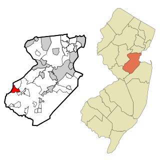
Heathcote is an unincorporated community and census-designated place (CDP) located within South Brunswick, in Middlesex County, in the U.S. state of New Jersey. As of the 2010 United States Census, the CDP's population was 5,821.

<span class="mw-page-title-main">Lakota, North Dakota</span> City in North Dakota, United States

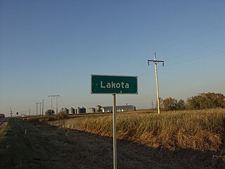
Lakota is a city in Nelson County, North Dakota, United States. It is the county seat of Nelson County Lakota is located 63 miles west of Grand Forks and 27 miles east of Devils Lake. The population was 683 at the 2020 census, making Lakota the 75th-largest city in North Dakota.

<span class="mw-page-title-main">Humboldt, South Dakota</span> Town in South Dakota, United States

Humboldt is a town in Minnehaha County, South Dakota, United States. The population was 579 at the 2020 census.

<span class="mw-page-title-main">St. Marie, Wisconsin</span> Town in Wisconsin, United States

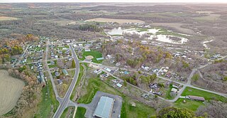
St. Marie is a town in Green Lake County, Wisconsin, United States. The population was 341 at the 2000 census.

<span class="mw-page-title-main">Minnesota Lake, Minnesota</span> City in Minnesota, United States

Minnesota Lake is a city in Blue Earth and Faribault counties in the State of Minnesota. The population was 661 at the 2020 census. The bulk of the city is in Faribault County; a small part extends into Blue Earth County.

<span class="mw-page-title-main">La Valle, Wisconsin</span> Village in Wisconsin, United States

La Valle is a village in Sauk County, Wisconsin, United States, along the Baraboo River. The population was 367 at the 2010 census. The village is located within the Town of La Valle.

References

  1. 1 2 3 U.S. Geological Survey Geographic Names Information System: New Chicago, Indiana
  2. "2020 U.S. Gazetteer Files". United States Census Bureau. Retrieved March 16, 2022.
  3. 1 2 "U.S. Census website". United States Census Bureau . Retrieved January 31, 2008.
  4. Baker, Ronald L. (October 1995). From Needmore to Prosperity: Hoosier Place Names in Folklore and History . Indiana University Press. p.  236. ISBN   978-0-253-32866-3. This village was platted in 1893...
  5. "Lake County". Jim Forte Postal History. Retrieved December 21, 2014.
  6. "G001 - Geographic Identifiers - 2010 Census Summary File 1". United States Census Bureau. Archived from the original on February 13, 2020. Retrieved July 17, 2015.
  7. "U.S. Census website". United States Census Bureau . Retrieved December 11, 2012.
  8. "2020 CENSUS - SCHOOL DISTRICT REFERENCE MAP: Lake County, IN" (PDF). U.S. Census Bureau. p. 1 (PDF p. 2/3). Retrieved November 17, 2023.
  9. "Locations and Hours Archived 2008-12-25 at the Wayback Machine ." Lake County Public Library. Retrieved on January 21, 2009.