Related Research Articles

St. Clair County is a county located in the western portion of the U.S. state of Missouri. As of the 2020 census, the population was 9,284. Its county seat is Osceola. The largest city is Appleton City. The county was organized in 1841 and named after General Arthur St. Clair, Governor of the Northwest Territory. St. Clair was also the 9th president of the United States in Congress Assembled. Under his presidency, the Northwest Ordinance and United States Constitution were passed.
Taberville is an unincorporated community in southwestern St. Clair County, Missouri, United States. It is located approximately sixteen miles west of Osceola, situated on the north side of the Osage River. Taberville formerly had a post office, but it has closed and mail is now delivered from nearby Rockville.
The sacking of Osceola was a Kansas Jayhawker initiative on September 23, 1861, to push out pro-slavery Southerners at Osceola, Missouri. It was not authorized by Union military authorities but was the work of an informal group of anti-slavery Kansas "Jayhawkers". The town of 2,077 people was plundered and burned to the ground, 200 slaves were freed and nine local citizens were court-martialed and executed.

Hudson Township is one of twenty-four townships in Bates County, Missouri, and is part of the Kansas City metropolitan area within the USA. As of the 2000 census, its population was 229. As of the 2010 census, the town's population was 252. Its population was estimated to be 226 in 2018.
Crooks Springs is an unincorporated community in southern St. Clair County, in the U.S. state of Missouri. The community is on Allen Branch a tributary of the Sac River approximately twelve miles southwest of Osceola.
Harper is an unincorporated community in St. Clair County, in the U.S. state of Missouri. The community is on Missouri Route 82 approximately ten miles east of Osceola and within one mile of the St. Clair - Hickory county line.
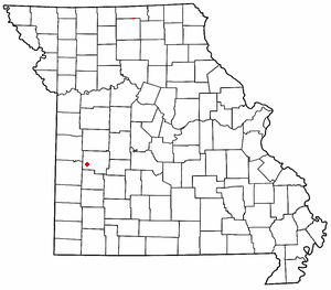
Iuka Springs is an extinct town in St. Clair County, in the U.S. state of Missouri. The GNIS classifies it as a populated place.
Tiffin is an unincorporated community in southern St. Clair County, in the U.S. state of Missouri.
Butler Township is an inactive township in St. Clair County, in the U.S. state of Missouri.
Center Township is an inactive township in St. Clair County, in the U.S. state of Missouri.
Chalk Level Township is an inactive township in St. Clair County, in the U.S. state of Missouri.
Dallas Township is an inactive township in St. Clair County, in the U.S. state of Missouri.
Jackson Township is an inactive township in St. Clair County, Missouri, United States.
Monegaw Township is an inactive township in St. Clair County, in the U.S. state of Missouri.
Osage Township is an inactive township in St. Clair County, in the U.S. state of Missouri.
Polk Township is an inactive township in St. Clair County, in the U.S. state of Missouri.
Roscoe Township is an inactive township in St. Clair County, in the U.S. state of Missouri.
Speedwell Township is an inactive township in St. Clair County, in the U.S. state of Missouri.
Taber Township is an inactive township in St. Clair County, in the U.S. state of Missouri.
Washington Township is an inactive township in St. Clair County, in the U.S. state of Missouri.
References
- ↑ U.S. Geological Survey Geographic Names Information System: Osceola Township, St. Clair County, Missouri
- ↑ "St. Clair County Place Names, 1928–1945". The State Historical Society of Missouri. Archived from the original on June 24, 2016. Retrieved November 27, 2016.
- ↑ "Census profile: Osceola township, St. Clair County, MO". Census Reporter. Retrieved June 1, 2024.
Municipalities and communities of St. Clair County, Missouri, United States | ||
|---|---|---|
| Cities |  | |
| Villages | ||
| Townships | ||
| Unincorporated communities | ||
| Ghost towns | ||
38°02′59″N93°41′20″W / 38.0497°N 93.6889°W
| | This Saint Clair County, Missouri state location article is a stub. You can help Wikipedia by expanding it. |