Vista, Missouri

Last updated

Vista, Missouri
St. Clair County Missouri Incorporated and Unincorporated areas Vista Highlighted.svg
Coordinates: 37°59′21″N93°39′49″W / 37.98917°N 93.66361°W / 37.98917; -93.66361
Country United States
State Missouri
County St. Clair
Area
[1]
  Total0.13 sq mi (0.34 km2)
  Land0.13 sq mi (0.34 km2)
  Water0.00 sq mi (0.00 km2)
Elevation
[2]
853 ft (260 m)
Population
 (2020)
  Total36
  Density274.81/sq mi (106.40/km2)
Time zone UTC-6 (Central (CST))
  Summer (DST) UTC-5 (CDT)
ZIP code
64776
FIPS code 29-76390 [3]
GNIS feature ID2400076 [2]

Vista is a village in St. Clair County, Missouri, United States. The population was 36 at the 2020 census. [4]

Contents

History

Vista was platted in 1885, and named after Vista Dawson, the daughter of a first settler. [5] A variant name was "Decherd". [6] A post office called Decherd was established in 1887, the name was changed to Vista in 1889, and the post office closed in 1973. [7]

Geography

According to the United States Census Bureau, the village has a total area of 0.13 square miles (0.34 km2), all land. [8]

Demographics

Historical population
CensusPop.Note
1960 50
1970 44−12.0%
1980 7365.9%
1990 50−31.5%
2000 5510.0%
2010 54−1.8%
2020 36−33.3%
U.S. Decennial Census [9]

2010 census

As of the census [10] of 2010, there were 54 people, 22 households, and 13 families residing in the village. The population density was 415.4 inhabitants per square mile (160.4/km2). There were 25 housing units at an average density of 192.3 per square mile (74.2/km2). The racial makeup of the village was 100.0% White.

There were 22 households, of which 36.4% had children under the age of 18 living with them, 54.5% were married couples living together, 4.5% had a female householder with no husband present, and 40.9% were non-families. 40.9% of all households were made up of individuals, and 13.6% had someone living alone who was 65 years of age or older. The average household size was 2.45 and the average family size was 3.38.

The median age in the village was 37 years. 35.2% of residents were under the age of 18; 3.7% were between the ages of 18 and 24; 20.4% were from 25 to 44; 26% were from 45 to 64; and 14.8% were 65 years of age or older. The gender makeup of the village was 48.1% male and 51.9% female.

Related Research Articles

<span class="mw-page-title-main">St. Clair County, Missouri</span> County in Missouri, United States

St. Clair County is a county located in the western portion of the U.S. state of Missouri. As of the 2020 census, the population was 9,284. Its county seat is Osceola. The largest city is Appleton City. The county was organized in 1841 and named after General Arthur St. Clair, Governor of the Northwest Territory. St. Clair was also the 9th president of the United States in Congress Assembled. Under his presidency, the Northwest Ordinance and United States Constitution were passed.

<span class="mw-page-title-main">Emmett, Michigan</span> Village in Michigan, United States

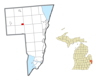
Emmett is a village in St. Clair County of the U.S. state of Michigan. The population was 269 at the 2010 census. The village is located within Emmett Township.

<span class="mw-page-title-main">Milford, Missouri</span> Village in Missouri, United States

Milford is a village in Barton County, Missouri, United States. The population was 24 at the 2020 census.

<span class="mw-page-title-main">Parkway, Missouri</span> Village in Missouri, United States

Parkway is a village in Franklin County, Missouri, United States. The population was 439 at the 2010 census.

<span class="mw-page-title-main">Saint Clair, Missouri</span> City in Missouri, United States

Saint Clair is a city in Franklin County, Missouri, United States. The population was 4,791 at the 2020 census.

<span class="mw-page-title-main">Preston, Missouri</span> Village in Missouri, United States

Preston is a village in Hickory County, Missouri, United States. The population was 157 at the 2020 census.

<span class="mw-page-title-main">Evergreen, Missouri</span> Village in Missouri, United States

Evergreen is a village in Laclede County, Missouri, United States. The population was 28 at the 2010 census. It was named Twin Bridges at the 2000 census.

<span class="mw-page-title-main">Newtonia, Missouri</span> Village in Missouri, United States

Newtonia is a village in Newton County, Missouri, United States. The population was 199 at the 2010 census. It is part of the Joplin, Missouri Metropolitan Statistical Area. Newtonia was the site of the Battles of Newtonia during the American Civil War. The village contains some Antebellum houses, such as the Mathew H. Ritchey House, as well as a cemetery for Civil War dead. It is a farming community and is immediately adjacent to Stark City, Missouri.

<span class="mw-page-title-main">Pascola, Missouri</span> Village in Missouri, United States

Pascola is a village in Pemiscot County, Missouri, United States. The population was 108 at the 2010 census.

<span class="mw-page-title-main">Ridgely, Missouri</span> Village in Missouri, United States

Ridgely is a village in Platte County, Missouri within the United States. The population was 104 at the 2010 census. It lies within the Kansas City metropolitan area.

<span class="mw-page-title-main">Rensselaer, Missouri</span> Village in Missouri, United States

Rensselaer is a village in Ralls County, Missouri, United States. The population was 253 at the 2020 census. It is part of the Hannibal Micropolitan Statistical Area.

<span class="mw-page-title-main">Appleton City, Missouri</span> City in Missouri, United States

Appleton City is a city in St. Clair County, Missouri, United States. The population was 1,032 as of the 2020 census. It is the largest city in St. Clair County.

<span class="mw-page-title-main">Collins, Missouri</span> Village in Missouri, United States

Collins is a village in St. Clair County, Missouri, United States. The population was 125 at the 2020 census.

<span class="mw-page-title-main">Gerster, Missouri</span> Town in Missouri, United States

Gerster is a town in St. Clair County, Missouri, United States. The population was 21 at the 2020 census.

<span class="mw-page-title-main">Lowry City, Missouri</span> City in Missouri, United States

Lowry City is a city in St. Clair County, Missouri, United States. The population was 613 at the 2020 census. Lowry City is the city where the Ozark Mountains meet the Great Plains.

<span class="mw-page-title-main">Roscoe, Missouri</span> Village in Missouri, United States

Roscoe is a village in St. Clair County, Missouri, United States. The population was 89 at the 2020 census.

<span class="mw-page-title-main">Country Life Acres, Missouri</span> Village in Missouri, United States

Country Life Acres is a village in St. Louis County, Missouri, United States. The population was 74 at the 2010 census.

<span class="mw-page-title-main">Moundville, Missouri</span> Village in Missouri, United States

Moundville is a village in southwest Vernon County, Missouri, United States. The population was 124 at the 2010 census.

<span class="mw-page-title-main">Phillipsburg, Missouri</span> Village in Missouri, United States

Phillipsburg is a village in Laclede County, Missouri, United States. The population was 202 at the 2010 census.

<span class="mw-page-title-main">Champ, Missouri</span> Village in Missouri, United States

Champ is a village in St. Louis County, Missouri, United States. The population was 10 at the 2020 census.

References

  1. "ArcGIS REST Services Directory". United States Census Bureau. Retrieved August 28, 2022.
  2. 1 2 U.S. Geological Survey Geographic Names Information System: Vista, Missouri
  3. "U.S. Census website". United States Census Bureau . Retrieved January 31, 2008.
  4. "Explore Census Data". data.census.gov. Retrieved December 27, 2021.
  5. "St. Clair County Place Names, 1928–1945". The State Historical Society of Missouri. Archived from the original on June 24, 2016. Retrieved November 27, 2016.
  6. U.S. Geological Survey Geographic Names Information System: Vista, Missouri
  7. "Post Offices". Jim Forte Postal History. Retrieved November 27, 2016.
  8. "US Gazetteer files 2010". United States Census Bureau. Archived from the original on January 25, 2012. Retrieved July 8, 2012.
  9. "Census of Population and Housing". Census.gov. Retrieved June 4, 2015.
  10. "U.S. Census website". United States Census Bureau . Retrieved July 8, 2012.