Related Research Articles

Lawrence County is located in the southwest portion of the U.S. state of Missouri, in the area of the Ozarks. As of the 2020 census, the population was 38,001. Its county seat is Mount Vernon. The county was organized in 1845 and named for James Lawrence, a naval officer from the War of 1812 known for his battle cry, "Don't give up the ship!"

Christian County is located in the southwestern part of the U.S. state of Missouri. As of the 2020 census, its population was 88,842. Its county seat is Ozark. The county was organized in 1859 and is named after William Christian, a Kentucky soldier of the American Revolutionary War.
Paris Springs Junction is a small unincorporated community in Lawrence County, Missouri, United States. It lies along former U.S. Route 66, four miles (6 km) west of Halltown. Paris Springs Junction started as a few businesses on Route 66 and, with the decommissioning of that highway, has now become only homes. It was so named because of a former town named Paris Springs to the north. That town was founded in 1855 and survived until the time of Route 66's decommissioning.
Sagrada is an unincorporated community in Camden County, in the U.S. state of Missouri. It is located in the far northwestern corner of the county, in Adair Township, just south of the Lake of the Ozarks.
Courtois Township is an inactive township in Crawford County, in the U.S. state of Missouri.
Turnback Creek is a stream in the Ozarks of southwest Missouri. The stream headwaters are in western Christian County just southwest of Billings. The stream flows north-northwest after passing under U.S. Route 60 and on through the extreme southwest corner of Greene County and into Lawrence County. In Lawrence County the stream flows northwest passing under Interstate 44 southwest of Halltown and into southeast Dade County. In Dade County the stream flows generally north and enters the Sac River arm of Stockton Lake at U.S. Route 160 east of Greenfield.
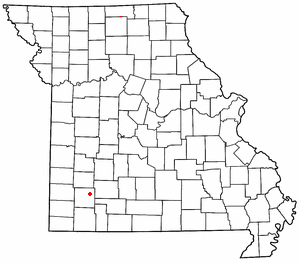
Freistatt Township is an inactive township in Lawrence County, in the U.S. state of Missouri.
Green Township is an inactive township in Lawrence County, in the U.S. state of Missouri.
Hoberg Township is an inactive township in Lawrence County, in the U.S. state of Missouri.
Lincoln Township is an inactive township in Lawrence County, in the U.S. state of Missouri.
Mount Pleasant Township is an inactive township in Lawrence County, in the U.S. state of Missouri.
Mount Vernon Township is a civil township located in Lawrence County, Missouri, in the United States. The township is part of the larger Mount Vernon micropolitan area, and its has a population of 8,267.
Turnback Township is an inactive township in Lawrence County, in the U.S. state of Missouri.
Vineyard Township is an inactive township in Lawrence County, in the U.S. state of Missouri.
Dawt Township is an inactive township in Ozark County, in the U.S. state of Missouri.
Ozark Township is a township in Texas County, in the U.S. state of Missouri.
Ozark Township is a defunct township in Webster County, in the U.S. state of Missouri.
East Ozark Township was a township in Webster County, in the U.S. state of Missouri. In 2022, it was divided into Hubble and Osage townships along Route 38.
Northview Township is a township in Webster County, in the U.S. state of Missouri.
South Lindsey Township is a township in Benton County, in the U.S. state of Missouri. Feaster Branch drains into the Lake of the Ozarks here.
References
- ↑ U.S. Geological Survey Geographic Names Information System: Ozark Township, Lawrence County, Missouri
- ↑ "Lawrence County Place Names, 1928–1945 (archived)". The State Historical Society of Missouri. Archived from the original on June 24, 2016. Retrieved October 27, 2016.
{{cite web}}: CS1 maint: bot: original URL status unknown (link)
Municipalities and communities of Lawrence County, Missouri, United States | ||
|---|---|---|
| Cities |  | |
| Villages | ||
| Townships | ||
| CDP | ||
| Other communities | ||
| Ghost town | ||
| Footnotes | ‡This populated place also has portions in an adjacent county or counties | |
37°13′26″N93°40′54″W / 37.2239°N 93.6817°W
| | This Lawrence County, Missouri state location article is a stub. You can help Wikipedia by expanding it. |