Quimby, Iowa

Last updated
Quimby, Iowa
Cherokee County Iowa Incorporated and Unincorporated areas Quimby Highlighted.svg
Location of Quimby, Iowa
Coordinates: 42°37′47″N95°38′34″W / 42.62972°N 95.64278°W / 42.62972; -95.64278 Coordinates: 42°37′47″N95°38′34″W / 42.62972°N 95.64278°W / 42.62972; -95.64278
Country Flag of the United States.svg  United States
State Flag of Iowa.svg  Iowa
County Cherokee
Area
[1]
  Total0.41 sq mi (1.06 km2)
  Land0.41 sq mi (1.06 km2)
  Water0.00 sq mi (0.00 km2)
Elevation
1,184 ft (361 m)
Population
 (2020)
  Total249
  Density611.79/sq mi (236.01/km2)
Time zone UTC-6 (Central (CST))
  Summer (DST) UTC-5 (CDT)
ZIP code
51049
Area code 712
FIPS code 19-65280
GNIS feature ID0460485

Quimby is a city in Cherokee County, Iowa, United States. The population was 249 at the time of the 2020 census. [2]

Contents

Geography

Quimby is located at 42°37′47″N95°38′34″W / 42.62972°N 95.64278°W / 42.62972; -95.64278 (42.629770, -95.642846). [3] It is situated near the Little Sioux River.

According to the United States Census Bureau, the city has a total area of 0.41 square miles (1.06 km2), all land. [4]

Demographics

Historical population
CensusPop.
1910 268
1920 36335.4%
1930 318−12.4%
1940 36314.2%
1950 3989.6%
1960 369−7.3%
1970 3957.0%
1980 4247.3%
1990 334−21.2%
2000 36810.2%
2010 319−13.3%
2020 249−21.9%
U.S. Decennial Census [5] [2]

2010 census

As of the census [6] of 2010, there were 319 people, 135 households, and 95 families residing in the city. The population density was 778.0 inhabitants per square mile (300.4/km2). There were 152 housing units at an average density of 370.7 per square mile (143.1/km2). The racial makeup of the city was 99.4% White and 0.6% Asian. Hispanic or Latino of any race were 1.3% of the population.

There were 135 households, of which 25.9% had children under the age of 18 living with them, 57.8% were married couples living together, 7.4% had a female householder with no husband present, 5.2% had a male householder with no wife present, and 29.6% were non-families. 25.2% of all households were made up of individuals, and 14.8% had someone living alone who was 65 years of age or older. The average household size was 2.36 and the average family size was 2.78.

The median age in the city was 47.3 years. 20.7% of residents were under the age of 18; 6.3% were between the ages of 18 and 24; 21.6% were from 25 to 44; 32% were from 45 to 64; and 19.4% were 65 years of age or older. The gender makeup of the city was 50.2% male and 49.8% female.

2000 census

As of the census [7] of 2000, there were 368 people, 151 households, and 106 families residing in the city. The population density was 893.0 inhabitants per square mile (344.8/km2). There were 164 housing units at an average density of 398.0 per square mile (153.7/km2). The racial makeup of the city was 98.64% White, 0.54% African American, 0.27% Asian, 0.27% from other races, and 0.27% from two or more races. Hispanic or Latino of any race were 0.82% of the population.

There were 151 households, out of which 31.1% had children under the age of 18 living with them, 55.0% were married couples living together, 9.9% had a female householder with no husband present, and 29.8% were non-families. 27.2% of all households were made up of individuals, and 14.6% had someone living alone who was 65 years of age or older. The average household size was 2.44 and the average family size was 2.89.

In the city, the population was spread out, with 28.5% under the age of 18, 8.7% from 18 to 24, 23.6% from 25 to 44, 22.8% from 45 to 64, and 16.3% who were 65 years of age or older. The median age was 38 years. For every 100 females, there were 91.7 males. For every 100 females age 18 and over, there were 92.0 males.

The median income for a household in the city was $25,625, and the median income for a family was $32,917. Males had a median income of $26,607 versus $19,250 for females. The per capita income for the city was $13,017. About 8.4% of families and 9.2% of the population were below the poverty line, including 8.6% of those under age 18 and none of those age 65 or over.

Schools

The River Valley Community School District operates public schools serving the community. [8] It was established on July 1, 1996 by the merger of the Eastwood Community School District and the Willow Community School District. [9]

Quimby once had its own school district, its mascot known as "Peacocks," but financial pressure and dwindling enrollment forced the school to combine with nearby Washta school district in the early-1960s to create Willow Community School District, the mascot being the T-Birds. In the early 1990s, similar factors led to the merger of Willow and nearby Eastwood School district to form River Valley School District, with the mascot of the Wolverines.[ citation needed ] The district encompasses the towns of Quimby, Washta, Cushing, and Correctionville. Although Quimby is the second-largest,[ which? ] it does not house a portion of the school's classes.[ citation needed ]

Quimby maintained a school building, which housed River Valley Middle School classes until the building, constructed in 1921, became too expensive to keep up to code. The building was sold to a local resident, Tim Tapper, who held the property for several years before selling it to a private developer who demolished the building.[ citation needed ]

Recreation

Quimby boasts a nine-hole golf course, a rarity for towns in the area of relative size.

Related Research Articles

<span class="mw-page-title-main">Cherokee County, Iowa</span> County in Iowa, United States

Cherokee County is a county located in the U.S. state of Iowa. As of the 2020 census, the population was 11,658. The county seat is Cherokee. The county was formed on January 15, 1851, from open territory. It was named after the Cherokee Indians.

<span class="mw-page-title-main">Plumerville, Arkansas</span> City in Arkansas, United States

Plumerville is a city in Conway County, Arkansas, United States. The population was 826 at the 2010 census.

<span class="mw-page-title-main">Jonesboro, Indiana</span> City in Indiana, United States

Jonesboro is a city in Grant County, Indiana, United States, located along the Mississinewa River opposite Gas City. The population was 1,756 at the 2010 census. According to the 2010 census, Jonesboro had the third smallest population of a city in Indiana.

<span class="mw-page-title-main">Rembrandt, Iowa</span> City in Iowa, United States

Rembrandt is a city in Buena Vista County, Iowa, United States. The population was 209 at the time of the 2020 census.

<span class="mw-page-title-main">Lewis, Iowa</span> City in Iowa, United States

Lewis is a city in Cass County, Iowa, United States, along the East Nishnabotna River. The population was 357 at the time of the 2020 census.

<span class="mw-page-title-main">Washta, Iowa</span> City in Iowa, United States

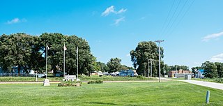
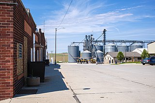
Washta is a city in Cherokee County, Iowa, United States. The population was 209 at the time of the 2020 census. It is called "The Coldest Spot in Iowa", recording a temperature of −47 °F (−44 °C) without wind chill on January 12, 1912.

<span class="mw-page-title-main">Arion, Iowa</span> City in Iowa, United States

Arion is a city in Crawford County, Iowa, United States, along the Boyer River. The population was 97 at the 2020 census.

<span class="mw-page-title-main">Aspinwall, Iowa</span> City in Iowa, United States

Aspinwall is a city in Crawford County, Iowa, United States. The population was 33 at the 2020 census.

<span class="mw-page-title-main">Imogene, Iowa</span> City in Iowa, United States

Imogene is a city in Fremont County, Iowa, United States. The population was 39 at the time of the 2020 census.

<span class="mw-page-title-main">Arthur, Iowa</span> City in Iowa, United States

Arthur is an urban settlement in Ida County, Iowa, United States. The population was 222 at the 2020 census.

<span class="mw-page-title-main">Hastings, Iowa</span> City in Iowa, United States

Hastings is a city in Mills County, Iowa, United States. The population was 152 at the time of the 2020 census.

<span class="mw-page-title-main">Northboro, Iowa</span> City in Iowa, United States

Northboro is a city in Page County, Iowa, United States. The population was 52 at the time of the 2020 census.

<span class="mw-page-title-main">Hancock, Iowa</span> City in Iowa, United States

Hancock is a city in Pottawattamie County, Iowa, United States, along the West Nishnabotna River. The population was 200 at the time of the 2020 census.

<span class="mw-page-title-main">Minden, Iowa</span> City in Iowa, United States

Minden is a city in Pottawattamie County, Iowa, United States. The population was 600 at the time of the 2020 census. It has possessed a post office since 1875.

<span class="mw-page-title-main">Nemaha, Iowa</span> City in Iowa, United States

Nemaha is a city in Sac County, Iowa, United States. The population was 66 at the time of the 2020 census.

<span class="mw-page-title-main">Bushong, Kansas</span> City in Lyon County, Kansas

Bushong is a city in Lyon County, Kansas, United States. As of the 2020 census, the population of the city was 27.

<span class="mw-page-title-main">Utica, Kansas</span> City in Ness County, Kansas

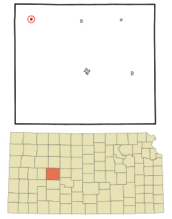
Utica is a city in Ness County, Kansas, United States. As of the 2020 census, the population of the city was 99.

<span class="mw-page-title-main">Underwood, Minnesota</span> City in Minnesota, United States

Underwood is a city in Otter Tail County, Minnesota, United States. The population was 356 at the 2020 census.

<span class="mw-page-title-main">Daisetta, Texas</span> City in Texas, United States

Daisetta is a city in Liberty County, Texas, United States. The population was 923 at the 2020 census.

Castile is a village in Wyoming County, New York, United States. The population was 1,015 at the 2010 census.

References

  1. "2020 U.S. Gazetteer Files". United States Census Bureau. Retrieved March 16, 2022.
  2. 1 2 "2020 Census State Redistricting Data". census.gov. United states Census Bureau. Retrieved 12 August 2021.
  3. "US Gazetteer files: 2010, 2000, and 1990". United States Census Bureau. 2011-02-12. Retrieved 2011-04-23.
  4. "US Gazetteer files 2010". United States Census Bureau. Archived from the original on January 12, 2012. Retrieved 2012-05-11.
  5. "Census of Population and Housing". Census.gov. Retrieved June 4, 2015.
  6. "U.S. Census website". United States Census Bureau . Retrieved 2012-05-11.
  7. "U.S. Census website". United States Census Bureau . Retrieved 2008-01-31.
  8. "River Valley" (PDF). Iowa Department of Education . Retrieved 2019-07-15.
  9. "REORGANIZATION & DISSOLUTION ACTIONS SINCE 1965-66" (PDF). Iowa Department of Education. 2018-06-19. Archived from the original (PDF) on 2018-06-19. Retrieved 2019-07-15.