R26 (South Africa)

Last updated

SA road R26.svg
Provincial route R26
Map of the R26 (South Africa).svg
Route information
Maintained by SANRAL and FSDPRT
Length491 km (305 mi)
Major junctions
South endSA road N6 jct.svg N6 in Rouxville
Major intersectionsSA road N8 jct.svg N8 near Ladybrand
SA road R70.svg R70 near Ficksburg
SA road N5 jct.svgSA road R76.svg N5  / R76 in Bethlehem
SA road R57.svg R57 near Reitz
SA road R34.svg R34 near Frankfort
North endSA road N3 jct.svg N3 near Villiers
Location
Country South Africa
Major cities
Highway system
SA road R25.svg R25 SA road R27.svg R27

The R26 is a provincial route in Free State, South Africa that connects Rouxville with Villiers via Zastron, Wepener, Ladybrand, Ficksburg, Bethlehem & Reitz. [1]

Contents

Route R26 near Reitz, Free State Houtkop en R26-roete, Reitz-Danielsrus, Vrystaat.jpg
Route R26 near Reitz, Free State

Route

The R26 begins in the town of Rouxville, at a t-junction with the N6 national route. It begins by going north-east for 30 kilometres to meet the north-western terminus of the R726 road and bypass the town of Zastron. From Zastron, the R26 goes northwards for 65 kilometres, following the borderline with Lesotho, through Van Stadensrus, to the town of Wepener near the Van Rooyen's Gate border with Lesotho, where it meets the R702 road. The R702 & R26 become one road for a few kilometres westwards. Just after crossing the Caledon River, at the northern terminus of the R701 road (a four-way junction), the R702 remains on the road westwards while the R26 turns northwards.

The R26 continues north-east, still following the Lesotho borderline, for 28 kilometres to the town of Hobhouse, where it meets the southern terminus of the R709 road. From Hobhouse, the R26 goes north-east for 40 kilometres to reach a junction with the N8 national route. They form one road eastwards for 12 kilometres before the N8 becomes its own road southwards towards Maseru while the R26 turns northwards and bypasses the town of Ladybrand to the east.

From Ladybrand, the R26 continues northwards for 35 kilometres to the town of Clocolan, where it meets the south-eastern terminus of the R708 road. From Clocolan, the R26 goes eastwards for 30 kilometres to the town of Ficksburg, which is another border point into Lesotho. Just after Ficksburg, the R26 meets the south-eastern terminus of the R70 road. From the R70 junction, the R26 goes north-east for 40 kilometres, following the Lesotho borderline again, to the town of Fouriesburg, where it meets the western terminus of the R711 road.

From Fouriesburg, the R26 goes northwards for 48 kilometres to the city of Bethlehem. At the intersection with the N5 national route in Bethlehem, where it meets the southern terminus of the R76 road, the R26 joins the N5 eastwards for a few kilometres up to the Hospital Road junction, where the N5 becomes the road southwards and the R26 becomes the road northwards. It turns to the north-east and meets the western end of the R714 road just after.

From the R714 junction in Bethlehem, the R26 goes northwards for 48 kilometres to bypass the town of Reitz and intersect with the R57 road. From the R57 junction, the R26 proceeds northwards for 58 kilometres, bypassing Tweeling, to reach an intersection with the R34 road. The R26 & R34 become one road eastwards, crossing the Wilge River into the town of Frankfort.

East of Frankfort, the R26 becomes its own road, going north-north-east for 28 kilometres, meeting the eastern terminus of the R716 road, to the town of Villiers, where it ends at an off-ramp junction with the N3 national route and the R103 route just north of the N3's Wilge Toll Plaza and just south of the N3's Vaal River Bridge.

Related Research Articles

<span class="mw-page-title-main">N3 (South Africa)</span> National road in South Africa

The N3 is a national route in South Africa that connects Johannesburg and Durban, respectively South Africa's largest and third-largest cities. Johannesburg is the financial and commercial heartland of South Africa, while Durban is South Africa's key port and one of the busiest ports in the Southern Hemisphere and is also a holiday destination. Durban is the port through which Johannesburg imports and exports most of its goods. As a result, the N3 is a very busy highway and has a high volume of traffic.

<span class="mw-page-title-main">N1 (South Africa)</span> National road in South Africa

The N1 is a national route in South Africa that runs from Cape Town through Bloemfontein, Johannesburg, Pretoria and Polokwane to Beit Bridge on the border with Zimbabwe. It forms the first section of the famed Cape to Cairo Road.

<span class="mw-page-title-main">Fouriesburg</span> Place in Free State, South Africa

Fouriesburg is a small town situated at the junction of the R711 and R26 routes in the eastern Free State, South Africa. It is near the Maluti Mountains and only 10 km from Caledon's Poort border post, which gives access to Lesotho.

<span class="mw-page-title-main">R33 (South Africa)</span> Road in South Africa

The R33 is a provincial route in South Africa that connects Pietermaritzburg with Lephalale via Greytown, Paulpietersburg, Carolina, Belfast and Vaalwater. It is a very long road, passing through 3 provinces.

<span class="mw-page-title-main">R34 (South Africa)</span> Road in South Africa

The R34 is a long provincial route in South Africa that connects Vryburg with Richards Bay via Kroonstad and Newcastle. It passes through three provinces, North West, the Free State and KwaZulu-Natal.

<span class="mw-page-title-main">R56 (South Africa)</span> Road in South Africa

The R56 is a provincial route in South Africa that connects Middelburg with Pietermaritzburg via Molteno, Maclear and Kokstad. It is co-signed with the N2 between Kokstad and Stafford's Post for 39 kilometres.

<span class="mw-page-title-main">R57 (South Africa)</span> Road in South Africa

The R57 is a provincial route in South Africa that connects Vanderbijlpark with Phuthaditjhaba via Sasolburg, Heilbron and Reitz.

<span class="mw-page-title-main">R70 (South Africa)</span>

The R70 is a provincial route in the Free State Province, South Africa that connects Odendaalsrus with Ficksburg via Ventersburg and Senekal.

<span class="mw-page-title-main">R74 (South Africa)</span>

The R74 is a provincial route in South Africa that connects Harrismith with KwaDukuza on the coast, via Oliviershoek Pass, Bergville, Winterton, Colenso, Weenen and Greytown.

<span class="mw-page-title-main">R76 (South Africa)</span> Road in South Africa

The R76 is a provincial route in Free State, South Africa that connects Orkney with Bethlehem via Kroonstad.

The R103 is a Regional Route in South Africa that is the designation for some of the old sections of roads that were previously the N3, prior to upgrading. It only has 3 sections, from Hillcrest to Ladysmith, from Warden to Villiers and from Heidelberg to Johannesburg.

<span class="mw-page-title-main">N12 (South Africa)</span> National road in South Africa

The N12 is a national route in South Africa which runs from George through Beaufort West, Kimberley, Klerksdorp and Johannesburg to eMalahleni.

<span class="mw-page-title-main">N5 (South Africa)</span> National road in South Africa

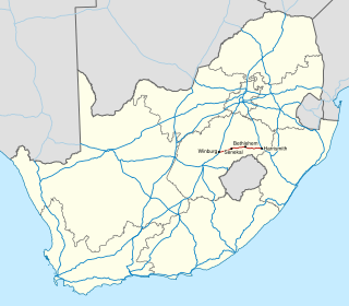
The N5 is a national route in South Africa that connects the N1 at Winburg with the N3 at Harrismith, via Senekal, Paul Roux and Bethlehem.

<span class="mw-page-title-main">N6 (South Africa)</span> National road in South Africa

The N6 is a national route in South Africa that connects East London with Bloemfontein, via Komani and Maletswai. It runs roughly from north to south, connecting the N1 with the N2.

<span class="mw-page-title-main">N8 (South Africa)</span> National road in South Africa

The N8 is a national route in South Africa that connects Groblershoop with Maseru in Lesotho via Kimberley and Bloemfontein. It is maintained by the South African National Roads Agency.

<span class="mw-page-title-main">N17 (South Africa)</span> National road in South Africa

The N17 is a national route in South Africa which runs from Johannesburg to Oshoek (Ngwenya) on the border with Eswatini. It passes through Springs, Bethal and Ermelo.

The R702 is a regional route in South Africa that connects Bloemfontein with the Lesotho border at Van Rooyen's Gate via Dewetsdorp and Wepener.

The R707 is a Regional Route in Free State, South Africa that connects Frankfort with Marquard via Petrus Steyn, Lindley, Arlington and Senekal.

The R708 is a Regional Route in South Africa that connects Jan Kempdorp in the Northern Cape with Clocolan in the Free State via Christiana, Hertzogville, Bultfontein, Theunissen, Winburg and Marquard.

References

  1. "RDDA SOUTH AFRICAN NUMBERED ROUTE DESCRIPTION AND DESTINATION ANALYSIS". NATIONAL DEPARTMENT OF TRANSPORT. May 2012. Retrieved 25 March 2021.