Washington Parish is a parish located in the interior southeast corner of the U.S. state of Louisiana, one of the Florida Parishes. As of the 2020 census, the population was 45,463. Its parish seat is Franklinton. Its largest city is Bogalusa. The parish was founded in 1819.
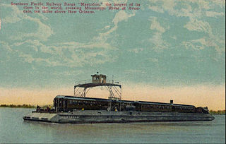
Avondale is a census-designated place (CDP) in Jefferson Parish, Louisiana, United States, on the west bank of the Mississippi River. The population was 4,582 in 2020. It is part of the New Orleans–Metairie–Kenner metropolitan statistical area.
Elmwood is a census-designated place (CDP) in Jefferson Parish, Louisiana, United States, within the New Orleans–Metairie–Kenner metropolitan statistical area. The population was 4,635 at the 2010 census, and 5,649 in 2020. Elmwood was part of neighboring Jefferson's census area from 1960 to 1990. The ZIP Code serving Elmwood is 70123.
Estelle is a census-designated place (CDP) in Jefferson Parish, Louisiana, United States. The population was 17,952 in 2020. It is part of the New Orleans–Metairie–Kenner metropolitan statistical area.

Harvey is a census-designated place (CDP) in Jefferson Parish, Louisiana, United States. Harvey is on the south side of the Mississippi River, within the New Orleans–Metairie–Kenner metropolitan statistical area. The majority-minority population was 20,348 at the 2010 census, down from 22,226 at the 2000 census. The 2020 census determined 22,236 people lived in the CDP.

Marrero is a census-designated place (CDP) in Jefferson Parish, Louisiana, United States. Marrero is on the south side of the Mississippi River, within the New Orleans–Metairie–Kenner metropolitan statistical area. The population was 32,382 at the 2020 U.S. census.
Terrytown is an unincorporated community and census-designated place (CDP) in Jefferson Parish, Louisiana, United States. It is on the "Westbank" of the Mississippi River. It is a suburb within the New Orleans–Metairie–Kenner metropolitan statistical area. The population was 23,319 at the 2010 census, and 25,278 in 2020.
Timberlane is a census-designated place (CDP) in Jefferson Parish, Louisiana, United States. The population was 10,364 in 2020. It is part of the New Orleans–Metairie–Kenner metropolitan statistical area.
Woodmere is an unincorporated community and census-designated place (CDP) in Jefferson Parish, Louisiana, United States. The population was 12,080 at the 2010 census, and 11,238 at the 2020 census. It is part of the New Orleans–Metairie–Kenner metropolitan statistical area.
Montz is a census-designated place (CDP) in St. Charles Parish, Louisiana, United States. It first appeared in the 2000 census with a population of 1,120. The 2020 census indicates a population of 2,106.
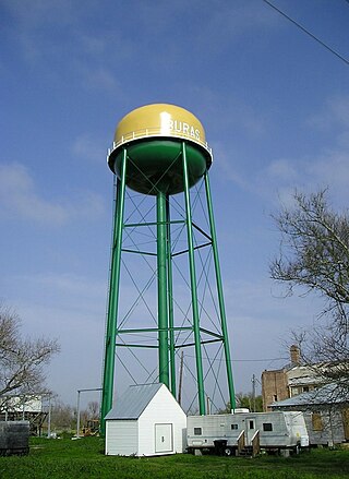
Buras is a census-designated place (CDP) in Plaquemines Parish, Louisiana, United States. Its population was 945 at the 2010 census, and 1,109 in 2020. Prior to the 2010 census, Buras was considered to be part of the Buras-Triumph CDP.
Marthaville is an unincorporated community and census-designated place (CDP) in Natchitoches Parish, Louisiana. It was first listed as a CDP in the 2020 census with a population of 90. It is part of the Natchitoches Micropolitan Statistical Area.
Midland is a farming unincorporated community and census-designated place in Acadia Parish, Louisiana, United States. It was first listed as a CDP in the 2020 census with a population of 249.
Paris is a census-designated place and unincorporated community in Lafayette County, Mississippi, United States. Paris is located at the junction of Mississippi Highway 9W and Mississippi Highway 315 10 miles (16 km) east of Water Valley.
Good Pine is an unincorporated community and census-designated place (CDP) in La Salle Parish, Louisiana, United States. It was first listed as a CDP in the 2020 census with a population of 259.
Centerville is an unincorporated community and census-designated place located at the junction of Louisiana Highways 182 and 317 in St. Mary Parish, Louisiana, United States. The community, located on the Bayou Teche, is located 6 miles (9.7 km) southeast of Franklin.
Perry is an unincorporated community and census-designated place in Vermilion Parish, Louisiana, United States. It was first listed as a CDP in the 2020 census with a population of 1,171.
Echo is an unincorporated community and census-designated place (CDP) in Rapides Parish, Louisiana, United States. It was first listed as a CDP in the 2020 census with a population of 352.
Trout is an unincorporated community and census-designated place in La Salle Parish, Louisiana, United States. The community is located on U.S. Route 84, 2.8 miles (4.5 km) west of Jena. Trout has a post office with ZIP code 71371.
Lewisburg is an unincorporated community and census-designated place in St. Tammany Parish, Louisiana, United States. The community is located 7 miles south of Covington, Louisiana. It was first listed as a CDP in the 2020 census with a population of 420.