
The Potomac River is found within the Mid-Atlantic region of the United States and flows from the Potomac Highlands into the Chesapeake Bay. The river is approximately 405 miles (652 km) long, with a drainage area of about 14,700 square miles (38,000 km2). In terms of area, this makes the Potomac River the fourth largest river along the East Coast of the United States and the 21st largest in the United States. Over 5 million people live within the Potomac watershed.

The Richmond, Fredericksburg, and Potomac Railroad was a railroad connecting Richmond, Virginia, to Washington, D.C. The track is now the RF&P Subdivision of the CSX Transportation system; the original corporation is no longer a railroad company.

The South Branch Potomac River has its headwaters in northwestern Highland County, Virginia near Hightown along the eastern edge of the Allegheny Front. After a river distance of 139 miles (224 km), the mouth of the South Branch lies east of Green Spring in Hampshire County, West Virginia where it meets the North Branch Potomac River to form the Potomac.

Green Spring is a census-designated place (CDP) and railroad town in Hampshire County, West Virginia, United States. As of the 2010 census, its population was 218. Green Spring is located north of Springfield on Green Spring Road near the confluence of the North and South Branches of the Potomac River. Green Spring is also the location of the South Branch Valley Railroad's terminus with the old Baltimore & Ohio Railroad mainline. Green Spring is the site of a one-lane low-water toll bridge that connects Green Spring Road to Maryland Route 51 in Oldtown, Allegany County, Maryland. This bridge is one of only 17 privately owned toll bridges in the United States. The toll for the bridge is currently US$1.50.

Sector is an unincorporated community in Hampshire County in the U.S. state of West Virginia. It is located along the west bank of the South Branch Potomac River on Fleming-Sector Road across the river from the community of Glebe.
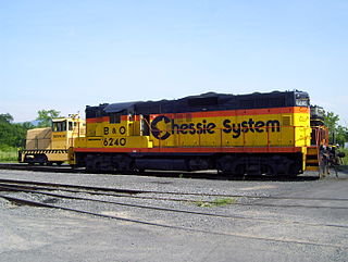
The South Branch Valley Railroad consists of a 52.4 mile (84.33 km) length of railroad in the U.S. state of West Virginia extending north along the South Branch Potomac River from Petersburg to the CSXT mainline at Green Spring adjacent to the Potomac River. At Green Spring, the CSXT mainline connects the SBVR to Cumberland, Maryland to the west and Martinsburg, West Virginia to the east. SBVR has been owned and operated by the West Virginia State Rail Authority (SRA) since it was sold by the Baltimore & Ohio Railroad on October 11, 1978. Upon purchasing the B&O's South Branch line, West Virginia became the first state in the United States to both own and operate a commercial freight railroad. In 1985, major flooding of the South Branch Valley destroyed most of the rail line, including all three bridges that crossed the South Branch Potomac River. Despite talk of shutting down the railroad after the flood, reconstruction began two years later.

The Trough is a 6-mile long wooded gorge carved by the South Branch Potomac River (SBPR) and situated in the Allegheny Mountains of Hampshire and Hardy Counties, West Virginia, USA. The area was the site of a 1756 skirmish of the French and Indian War, known as the "Battle of the Trough".

Cherry Run is a small unincorporated community hamlet located along the CSX Transportation mainline on the Potomac River in Morgan County in the U.S. state of West Virginia. The community is named for the stream, Cherry Run, that meets the Potomac in its vicinity. It was originally known as Cherry Run Depot because of the important interchange between the B&O and the Western Maryland Railway located there.
Magnolia is an unincorporated community northeast of Paw Paw in Morgan County in the U.S. state of West Virginia on the Potomac River. Magnolia is located along the Baltimore and Ohio Railroad mainline and east of where the Western Maryland Railway crosses the Potomac, bypassing a series of bends in the river. As a depot and water station on the B&O, Magnolia has been known by a number of names including Magnolia Dale, Magnolia Vale, and sometimes as Water Station Number 12 on the railroad.
Green Spring Run is an 8.9-mile-long (14.3 km) tributary stream of the North Branch Potomac River in Hampshire County in the U.S. state of West Virginia. Green Spring Run rises in Greenwood Hollow north of Springfield and meanders northeast through Green Spring Valley. The South Branch Valley Railroad and Green Spring Road run parallel to the stream. It runs through the community of Green Spring, from which the stream takes its name. From Green Spring, Green Spring Run flows east where it reaches its confluence with the North Branch Potomac shortly before the North Branch joins with the South Branch Potomac River to form the Potomac River.

Big Run is a 4.4-mile-long (7.1 km) tributary stream of the South Branch Potomac River, belonging to the Potomac River and Chesapeake Bay watersheds. Big Run flows through the city of Romney and the campus of the West Virginia Schools for the Deaf and Blind in Hampshire County, West Virginia. The stream is known by local residents as Town Run and Town Creek.
Ridgedale is an unincorporated community in Hampshire County in the U.S. state of West Virginia. It is located within a horsehoe bend in the South Branch Potomac River between the communities of Blues Beach and Wappocomo. Ridgedale is named for the recently restored 1835 plantation built by George W. Washington, also known as Washington Bottom Farm. Washington's plantation obtained its name due to its location at the foot of Mill Creek Ridge at its northernmost extent. Ridgedale is located off the South Branch Valley Railroad and is accessible from West Virginia Route 28 by way of Washington Road. Ridgedale once had a post office and a school in operation there. Today, Ridgedale consists of the old Washington farm and a number of summer camps, cabins, and vacation homes on the South Branch.
Buffalo Creek is a 4.1-mile-long (6.6 km) free-flowing tributary stream of the South Branch Potomac River, itself a tributary of the Potomac River, making it a part of the Chesapeake Bay watershed. Buffalo Creek is located in west-central Hampshire County in the U.S. state of West Virginia. Because the stream flows through several small farms, Buffalo Creek primarily serves agriculture purposes with segments used for livestock watering.

Wappocomo is a late 18th-century Georgian mansion and farm overlooking the South Branch Potomac River north of Romney, Hampshire County, West Virginia, USA. It is located along Cumberland Road and the South Branch Valley Railroad.
The Capon and North Branch Turnpike was a 19th-century turnpike in Hampshire County in the U.S. state of Virginia. The turnpike facilitated increased communication and transportation between Cumberland, Maryland and Winchester, Virginia via the Northwestern Turnpike in Capon Bridge, West Virginia. As of July 2010, the Capon and North Branch Turnpike's original route is made up of segments of West Virginia Route 28, Springfield Pike, Slanesville Pike, and Cold Stream Road.

William Benjamin Cornwell was an American lawyer, businessperson, newspaper editor and publisher, and railroad and timber executive in the U.S. state of West Virginia. He was an older brother of writer and newspaper publisher Marshall S. Cornwell (1871–1898) and of West Virginia Governor John J. Cornwell (1867–1953).
Beaverdam Depot is a historic railway depot located at Beaverdam, Hanover County, Virginia.

Valley View is a mid-19th-century Greek Revival residence and farm overlooking the South Branch Potomac River northwest of Romney, West Virginia. The house is atop a promontory where Depot Valley joins the South Branch Potomac River valley.
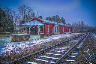
Valley was a populated place and post office on the South Branch line of the Baltimore and Ohio Railroad in the U.S. state of West Virginia. It was centered near the intersection of West Sioux Lane and Depot Valley Road, now located within the present-day corporate boundaries of Romney. Valley developed in 1884 following the completion of the South Branch line when the rail line's original southern terminus and corresponding Romney Depot were built there. The United States Post Office Department established a post office at Valley on May 19, 1928, remaining in operation until its disestablishment on June 15, 1937. Following the closure of Valley's post office, its mail was routed through the post office in Romney.


