South Range, Michigan

Last updated

South Range, Michigan
SouthRangeMichiganDowntownM26.jpg
Looking south along M-26
South Range, MI location2.png
Location within Houghton County
USA Michigan location map.svg
Red pog.svg
South Range
Location within the state of Michigan
Coordinates: 47°04′19″N88°38′32″W / 47.07194°N 88.64222°W / 47.07194; -88.64222
Country United States
State Michigan
County Houghton
Township Adams
Platted 1902
Government
  Type Village council
  PresidentJustin Marier
Area
[1]
  Total0.36 sq mi (0.94 km2)
  Land0.36 sq mi (0.94 km2)
  Water0.00 sq mi (0.00 km2)
Elevation
[2]
1,139 ft (347 m)
Population
 (2020)
  Total750
  Density2,060.44/sq mi (795.09/km2)
Time zone UTC-5 (Eastern (EST))
  Summer (DST) UTC-4 (EDT)
ZIP code(s)
49963
Area code 906
FIPS code 26-75220 [3]
GNIS feature ID0638402 [2]
Website Official website

South Range is a village in Adams Township, Houghton County in the U.S. state of Michigan. It is bordered on the east by the unincorporated community of Baltic. It is about five miles southwest of Houghton on M-26. The population was 758 at the 2010 census. The ZIP code for South Range is 49963.

Contents

It is a "cooperating community of the Keweenaw National Historical Park." [4]

History

South Range was platted in 1902 by the Wheal Kate Mining Company, which operated an unsuccessful copper mine nearby. In 1906 the community tried to incorporate as the town of Stanton, but there was already a Stanton, Michigan, so they incorporated as South Range, because it was at the south end of the Michigan copper range. Italians were the dominant ethnic group in early years. [5]

On December 11, 1913, during the bitter Copper Country Strike of 1913–1914, a raid was conducted by the Citizens' Alliance shortly after the mass murder at the Dally boardinghouse in Painesdale, Michigan which had occurred just a mere few days before. Thirty-seven rifles, and hundreds of rounds of ammunition was seized. Twenty-three strikers were arrested with guns ready to shoot up the area that night, and Deputy T. Driscoll was non-fatally shot in the arm during the raid.[ citation needed ]

Geography

According to the United States Census Bureau, the village has a total area of 0.36 square miles (0.93 km2), all land. [6]

Demographics

Historical population
CensusPop.Note
1910 1,097
1920 1,43530.8%
1930 1,120−22.0%
1940 918−18.0%
1950 712−22.4%
1960 7606.7%
1970 89818.2%
1980 861−4.1%
1990 745−13.5%
2000 727−2.4%
2010 7584.3%
2020 750−1.1%
U.S. Decennial Census [7]
Post office SouthRangeMichiganPostOffice.jpg
Post office

2010 census

As of the census [8] of 2010, there were 758 people, 343 households, and 181 families living in the village. The population density was 2,105.6 inhabitants per square mile (813.0/km2). There were 395 housing units at an average density of 1,097.2 per square mile (423.6/km2). The racial makeup of the village was 95.9% White, 0.4% Native American, 1.2% Asian, 0.1% from other races, and 2.4% from two or more races. Hispanic or Latino of any race were 1.1% of the population.

There were 343 households, of which 23.0% had children under the age of 18 living with them, 38.5% were married couples living together, 10.8% had a female householder with no husband present, 3.5% had a male householder with no wife present, and 47.2% were non-families. 39.7% of all households were made up of individuals, and 16.6% had someone living alone who was 65 years of age or older. The average household size was 2.19 and the average family size was 2.96.

The median age in the village was 40.2 years. 23.4% of residents were under the age of 18; 9.7% were between the ages of 18 and 24; 22.5% were from 25 to 44; 24.7% were from 45 to 64; and 19.7% were 65 years of age or older. The gender makeup of the village was 52.0% male and 48.0% female.

2000 census

As of the census [3] of 2000, there were 727 people, 347 households, and 191 families living in the village. The population density was 1,821.1 inhabitants per square mile (703.1/km2). There were 378 housing units at an average density of 946.9 per square mile (365.6/km2). The racial makeup of the village was 96.84% White, 2.20% African American, 0.14% Native American, 0.28% Asian, 0.14% from other races, and 0.41% from two or more races. Hispanic or Latino of any race were 0.14% of the population. 46.4% were of Finnish, 13.8% Italian, 6.2% German and 5.2% French ancestry according to Census 2000.

There were 347 households, out of which 21.0% had children under the age of 18 living with them, 40.6% were married couples living together, 11.0% had a female householder with no husband present, and 44.7% were non-families. 38.3% of all households were made up of individuals, and 18.7% had someone living alone who was 65 years of age or older. The average household size was 2.09 and the average family size was 2.78.

In the village, the population was spread out, with 20.4% under the age of 18, 9.6% from 18 to 24, 24.8% from 25 to 44, 21.3% from 45 to 64, and 23.9% who were 65 years of age or older. The median age was 40 years. For every 100 females, there were 107.1 males. For every 100 females age 18 and over, there were 104.6 males.

The median income for a household in the village was $26,250, and the median income for a family was $34,500. Males had a median income of $26,550 versus $25,000 for females. The per capita income for the village was $15,611. About 7.5% of families and 13.7% of the population were below the poverty line, including 24.6% of those under age 18 and 8.4% of those age 65 or over.

Related Research Articles

<span class="mw-page-title-main">Martin, Michigan</span> Village in Michigan, United States

Martin is a village in southeastern Allegan County in the U.S. state of Michigan. The population was 377 at the 2020 census.

<span class="mw-page-title-main">Ellsworth, Michigan</span> Village in Michigan, United States

Ellsworth is a village in Antrim County in the U.S. state of Michigan. The population was 367 at the 2020 census. The village is located within Banks Township.

<span class="mw-page-title-main">L'Anse, Michigan</span> Village in Michigan, United States

L'Anse is a village and the county seat of Baraga County, Michigan. The population was 1,874 at the 2020 census. The village is located within L'Anse Township in the Upper Peninsula, and partially inside the L'Anse Indian Reservation.

<span class="mw-page-title-main">Benzonia, Michigan</span> Village in Michigan, United States

Benzonia is a village in Benzie County in the U.S. state of Michigan. The population was 551 at the 2020 census, up from 497 at the 2010 census. The village is located within Benzonia Township at the southeast end of Crystal Lake on U.S. Highway 31 at the junction with M-115 west.

<span class="mw-page-title-main">Eau Claire, Michigan</span> Village in Michigan, United States

Eau Claire is a village located in east central Berrien County in the U.S. state of Michigan. The population was 552 at the 2020 census.

<span class="mw-page-title-main">Three Oaks Township, Michigan</span> Civil township in Michigan, United States

Three Oaks Township is a civil township of Berrien County in the U.S. state of Michigan on the border with the state of Indiana. The population was 2,324 at the 2020 census.

<span class="mw-page-title-main">Cassopolis, Michigan</span> Village in Michigan, United States

Cassopolis is a village in the U.S. state of Michigan and the county seat of Cass County. It is located mostly in LaGrange Township with a small portion extending east into Penn Township. The village and county are named after statesman Lewis Cass, a New Hampshire native and a prominent U.S. senator from Michigan prior to the American Civil War.

<span class="mw-page-title-main">Harrison, Michigan</span> City in Michigan, United States

Harrison is a city in and county seat of Clare County in the U.S. state of Michigan. The population was 2,150 at the 2020 census.

<span class="mw-page-title-main">Otisville, Michigan</span> Village in Michigan, United States

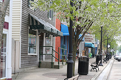
Otisville is a village in Forest Township, Genesee County in the U.S. state of Michigan. The population was 864 at the 2010 census. It is located along M-15, just south of M-57. It is part of the Flint metropolitan area.

<span class="mw-page-title-main">Ashley, Michigan</span> Village in Michigan, United States

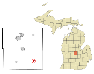
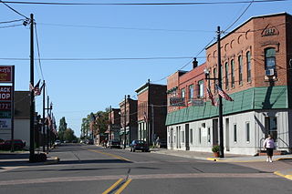
Ashley is a village in Gratiot County in the U.S. state of Michigan. The population was 508 at the 2020 census. The village is located in the northwest corner of Elba Township. No major state trunkline runs through the village, although M-57 passes within one mile to the south. Ashley was platted in 1884.

<span class="mw-page-title-main">Schoolcraft Township, Houghton County, Michigan</span> Civil township in Michigan, United States

Schoolcraft Township is a civil township of Houghton County in the U.S. state of Michigan. As of the 2020 census, the township had a population of 1,992. The township was organized in 1866.

<span class="mw-page-title-main">Brooklyn, Michigan</span> Village in Michigan, United States

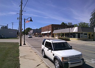
Brooklyn is a village in Jackson County in the U.S. state of Michigan. The population was 1,313 at the 2020 census. It is located in the Irish Hills region of southern Michigan, just north of U.S. Route 12 along M-50. The village is located within Columbia Township.

<span class="mw-page-title-main">Hanover Township, Jackson County, Michigan</span> Civil township in Michigan, United States

Hanover Township is a civil township of Jackson County in the U.S. state of Michigan. The population was 3,662 at the 2020 census.

<span class="mw-page-title-main">Caledonia, Michigan</span> Village in Michigan, United States

Caledonia is a village in Kent County in the U.S. state of Michigan. The population was 1,622 at the 2020 census. The village is located within Caledonia Township about 15 miles (24.1 km) southeast of downtown Grand Rapids.

<span class="mw-page-title-main">Marion, Michigan</span> Village in Michigan, United States

Marion is a village in Osceola County in the U.S. state of Michigan. The population was 872 at the 2010 census. The village is located within Marion Township.

<span class="mw-page-title-main">Ferrysburg, Michigan</span> City in Michigan, United States

Ferrysburg is a city in Ottawa County in the U.S. state of Michigan. The population was 2,892 at the 2010 census.

<span class="mw-page-title-main">Lexington, Michigan</span> Village in Michigan, United States

Lexington is a village in Sanilac County in the U.S. state of Michigan. The population was 1,178 at the 2010 census. The village is located within Lexington Township.

<span class="mw-page-title-main">Decatur, Michigan</span> Village in Michigan, United States

Decatur is a village in Van Buren County, Michigan, United States. The population was 1,819 at the 2010 census. The village is located within Decatur Township.

<span class="mw-page-title-main">Hollandale, Wisconsin</span> Village in Wisconsin, United States

Hollandale is a village in Iowa County, Wisconsin, United States. The population was 306 at the 2020 census. It is part of the Madison Metropolitan Statistical Area.

Bear Lake Township is a civil township of Manistee County in the U.S. state of Michigan. As of the 2020 census, the population of the township was 1,831. Within the township is the village of Bear Lake.

References

  1. "2020 U.S. Gazetteer Files". United States Census Bureau. Retrieved May 21, 2022.
  2. 1 2 U.S. Geological Survey Geographic Names Information System: South Range, Michigan
  3. 1 2 "U.S. Census website". United States Census Bureau . Retrieved January 31, 2008.
  4. Village of South Range
  5. Clarence J. Monette (1995) Early South Range, Lake Linden, Mich.: Clarence Monette.
  6. "US Gazetteer files 2010". United States Census Bureau. Archived from the original on January 25, 2012. Retrieved November 25, 2012.
  7. "Census of Population and Housing". Census.gov. Retrieved June 4, 2015.
  8. "U.S. Census website". United States Census Bureau . Retrieved November 25, 2012.