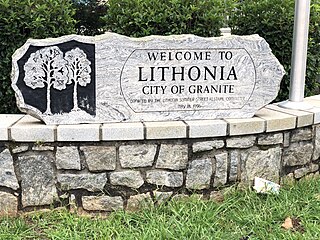
Lithonia is a city in eastern DeKalb County, Georgia, United States. The city's population was 2,662 at the 2020 census. Lithonia is in the Atlanta metropolitan area.

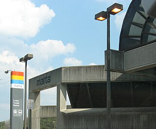
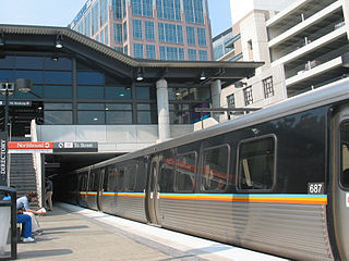
The Metropolitan Atlanta Rapid Transit Authority is the principal public transport operator in the Atlanta metropolitan area. Formed in 1971 as strictly a bus system, MARTA operates a network of bus routes linked to a rapid transit system consisting of 48 miles (77 km) of rail track with 38 subway stations. MARTA's rapid transit system is the eighth-largest rapid transit system in the United States by ridership.

Centennial Olympic Stadium was the 85,000-seat main stadium of the 1996 Summer Olympics and Paralympics in Atlanta, Georgia, United States. Construction of the stadium began in 1993, and it was complete and ready for the opening ceremony in July 1996, where it hosted track and field events and the closing ceremony. After the Olympics and Paralympics, it was reconstructed into the baseball-specific Turner Field, used by the Atlanta Braves of Major League Baseball for 20 seasons (1997–2016). After the Braves departed for Truist Park, the facility was purchased by Georgia State University, which rebuilt the stadium a second time as Center Parc Stadium, designed for American football.

The Fairlie–Poplar Historic District is part of the central business district in downtown Atlanta. It is named for the two streets that cross at its center, northeast-only Fairlie and southeast-only Poplar. Fairlie–Poplar is immediately north of Five Points, the definitive center point and longtime commercial heart of Atlanta. It is roughly bounded on the southwest by Marietta Street, on the southeast by Peachtree Street or Park Place, on the northeast by Luckie Street or Williams Street, and on the northwest by Cone Street or Spring Street. It has smaller city blocks than the rest of the city, and the streets run at a 40° diagonal.

Inman Park / Reynoldstown is a train station in Atlanta, Georgia, serving the Blue Line of the Metropolitan Atlanta Rapid Transit Authority (MARTA) rail system. It also serves the Green Line on weekdays, and has two side platforms and two tracks. This station opened June 30, 1979.
Lenox is an underground metro station in Atlanta, Georgia, serving the Gold Line of the Metropolitan Atlanta Rapid Transit Authority. Located in the Buckhead district, it provides access to Lenox Square and Phipps Plaza, which are located on Peachtree Street across the street from one another, as well as the nearby neighborhoods of Lenox Park and Pine Hills. It also provides connecting bus service to Piedmont Park, Atlanta Botanical Garden, and Ansley Mall.

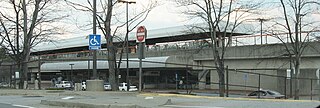
GWCC/CNN Center station is a rail station in Atlanta, Georgia, on the Blue and Green lines of the Metropolitan Atlanta Rapid Transit Authority (MARTA) rail system. Located on the western edge of Downtown Atlanta, the station officially opened on December 22, 1979. It was originally called Omni station due to its proximity to the Omni Coliseum, which was demolished to build Philips Arena. The station's name expanded in 1992 as Omni/Dome/World Congress Center with that year's opening of the Georgia Dome as well as the Georgia World Congress Center. By the year 2000, the station name had changed to Dome/GWCC/Philips Arena/CNN Center. In June 2019, MARTA held a town hall to gather community input on a new name for the station after the demolition of the Georgia Dome and the renaming of Philips Arena to State Farm Arena. The station was one of five MARTA rail stations that were under consideration for new names in 2019. The name of the station was changed to GWCC/CNN Center.
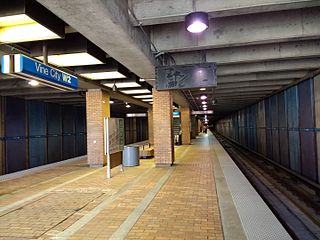
Vine City is an at-grade train station in Atlanta, Georgia, serving the Blue and Green lines of the Metropolitan Atlanta Rapid Transit Authority (MARTA) rail system. It is one of only two stations served by the Green and Blue lines at all times.
Brookhaven/Oglethorpe is a train station in Brookhaven, Georgia, on the Gold Line of the Metropolitan Atlanta Rapid Transit Authority (MARTA) rail system. An elevated station, it is located one mile south of Oglethorpe University. The station provides connecting bus service to North Druid Hills, Toco Hills, North DeKalb Mall, the Peachtree Boulevard business district, and the Georgia Department of Labor.

North Springs is an elevated metro station in Sandy Springs, Georgia, and the northern terminus for the Red Line of the Metropolitan Atlanta Rapid Transit Authority (MARTA) rail system. North Springs is primarily a commuter station for Atlanta workers and university students, featuring a large parking deck and direct access on and off State Route 400, a major highway for commuters, so that drivers can avoid surface roads. North Springs attracts commuters from Roswell, Alpharetta and other towns north on State Route 400. As the northern terminus, this station is a hub for buses that continue on north, with connecting bus services to Sandy Springs, the city of Alpharetta, North Point Mall, the city of Roswell, the Ameris Bank Amphitheatre at Encore Park, the Mansell Road and Windward Parkway park-and-rides, and even as far north as the city of Milton. This station also provides bus assistance from North Springs High School via MARTA bus route 87.

Capitol View is a historic in-town southwest Atlanta neighborhood 2.5 miles from downtown Atlanta, Georgia that was named for its view of the Georgia State Capitol building. Its boundaries include Metropolitan Parkway to the east, Lee Street to the west, and the Beltline to the north. On the south, the border follows Arden Street, Deckner Avenue, and Perkerson Park.
The transportation system of Georgia is a cooperation of complex systems of infrastructure comprising over 1,200 miles (1,900 km) of interstates and more than 120 airports and airbases serving a regional population of 59,425 people.

South Downtown is a historic neighborhood of Downtown Atlanta, Georgia, United States. South Downtown is primarily home to city, county, state, and federal governmental offices, which prompted the city to adopt signage declaring the area "Government Walk." Although much of South Downtown is dominated by surface parking lots, the neighborhood was passed over during the redevelopment boom of the 1960s and 1970s that resulted in the demolition of much of Downtown's architecturally significant buildings. The result is myriad buildings from the 1950s and earlier that retain their historic structural integrity.
Lindbergh, officially Lindbergh/Morosgo, is a neighborhood in the Buckhead district of Atlanta, Georgia. Most of the neighborhood consists of multi-use development combining retail, office and residential space.
The Atlanta Hotel, also known as Thompson's Hotel, was one of the original hotels in antebellum Atlanta, Georgia, United States. It stood at the northwest side of State Square, pre-war Atlanta's central square, on the northwest side of Pryor Street between Decatur Street and what is now Wall Street.

Atlanta's first Union Station, also known as Union Depot (1853–1864) was the original depot of Atlanta, Georgia. It was designed by architect Edward A. Vincent. It stood in the middle of State Square, the city's main square at the time, where Wall Street now is between Pryor Street and Central Avenue. It was destroyed in General Sherman's burning of the city during the Battle of Atlanta. Atlanta's 1871 Union Station was built on the site.

Atlanta's second Union Station was built in 1871 on the site of the 1853 station, burned in mid November 1864 when Federal forces left Atlanta for the March to the Sea. It was built in Second Empire style, designed by architect Max Corput. It was located at what is now Wall Street between Pryor Street and Central Avenue.

The Centennial Park District, formerly the Luckie-Marietta District, is a district of Downtown Atlanta named after the walkable neighborhood and entertainment district that surround Centennial Olympic Park. The district was originally created in 2007 by Legacy Properties, in support of their redevelopment projects in the district. However, "Luckie Marietta" was used by a wide range of Atlanta media to refer to the district. The district was rebranded the Centennial Park District and is now under the management of Central Atlanta Progress.
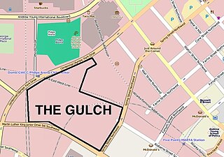
The Gulch is an area of Downtown Atlanta, Georgia, which is unbuilt but envisioned as the site of major development.
Tenth Street is a street in Midtown Atlanta, Georgia.