
The English River is a river in Kenora District and Thunder Bay District in Northwestern Ontario, Canada. It flows through Lac Seul to join the Winnipeg River at Tetu Lake as a right tributary. The river is in the Hudson Bay drainage basin, is 615 kilometres (382 mi) long and has a drainage basin of 52,300 square kilometres (20,200 sq mi). Although there are several hydroelectric plants on this river, the English River upstream of Minnitaki Lake is notable as one of the few large river systems in northwestern Ontario with a natural flow and without any upstream source of pollution. It is the fourth longest river entirely in Ontario.

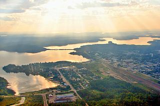
Sioux Lookout is a town in Northwestern Ontario, Canada. Located approximately 350 km (220 mi) northwest of Thunder Bay, it has a population of 5,272 people, an elevation of 390 m (1,280 ft), and its boundaries cover an area of 536 km2 (207 sq mi), of which 157 km2 (61 sq mi) is lake and wetlands. Known locally as the "Hub of the North", it is serviced by the Sioux Lookout Airport, Highway 72, and the Sioux Lookout railway station. According to a 2011 study commissioned by the municipality, health care and social services ranked as the largest sources of employment, followed by the retail trade, public administration, transportation and warehousing, manufacturing, accommodation and food services, and education.
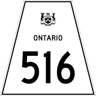
Secondary Highway 516, commonly referred to as Highway 516, is a provincially maintained secondary highway in the Canadian province of Ontario. The highway is 103.6-kilometre (64.4 mi) in length, connecting Highway 72 and Highway 642 near Sioux Lookout with Highway 599 north of Savant Lake.
Savant Lake is an unincorporated place and community in Unorganized Thunder Bay District in northwestern Ontario, Canada.
Robinson is a railway point and unincorporated place just west of an arm of Marchington Lake on the Sturgeon River in Unorganized Kenora District in northwestern Ontario, Canada.
The Marchington River is a river in the Hudson Bay drainage basin located in Kenora and Thunder Bay Districts in northwestern Ontario, Canada. It travels 78 kilometres (48 mi) from its head at Kashaweogama Lake in Thunder Bay District through a series of lakes to Marchington Lake, where it meets the Sturgeon River and North River. It then continues 30 kilometres (19 mi) over the small McDougall Falls and through Botsford Lake before emptying into the English River at Abram Lake near Sioux Lookout.

Abram Lake is a lake located adjacent to Sioux Lookout in the Kenora District of Northwestern Ontario, Canada. It is at the mouth of the Marchington River and the confluence point of the Marchington River with the English River.
The Sturgeon River is a river in the Hudson Bay drainage basin located in Kenora and Thunder Bay Districts in northwestern Ontario, Canada. It travels 38.5 kilometres (23.9 mi) west from its head at Sturgeon Lake, Thunder Bay District, through several intermediate lakes, to the Marchington River at Marchington Lake, Kenora District.
Marchington Lake is a lake in the Hudson Bay drainage basin located near Sioux Lookout in the Kenora District of northwestern Ontario, Canada.

Hudson is an unincorporated place and community in the municipality of Sioux Lookout, Kenora District in northwestern Ontario, Canada. It is located on Lost Lake on the English River in the Nelson River drainage basin.
Black Lake is a lake in the Hudson Bay drainage basin in the Unorganized Part of Kenora District in Northwestern Ontario, Canada. It is about 2 kilometres (1.2 mi) long and 0.6 kilometres (0.4 mi) wide and lies at an elevation of 372 metres (1,220 ft), 13 kilometres (8.1 mi) northeast of Superior Junction and Highway 642, 4 kilometres (2 mi) southwest of McDougall Mills and 1.3 kilometres (0.8 mi) south of Rosnel. The primary outflow is an unnamed creek north to Botsford Lake on the Marchington River, which flows via the English River, the Winnipeg River and the Nelson River to Hudson Bay. The CN transcontinental rail line crosses the creek between Black Lake and Botsford Lake.
Botsford Lake is a lake in the Hudson Bay drainage basin in Kenora District in northwestern Ontario, Canada. It is about 15 kilometres (9 mi) long and 2.2 kilometres (1.4 mi) wide, is at an elevation of 357 metres (1,171 ft), and lies between the settlements of Superior Junction and McDougall Mills; Rosnel is on the south shore of the lake. The CN transcontinental rail line travels the along the entire south shore. Highway 642 runs west of the lake, and Highway 516 runs approximately parallel to the north shore of the lake at a distance of about 6 kilometres (4 mi).
Pelican Lake is a lake in the Hudson Bay drainage basin in the town of Sioux Lookout and in Unorganized Kenora District in Kenora District, northwestern Ontario, Canada. It is about 8.5 kilometres (5.3 mi) long and 6.3 kilometres (3.9 mi) wide and lies at an elevation of 356 metres (1,168 ft). The town centre of Sioux Lookout is on the east shore of the lake, the railway point Pelican on the southwest, and the Canadian National Railway transcontinental main line crosses the lake and runs along the west shore.
Red Lake Road is an unincorporated place and community in Unorganized Kenora District in northwestern Ontario, Canada. It is named for the road, today's Ontario Highway 105, that runs from the community of Vermilion Bay in the south to the town of Red Lake in the north. Red Lake Road is at the junction of Highway 105 with the eastern terminus of Ontario Highway 609, which runs west to the community of Quibell and onward to its northern terminus at Clay Lake.
Ghost River is an unincorporated place on the south side of Marchington Lake on the Marchington River in Unorganized Kenora District in northwestern Ontario, Canada.
Rosnel is a railway point and unincorporated place on the south side of Botsford Lake on the Marchington River in Unorganized Kenora District in northwestern Ontario, Canada.
McDougall Mills is an unincorporated place on the Marchington River between Botsford Lake and the McDougall Falls downstream and Marchington Lake upstream in Unorganized Kenora District in northwestern Ontario, Canada.
The Matawin River is a river in Thunder Bay District in Northwestern Ontario, Canada. It is in the Great Lakes Basin and is a right tributary of the Kaministiquia River.
The Kashabowie River is a river in southwestern Thunder Bay District in Northwestern Ontario, Canada. It is in the Great Lakes Basin and is a tributary of the Shebandowan Lakes.

