Related Research Articles

Greene County is a county in the U.S. state of Indiana. As of 2010, the population was 33,165. The county seat is Bloomfield. The county was determined by the US Census Bureau to include the mean center of U.S. population in 1930.

John Riley Tanner was the 21st Governor of Illinois, from 1897 until 1901.

Spring Bay Township is located in Woodford County, Illinois, United States. As of the 2010 census, its population was 2,643 and it contained 1,133 housing units.

Stony Lonesome is an unincorporated community in Harrison Township, Bartholomew County, in the U.S. state of Indiana.

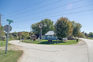
Calvertville is an unincorporated community in Highland Township, Greene County, Indiana, United States.
Cincinnati is an unincorporated community in Center Township, Greene County, Indiana.
Hashtown is an unincorporated community in Richland Township, Greene County, Indiana.
Hendricksville is an unincorporated community in Beech Creek Township, Greene County, Indiana.
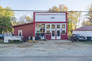
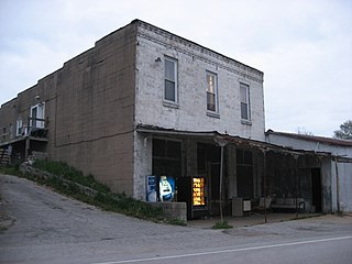
Koleen is an unincorporated community in Jackson Township, Greene County, Indiana.
McVille is an unincorporated community in Beech Creek Township, Greene County, Indiana.
Mineral City is an unincorporated community in Richland Township, Greene County, Indiana.

Newark is an unincorporated community in Beech Creek Township, Greene County, Indiana.
Park is an unincorporated community in Richland Township, Greene County, Indiana.
Point Commerce is an unincorporated community in Jefferson Township, Greene County, Indiana.
Ridgeport is an unincorporated community in Center Township, Greene County, Indiana.

Solsberry is an unincorporated community in Beech Creek Township, Greene County, Indiana.
Canterbury College was a private institution located in Danville, Indiana, United States from 1878 to 1951. The school was known as Central Normal College prior to 1946.

Plummer is an unincorporated community in Washington Township, Greene County, in the U.S. state of Indiana.
Dixon is an unincorporated community in Greene County, Indiana, in the United States.
Jordan Creek is a stream in Clay and Owen counties, in the U.S. state of Indiana. It is a tributary of the Eel River.
References
- ↑ U.S. Geological Survey Geographic Names Information System: Tanner, Indiana
- ↑ Baker, Ronald L. (October 1995). From Needmore to Prosperity: Hoosier Place Names in Folklore and History. Indiana University Press. p. 320. ISBN 978-0-253-32866-3.
...John Riley Tanner, Republican governor of Illinois...
- ↑ "Greene County". Jim Forte Postal History. Retrieved 16 September 2014.CS1 maint: discouraged parameter (link)
Municipalities and communities of Greene County, Indiana, United States | ||
|---|---|---|
| Cities |  | |
| Towns | ||
| Townships | ||
| CDPs | ||
| Other unincorporated communities |
| |
| Footnotes | ‡This populated place also has portions in an adjacent county or counties | |
Coordinates: 39°01′05″N86°47′36″W / 39.01806°N 86.79333°W
| | This Greene County, Indiana location article is a stub. You can help Wikipedia by expanding it. |