Texas State Highway 19

Last updated

Texas 19.svg

State Highway 19

Texas State Highway 19
Route information
Maintained by TxDOT
Length188.4 mi [1]  (303.2 km)
ExistedApril 4, 1917–present
Major junctions
South endI-45.svg I-45 in Huntsville
Major intersectionsUS 190.svg US 190 in Huntsville
US 84.svg US 84 in Palestine
US 79.svg US 79 in Palestine
I-20.svg I-20 in Canton
US 80.svg US 80 near Fruitvale
I-30.svgUS 67.svg I-30  / US 67 in Sulphur Springs
North endBusiness plate.svg
US 82.svg
Business plate.svg
US 271.svg
Bus. US 82  / Bus. US 271 in Paris
Location
Country United States
State Texas
Highway system
Texas 18.svg SH 18 I-20.svg I-20
Texas State Highway 19 in Emory Emory October 2017 02 (Texas State Highway 19).jpg
Texas State Highway 19 in Emory

State Highway 19 (SH 19) is a state highway in Texas runs from Huntsville to Paris in east Texas.

Contents

Route description

SH 19 begins at an interchange with Interstate 45 in southeast Huntsville. The highway runs through the eastern edge of the town as an expressway running close to the Sam Houston National Forest. The expressway ends at an intersection with State Highway 30 and runs through rural areas before reaching the town of Trinity. SH 19 runs north towards Crockett where the highway begins a concurrency with US 287. The two highways leave each other just northwest of Palestine. SH 19 runs northwest to Athens, running around the town with US 175/State Highway 31. The highway next runs through Canton, where it intersects Interstate 20. SH 19 runs through more rural areas of East Texas until the highway comes to Emory. The highway turns more northeast before running through the western part of Sulphur Springs. State Highway 154 joins SH 19, before leaving just east of Cooper. State Highway 24 joins the highway, where the two highways run together before ending in Paris.

A widening project for SH 19 between Montalba, north of Palestine, and Athens began in 2013, providing passing lanes, left turn lanes, and a shoulder. The segment in Henderson County was completed in 2014, but the Anderson County portion was not completed until spring 2019.

History

Historic SH 19 Old Texas 19.svg
Historic SH 19

SH 19 was one of the original 25 Texas state highways proposed on June 21, 1917, overlaid on top of the Paris-Houston Highway. [2] The original proposal was for it to run from the Texas/Oklahoma border north of Paris to Houston. On February 5, 1918, it was extended south to Freeport. [3] On August 21, 1923, SH 19 was pared back significantly, eliminating the section north of Grand Saline. On August 4, 1932, it had extended north to Alba. [4] On May 13, 1935, it was rerouted to end in Fruitvale. [5] On September 4, 1935, an eventual extension via Emory, Commerce, Ladonia, and Bonham to Oklahoma was proposed. [6] On August 1, 1936, the section from Canton to Grand Saline was restored as SH 19T. [7] SH 19T was cancelled when the rerouting of SH 19 from Canton to Fruitvale opened. On September 26, 1939, the sections south of Palestine which were cosigned with US 287 and US 75 were dropped. One section became part of SH 45 (now SH 30), and another was renumbered to SH 288. On April 15, 1940, SH 19 was extended north to Sulphur Springs, a modification of the much longer proposed extension that was not designated. On September 26, 1945, SH 19 was routed over FM 647 from 1 mile south of the Hopkins County line through Emory to Dunbar. On August 24, 1960, it was extended northward to its original starting point of Paris and again to the south to Huntsville, replacing a portion of SH 45. On May 21, 1979, SH 19 was extended over Loop 405 in Huntsville.

Historic SH 19A TexasHistSH19A.png
Historic SH 19A

SH 19A was a spur route of SH 19 that was originally planned on February 18, 1919, splitting off at Angleton and traveling to Palacios. [8] On March 19, 1923, it was extended east to Galveston and west to Ganado, with the old route to Palacios being changed to SH 19B. [9] On August 21, 1923, the route had been renumbered as SH 58 (now SH 35). [10]

SH 19B was a spur route of SH 19 that was originally planned on March 19, 1923, from Midfield to Palacios replacing part of rerouted SH 19A. On August 21, 1923, the route had been renumbered as SH 59. [10]

Junction list

CountyLocationmikmDestinationsNotes
Walker Huntsville 0.00.0I-45.svg I-45  Dallas, Houston Interchange; I-45 exit 113.
1.42.3Texas 75.svg SH 75  Madisonville, Conroe Interchange
1.62.6East plate.svg
Texas FM 3411.svg
FM 3411 east
2.43.9US 190.svg US 190  / Bear Cat Boulevard Huntsville, Livingston, Sam Houston State University Interchange
4.16.6Texas 30.svg SH 30  Huntsville, College Station Interchange
4.87.7Texas FM 2821.svg FM 2821  Sam Houston National Forest Interchange; North end of expressway
6.09.7West plate.svg
Texas 30.svg
SH 30 west
Riverside 15.324.6South plate.svg
Texas FM 405.svg
FM 405 south Dodge
15.825.4Texas FM 980.svg FM 980  Point Blank
Trinity River 16.326.2Unnamed bridge
Trinity 19.331.1East plate.svg
Texas FM 3453.svg
FM 3453 east Lake Livingston
Trinity 20.533.0North plate.svg
Texas FM 1617.svg
FM 1617 north
21.134.0South plate.svg
Texas FM 1617.svg
FM 1617 south
21.734.9North plate.svg
Texas FM 230.svg
FM 230 north Lovelady
21.835.1East plate.svg
Texas 94.svg
SH 94 east Groveton
26.642.8North plate.svg
Texas FM 1893.svg
FM 1893 north
Houston Lovelady 35.657.3South plate.svg
Texas FM 230.svg
FM 230 south Trinity
35.757.5Texas FM 1280.svg FM 1280  Groveton
41.066.0South plate.svg
Texas FM 231.svg
FM 231 south
Crockett 48.277.6Texas Loop 304.svg Loop 304
48.778.4South plate.svg
Texas FM 2110.svg
FM 2110 south
49.780.0Texas 7.svgWest plate.svg
Texas 21.svg
SH 7  / SH 21 west Centerville, Madisonville
West end of SH 21/SH 7 overlap
49.7680.08South plate.svg
US 287.svg
East plate.svg
Texas 7.svg
US 287 south / SH 7 east Groveton, Nacogdoches
East end of SH 7 overlap; south end of US 287 overlap
49.8280.18East plate.svg
Texas 21.svg
SH 21 east Alto, Nacogdoches
East end of SH 21 overlap
50.080.5North plate.svg
Texas FM 229.svg
FM 229 north
51.282.4Texas Loop 304.svg Loop 304
Latexo 53.085.3West plate.svg
Texas FM 2160.svg
FM 2160 west
55.589.3East plate.svg
Texas FM 2663.svg
FM 2663 east
61.699.1North plate.svg
Business plate.svg
US 287.svg
Bus. US 287 north Grapeland
62.2100.1Texas FM 2423.svg FM 2423  Grapeland
Grapeland 63.1101.5Texas FM 227.svg FM 227  Grapeland, Augusta
63.5102.2Texas FM 228.svg FM 228  Grapeland
64.4103.6South plate.svg
Business plate.svg
US 287.svg
Bus. US 287 south Grapeland
Anderson 72.8117.2East plate.svg
Texas 294.svg
SH 294 east Alto
South end of SH 294 overlap
Elkhart 73.3118.0North plate.svg
Texas FM 1817.svg
FM 1817 north
73.7118.6West plate.svg
Texas 294.svg
SH 294 west Oakwood, Fairfield
North end of SH 294 overlap
79.3127.6South plate.svg
Texas FM 2419.svg
FM 2419 south
Palestine 81.6131.3Texas Loop 256.svg Loop 256
83.4134.2East plate.svg
US 84.svg
US 84 east Rusk
South end of US 84 overlap
83.7134.7West plate.svg
US 84.svg
North plate.svg
US 287.svg
US 84 west / US 287 north Fairfield
North end of US 84/ US 287 overlap
83.9135.0Texas Loop 127.svg Loop 127
84.4135.8North plate.svg
US 79.svg
US 79 north Jacksonville
South end of US 79 overlap
85.7137.9South plate.svg
US 79.svg
South plate.svg
US 287.svg
US 79 south / US 287 south Oakwood
North end of US 79 overlap; south end of US 287 overlap
86.4139.0Texas Loop 256.svg Loop 256 Interchange
88.3142.1North plate.svg
US 287.svg
US 287 north Corsicana
North end of US 287 overlap
Montalba 95.1153.0Texas FM 321.svg FM 321  Tennessee Colony, Neches
96.8155.8West plate.svg
Texas FM 2330.svg
FM 2330 west
Bois d'Arc 100.9162.4West plate.svg
Texas FM 860.svg
FM 860 west
103.2166.1Texas FM 837.svg FM 837  Frankston
Henderson Athens 115.7186.2South plate.svg
Texas FM 1615.svg
FM 1615 south
115.8186.4West plate.svg
Texas FM 753.svg
FM 753 west Malakoff
116.5187.5West plate.svg
Texas Loop 7.svg
North plate.svg
Business plate.svg
Texas 19.svg
Loop 7 west / Bus. SH 19 north Corsicana, Athens
Interchange; south end of Loop 7 overlap
118.9191.4East plate.svg
US 175.svg
West plate.svg
Business plate.svg
US 175.svg
US 175 east / Bus. US 175 west Jacksonville, Athens
Interchange; south end of US 175 overlap
120.3193.6Texas FM 2495.svg FM 2495  Athens Interchange
121.7195.9East plate.svg
Texas 31.svg
West plate.svg
Business plate.svg
Texas 31.svg
SH 31 east / Bus. SH 31 west Tyler, Athens
Interchange; south end of SH 31 overlap
122.4197.0Texas FM 1616.svg FM 1616  Murchison
124.1199.7West plate.svg
US 175.svg
West plate.svg
Texas 31.svg
South plate.svg
Business plate.svg
Texas 19.svg
West plate.svg
Texas Loop 7.svg
US 175 west / SH 31 west / Bus. SH 19 south / Loop 7 west Dallas, Corsicana, Athens
Interchange; north end of US 175/SH 31/Loop 7 overlap
127.1204.5East plate.svg
Texas FM 2752.svg
FM 2752 east
129.6208.6West plate.svg
Texas FM 2709.svg
FM 2709 west Eustace
Van Zandt 133.3214.5Texas FM 1861.svg FM 1861  Martins Mill
135.9218.7West plate.svg
Texas FM 1256.svg
FM 1256 west
137.3221.0East plate.svg
Texas FM 858.svg
FM 858 east Martins Mill, Ben Wheeler
142.4229.2West plate.svg
Texas FM 1651.svg
FM 1651 west
Canton 145.2233.7South plate.svg
Texas RM 2909.svg
RM 2909 south Martins Mill
146.1235.1Texas 243.svg SH 243  Kaufman, Ben Wheeler
146.9236.4Texas 64.svg SH 64  Wills Point, Ben Wheeler
148.4238.8I-20.svg I-20  Dallas, Shreveport I-20 exit 527.
156.0251.1US 80.svg US 80  Wills Point, Grand Saline
161.2259.4South plate.svg
Texas FM 859.svg
FM 859 south Edgewood
Sabine River 161.8260.4Unnamed bridge
Rains 165.3266.0West plate.svg
Texas FM 2324.svg
FM 2324 west Lake Tawakoni
Emory 167.9270.2South plate.svg
Texas FM 3274.svg
FM 3274 south (Willow Springs Rd)
168.0270.4US 69.svg US 69 (Lennon Dr) Greenville, Mineola
168.1270.5Texas FM 2795.svg FM 2795 (Quitman St)
168.6271.3North plate.svg
Texas FM 275.svg
FM 275 north Cumby
173.9279.9West plate.svg
Texas FM 514.svg
FM 514 west Point
South end of FM 514 overlap
174.4280.7East plate.svg
Texas FM 514.svg
FM 514 east Lake Fork Reservoir
North end of FM 514 overlap
Hopkins 179.0288.1West plate.svg
Texas FM 1567.svg
FM 1567 west Lone Oak
South end of FM 1567 overlap
179.3288.6East plate.svg
Texas FM 1567.svg
FM 1567 east Como
North end of FM 1567 overlap
Sulphur Springs 186.3299.8South plate.svg
Texas 11.svg
SH 11 south Winnsboro
South end of SH 11 overlap
186.9300.8I-30.svgUS 67.svg I-30  / US 67  Greenville, Mount Pleasant I-30 exit 122; interchange.
187.8302.2Business plate.svg
US 67.svg
Bus. US 67 (Main Street) Sulphur Springs
188.4303.2North plate.svg
Texas 11.svg
SH 11 north Commerce
North end of SH 11 overlap
189.9305.6Texas FM 2285.svg FM 2285
191.6308.4East plate.svg
Texas 154.svg
East plate.svg
Texas Loop 301.svg
SH 154 east / Loop 301 east Sulphur Springs
South end of SH 154 overlap
193.1310.8East plate.svg
Texas FM 1537.svg
FM 1537 east
198.4319.3Texas FM 71.svg FM 71
Oak Grove 202.0325.1East plate.svg
Texas FM 1536.svg
FM 1536 east Oak Grove
South Sulphur River 204.3328.8Unnamed bridge
Delta 205.2330.2West plate.svg
Texas 154.svg
SH 154 west Cooper
North end of SH 154 overlap
206.6332.5West plate.svg
Texas FM 1529.svg
FM 1529 west Cooper
207.8334.4East plate.svg
Texas FM 895.svg
FM 895 east
211.0339.6West plate.svg
Texas 24.svg
SH 24 west Commerce
South end of SH 24 overlap
211.6340.5Texas FM 198.svg FM 198
212.2341.5South plate.svg
Texas FM 1335.svg
FM 1335 south
North Sulphur River 213.3343.3Unnamed bridge
Lamar 215.6347.0Texas FM 1184.svg FM 1184  Roxton
219.1352.6West plate.svg
Texas FM 2036.svg
FM 2036 west
Paris 223.4359.5Texas Loop 286.svg Loop 286 Interchange
224360South plate.svg
Texas FM 1497.svg
FM 1497 south
224.4361.1East plate.svg
Texas FM 1507.svg
FM 1507 east (Evergreen Street)
225.7363.2Business plate.svg
US 82.svg
Business plate.svg
US 271.svg
Bus. US 82  / Bus. US 271  Bonham, Clarksville, Bogata, Hugo
1.000 mi = 1.609 km; 1.000 km = 0.621 mi

Business routes

SH 19 has one business route.

Athens business loop

Business plate.svg

Texas 19-J.svg

Business State Highway 19-J

Location Athens
Length4.186 mi [11]  (6.737 km)
Existed2010–present

Business State Highway 19-J (Bus. SH 19-J) is a 4.186 mi (6.737 km) long business route through Athens. The route was designated on May 27, 2004 after SH 19 proper was re-routed east onto the Jed Robinson Loop, also designated as US 175, SH 31 and Loop 7 (formerly FM 317). [11] Bus. SH 19-J begins at an interchange with the Jed Robinson Loop and SH 19, north of downtown Athens, heading south on North Palestine Street, while SH 19 heads east along the loop around the city. Bus. SH 19-J continues south through the town square, which is the location of the Henderson County Courthouse and also comprises the junction with Bus. SH 31-H (Tyler Street) and Bus. US 175-G (Corsicana Street). For a short distance, the business route is paralleled by FM 2494, which takes South Praireville Street, before cutting east, away from Bus. SH 19-J on Lakeside Drive. The business route curves southeast, still following Palestine Street, past the northern terminus of FM 59 at West Cayuga Drive, before reaching its southern terminus at the Jim Robinson Loop, where SH 19 splits from Loop 7 and serves as a continuation of the route. [12]

Major intersections

The entire route is in Athens, Henderson County.

mikmDestinationsNotes
0.0000.000North plate.svg
Texas 19.svg
Texas Loop 7.svg SH 19 north / Loop 7 (Jim Robinson Loop)
South plate.svg
Texas 19.svg
SH 19 south Palestine
Southern terminus; road continues south as SH 19
1.4712.367South plate.svg
Texas FM 39.svg
FM 39 south (West Cayuga Drive)
Northern terminus of FM 39
2.5824.155Business plate.svg
US 175.svg
Bus. US 175 (Corsicana Street)
2.6584.278Business plate.svg
Texas 31-H.svg
Bus. SH 31-H (Tyler Street)
4.1866.737US 175.svgSouth plate.svg
Texas 19.svg
Texas 31.svgTexas Loop 7.svg US 175  / SH 19 south / SH 31  / Loop 7 (Jim Robinson Loop) Malakoff, Eustace
North plate.svg
Texas 19.svg
SH 19 north Canton
Northern terminus; road continues north as SH 19
1.000 mi = 1.609 km; 1.000 km = 0.621 mi

Related Research Articles

<span class="mw-page-title-main">Texas State Highway 30</span> State highway in Texas

State Highway 30 runs from Business SH 6-R in College Station via Roans Prairie to SH 19 in Huntsville. It is known as Harvey Road between Business SH 6-R and FM 158 in College Station, as 11th Street between I-45 and US 190 in Huntsville, and as Riverside Drive east of US 190 in Huntsville.

<span class="mw-page-title-main">Texas State Highway 40</span> State highway in Texas

State Highway 40 or William D. Fitch Parkway, runs from Farm to Market Road 2154 (FM 2154) to SH 6 in College Station, Texas. The current SH 40 was authorized in 1994. Signage for the highway went up March 2006 and the road was officially opened June 23, 2006.

<span class="mw-page-title-main">Texas State Highway 47</span> State highway in Texas

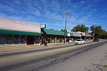
State Highway 47 (SH 47) runs from FM 60 near Easterwood Airport and Texas A&M University Research Park in College Station to SH 21 at Texas A&M University-Riverside near Bryan. This highway was designated on January 28, 1987.

<span class="mw-page-title-main">Texas State Highway 8</span> Highway in Texas

State Highway 8 is a north–south state highway in the U.S. state of Texas that runs from the Red River, which serves as the boundary between Texas and Arkansas, north of New Boston to SH 155 at Linden.

<span class="mw-page-title-main">Texas State Highway 10</span> State highway in Tarrant County, Texas, United States

State Highway 10 (SH 10) runs from SH 183 in Euless to the intersection of I-820, SH 121 and SH 183 in Hurst. This highway was created when a portion of SH 183 was rerouted on August 29, 1979. It is locally known as Hurst Boulevard and Euless Boulevard. It passes near the main facility of Bell Helicopter Textron.

<span class="mw-page-title-main">Texas State Highway 11</span> State highway in Texas

State Highway 11 is a highway that runs from US 59 in Linden to SH 56 in Sherman in northeast Texas.

<span class="mw-page-title-main">Texas State Highway 12</span> Highway in Texas

State Highway 12 (SH 12) is a west–east state highway in the U.S. state of Texas that runs from Interstate 10 (I-10) in Vidor to the Louisiana state line at Deweyville. The route was designated on August 27, 1959, as a renumbering of SH 235 to match the numbering of Louisiana Highway 12 (LA 12), with which it connects.

<span class="mw-page-title-main">Texas State Highway 15</span> Highway in Texas

State Highway 15 is a state highway in the U.S. state of Texas. It runs from the Oklahoma state line 6 miles (9.7 km) east of Follett to US 287 in Stratford.

<span class="mw-page-title-main">Texas State Highway 18</span> State highway in Texas

State Highway 18 is a state highway in the U.S. state of Texas maintained by the Texas Department of Transportation (TxDOT) that runs from Fort Stockton in western Texas to the New Mexico state line between Kermit and Jal, New Mexico. This route was designated in 1958 over the northern half of what was previously SH 82.

<span class="mw-page-title-main">Texas State Highway 21</span> State highway in Texas

State Highway 21 runs from the Texas-Louisiana boundary east of San Augustine to San Marcos in east and central Texas. SH 21 mostly follows the alignment of the Old San Antonio Road and the El Camino Real, except for the portion between Midway and Bryan, where the Old San Antonio Road took a more northerly route, and SH 21 follows a more direct route. That section of the Old San Antonio Road is served by Texas State Highway OSR.

<span class="mw-page-title-main">Texas State Highway 24</span> State highway in Texas

State Highway 24 runs from Campbell to Paris in north Texas. It is a portion of the main route, along with Interstate 30, from Paris to the Dallas–Fort Worth metroplex.

<span class="mw-page-title-main">Texas State Highway 114</span> State highway in Texas, United States

State Highway 114 is a state highway that runs from the Dallas-Fort Worth Metroplex westward across Texas to the New Mexico state line, where it becomes New Mexico State Road 114, which eventually ends at Elida, New Mexico at US 70 / NM 330.

<span class="mw-page-title-main">Texas State Highway 29</span> State highway in Texas

State Highway 29 runs from 3.0 miles (4.8 km) south of Menard, Texas, east to SH 95 in Circleville via Mason, Llano, Burnet, Liberty Hill, and Georgetown in central Texas, United States.

<span class="mw-page-title-main">Texas State Highway 36</span> State highway in Texas

State Highway 36 runs from Freeport to Abilene. It was designated as the 36th Division Memorial Highway between Cameron and Sealy by the Texas Legislature in 1985.

<span class="mw-page-title-main">Texas State Highway 37</span> State highway in Wood, Franklin, and Red River counties in Texas, United States

State Highway 37 is a state highway that runs from the Oklahoma state line near Albion to Mineola in the northeast corner of the state.

<span class="mw-page-title-main">Texas State Highway 43</span> State highway in Texas

State Highway 43 is a Texas state highway that runs from Henderson to Atlanta.

<span class="mw-page-title-main">Texas State Highway 57</span> State highway in Texas

State Highway 57 is a 1.474-mile (2.372 km) Texas state highway located in Tyler.

<span class="mw-page-title-main">Texas State Highway 73</span> State highway in Texas

State Highway 73 (SH 73) is a Texas state highway that runs 42 miles (68 km) from Winnie through Port Arthur to near Orange.

<span class="mw-page-title-main">Texas State Highway 111</span> State highway in Texas

State Highway 111 is a state highway that runs from Gonzales to Midfield in the southeastern region of the U.S. state of Texas.

References

  1. Transportation Planning and Programming Division (n.d.). "State Highway No. 19". Highway Designation Files. Texas Department of Transportation.
  2. "Minutes" (PDF). publicdocs.txdot.gov. Texas Department of Transportation. June 21, 1917. Archived (PDF) from the original on October 23, 2017. Retrieved 29 April 2023.
  3. "Minutes" (PDF). publicdocs.txdot.gov. Texas Department of Transportation. February 5, 1918. Archived (PDF) from the original on October 23, 2017. Retrieved 29 April 2023.
  4. "Minutes" (PDF). publicdocs.txdot.gov. Texas Department of Transportation. August 2, 1932. Archived (PDF) from the original on January 29, 2018. Retrieved 29 April 2023.
  5. "Minutes" (PDF). publicdocs.txdot.gov. Texas Department of Transportation. May 13, 1935. Archived (PDF) from the original on October 20, 2017. Retrieved 29 April 2023.
  6. "Minutes" (PDF). publicdocs.txdot.gov. Texas Department of Transportation. August 19, 1935. Archived (PDF) from the original on October 20, 2017. Retrieved 29 April 2023.
  7. "Minutes" (PDF). publicdocs.txdot.gov. Texas Department of Transportation. July 31, 1936. Archived (PDF) from the original on October 21, 2017. Retrieved 29 April 2023.
  8. "Minutes" (PDF). publicdocs.txdot.gov. Texas Department of Transportation. February 18, 1919. Archived (PDF) from the original on October 24, 2017. Retrieved 29 April 2023.
  9. "Minutes" (PDF). publicdocs.txdot.gov. Texas Department of Transportation. March 19, 1923. Archived (PDF) from the original on October 27, 2017. Retrieved 29 April 2023.
  10. 1 2 "Minutes" (PDF). publicdocs.txdot.gov. Texas Department of Transportation. August 21, 1923. Archived (PDF) from the original on October 26, 2017. Retrieved 29 April 2023.
  11. 1 2 Transportation Planning and Programming Division (n.d.). "Business State Highway No. 19-J". Highway Designation Files. Texas Department of Transportation.
  12. Texas Department of Transportation (2018). "Statewide Planning Map LRS Readout (ArcGIS)" . Retrieved July 29, 2022.

Commons-logo.svg Media related to Texas State Highway 19 at Wikimedia Commons