Walker County, Texas

Last updated

Walker County
Huntsville May 2022 06 (Walker County Courthouse).jpg
The Walker County Courthouse in 2022
Map of Texas highlighting Walker County.svg
Location within the U.S. state of Texas
Texas in United States.svg
Texas's location within the U.S.
Coordinates: 30°44′N95°34′W / 30.74°N 95.57°W / 30.74; -95.57
CountryFlag of the United States.svg United States
StateFlag of Texas.svg  Texas
Founded1846
Named for Robert J. Walker, Renamed for Samuel H. Walker
Seat Huntsville
Largest cityHuntsville
Area
  Total802 sq mi (2,080 km2)
  Land784 sq mi (2,030 km2)
  Water17 sq mi (40 km2)  2.2%
Population
 (2020)
  Total76,400
  Density95/sq mi (37/km2)
Time zone UTC−6 (Central)
  Summer (DST) UTC−5 (CDT)
Congressional districts 8th, 17th
Website www.co.walker.tx.us

Walker County is a county located in the east central section of the U.S. state of Texas. As of the 2020 census, its population was 76,400. [1] Its county seat is Huntsville. [2] Initially, Walker County was named for Robert J. Walker, a legislator from Mississippi who introduced into the United States Congress the resolution to annex Texas. Walker later supported the U.S. during its Civil War and earned some enmity for it. In order to keep the county's name, the state renamed it for Samuel H. Walker (no relation), a Texas Ranger and soldier in the United States Army.

Contents

Walker County comprises the Huntsville Micropolitan Statistical Area which is part of the Houston-The Woodlands Combined Statistical Area.

Geography

According to the U.S. Census Bureau, the county has a total area of 802 square miles (2,080 km2), of which 784 square miles (2,030 km2) is land and 17 square miles (44 km2) (2.2%) is water. [3]

Major highways

Adjacent counties

National protected area

Demographics

Historical population
CensusPop.Note
1850 3,964
1860 8,191106.6%
1870 9,76619.2%
1880 12,02423.1%
1890 12,8747.1%
1900 15,81322.8%
1910 16,0611.6%
1920 18,55615.5%
1930 18,528−0.2%
1940 19,8687.2%
1950 20,1631.5%
1960 21,4756.5%
1970 27,68028.9%
1980 41,78951.0%
1990 50,91721.8%
2000 61,75821.3%
2010 67,8619.9%
2020 76,40012.6%
U.S. Decennial Census [4]
1850–2010 [5] 2010–2020 [6]
Walker County, Texas - Demographic Profile
(NH = Non-Hispanic)
Race / EthnicityPop 2010 [7] Pop 2020 [6] % 2010% 2020
White alone (NH)39,67139,82358.46%52.12%
Black or African American alone (NH)15,09816,38222.25%21.44%
Native American or Alaska Native alone (NH)1862510.27%0.33%
Asian alone (NH)6171,1260.91%1.47%
Pacific Islander alone (NH)19390.03%0.05%
Some Other Race alone (NH)723180.11%0.42%
Mixed Race/Multi-Racial (NH)8091,8831.19%2.46%
Hispanic or Latino (any race)11,38916,57816.78%21.70%
Total67,86176,400100.00%100.00%

Note: the US Census treats Hispanic/Latino as an ethnic category. This table excludes Latinos from the racial categories and assigns them to a separate category. Hispanics/Latinos can be of any race.

As of the census [8] of 2000, there were 61,758 people, 18,303 households, and 11,384 families residing in the county. The population density was 78 people per square mile (30 people/km2). There were 21,099 housing units at an average density of 27 units per square mile (10 units/km2). The racial makeup of the county was 69.12% white, 23.88% black or African American, 0.35% Native American, 0.77% Asian, 0.05% Pacific Islander, 4.42% from other races, and 1.41% from two or more races. 14.11% of the population were Hispanic or Latino of any race.

There were 18,303 households, out of which 28.70% had children under the age of 18 living with them, 46.80% were married couples living together, 11.70% had a female householder with no husband present, and 37.80% were non-families. 27.00% of all households were made up of individuals, and 8.00% had someone living alone who was 65 years of age or older. The average household size was 2.44 and the average family size was 3.02.

In the county, the population was spread out, with 18.00% under the age of 18, 23.00% from 18 to 24, 31.10% from 25 to 44, 18.90% from 45 to 64, and 8.90% who were 65 years of age or older. The median age was 31 years. For every 100 females, there were 151.10 males. For every 100 females age 18 and over, there were 161.90 males.

The median income for a household in the county was $31,468, and the median income for a family was $42,589. Males had a median income of $27,634 versus $22,579 for females. The per capita income for the county was $14,508. About 10.60% of families and 18.40% of the population were below the poverty line, including 19.10% of those under age 18 and 13.40% of those age 65 or over.

Education

Sam Houston State University is located in Huntsville.

School districts serving portions of the county include: [9]

The Gulf Coast Trades Center, a charter school, is in an unincorporated area of the county. [9] [10]

The Huntsville and New Waverly ISDs are assigned to Lone Star College. Areas of Walker County in Trinity ISD are assigned to Angelina College. The portion of Richards ISD in Walker County is zoned to Blinn College. [11]

Government and infrastructure

Ellis Unit, a prison in unincorporated Walker County EllisUnitTX.jpg
Ellis Unit, a prison in unincorporated Walker County

The headquarters of the Texas Department of Criminal Justice (TDCJ), the Texas agency that operates adult state correctional facilities, are in Huntsville. [12] [13]

Walker County has the highest number of state prisons and jails of all of the counties in Texas. [14] Several TDCJ prisons for men, including the Byrd Unit, [15] the Goree Unit, [16] the Huntsville Unit, [17] and the Wynne Unit, are in the Huntsville city limits. [18] The Holliday Unit, a transfer unit, is in Huntsville. [19] In addition the Ellis Unit and the Estelle Unit are in unincorporated areas of Walker County. [20] [21] The Huntsville Unit houses the State of Texas execution chamber. [22]

Politics

Like most of Texas, Walker County was solidly Democratic for the first half of the 20th century. Before 1972, the only time a Republican carried the county was in 1956, and it became a Republican stronghold afterwards, with only one candidate carrying the county from that point forward.

United States presidential election results for Walker County, Texas [23]
Year Republican Democratic Third party
No.%No.%No.%
2020 15,37565.12%7,88433.39%3531.50%
2016 12,88465.08%6,09130.77%8214.15%
2012 12,14064.97%6,25233.46%2931.57%
2008 11,62360.71%7,33438.31%1890.99%
2004 11,71065.71%5,97733.54%1350.76%
2000 9,07663.14%4,94334.39%3552.47%
1996 7,17749.27%6,08841.79%1,3028.94%
1992 6,66241.84%5,61935.29%3,64322.88%
1988 8,47358.88%5,82640.48%920.64%
1984 8,80967.24%4,26332.54%280.21%
1980 5,65751.87%4,86944.65%3803.48%
1976 4,97448.90%5,10550.19%920.90%
1972 5,08263.20%2,94036.56%190.24%
1968 1,94633.62%2,39141.30%1,45225.08%
1964 1,55735.10%2,87764.86%20.05%
1960 1,75048.57%1,83250.85%210.58%
1956 1,99159.86%1,28738.70%481.44%
1952 1,89747.71%2,07852.26%10.03%
1948 57022.23%1,43956.12%55521.65%
1944 1457.12%1,63880.41%25412.47%
1940 2189.18%2,15890.82%00.00%
1936 693.86%1,71596.02%20.11%
1932 834.36%1,81195.17%90.47%
1928 48839.51%74760.49%00.00%
1924 20110.07%1,79289.78%30.15%
1920 40423.45%78845.73%53130.82%
1916 31528.56%76369.17%252.27%
1912 32330.88%63160.33%928.80%

Communities

Cities

Unincorporated community

Notable people

See also

Related Research Articles

<span class="mw-page-title-main">Brazoria County, Texas</span> County in Texas, United States

Brazoria County is a county in the U.S. state of Texas. As of the 2020 census, the population of the county was 372,031. The county seat is Angleton.

<span class="mw-page-title-main">Trinity County, Texas</span> County in Texas, United States

Trinity County is a county located in the U.S. state of Texas. As of the 2020 census, the population was 13,602. Its county seat is Groveton. The county is named for the Trinity River.

<span class="mw-page-title-main">Travis County, Texas</span> County in Texas, U.S.

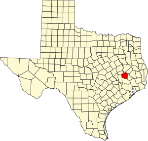
Travis County is located in Central Texas. As of the 2020 census, the population was 1,290,188. It is the fifth-most populous county in Texas. Its county seat and most populous city is Austin, the capital of Texas. The county was established in 1840 and is named in honor of William Barret Travis, the commander of the Republic of Texas forces at the Battle of the Alamo. Travis County is part of the Austin–Round Rock–Georgetown Metropolitan Statistical Area. It is located along the Balcones Fault, the boundary between the Edwards Plateau to the west and the Blackland Prairie to the east.

<span class="mw-page-title-main">Polk County, Texas</span> County in Texas, United States

Polk County is a county located in the U.S. state of Texas. As of the 2020 census, its population was 50,123. Its county seat is Livingston. The county is named after James K. Polk.

<span class="mw-page-title-main">Madison County, Texas</span> County in Texas, United States

Madison County is a county located in the U.S. state of Texas. As of the 2020 census, its population was 13,455. Its seat is Madisonville. The county was created in 1853 and organized the next year. It is named for James Madison, the fourth President of the United States. In 1852, Hillary Mercer Crabb was elected to serve the unexpired term of State Representative F. L. Hatch. Among Crabb's accomplishments as a legislator was the introduction of a bill to create Madison County.

<span class="mw-page-title-main">Liberty County, Texas</span> County in Texas, United States

Liberty County is a county in the U.S. state of Texas. As of the 2020 census, its population was 91,628. The county seat is Liberty. It was founded in 1831, as a municipality in Mexico as Villa de la Santísima Trinidad de la Libertad by commissioner José Francisco Madero and organized as a county of the Republic of Texas in 1836. Its name was anglicized as Liberty based on the ideal of American liberty.

<span class="mw-page-title-main">Jones County, Texas</span> County in Texas, United States

Jones County is a county located in the U.S. state of Texas. As of the 2020 census, its population was 19,663. Its county seat is Anson. The county was created in 1858 and organized in 1881. Both the county and its county seat are named for Anson Jones, the fourth and final president of the Republic of Texas.

<span class="mw-page-title-main">Houston County, Texas</span> County in Texas, United States

Houston County is a county located in the U.S. state of Texas. As of the 2020 census, its population was 22,066. Its county seat is Crockett. Houston County was one of 46 entirely dry counties in the state of Texas, until voters in a November 2007 special election legalized the sale of alcohol in the county.

<span class="mw-page-title-main">Harris County, Texas</span> County in Texas, U.S.

Harris County is a county located in the U.S. state of Texas; as of the 2020 census, the population was 4,731,145, making it the most populous county in Texas and the third-most populous county in the United States. Its county seat is Houston, the most populous city in Texas and fourth-most populous city in the United States. The county was founded in 1836 and organized in 1837. It is named for John Richardson Harris, who founded the town of Harrisburg on Buffalo Bayou in 1826. According to the July 2022 census estimate, Harris County's population has shifted to 4,780,913 comprising over 16% of Texas's population. Harris County is included in the nine-county Houston–The Woodlands–Sugar Land metropolitan statistical area, which is the fifth-most populous metropolitan area in the United States.

<span class="mw-page-title-main">Galveston County, Texas</span> County in Texas, United States

Galveston County is a county in the U.S. state of Texas, located along the Gulf Coast adjacent to Galveston Bay. As of the 2020 census, its population was 350,682. The county was founded in 1838. The county seat is the City of Galveston, founded the following year, and located on Galveston Island. The most-populous municipality in the county is League City, a suburb of Houston at the northern end of the county, which surpassed Galveston in population during the early 2000s.

<span class="mw-page-title-main">Fort Bend County, Texas</span> County in Texas, United States

Fort Bend County is a county located in the U.S. state of Texas. The county was founded in 1837 and organized the next year. It is named for a blockhouse at a bend of the Brazos River. The community developed around the fort in early days. The county seat is Richmond. The largest city located entirely within the county borders is Sugar Land. The largest city by population in the county is Houston; however, most of Houston's population is located in neighboring Harris County.

<span class="mw-page-title-main">Coryell County, Texas</span> County in Texas, United States

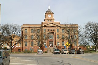
Coryell County is a county located on the Edwards Plateau in the U.S. state of Texas. As of the 2020 census, its population was 83,093. The county seat is Gatesville. The county is named for James Coryell, a frontiersman and Texas Ranger who was killed by Caddo Indians.

<span class="mw-page-title-main">Bee County, Texas</span> County in Texas, United States

Bee County is a county located in the U.S. state of Texas. It is in South Texas and its county seat is Beeville. As of the 2020 census, its population was 31,047. The Beeville, TX micropolitan statistical area includes all of Bee County. The county was founded December 8, 1857, and organized the next year. It is named for Barnard E. Bee, Sr., a secretary of state of the Republic of Texas.

<span class="mw-page-title-main">Angleton, Texas</span> City in Texas, United States

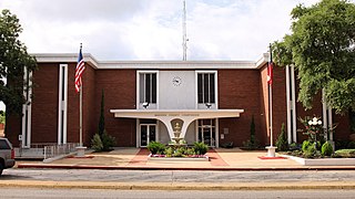
Angleton is a city in and the county seat of Brazoria County, Texas, United States, within the Houston–The Woodlands–Sugar Land metropolitan area. Angleton lies at the intersection of State Highway 288, State Highway 35, and the Union Pacific Railroad. The population was 19,429 at the 2020 census. Angleton is in the 14th congressional district, and is represented by Republican Congressman Randy Weber.

<span class="mw-page-title-main">Channelview, Texas</span> Census-designated place in Texas, United States

Channelview is a census-designated place (CDP) in the U.S. state of Texas on the east side of Houston in Harris County. Its population was 45,688 at the 2020 U.S. census.

<span class="mw-page-title-main">Lovelady, Texas</span> City in Texas, United States

Lovelady is a town in Houston County, Texas, United States. The population was 570 at the 2020 census.

<span class="mw-page-title-main">Cleveland, Texas</span> City in Texas, United States

Cleveland is a city in the U.S. state of Texas, within the Greater Houston metropolitan area and Liberty County. The population was 7,471 at the 2020 census.

<span class="mw-page-title-main">Dayton, Texas</span> City in Texas, United States

Dayton is a city in Liberty County, Texas, United States. The population was 8,777 at the 2020 census.

<span class="mw-page-title-main">Huntsville, Texas</span> City in the United States

Huntsville is a city in and the county seat of Walker County, Texas, United States. The population was 45,941 as of the 2020 census. It is the center of the Huntsville micropolitan area. Huntsville is in the East Texas Piney Woods on Interstate 45 and home to Sam Houston State University, Texas State Prison, the Texas Department of Criminal Justice, Huntsville State Park, and HEARTS Veterans Museum of Texas.

<span class="mw-page-title-main">New Waverly, Texas</span> City in Texas, United States

New Waverly is a city in Walker County, Texas, United States. The population was 914 at the 2020 census.

References

  1. "Walker County, Texas". United States Census Bureau . Retrieved January 30, 2022.
  2. "Find a County". National Association of Counties. Retrieved June 7, 2011.
  3. "2010 Census Gazetteer Files". United States Census Bureau. August 22, 2012. Retrieved May 12, 2015.
  4. "Decennial Census of Population and Housing by Decades". US Census Bureau.
  5. "Texas Almanac: Population History of Counties from 1850–2010" (PDF). Texas Almanac. Archived (PDF) from the original on October 9, 2022. Retrieved May 12, 2015.
  6. 1 2 "P2 HISPANIC OR LATINO, AND NOT HISPANIC OR LATINO BY RACE - 2020: DEC Redistricting Data (PL 94-171) - Walker County, Texas". United States Census Bureau .
  7. "P2 HISPANIC OR LATINO, AND NOT HISPANIC OR LATINO BY RACE - 2010: DEC Redistricting Data (PL 94-171) - Walker County, Texas". United States Census Bureau .
  8. "U.S. Census website". United States Census Bureau . Retrieved May 14, 2011.
  9. 1 2 "Education Service Center, Region VI Archived November 17, 2011, at the Wayback Machine ." (Map) Educational Service Center 6. Retrieved December 8, 2011.
    "2020 CENSUS - SCHOOL DISTRICT REFERENCE MAP: Walker County, TX" (PDF). U.S. Census Bureau. Archived (PDF) from the original on October 9, 2022. Retrieved June 30, 2022. - See text list
  10. "We can be reached at: Archived December 3, 2011, at the Wayback Machine " Gulf Coast Trades Center. Retrieved December 8, 2011. "Gulf Coast Trades Center / Raven School 143 Forest Service Rd. 233 New Waverly, TX 77358"
  11. Texas Education Code, Sec. 130.165. ANGELINA COUNTY JUNIOR COLLEGE DISTRICT SERVICE AREA. Sec. 130.168. BLINN JUNIOR COLLEGE DISTRICT SERVICE AREA. Sec. 130.191. LONE STAR COLLEGE SYSTEM DISTRICT SERVICE AREA..
  12. "Huntsville Prison Blues." National Public Radio . September 10, 2001. Retrieved December 2, 2009.
  13. "LIVINGSTON NAMED EXECUTIVE DIRECTOR OF STATE’S CRIMINAL JUSTICE AGENCY Archived January 25, 2010, at the Wayback Machine ." Texas Department of Criminal Justice. July 28, 2005. Retrieved December 2, 2009.
  14. Horswell, Cindy. "For hard-hit economy of Liberty County, crime officially pays." Houston Chronicle . June 29, 1995, A30, Retrieved July 23, 2010.
  15. "Byrd Unit Archived July 25, 2010, at the Wayback Machine ." Texas Department of Criminal Justice. Retrieved May 10, 2010.
  16. "Goree Unit Archived July 25, 2010, at the Wayback Machine ." Texas Department of Criminal Justice. Retrieved May 10, 2010.
  17. "Huntsville Unit Archived March 30, 2008, at the Wayback Machine ." Texas Department of Criminal Justice. Retrieved May 10, 2010.
  18. "Wynne Unit Archived July 25, 2010, at the Wayback Machine ." Texas Department of Criminal Justice. Retrieved May 10, 2010.
  19. "Holliday Unit Archived July 25, 2010, at the Wayback Machine ." Texas Department of Criminal Justice. Retrieved July 13, 2010.
  20. "Ellis Unit Archived July 25, 2010, at the Wayback Machine ." Texas Department of Criminal Justice. Retrieved May 10, 2010.
  21. "Estelle Unit Archived January 25, 2010, at the Wayback Machine ." Texas Department of Criminal Justice. Retrieved May 10, 2010.
  22. "Death Tow Facts Archived November 5, 2010, at the Wayback Machine ." Texas Department of Criminal Justice. Retrieved May 7, 2010.
  23. Leip, David. "Dave Leip's Atlas of U.S. Presidential Elections". uselectionatlas.org. Retrieved August 1, 2018.
  24. "Marilyn McAdams Sibley". Huntsville Item online. January 19, 2006. Retrieved September 23, 2010.

30°44′N95°34′W / 30.74°N 95.57°W / 30.74; -95.57