Colorado County, Texas

Last updated

Colorado County
Colorado County Courthouse -- Columbus,Texas.jpg
Colorado County Courthouse in Columbus. Built 1890-1891: this 2014 photo shows restoration to original color scheme made in 2013
Map of Texas highlighting Colorado County.svg
Location within the U.S. state of Texas
Texas in United States.svg
Texas's location within the U.S.
Coordinates: 29°37′N96°31′W / 29.62°N 96.52°W / 29.62; -96.52
CountryFlag of the United States.svg United States
StateFlag of Texas.svg  Texas
Founded1837
Named for Colorado River
Seat Columbus
Largest cityColumbus
Area
  Total974 sq mi (2,520 km2)
  Land960 sq mi (2,500 km2)
  Water13 sq mi (30 km2)  1.4%
Population
 (2020)
  Total20,557
  Density21/sq mi (8.1/km2)
Time zone UTC−6 (Central)
  Summer (DST) UTC−5 (CDT)
Congressional district 10th
Website www.co.colorado.tx.us

Colorado County is a county located in the U.S. state of Texas. As of the 2020 census, its population was 20,557. [1] [2] Its county seat is Columbus. [3] It is named for the Colorado River of Texas. The county was founded in 1836 and organized the next year. [4] [5]

Contents

History

The territory that is now Colorado County has been continually inhabited by humans for at least 12,000 years. The Coco branch of the Karaknawa are said to have hunted in the area, while Tonkawa crossed the area from the south.

Confederate Memorial Museum, Colorado County, Texas Confederate Memorial Museum -- Colorado County, Texas.jpg
Confederate Memorial Museum , Colorado County, Texas

The first record of a European coming through the area that is now Colorado County was January 20, 1687, when René Robert Cavelier, Sieur de La Salle, camped along Skull Creek. The party located an Indian village and named it Hebemes. The fourth expedition of Alonso De León may have crossed into the area while looking for Fort St. Louis in 1689. [6]

The area was settled by Anglo colonists who were part of Stephen F. Austin's Old Three Hundred starting in 1821. Some families settled near Beeson's Ford, a few miles south of Columbus' present day location. The area was active during the days of the Texas Revolution. [6] Dilue Rose Harris wrote her memoir of the Runaway Scrape from within the boundaries of Colorado County. [7]

The county was one of the original Republic of Texas counties when it formed in 1836. [6] Following the American Civil War, the county had one of the larger populations of African-American freedmen in the state, and was granted a Freedmen's Bureau office in Columbus. [8]

Many European settlers, particularly Germans, as well as Moravians and Bohemians from what became Czechoslovakia, began to settle in the county after the Civil War, although Germans had settled in the area as early as 1830. [6]

Geography

According to the U.S. Census Bureau, the county has a total area of 974 sq mi (2,520 km2), of which 13 sq mi (34 km2) (1.4%) are covered by water. [9]

Major highways

Adjacent counties

National protected area

Demographics

Historical population
CensusPop.Note
1850 2,257
1860 7,885249.4%
1870 8,3265.6%
1880 16,673100.3%
1890 19,51217.0%
1900 22,20313.8%
1910 18,897−14.9%
1920 19,0130.6%
1930 19,1290.6%
1940 17,812−6.9%
1950 17,576−1.3%
1960 18,4635.0%
1970 17,638−4.5%
1980 18,8236.7%
1990 18,383−2.3%
2000 20,39010.9%
2010 20,8742.4%
2020 20,557−1.5%
U.S. Decennial Census [10]
1850–2010 [11] 2010 [12] 2020 [13]
Colorado County, Texas - Demographic Profile
(NH = Non-Hispanic)
Race / EthnicityPop 2010 [12] Pop 2020 [13] % 2010% 2020
White alone (NH)12,49611,76159.86%57.21%
Black or African American alone (NH)2,6362,22212.63%10.81%
Native American or Alaska Native alone (NH)24130.11%0.06%
Asian alone (NH)75800.36%0.39%
Pacific Islander alone (NH)1500.07%0.00%
Some Other Race alone (NH)25410.12%0.20%
Mixed Race/Multi-Racial (NH)1514500.72%2.19%
Hispanic or Latino (any race)5,4525,99026.12%29.14%
Total20,87420,557100.00%100.00%

Note: the US Census treats Hispanic/Latino as an ethnic category. This table excludes Latinos from the racial categories and assigns them to a separate category. Hispanics/Latinos can be of any race.

As of the census [14] of 2000, 20,390 people, 7,641 households, and 5,402 families were residing in the county. The population density was 21 people/sq mi (8.1 people/km2). The 9,431 housing units averaged 10 per square mile (3.9/km2). The racial makeup of the county was 72.79% White, 14.80% African American, 0.37% Native American, 0.21% Asian, 10.06% from other races, and 1.78% from two or more races. About 19.74% of the population were Hispanics or Latinos of any race.

Of the 7,641 households, 31.1% had children under 18 living with them, 56.3% were married couples living together, 10.9% had a female householder with no husband present, and 29.3% were not families. About 26.2% of all households were made up of individuals, and 14.4% had someone living alone who was 65 or older. The average household size was 2.56, and the average family size was 3.08.

In the county, the age distribution was 25.6% under 18, 8.9% from 18 to 24, 23.8% from 25 to 44, 23.1% from 45 to 64, and % who were 65 or older. The median age was 39 years. For every 100 females, there were 95.30 males. For every 100 females age 18 and over, there were 92.40 males.

The median income for a household in the county was $32,425, and for a family was $41,388. Males had a median income of $30,063 versus $20,014 for females. The per capita income for the county was $16,910. About 12.3% of families and 16.2% of the population were below the poverty line, including 21.0% of those under age 18 and 15.80% of those age 65 or over.

Communities

Cities

Census-designated place

Unincorporated communities

Ghost towns

Politics

Like many southern counties, Colorado County was predominantly Democratic prior to the 1960s and predominantly Republican since then. The last Democrat to carry the state was Jimmy Carter in 1976; George W. Bush, Mitt Romney and Donald Trump all received more than 70 percent of the vote in the county.

United States presidential election results for Colorado County, Texas [15]
Year Republican Democratic Third party
No.%No.%No.%
2020 7,47274.91%2,42024.26%830.83%
2016 6,32574.30%1,98723.34%2012.36%
2012 6,02674.24%2,02925.00%620.76%
2008 5,79569.38%2,50830.03%500.60%
2004 5,48871.37%2,16128.10%410.53%
2000 4,91367.77%2,22930.75%1071.48%
1996 3,38149.90%2,79541.25%5998.84%
1992 3,28645.88%2,44234.10%1,43420.02%
1988 3,72356.41%2,84743.14%300.45%
1984 4,52864.95%2,42834.83%150.22%
1980 3,52058.75%2,37739.68%941.57%
1976 2,99149.23%3,02849.84%560.92%
1972 3,49569.66%1,50229.94%200.40%
1968 2,29642.22%1,97636.34%1,16621.44%
1964 1,91834.41%3,65065.48%60.11%
1960 1,90944.95%2,29954.13%390.92%
1956 2,69161.62%1,64837.74%280.64%
1952 3,23761.19%2,04338.62%100.19%
1948 90028.53%1,31641.71%93929.76%
1944 63820.59%1,51748.97%94330.44%
1940 1,16641.00%1,67458.86%40.14%
1936 37220.50%1,43579.06%80.44%
1932 33110.79%2,71588.47%230.75%
1928 89133.22%1,78766.63%40.15%
1924 68121.54%2,10566.57%37611.89%
1920 47719.27%76530.91%1,23349.82%
1916 35824.17%1,04170.29%825.54%
1912 1067.24%1,20482.18%15510.58%

See also

Related Research Articles

<span class="mw-page-title-main">Wharton County, Texas</span> County in Texas, United States

Wharton County is a county located in the U.S. state of Texas. As of the 2020 census, its population was 41,570. Its county seat is Wharton. The county was named for brothers William Harris Wharton and John Austin Wharton.

<span class="mw-page-title-main">Tyler County, Texas</span> County in Texas, United States

Tyler County is a county located in the U.S. state of Texas. It is in East Texas and its seat is Woodville.

<span class="mw-page-title-main">Stephens County, Texas</span> County in Texas, United States

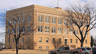
Stephens County is a county located in the U.S. state of Texas. As of the 2020 census, its population was 9,101. Its county seat is Breckenridge. The county was created in 1858 and organized in 1876. It was originally named Buchanan County, after U.S. President James Buchanan, but was renamed in 1861 for Alexander H. Stephens, the vice president of the Confederate States of America.

<span class="mw-page-title-main">Navarro County, Texas</span> County in Texas, United States

Navarro County is a county in the U.S. state of Texas. As of the 2020 census, the population was 52,624. Its county seat is Corsicana. The county is named for José Antonio Navarro, a Tejano leader in the Texas Revolution who signed the Texas Declaration of Independence.

<span class="mw-page-title-main">Nacogdoches County, Texas</span> County in Texas, United States

Nacogdoches County is a county located in the U.S. state of Texas. As of the 2020 census, its population was 64,653. Its county seat is Nacogdoches.

<span class="mw-page-title-main">Mitchell County, Texas</span> County in Texas, United States

Mitchell County is a county in the U.S. state of Texas. As of the 2020 census, its population was 8,990. Its county seat is Colorado City. The county was created in 1876 and organized in 1881. It is named for Asa and Eli Mitchell, two early settlers and soldiers in the Texas Revolution.

<span class="mw-page-title-main">Matagorda County, Texas</span> County in Texas, United States

Matagorda County is a county located in the U.S. state of Texas. As of the 2020 census, the population was 36,255. Its county seat is Bay City, not to be confused with the larger Baytown in Harris and Chambers Counties. Matagorda County is named for the canebrakes that once grew along the coast.

<span class="mw-page-title-main">Madison County, Texas</span> County in Texas, United States

Madison County is a county located in the U.S. state of Texas. As of the 2020 census, its population was 13,455. Its seat is Madisonville. The county was created in 1853 and organized the next year. It is named for James Madison, the fourth President of the United States. In 1852, Hillary Mercer Crabb was elected to serve the unexpired term of State Representative F. L. Hatch. Among Crabb's accomplishments as a legislator was the introduction of a bill to create Madison County.

<span class="mw-page-title-main">Live Oak County, Texas</span> County in Texas, United States

Live Oak County is a county in the U.S. state of Texas. It was named for its native groves of live oak. George West is its county seat. Its population was 11,335 in the 2020 census.

<span class="mw-page-title-main">Lavaca County, Texas</span> County in Texas, United States

Lavaca County is a county located in the U.S. state of Texas. As of the 2020 census, its population was 20,337. Its county seat is Hallettsville. The county was created in 1846. It is named for the Lavaca River, which curves its way southeast through Moulton and Hallettsville before reaching the coast at Matagorda Bay.

<span class="mw-page-title-main">Jackson County, Texas</span> County in Texas, United States

Jackson County is a county in the U.S. state of Texas. As of the 2020 census its population was 14,988. Its county seat is Edna. The county was created in 1835 as a municipality in Mexico and in 1836 was organized as a county. It is named for Andrew Jackson, President of the United States from 1829 to 1837.

<span class="mw-page-title-main">Hood County, Texas</span> County in Texas, United States

Hood County is a county in the U.S. state of Texas. As of the 2020 census, the population was 61,598. Its county seat is Granbury. The county is named for John Bell Hood, a Confederate lieutenant general and the commander of Hood's Texas Brigade.

<span class="mw-page-title-main">Gregg County, Texas</span> County in Texas, United States

Gregg County is a county located in the eastern part of the U.S. state of Texas. As of the 2020 census, its population was 124,239. Its county seat is Longview. The county is named after John Gregg, a Confederate general killed in action during the American Civil War.

<span class="mw-page-title-main">Cooke County, Texas</span> County in Texas, United States

Cooke County is a county in the U.S. state of Texas. At the 2020 census, its population was 41,668. The county seat is Gainesville. The county was founded in 1848 and organized the next year. It is named for William Gordon Cooke, a soldier during the Texas Revolution. It is a part of the Texoma region.

<span class="mw-page-title-main">Cochran County, Texas</span> County in Texas, United States

Cochran County is a county located in the U.S. state of Texas. As of the 2020 census, its population was 2,547. The county seat is Morton. The county was created in 1876 and later organized in 1924. It is named for Robert E. Cochran, a defender of the Alamo.

<span class="mw-page-title-main">Cass County, Texas</span> County in Texas, United States

Cass County is a county located in the U.S. state of Texas. As of the 2020 census, its population was 28,454. The county seat is Linden. The county was named for United States Senator Lewis Cass (D-Michigan), who favored the U.S. annexation of Texas in the mid-19th century.

<span class="mw-page-title-main">Callahan County, Texas</span> County in Texas, United States

Callahan County is a county located in the U.S. state of Texas. As of the 2020 census, the population was 13,708. Its county seat is Baird. The county was founded in 1858 and later organized in 1877. It is named for James Hughes Callahan, an American soldier in the Texas Revolution. Callahan County is included in the Abilene, Texas metropolitan statistical area.

<span class="mw-page-title-main">Briscoe County, Texas</span> County in Texas, United States

Briscoe County is a county located in the U.S. state of Texas. As of the 2020 census, the population was 1,435. Its county seat is Silverton. The county was created in 1876 and later organized in 1892. It is named for Andrew Briscoe, a soldier during the Texas Revolution.

<span class="mw-page-title-main">Austin County, Texas</span> County in Texas, United States

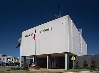
Austin County is a rural, agricultural dominated county in the U.S. state of Texas. As of the 2020 census, the population was 30,167. Its seat is Bellville. The county and region was settled primarily by German emigrants in the 1800s.

<span class="mw-page-title-main">Columbus, Texas</span> City in Texas, United States

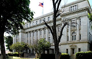
Columbus is a city in and the county seat of Colorado County in southeastern Texas, United States. The population was 3,699 as of the 2020 census. It is located on the Colorado River. The Colorado County Courthouse is listed on the National Register of Historic Places.

References

  1. "U.S. Census Bureau QuickFacts: Colorado County, Texas". United States Census Bureau. Retrieved January 31, 2022.
  2. "Colorado County, Texas". United States Census Bureau . Retrieved January 30, 2022.
  3. "Find a County". National Association of Counties. Archived from the original on May 31, 2011. Retrieved June 7, 2011.
  4. Mark Odintz (June 12, 2010). "Colorado County". Handbook of Texas Online. Texas State Historical Association. Retrieved June 20, 2015.
  5. "Colorado County". Texas Almanac. Texas State Historical Association. Retrieved June 20, 2015.
  6. 1 2 3 4 ODINTZ, MARK (June 12, 2010). "COLORADO COUNTY". tshaonline.org. Retrieved June 4, 2019.
  7. LANG, HERBERT H. (June 15, 2010). "HARRIS, DILUE ROSE". tshaonline.org. Retrieved June 4, 2019.
  8. Crouch, Barry A., 1941- (1992). The Freedmen's Bureau and Black Texans (1st ed.). Austin: University of Texas Press. ISBN   0292724756. OCLC   24320568.{{cite book}}: CS1 maint: multiple names: authors list (link) CS1 maint: numeric names: authors list (link)
  9. "2010 Census Gazetteer Files". United States Census Bureau. August 22, 2012. Retrieved April 21, 2015.
  10. "Decennial Census of Population and Housing by Decades". US Census Bureau.
  11. "Texas Almanac: Population History of Counties from 1850–2010" (PDF). Texas Almanac. Archived (PDF) from the original on October 9, 2022. Retrieved April 21, 2015.
  12. 1 2 "P2 HISPANIC OR LATINO, AND NOT HISPANIC OR LATINO BY RACE - 2010: DEC Redistricting Data (PL 94-171) - Colorado County, Texas". United States Census Bureau .
  13. 1 2 "P2 HISPANIC OR LATINO, AND NOT HISPANIC OR LATINO BY RACE - 2020: DEC Redistricting Data (PL 94-171) - Colorado County, Texas". United States Census Bureau .
  14. "U.S. Census website". United States Census Bureau . Retrieved May 14, 2011.
  15. Leip, David. "Dave Leip's Atlas of U.S. Presidential Elections". uselectionatlas.org. Retrieved July 20, 2018.

29°37′N96°31′W / 29.62°N 96.52°W / 29.62; -96.52