Reeves County, Texas

Last updated

Reeves County
Reeves County Courthouse June 2020.jpg
Reeves County Courthouse in Pecos
Map of Texas highlighting Reeves County.svg
Location within the U.S. state of Texas
Texas in United States.svg
Texas's location within the U.S.
Coordinates: 31°19′N103°41′W / 31.32°N 103.68°W / 31.32; -103.68
CountryFlag of the United States.svg United States
StateFlag of Texas.svg  Texas
Founded1884
Named for George R. Reeves
Seat Pecos
Largest cityPecos
Area
  Total2,642 sq mi (6,840 km2)
  Land2,635 sq mi (6,820 km2)
  Water6.7 sq mi (17 km2)  0.3%
Population
 (2020)
  Total14,748
  Density5.2/sq mi (2.0/km2)
Time zone UTC−6 (Central)
  Summer (DST) UTC−5 (CDT)
Congressional district 23rd
Website www.reevescounty.org

Reeves County is a county located in the U.S. state of Texas. As of the 2020 census, its population was 14,748. [1] Its county seat and most populous city is Pecos. [2] The county was created in 1883 and organized the next year. [3] It is named for George R. Reeves, a Texas state legislator and colonel in the Confederate Army. It is one of the nine counties that comprise the Trans-Pecos region of West Texas. Reeves County comprises the Pecos micropolitan statistical area.

Contents

History

Native Americans

Prehistoric Clovis culture peoples [4] in Reeves County lived in the rock shelters and caves nestled near water supplies. These people left behind artifacts and pictographs as evidence of their presence. [5] Jumano Indians led the Antonio de Espejo [6] 1582–1583 expedition near Toyah Lake on a better route to the farming and trade area of La Junta de los Ríos. Espejo's diary places the Jumano along the Pecos River and its tributaries. [7] The Mescalero Apache [8] [9] frequented San Solomon Springs to irrigate their crops. In 1849, John Salmon "RIP" Ford [10] explored the area between San Antonio and El Paso, noting in his mapped report the productive land upon which the Mescalero Indians farmed.

County established and growth

The state legislature formed Reeves from Pecos County in 1883, and named it after Texas legislator and soldier George Robertson Reeves. [11] [12] The county was organized in 1884. The town of Pecos [13] was named as county seat.

Toyah Valley farmers George B. and Robert E. Lyle were the first Anglo settlers 1871. White settlers started arriving in the area four years later, lured by open-range ranching. [14] For the remainder of the century, the county economy was dependent upon farming and ranching as it moved into the manufacturing and oil industries of the 20th century.

The Texas and Pacific Railway built through Reeves County in 1881, with stations at Pecos [15] and Toyah. [16] By 1890, the Pecos River Railway [17] had built from Pecos to New Mexico. Toyahvale, [18] which means "flowing water", became the western terminus of the railroad.

Balmorhea State Park was built at Toyahvale by the Civilian Conservation Corps. [19] The park was deeded to the State of Texas in 1934 and opened to the public in 1968.

Pecos Army Air Field was one of the 120 airbases that trained the pioneer Women Airforce Service Pilots [20] to fly military aircraft. At the Pecos installation, WASP flew AT-6, UC-78, and AT-17 aircraft in engineering tests, administrative duties, and transporting freight. The base was activated in 1942 as a World War II pilot school. [21] The base was deactivated in 1945. At its peak, the base population of 4,034 rivaled the town of Pecos in size. Portions of the base were sold off over the years, with Pecos Municipal Airport retaining the remainder.

Pecos is the site of the largest private prison in the world, the Reeves County Detention Complex, operated by the GEO Group. [22]

Geography

According to the U.S. Census Bureau, the county has a total area of 2,642 square miles (6,840 km2), of which 6.7 sq mi (17 km2) (0.3%) are covered by water. [23]

Major highways

Adjacent counties

Demographics

Historical population
CensusPop.Note
1890 1,247
1900 1,84748.1%
1910 4,392137.8%
1920 4,4571.5%
1930 6,40743.8%
1940 8,00625.0%
1950 11,74546.7%
1960 17,64450.2%
1970 16,526−6.3%
1980 15,801−4.4%
1990 15,8520.3%
2000 13,137−17.1%
2010 13,7834.9%
2020 14,7487.0%
U.S. Decennial Census [24]
1850–2010 [25] 2010–2020 [26] 2020 [1]
Reeves County racial/ethnic composition [27] [28]
(NH = Non-Hispanic) [lower-alpha 1]
RacePop 2010Pop 2020% 2010% 2020
White (NH)2,6901,69719.52%11.51%
Black or African American (NH)6722244.88%1.52%
Native American or Alaska Native (NH)21270.15%0.18%
Asian (NH)1181650.86%1.12%
Pacific Islander (NH)230.01%0.02%
Some Other Race (NH)20390.15%0.26%
Mixed/Multi-Racial (NH)27830.2%0.56%
Hispanic or Latino 10,23312,51074.24%84.83%
Total13,78314,748

As of the 2020 United States census, there were 14,748 people, 3,772 households, and 2,388 families residing in the county. According to the 2010 United States census, 13,783 people were living in the county; 77.2% White, 5.0% African American, 0.9% Asian, 0.5% Native American, 14.9% of some other race, and 1.5% of two or more races. About 74.2% were Hispanics or Latinos (of any race).

Communities

Cities

Towns

Census-designated places

Unincorporated communities

Ghost town

Politics

In 2020, Donald Trump not only flipped Reeves County, but won the greatest margin of victory for a Republican presidential candidate since President Nixon's 1972 re-election at 61.1%.

United States presidential election results for Reeves County, Texas [31]
Year Republican Democratic Third party
No.%No.%No.%
2020 2,25461.10%1,39537.82%401.08%
2016 1,41744.50%1,65952.10%1083.39%
2012 1,18841.29%1,65557.53%341.18%
2008 1,44546.96%1,60652.19%260.84%
2004 1,77752.34%1,60047.13%180.53%
2000 1,27340.08%1,87258.94%310.98%
1996 1,00728.40%2,27964.27%2607.33%
1992 1,24427.30%2,56956.37%74416.33%
1988 1,72437.86%2,81261.75%180.40%
1984 2,46150.51%2,39649.18%150.31%
1980 2,31550.95%2,13847.05%912.00%
1976 1,71139.41%2,61360.18%180.41%
1972 2,42761.57%1,51038.31%50.13%
1968 1,31037.33%1,45641.49%74321.17%
1964 1,25134.80%2,34065.09%40.11%
1960 1,54940.53%2,23558.48%380.99%
1956 1,49252.24%1,35647.48%80.28%
1952 1,72755.39%1,38544.42%60.19%
1948 30917.27%1,38377.31%975.42%
1944 20113.31%1,15776.62%15210.07%
1940 24715.89%1,30583.98%20.13%
1936 1008.13%1,12791.63%30.24%
1932 12210.07%1,08589.60%40.33%
1928 34446.61%39453.39%00.00%
1924 9618.75%38775.59%295.66%
1920 9116.55%45783.09%20.36%
1916 4310.89%34687.59%61.52%
1912 82.37%27882.49%5115.13%

Education

Two school districts serve sections of the county: [32]

All of the county is in the service area of Odessa College. [33]

See also

Notes

  1. Note: the US Census treats Hispanic/Latino as an ethnic category. This table excludes Latinos from the racial categories and assigns them to a separate category. Hispanics/Latinos can be of any race. [29] [30]

Related Research Articles

<span class="mw-page-title-main">Yoakum County, Texas</span> County in Texas, United States

Yoakum County is a county located in the far western portion of the U.S. state of Texas. As of the 2020 census, the population was 7,694. Its county seat is Plains. The county was created in 1876 and later organized in 1907. It is named for Henderson King Yoakum, a Texas historian.

<span class="mw-page-title-main">Ward County, Texas</span> County in Texas, United States

Ward County is a county located in the U.S. state of Texas. As of the 2020 census, its population was 11,644. The county seat is Monahans. The county was created in 1887 and organized in 1892. It is named for Thomas W. Ward, a soldier in the Texas Revolution.

<span class="mw-page-title-main">Val Verde County, Texas</span> County in Texas, United States

Val Verde County is a county located on the southern Edwards Plateau in the U.S. state of Texas. The 2020 population is 47,586. Its county seat is Del Rio. The Del Rio micropolitan statistical area includes all of Val Verde County.

<span class="mw-page-title-main">Upton County, Texas</span> County in Texas, United States

Upton County is a county located on the Edwards Plateau in the U.S. state of Texas. As of the 2020 census, its population was 3,308. Its county seat is Rankin. The county was created in 1887 and later organized in 1910. It is named for two brothers: John C. and William F. Upton, both colonels in the Confederate Army.

<span class="mw-page-title-main">Somervell County, Texas</span> County in Texas, United States

Somervell County is a county on the Edwards Plateau in the U.S. state of Texas. As of the 2020 census, its population was 9,205. Its county seat is Glen Rose. The county is named for Alexander Somervell, secretary of war for the Republic of Texas.

<span class="mw-page-title-main">Schleicher County, Texas</span> County in Texas, United States

Schleicher County is a county located on the Edwards Plateau in the U.S. state of Texas. As of the 2020 census, its population was 2,451. Its county seat is Eldorado. The county was created in 1887 and organized in 1901. It is named for Gustav Schleicher, a German immigrant who became a surveyor and politician.

<span class="mw-page-title-main">Reagan County, Texas</span> County in Texas, United States

Reagan County is a county on the Edwards Plateau in the U.S. state of Texas. As of the 2020 census, its population was 3,385. The county seat is Big Lake. The county is named after John Henninger Reagan (1818–1905), who was the postmaster general of the Confederate States and also a U.S. senator, U.S. representative, and first chairman of the Railroad Commission of Texas.

<span class="mw-page-title-main">Presidio County, Texas</span> County in Texas, United States

Presidio County is a county located in the U.S. state of Texas. As of the 2020 census, its population was 6,131. Its county seat is Marfa. The county was created in 1850 and later organized in 1875. Presidio County is in the Trans-Pecos region of West Texas and is named for the border settlement of Presidio del Norte. It is on the Rio Grande, which forms the Mexican border.

<span class="mw-page-title-main">Pecos County, Texas</span> County in Texas, United States

Pecos County is a county located in the U.S. state of Texas. As of the 2020 census, its population was 15,193. The county seat is Fort Stockton. The county was created in 1871 and organized in 1875. It is named for the Pecos River. It is one of the nine counties that comprise the Trans-Pecos region of West Texas.

<span class="mw-page-title-main">Loving County, Texas</span> County in Texas, United States

Loving County is a county in the U.S. state of Texas. With a population at 64 during the 2020 census, it is the least populous county in the United States with a permanent population. Its county seat and only community is Mentone. The county was originally created in 1887, and after being disorganized in 1897, was reorganized in 1931.

<span class="mw-page-title-main">Limestone County, Texas</span> County in the United States

Limestone County is a county in the U.S. state of Texas. As of the 2020 census, its population was 22,146. Its county seat is Groesbeck. The county was created in 1846.

<span class="mw-page-title-main">Jeff Davis County, Texas</span> County in Texas, United States

Jeff Davis County is a county in the U.S. state of Texas. As of the 2020 census, its population was 1,996. Its county seat is Fort Davis. The county is named for Jefferson Davis, who served as the 23rd United States Secretary of War in the 1850s, and as Confederate president.

<span class="mw-page-title-main">Hudspeth County, Texas</span> County in Texas, United States

Hudspeth County is a county located in the U.S. state of Texas. As of the 2020 census, the population was 3,202. Its county seat is Sierra Blanca, and the largest community is Fort Hancock. The county is named for Claude Benton Hudspeth, a state senator and United States Representative from El Paso. It is northeast of the Mexico–U.S. border.

<span class="mw-page-title-main">Falls County, Texas</span> County in Texas, United States

Falls County is a county in the U.S. state of Texas. As of the 2020 census, its population was 16,968. The county seat is Marlin. It is named for the original 10-foot-tall waterfall on the Brazos River, which existed until the river changed course during a storm in 1866. The present falls is two miles northeast of the original falls, at the Falls on the Brazos Park, a camping site only a few miles out of Marlin on Farm to Market Road 712.

<span class="mw-page-title-main">Culberson County, Texas</span> County in Texas, United States

Culberson County is a county located in the U.S. state of Texas. As of the 2020 census, its population was 2,188. The county seat is Van Horn. Culberson County was founded in 1911 and organized the next year. It is named for David B. Culberson, a Confederate soldier and U.S. representative.

<span class="mw-page-title-main">Crockett County, Texas</span> County in Texas, United States

Crockett County is a county located on the Edwards Plateau in the U.S. state of Texas. As of the 2020 census, its population was 3,098. The county seat is Ozona. The county was founded in 1875 and later organized in 1891. It is named in honor of Davy Crockett, the legendary frontiersman who died at the Battle of the Alamo.

<span class="mw-page-title-main">Brewster County, Texas</span> County in Texas, United States

Brewster County is a county located in the U.S. state of Texas. It is in West Texas and its county seat is Alpine. It is one of the nine counties that comprise the Trans-Pecos region, and borders Mexico. Brewster County is the largest county by area in the state - at 6,192 square miles (16,040 km2) it is over three times the size of the state of Delaware, and more than 500 square miles (1,300 km2) bigger than Connecticut.

<span class="mw-page-title-main">Balmorhea, Texas</span> City in the United States

Balmorhea is a city in Reeves County, in the U.S. state of Texas. The population was 479 in the U.S. Census of 2010.

<span class="mw-page-title-main">Pecos, Texas</span> City in Texas, United States

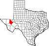
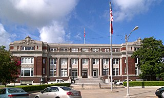
Pecos is the largest city in and the county seat of Reeves County, Texas, United States. It is in the valley on the west bank of the Pecos River at the eastern edge of the Chihuahuan Desert, in the Trans-Pecos region of West Texas and just south of New Mexico's border. Its population was 12,916 at the 2020 census. On January 24, 2012, Pecos City appeared on the Forbes 400 as the second-fastest growing small town in the United States. The city is a regional commercial center for ranching, oil and gas production, and agriculture. The city is most recognized for its association with the local cultivation of cantaloupes. Pecos claims to be the site of the world's first rodeo on July 4, 1883.

<span class="mw-page-title-main">Toyahvale, Texas</span> Unincorporated community in Texas, United States

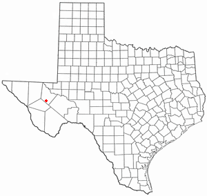
Toyahvale is an unincorporated community in southern Reeves County, Texas, United States. It lies along State Highway 17 and FM 3078, south of the city of Pecos, the county seat of Reeves County. Despite its similar name, Toyahvale is distinct from the town of Toyah, which lies 25 miles (40 km) to the north. Its elevation is 3,323 feet (1,013 m). Although Toyahvale is unincorporated, it has a post office, with the ZIP code of 79786.

References

  1. 1 2 "2020 Census Data". data.census.gov.
  2. "Find a County". National Association of Counties. Retrieved June 7, 2011.
  3. "Texas: Individual County Chronologies". Texas Atlas of Historical County Boundaries. The Newberry Library. 2008. Retrieved May 26, 2015.
  4. Mallouf, Robert J. "Exploring the Past in Trans-Pecos Texas". Sul Ross University. Archived from the original on May 27, 2010. Retrieved April 29, 2010. Texas Beyond History
  5. "Artistic Expression". Texas Beyond History. Retrieved April 29, 2010. Texas Beyond History
  6. Blake, Robert Bruce: Antonio de Espejo from the Handbook of Texas Online. Retrieved April 29, 2010. Texas State Historical Association
  7. "Who Were The Jumano?". Texas Beyond History. Retrieved April 29, 2010. Texas Beyond History
  8. "Texas Indians Map". R E. Moore and Texarch Associates. Retrieved April 29, 2010. R E. Moore and Texarch Associates
  9. "Mescalero Spring". Texas Historical Marker. Archived from the original on March 14, 2012. Retrieved April 29, 2010.
  10. Connor, Seymour V.: John Salmon Ford from the Handbook of Texas Online. Retrieved April 29, 2010. Texas State Historical Association
  11. Britton, Morris L.: George Robertson Reeves from the Handbook of Texas Online. Retrieved April 29, 2010. Texas State Historical Association
  12. Britton, Morris L. "George R. Reeves, Speaker of the House". Texas Politics, UT Austin. Retrieved April 29, 2010. The Texas State Historical Association
  13. Troesser, John. "Pecos, Texas". Texas Escapes. Retrieved April 29, 2010.
  14. Smith, Julia Cauble: Reeves from the Handbook of Texas Online. Retrieved April 29, 2010. Texas State Historical Association
  15. "Texas and Pacific Railway Stations". Texas and Pacific Railway. Retrieved April 29, 2010.
  16. "Texas and Pacific Railway Stations". Texas and Pacific Railway. Retrieved April 29, 2010.
  17. Cravens, Cris: Pecos River Railway from the Handbook of Texas Online. Retrieved April 29, 2010. Texas State Historical Association
  18. Smith, Julia Cauble: Toyahvale from the Handbook of Texas Online. Retrieved April 29, 2010. Texas State Historical Association
  19. "Balmorhea State Park". Texas Parks and Wildlife Department. Retrieved April 29, 2010.Texas Parks and Wildlife Department
  20. "Women Airforce Service Pilots". Wings Across America. Retrieved April 29, 2010. Wings Across America
  21. Colwell, James L.: Pecos Army Airfield from the Handbook of Texas Online. Retrieved April 29, 2010. Texas State Historical Association
  22. Weekly, Fort Worth (March 10, 2010). "Private Prisons, Public Pain". Fort Worth Weekly. Retrieved July 29, 2018.
  23. "2010 Census Gazetteer Files". United States Census Bureau. August 22, 2012. Retrieved May 9, 2015.
  24. "Decennial Census by Decade". US Census Bureau.
  25. "Texas Almanac: Population History of Counties from 1850–2010" (PDF). Texas Almanac. Archived (PDF) from the original on October 9, 2022. Retrieved May 9, 2015.
  26. "State & County QuickFacts". United States Census Bureau. Retrieved December 23, 2013.
  27. "Explore Census Data". data.census.gov. Retrieved May 19, 2022.
  28. "Explore Census Data". data.census.gov. Retrieved May 19, 2022.
  29. https://www.census.gov/ [ not specific enough to verify ]
  30. "About the Hispanic Population and its Origin". www.census.gov. Retrieved May 18, 2022.
  31. Leip, David. "Dave Leip's Atlas of U.S. Presidential Elections". uselectionatlas.org. Retrieved July 29, 2018.
  32. "2020 CENSUS - SCHOOL DISTRICT REFERENCE MAP: Reeves County, TX" (PDF). U.S. Census Bureau. Archived (PDF) from the original on October 9, 2022. Retrieved June 28, 2022. - Text list
  33. Texas Education Code, Section 130.193, "Odessa College District Service Area".

31°19′N103°41′W / 31.32°N 103.68°W / 31.32; -103.68