Live Oak County, Texas

Last updated

Live Oak County
Live oak courthouse.jpg
The Live Oak County Courthouse in George West
Map of Texas highlighting Live Oak County.svg
Location within the U.S. state of Texas
Texas in United States.svg
Texas's location within the U.S.
Coordinates: 28°21′N98°08′W / 28.35°N 98.13°W / 28.35; -98.13
CountryFlag of the United States.svg United States
StateFlag of Texas.svg  Texas
Founded1856
Named for Groves of live oak
Seat George West
Largest cityGeorge West
Area
  Total1,079 sq mi (2,790 km2)
  Land1,040 sq mi (2,700 km2)
  Water39 sq mi (100 km2)  3.6%
Population
 (2020)
  Total11,335 Decrease2.svg
  Density11/sq mi (4/km2)
Time zone UTC−6 (Central)
  Summer (DST) UTC−5 (CDT)
Congressional district 15th
Website www.co.live-oak.tx.us

Live Oak County is a county in the U.S. state of Texas. It was named for its native groves of live oak. [1] George West is its county seat. [2] Its population was 11,335 in the 2020 census. [3]

Contents

Geography

According to the U.S. Census Bureau, the county has a total area of 1,079 square miles (2,790 km2), of which 1,040 square miles (2,700 km2) is land and 39 square miles (100 km2) (3.6%) is water. [4] It is home to the Choke Canyon Reservoir.

Major highways

Adjacent counties

Demographics

Historical population
CensusPop.Note
1860 593
1870 85243.7%
1880 1,994134.0%
1890 2,0553.1%
1900 2,26810.4%
1910 3,44251.8%
1920 4,17121.2%
1930 8,956114.7%
1940 9,7999.4%
1950 9,054−7.6%
1960 7,846−13.3%
1970 6,697−14.6%
1980 9,60643.4%
1990 9,556−0.5%
2000 12,30928.8%
2010 11,531−6.3%
2020 11,335−1.7%
U.S. Decennial Census [5]
1850–2010 [6] 2020 [7]
Live Oak County, Texas - Demographic Profile
(NH = Non-Hispanic)
Race / EthnicityPop 2010 [8] Pop 2020 [7] % 2010% 2020
White alone (NH)6,8055,96859.01%52.65%
Black or African American alone (NH)4532053.93%1.81%
Native American or Alaska Native alone (NH)62490.54%0.43%
Asian alone (NH)56350.49%0.31%
Pacific Islander alone (NH)330.03%0.03%
Some Other Race alone (NH)9450.08%0.40%
Mixed Race/Multi-Racial (NH)832400.72%2.12%
Hispanic or Latino (any race)4,0604,79035.21%42.26%
Total11,53111,335100.00%100.00%

Note: the US Census treats Hispanic/Latino as an ethnic category. This table excludes Latinos from the racial categories and assigns them to a separate category. Hispanics/Latinos can be of any race.

As of the census [9] of 2000, there were 12,309 people, 4,230 households, and 3,070 families residing in the county. The population density was 12 people per square mile (4.6 people/km2). There were 6,196 housing units at an average density of 6 units per square mile (2.3/km2). The racial makeup of the county was 87.28% White, 2.45% Black or African American, 0.41% Native American, 0.19% Asian, 0.02% Pacific Islander, 7.72% from other races, and 1.94% from two or more races. 38.05% of the population were Hispanic or Latino of any race.

There were 4,230 households, out of which 30.90% had children under the age of 18 living with them, 60.10% were married couples living together, 8.70% had a female householder with no husband present, and 27.40% were non-families. 23.90% of all households were made up of individuals, and 12.40% had someone living alone who was 65 years of age or older. The average household size was 2.53 and the average family size was 3.00.

In the county, the population was spread out, with 22.30% under the age of 18, 9.50% from 18 to 24, 27.10% from 25 to 44, 25.10% from 45 to 64, and 16.00% who were 65 years of age or older. The median age was 39 years. For every 100 females there were 122.20 males. For every 100 females age 18 and over, there were 129.80 males.

The median income for a household in the county was $32,057, and the median income for a family was $38,235. Males had a median income of $30,061 versus $19,665 for females. The per capita income for the county was $15,886. About 14.10% of families and 16.50% of the population were below the poverty line, including 22.20% of those under age 18 and 11.70% of those age 65 or over.

Government and infrastructure

The Federal Bureau of Prisons, Federal Correctional Institution, Three Rivers is located in unincorporated Live Oak County, near Three Rivers. [10] [11]

Politics

Live Oak County voted predominantly Democratic at the presidential level during the first half of the 20th century. Native son Dwight D. Eisenhower’s 1952 win was an exception. Jimmy Carter in 1976, however, was the last Democratic presidential candidate to carry the county, with Republicans winning since 1980.

United States presidential election results for Live Oak County, Texas [12]
Year Republican Democratic Third party
No.%No.%No.%
2020 4,19983.08%81916.20%360.71%
2016 3,46480.52%74217.25%962.23%
2012 3,15476.68%91922.34%400.97%
2008 3,09574.11%1,04825.10%330.79%
2004 3,14774.91%1,03624.66%180.43%
2000 2,82870.63%1,11427.82%621.55%
1996 1,92953.41%1,37237.98%3118.61%
1992 1,80545.52%1,34533.92%81520.55%
1988 2,27758.69%1,57340.54%300.77%
1984 2,48166.00%1,26033.52%180.48%
1980 2,19360.61%1,38038.14%451.24%
1976 1,28743.47%1,65655.93%180.61%
1972 1,74573.97%61025.86%40.17%
1968 93840.02%92239.33%48420.65%
1964 79535.71%1,42363.93%80.36%
1960 1,04857.52%77042.26%40.22%
1956 1,07765.71%52131.79%412.50%
1952 1,44371.22%57328.28%100.49%
1948 47930.57%94560.31%1439.13%
1944 54839.00%64245.69%21515.30%
1940 49935.90%88863.88%30.22%
1936 23120.17%87476.33%403.49%
1932 1149.56%1,07089.77%80.67%
1928 48455.82%38344.18%00.00%
1924 32331.92%59658.89%939.19%
1920 16132.46%23447.18%10120.36%
1916 11920.73%39769.16%5810.10%
1912 266.52%30877.19%6516.29%

Communities

Cities

Village

Unincorporated communities

Ghost town

Education

School districts include: [13]

Coastal Bend College (formerly Bee County College) is the county's designated community college. [14]

See also

Related Research Articles

<span class="mw-page-title-main">Montgomery County, Texas</span> County in Texas, United States

Montgomery County is a county in the U.S. state of Texas. As of the 2020 U.S. census, the county had a population of 620,443. The county seat is Conroe. The county was created by an act of the Congress of the Republic of Texas on December 14, 1837, and is named for the town of Montgomery. Between 2000 and 2010, its population grew by 55%, the 24th-fastest rate of growth of any county in the United States. Between 2010 and 2020, its population grew by 36%. According to the U.S. Census Bureau, the estimated population is 711,354 as of July 1, 2023.

<span class="mw-page-title-main">Wheeler County, Texas</span> County in Texas, United States

Wheeler County is a county located in the U.S. state of Texas. As of the 2020 census, its population was 4,990. Its county seat is Wheeler. The county was formed in 1876 and organized in 1879. It is named for Royall Tyler Wheeler, a chief justice of the Texas Supreme Court.

<span class="mw-page-title-main">Titus County, Texas</span> County in Texas, United States

Titus County is a county located in the northeastern region of the U.S. state of Texas. As of the 2020 census, its population was 31,247. Its county seat is Mount Pleasant. The county is named for Andrew Jackson Titus, an early settler. Titus County comprises the Mount Pleasant micropolitan statistical area.

<span class="mw-page-title-main">Morris County, Texas</span> County in Texas, United States

Morris County is a county located near the eastern border of the U.S. state of Texas. As of the 2020 census, its population was 11,973. Its county seat is Daingerfield. Morris County is probably named for William Wright Morris, an early judge and planter from Henderson, also in northeast Texas. As of 2016, Morris County is no longer one of six entirely dry, prohibition counties in the state of Texas. Morris County is "partially wet."

<span class="mw-page-title-main">McMullen County, Texas</span> County in Texas, United States

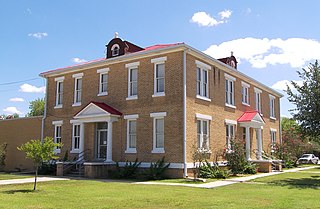
McMullen County is a county located in the U.S. state of Texas. As of the 2020 census, its population was 600, making it the fourth-least populous county in Texas. Its county seat is Tilden. The county was established from parts of Bexar County, Atascosa County, and Live Oak County in 1858 and later organized in 1877. It is named for John McMullen, founder of a colony in Texas. The McMullen County Courthouse was designed by the architect W.C. Stephenson, originally from Buffalo, New York. Stephenson also designed some 50 buildings in Beeville, including the Bee County Courthouse.

<span class="mw-page-title-main">Karnes County, Texas</span> County in Texas, United States

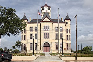
Karnes County is a county in the U.S. state of Texas. As of the 2020 census, the population was 14,710. Its county seat is Karnes City. The county is named for Henry Karnes, a soldier in the Texas Revolution. The former San Antonio and Aransas Pass Railway passed through Karnes County in its connection linking San Antonio with Corpus Christi.

<span class="mw-page-title-main">Jim Wells County, Texas</span> County in Texas, United States

Jim Wells County is a county in the U.S. state of Texas. As of the 2020 census, its population was 38,891. The county was founded in 1911 and is named for James B. Wells Jr. (1850–1923), for three decades a judge and Democratic Party political boss in South Texas.

<span class="mw-page-title-main">Howard County, Texas</span> County in Texas, United States

Howard County is a county located in the U.S. state of Texas. At the 2020 census, its population was 34,860. Its county seat is Big Spring. The county was created in 1876 and organized in 1882. It is named for Volney E. Howard, a U.S. Congressman from Texas.

<span class="mw-page-title-main">Frio County, Texas</span> County in Texas, United States

Frio County is a county located in the U.S. state of Texas. As of the 2020 census, its population was 18,385. The county seat is Pearsall. The county was created in 1858 and later organized in 1871. Frio is named for the Frio River, whose name is Spanish for "cold".

<span class="mw-page-title-main">Crockett County, Texas</span> County in Texas, United States

Crockett County is a county located on the Edwards Plateau in the U.S. state of Texas. As of the 2020 census, its population was 3,098. The county seat is Ozona. The county was founded in 1875 and later organized in 1891. It is named in honor of Davy Crockett, the legendary frontiersman who died at the Battle of the Alamo.

<span class="mw-page-title-main">Cooke County, Texas</span> County in Texas, United States

Cooke County is a county in the U.S. state of Texas. At the 2020 census, its population was 41,668. The county seat is Gainesville. The county was founded in 1848 and organized the next year. It is named for William Gordon Cooke, a soldier during the Texas Revolution. It is a part of the Texoma region.

<span class="mw-page-title-main">Bee County, Texas</span> County in Texas, United States

Bee County is a county located in the U.S. state of Texas. It is in South Texas and its county seat is Beeville. As of the 2020 census, its population was 31,047. The Beeville, TX micropolitan statistical area includes all of Bee County. The county was founded December 8, 1857, and organized the next year. It is named for Barnard E. Bee, Sr., a secretary of state of the Republic of Texas.

<span class="mw-page-title-main">Atascosa County, Texas</span> County in Texas, United States

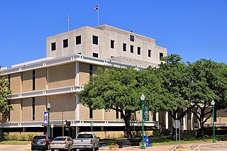
Atascosa County is a county located in the U.S. state of Texas. It is in South Texas and its county seat is Jourdanton.

<span class="mw-page-title-main">Scenic Oaks, Texas</span> Census-designated place in Texas, United States

Scenic Oaks is a census-designated place (CDP) in Bexar County, Texas, United States. It is part of the San Antonio Metropolitan Statistical Area. The population was 10,458 at the 2010 census, up from 4,957 at the 2010 census.

<span class="mw-page-title-main">Cove, Texas</span> City in Texas, United States

Cove is a city in Chambers County, Texas, United States. The population was 525 at the 2020 census, up from 510 at the 2010 census.

<span class="mw-page-title-main">West Odessa, Texas</span> Census-designated place in Texas, United States

West Odessa is an unincorporated area and census-designated place (CDP) in Ector County, Texas, United States, on the west side of the city of Odessa. The population was 22,707 at the 2010 census, up from 17,799 at the 2000 census. It is part of the Odessa metropolitan area.

<span class="mw-page-title-main">Oak Trail Shores, Texas</span> Census-designated place in Texas, United States

Oak Trail Shores is an unincorporated community and census-designated place (CDP) in Hood County, Texas, United States. Its population was 2,755 at the 2010 census. It is part of the Granbury micropolitan area as well as the Dallas–Fort Worth metroplex.

<span class="mw-page-title-main">Ingram, Texas</span> City in Texas, United States

Ingram is a city in Kerr County, Texas, United States. The population was 1,804 at the 2010 census.

<span class="mw-page-title-main">Encinal, Texas</span> Town in Texas, United States

Encinal is a city in La Salle County, Texas, United States. The population was 540 at the 2020 census. Interstate 35 Business runs through the community. There are few businesses in Encinal; most have closed along the main street.

<span class="mw-page-title-main">Fair Oaks Ranch, Texas</span> City in Texas, United States

Fair Oaks Ranch is a city in Bexar, Comal, and Kendall counties in the U.S. state of Texas. The population was 5,986 at the 2010 census and an estimated 9,700 in 2018. It is part of the San Antonio-New Braunfels Metropolitan Statistical Area. The city was named after Ralph Fair Sr, an oilman who had a large cattle ranch on the now residential town. The Fair family decided to sell a portion of the ranch to build what is now Fair Oaks Ranch in 1975.

References

  1. Gannett, Henry (1905). The Origin of Certain Place Names in the United States. U.S. Government Printing Office. p. 188.
  2. "Find a County". National Association of Counties. Retrieved June 7, 2011.
  3. "Live Oak County, Texas". United States Census Bureau . Retrieved January 30, 2022.
  4. "2010 Census Gazetteer Files". United States Census Bureau. August 22, 2012. Retrieved May 3, 2015.
  5. "Decennial Census of Population and Housing by Decades". US Census Bureau.
  6. "Texas Almanac: Population History of Counties from 1850–2010" (PDF). Texas Almanac. Archived (PDF) from the original on October 9, 2022. Retrieved May 3, 2015.
  7. 1 2 "P2 HISPANIC OR LATINO, AND NOT HISPANIC OR LATINO BY RACE - 2020: DEC Redistricting Data (PL 94-171) - Live Oak County, Texas". United States Census Bureau .
  8. "P2 HISPANIC OR LATINO, AND NOT HISPANIC OR LATINO BY RACE - 2010: DEC Redistricting Data (PL 94-171) - Live Oak County, Texas". United States Census Bureau .
  9. "U.S. Census website". United States Census Bureau . Retrieved May 14, 2011.
  10. "FCI Three Rivers Contact Information Archived December 3, 2010, at the Wayback Machine ." Federal Bureau of Prisons. Retrieved on December 12, 2010. "US HIGHWAY 72 WEST THREE RIVERS, TX 78071"
  11. "Three Rivers city, Texas [ permanent dead link ]." U.S. Census Bureau. Retrieved on December 12, 2010.
  12. Leip, David. "Dave Leip's Atlas of U.S. Presidential Elections". uselectionatlas.org. Retrieved July 26, 2018.
  13. "2020 CENSUS - SCHOOL DISTRICT REFERENCE MAP: Live Oak County, TX" (PDF). U.S. Census Bureau . Retrieved February 15, 2024. - Text list
  14. Texas Education Code Sec. 130.167. BEE COUNTY COLLEGE DISTRICT SERVICE AREA. The legislation calls it "Bee County College".

28°21′N98°08′W / 28.35°N 98.13°W / 28.35; -98.13