Union City, Indiana

Last updated
Union City, Indiana
Union City Skyline from Water Tower.jpg
Union City water tower and skyline
Randolph County Indiana Incorporated and Unincorporated areas Union City Highlighted 1877768.svg
Location of Union City in Randolph County, Indiana.
Coordinates: 40°11′58″N84°49′14″W / 40.19944°N 84.82056°W / 40.19944; -84.82056
Country United States
State Indiana
County Randolph
Township Wayne
Government
   Mayor Chad E. Spence (R)
Area
[1]
  Total2.27 sq mi (5.87 km2)
  Land2.26 sq mi (5.85 km2)
  Water0.01 sq mi (0.02 km2)  0.45%
Elevation
[2]
1,109 ft (338 m)
Population
 (2020)
  Total3,454
  Density1,530.35/sq mi (590.88/km2)
Time zone UTC-5 (EST)
  Summer (DST) UTC-4 (EDT)
ZIP code
47390
Area code 765
FIPS code 18-77768 [3]
GNIS feature ID2397087 [2]
Website
http://www.unioncity-in.com/
Map from around 1890 showing property owners and details of Union City Indiana and Ohio Union City, Indiana and Ohio - DPLA - 0457a22492494fb4fe20b1836b807ed9.jpg
Map from around 1890 showing property owners and details of Union City Indiana and Ohio

Union City is a city in Wayne Township, Randolph County, Indiana, United States. [2] As of the 2020 census, the city had a population of 3,454. [4]

Contents

Union City was a stop along the Pittsburgh, Cincinnati, Chicago and St. Louis Railroad, a forerunner of the Pennsylvania Railroad that connected Pittsburgh to Chicago and St. Louis. The Cleveland, Cincinnati, Chicago and St. Louis Railway (also known as the "Big Four", a predecessor of the New York Central) had the east–west route connecting Indianapolis, Anderson and Muncie, Indiana with Sidney, Bellefontaine and Columbus, Ohio. It is believed by some area residents that the town got its nickname "The Hub City" because the two railroads intersected near the Ohio and Indiana state line.

Union City, Indiana Union City, Indiana.jpg
Union City, Indiana

History

Union City was platted in 1849, eleven years after its twin city of Union City, Ohio. [5] A post office has been in operation at Union City, Indiana since 1852. [6]

The William Kerr House, Raphael Kirshbaum Building, Union City Commercial Historic District, Union City Passenger Depot, Union City Public Library, and Union City School are listed on the National Register of Historic Places. [7]

Geography

According to the 2010 census, Union City has a total area of 2.209 square miles (5.72 km2), of which 2.2 square miles (5.70 km2) (or 99.59%) is land and 0.009 square miles (0.02 km2) (or 0.41%) is water. [8]

Demographics

Historical population
CensusPop.Note
1870 1,439
1880 2,47872.2%
1890 2,6818.2%
1900 2,7161.3%
1910 3,20918.2%
1920 3,4066.1%
1930 3,084−9.5%
1940 3,53514.6%
1950 3,5721.0%
1960 4,04713.3%
1970 3,995−1.3%
1980 3,908−2.2%
1990 3,612−7.6%
2000 3,6220.3%
2010 3,584−1.0%
2020 3,454−3.6%
U.S. Decennial Census [9]

2010 census

As of the census [10] of 2010, there were 3,584 people, 1,477 households, and 922 families residing in the city. The population density was 1,629.1 inhabitants per square mile (629.0/km2). There were 1,733 housing units at an average density of 787.7 per square mile (304.1/km2). The racial makeup of the city was 87.6% White, 1.1% African American, 0.1% Native American, 0.1% Asian, 9.2% from other races, and 1.9% from two or more races. Hispanic or Latino of any race were 12.8% of the population.

There were 1,477 households, of which 33.0% had children under the age of 18 living with them, 41.4% were married couples living together, 15.2% had a female householder with no husband present, 5.8% had a male householder with no wife present, and 37.6% were non-families. 32.8% of all households were made up of individuals, and 17% had someone living alone who was 65 years of age or older. The average household size was 2.43 and the average family size was 3.04.

The Union City Public Library is one of six sites in Union City listed on the National Register of Historic Places Union City Public Library.jpg
The Union City Public Library is one of six sites in Union City listed on the National Register of Historic Places

The median age in the city was 35.4 years. 28.3% of residents were under the age of 18; 8.7% were between the ages of 18 and 24; 24.7% were from 25 to 44; 21.9% were from 45 to 64; and 16.5% were 65 years of age or older. The gender makeup of the city was 48.6% male and 51.4% female.

2000 census

As of the census [3] of 2000, there were 3,622 people, 1,569 households, and 969 families residing in the city. The population density was 1,995.1 inhabitants per square mile (770.3/km2). There were 1,738 housing units at an average density of 957.3 per square mile (369.6/km2). The racial makeup of the city was 94.04% White, 1.02% African American, 0.17% Native American, 0.22% Asian, 0.08% Pacific Islander, 3.12% from other races, and 1.35% from two or more races. Hispanic or Latino of any race were 4.53% of the population.

There were 1,569 households, of which 29.3% had children under the age of 18 living with them, 46.3% were married couples living together, 11.7% had a female householder with no husband present, and 38.2% were non-families. 34.4% of all households were made up of individuals, and 17.8% had someone living alone who was 65 years of age or older. The average household size was 2.29 and the average family size was 2.91.

In the city, the population was 25.2% under the age of 18, 9.2% from 18 to 24, 25.9% from 25 to 44, 21.5% from 45 to 64, and 18.2% who were 65 years of age or older. The median age was 37 years. For every 100 females, there were 90.4 males. For every 100 females age 18 and over, there were 88.3 males.

The median income for a household in the city was $26,526, and the median income for a family was $34,250. Males had a median income of $27,877 versus $17,850 for females. The per capita income for the city was $13,981. About 14.5% of families and 19.7% of the population were below the poverty line, including 31.4% of those under age 18 and 14.1% of those age 65 or over.

Education

The Randolph Eastern School Corporation serves Union City through two schools: North Side Elementary School and Union City Junior Senior High School. [11] They are housed in adjoining buildings on the northwest side of the town.

The town has a lending library, the Union City Public Library. [12]

Media

UnionCityNow.com is a locally owned online media outlet that focuses on current events and news stories in the community. The site also contains discussion forums focused on Union City history and local genealogy.

KISS TV is a local-access television station run by the school corporation. It broadcasts on the local Time Warner Cable feed, as well as online. [13] The school's DECA chapter also runs two school businesses: "The TeePee", a school store where students and staff can buy snacks during lunch periods, and "Apache Design", a T-shirt printing business where students record and produce orders for school functions and for organizations in the community and surrounding area.

WJYW 88.9 "Joy FM" broadcasts a Contemporary Christian music format.

WTGR 97.5 FM "Tiger Country" is licensed to neighboring Union City, Ohio, with a studio in Greenville and a new studio to be built in Winchester.

Flag

The flag of Union City was adopted on January 20, 2021, by vote of the people of Union City. [14]

The design features a red background with a blue stripe, surrounding a white skinny stripe. The colors represent the United States. On the center is a big white star on the center of the state outlines of Indiana and Ohio, which represent the city's location and ties to both states. [14]

Mayor Chad E. Spence said in January 2021 that he supported the flag's design. [15]

Notable people

Related Research Articles

<span class="mw-page-title-main">Preble County, Ohio</span> County in Ohio, United States

Preble County is a county located in the U.S. state of Ohio. As of the 2020 census, the population was 40,999, down 3.0% from the 2010 census population of 42,270. Its county seat is Eaton. The county was formed on February 15, 1808, from portions of Butler and Montgomery Counties. It is named for Edward Preble, a naval officer who fought in the American Revolutionary War and against the Barbary Pirates.

<span class="mw-page-title-main">Darke County, Ohio</span> County in Ohio, United States

Darke County is a county in the U.S. state of Ohio. As of the 2020 census, the population was 51,881. Its county seat and largest city is Greenville. The county was created in 1809 and later organized in 1817. It is named for William Darke, an officer in the American Revolutionary War. Darke County comprises the Greenville, OH Micropolitan Statistical Area, which is also included in the Dayton-Springfield-Sidney, OH Combined Statistical Area.

<span class="mw-page-title-main">Lawrenceburg, Indiana</span> City in Indiana, United States

Lawrenceburg is a city and the county seat of Dearborn County, Indiana, United States. The population was 5,129 at the 2020 census. It is the largest city in Dearborn County. Lawrenceburg is in southeast Indiana, on the Ohio River west of Cincinnati.

<span class="mw-page-title-main">Worthington, Indiana</span> Town in Indiana, United States

Worthington is a town in Jefferson Township, Greene County, Indiana, United States. The population was 1,463 at the 2010 United States Census. It is part of the Bloomington, Indiana, Metropolitan Statistical Area.

<span class="mw-page-title-main">Syracuse, Indiana</span> Town in Indiana, United States

Syracuse is a town in Turkey Creek Township, Kosciusko County, in the U.S. state of Indiana. The population was 3,079 at the 2020 census. Syracuse is the location of Lake Syracuse and the nearby, larger Lake Wawasee, in addition to several other lakes in the region. The National Weather Service operates a Weather Forecast Office South of town, toward North Webster. It serves Northern Indiana, Northwestern Ohio and Southwestern Michigan.

<span class="mw-page-title-main">Winona Lake, Indiana</span> Town in Indiana, United States

Winona Lake is a town in Wayne Township, Kosciusko County, in the U.S. state of Indiana, and the major suburb of Warsaw. The population was 4,908 at the 2010 census.

<span class="mw-page-title-main">Tell City, Indiana</span> City in Indiana, United States

Tell City is a city in Troy Township, Perry County, in the U.S. state of Indiana. It is located along the Ohio River. The population was 7,506 at the 2020 census. The city is the county seat of Perry County.

<span class="mw-page-title-main">Modoc, Indiana</span> Town in Indiana, United States

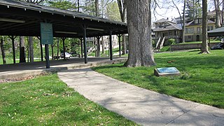
Modoc is a town in Union Township, Randolph County, in the U.S. state of Indiana. The population was 196 at the 2010 census.

<span class="mw-page-title-main">Winchester, Indiana</span> City in Indiana, United States

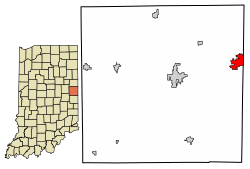
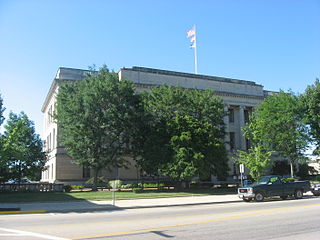
Winchester is a city in White River Township, Randolph County, in the U.S. state of Indiana. The city is the county seat of Randolph County. The population was 4,935 at the 2010 census. It is the home of Winchester Speedway.

<span class="mw-page-title-main">Rockport, Indiana</span> City in Indiana, United States

Rockport is a city in Ohio Township and the county seat of Spencer County, Indiana, along the Ohio River. The population was 2,270 at the 2010 census. Once the largest community in Spencer County, the city has recently been surpassed by the town of Santa Claus. At 37°53'1" north, Rockport is also the southernmost city in the state, located slightly south of Evansville, Cannelton, or Mount Vernon.

<span class="mw-page-title-main">Liberty, Indiana</span> Town in Indiana, United States

Liberty is a town in and the county seat of Union County, Indiana, United States, located about 5 miles (8.0 km) west of the state's border with Ohio. The population was 2,000 at the 2020 census.

<span class="mw-page-title-main">Fort Wright, Kentucky</span> City in Kentucky, United States

Fort Wright is a home rule-class city in Kenton County, Kentucky, in the United States. The population was 5,851 at the 2020 census. It is part of the Cincinnati metropolitan area.

<span class="mw-page-title-main">St. Paris, Ohio</span> Village in Ohio, United States

St. Paris or Saint Paris is a village in Champaign County, Ohio, United States. The population was 1,882 at the 2020 census.

<span class="mw-page-title-main">Union City, Ohio</span> Village in Ohio, United States

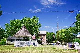
Union City is a village in Darke County, Ohio, United States. The population was 1,582 at the 2020 census. It is directly across the state line from its twin city of Union City, Indiana.

<span class="mw-page-title-main">Harrison, Ohio</span> City in Ohio, United States

Harrison is a city in western Hamilton County, Ohio, United States. The population was 12,563 at the 2020 census. It is part of the Cincinnati metropolitan area.

<span class="mw-page-title-main">Pleasant Run, Ohio</span> Census-designated place in Ohio, United States

Pleasant Run is a census-designated place (CDP) in Colerain Township, Hamilton County, Ohio, United States. The population was 4,861 at the 2020 census.

<span class="mw-page-title-main">Clayton, Ohio</span> City in Ohio, United States

Clayton is a city in Montgomery County, Ohio, United States. The population was 13,310 at the 2020 census. A suburb of Dayton, it is part of the Dayton metropolitan area.

<span class="mw-page-title-main">Hubbard, Ohio</span> City in Ohio, United States

Hubbard is a city in southeastern Trumbull County, Ohio, United States. It is formed from part of Hubbard Township, which was formed from the Connecticut Western Reserve. The population was 7,636 at the 2020 census. It is a suburb of the Youngstown–Warren metropolitan area.

<span class="mw-page-title-main">College Corner, Ohio</span> Village in Ohio, United States

College Corner is a village in Butler and Preble counties in the southwestern part of the U.S. state of Ohio, 5 miles (8 km) northwest of Oxford. The population was 387 at the 2020 census. The village lies on the state line with Indiana, where it borders the town of West College Corner. The public school, part of the Union County–College Corner Joint School District, is bisected by the state line and is operated jointly with Indiana authorities.

<span class="mw-page-title-main">Union, Ohio</span> City in Ohio, United States

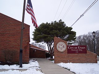
Union is a city in Montgomery and Miami Counties in the U.S. state of Ohio. The population was 6,859 at the time of the 2020 census. It is part of the Dayton Metropolitan Statistical Area.

References

  1. "2020 U.S. Gazetteer Files". United States Census Bureau. Retrieved March 16, 2022.
  2. 1 2 3 U.S. Geological Survey Geographic Names Information System: Union City, Indiana
  3. 1 2 "U.S. Census website". United States Census Bureau . Retrieved January 31, 2008.
  4. "Explore Census Data". data.census.gov. Retrieved November 16, 2023.
  5. Willis, Wanda Lou (October 9, 2013). More Haunted Hoosier Trails: Folklore from Indiana's Spookiest Places. Emmis Books. p. 128. ISBN   978-1-57860-182-0.
  6. "Randolph County". Jim Forte Postal History. Retrieved November 1, 2015.
  7. "National Register Information System". National Register of Historic Places . National Park Service. July 9, 2010.
  8. "G001 - Geographic Identifiers - 2010 Census Summary File 1". United States Census Bureau. Archived from the original on February 13, 2020. Retrieved July 29, 2015.
  9. "Census of Population and Housing". Census.gov. Retrieved June 4, 2015.
  10. "U.S. Census website". United States Census Bureau . Retrieved December 11, 2012.
  11. "Union City, IN website". Archived from the original on January 28, 2019. Retrieved January 27, 2019.
  12. "Indiana public library directory" (PDF). Indiana State Library. Archived from the original (PDF) on February 18, 2017. Retrieved March 14, 2018.
  13. "Union City Jr-Sr High School". hs.resc.k12.in.us.
  14. 1 2 Official Site, Results of New Flag Vote on Union City. "Union City IN Official Site". Union City IN Official Site. Retrieved August 11, 2022.
  15. Gazette, The News. "Display sets new record, council approves city flag". Winchester News Gazette. Retrieved August 11, 2022.
  16. "Rick Derringer Hometown Concert". Union City Now. September 15, 2015. Archived from the original on January 18, 2017. Retrieved January 17, 2017. On September 12th, Rick will return to his hometown to celebrate the 2015 Union City Arts Festival
  17. Muise, Dan (March 18, 2002). Gallagher, Marriott, Derringer & Trower: Their Lives and Music. Hal Leonard Corporation. ISBN   9780634029561 via Google Books.
  18. Buddhism, A Westerner's Compendium, p.3 footnote, by Kirby L. Whitacre, 2007