Related Research Articles

Ozone Park is a neighborhood in the southwestern section of the New York City borough of Queens, New York, United States. It is next to the Aqueduct Racetrack in South Ozone Park, a popular spot for Thoroughbred racing and home to the Resorts World Casino & Hotel. Traditionally home to a large Italian-American population, Ozone Park has grown to have many residents of Caribbean, Hispanic, and Asian backgrounds.

The Rockaway Peninsula, commonly referred to as The Rockaways or Rockaway, is a peninsula at the southern edge of the New York City borough of Queens on Long Island, New York. Relatively isolated from Manhattan and other more urban parts of the city, Rockaway became a popular summer retreat in the 1830s. It has since become a mixture of lower, middle, and upper-class neighborhoods. In the 2010s, it became one of the city's most quickly gentrifying areas.
Howard Beach is a neighborhood in the southwestern portion of the New York City borough of Queens. It is bordered to the north by the Belt Parkway and Conduit Avenue in Ozone Park, to the south by Jamaica Bay in Broad Channel, to the east by 102nd–104th Streets in South Ozone Park, and to the west by 75th Street in East New York, Brooklyn. The area consists mostly of low-rise single-family houses.

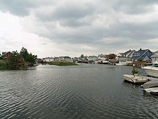
Broad Channel is a neighborhood in the southern portion of the New York City borough of Queens. It occupies the southern portion of Rulers Bar Hassock, the only inhabited island in Jamaica Bay.

Far Rockaway is a neighborhood on the eastern part of the Rockaway peninsula in the New York City borough of Queens. It is the easternmost section of the Rockaways. The neighborhood extends from Beach 32nd Street east to the Nassau County line. Its southern boundary is the Atlantic Ocean; it is one of the neighborhoods along Rockaway Beach.

New York State Route 878 (NY 878) is an east-west expressway on Long Island and in New York City. The route exists in two sections, which both form the Nassau Expressway. NY 878's western terminus is the Belt Parkway and Conduit Avenue (NY 27) in Ozone Park, within southern Queens. Its southern terminus is immediately before the Village of Atlantic Beach, at the Atlantic Beach Bridge in Lawrence, within southwestern Nassau County. NY 878 is discontinuous between Farmers Boulevard in Queens and the town of Inwood in Nassau County. The two sections are connected to each other by Rockaway Boulevard and Rockaway Turnpike.

Rockaway Park is a neighborhood in the New York City borough of Queens. The area is on the Rockaway Peninsula, nestled between Jamaica Bay to the north and the Atlantic Ocean to the south. The neighborhood of Rockaway Beach lies on its eastern border while the community of Belle Harbor is situated on its western side. The neighborhood is part of Queens Community Board 14.

Rockaway Beach Boulevard, opened in 1886, was the first major east-west thoroughfare on the Rockaway Peninsula in the Borough of Queens in New York City. Much of its route parallels the Rockaway Freeway and the IND Rockaway Line above the Freeway. The boulevard first forks off at its eastern end from Beach Channel Drive at Beach 35th Street in Edgemere and merges once again with Beach Channel Drive by Jacob Riis Park shortly before the Marine Parkway–Gil Hodges Memorial Bridge.
Curley's Atlas Hotel and Baths was a long-standing institution in Queens, New York City. The hotel was founded in 1876 by John J. Curley on the beachfront at present-day Beach 102nd Street, in the neighborhood now known as Rockaway Beach or "Irishtown". The hotel was moved to its larger longer-lasting site at Beach 116th Street in 1900.
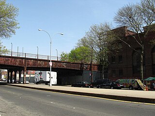
The Rockaway Beach Branch was a rail line owned and operated by the Long Island Rail Road in Queens, New York City, United States. The line left the Main Line at Whitepot Junction in Rego Park heading south via Ozone Park and across Jamaica Bay to Hammels in the Rockaways, turning west there to a terminal at Rockaway Park. Along the way it connected with the Montauk Branch near Glendale, the Atlantic Branch near Woodhaven, and the Far Rockaway Branch at Hammels.
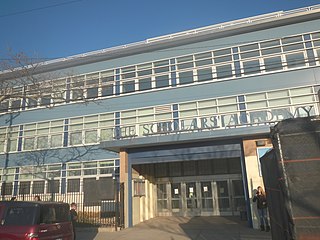
Scholars' Academy is a uniformed preparatory school consisting of a middle school and a high school for gifted and talented children located in Rockaway Park, in the New York City borough of Queens. Scholars' Academy grew out of a pilot program and established a middle school in 2004 and added a 9th grade in 2007. It draws 51% of its students from the Rockaway Peninsula and is known for its diversity.
Woodhaven Junction was a station complex on the Atlantic Branch and Rockaway Beach Branch of the Long Island Rail Road, located at Atlantic Avenue between 98th and 100th Streets in Woodhaven, Queens, New York City. The elevated Rockaway Beach station was closed in 1962 along with the rest of the branch, while the underground Atlantic Branch station was closed and abandoned on January 7, 1977.

Catholic War Veterans is a national service organization of baptized Catholics that have served or are currently serving in the United States Armed Forces. Founded in 1935, the Catholic War Veterans are dedicated to serving all service members and their families regardless of their religion. Membership in the Catholic War Veterans is open to baptized Catholics, male or female, who have served on Active Duty for a period of at least 90 days, in the reserve component, or National Guard, or are currently on active duty in any branch of the military, specific war time service is not required.

Rockaway Boulevard is a major road in the New York City borough of Queens. Unlike the similarly named Rockaway Beach Boulevard and Rockaway Freeway, it serves mainland Queens and does not enter the Rockaways.
Travis Triangle is a narrow green space in the Murray Hill/Flushing neighborhoods of Queens, New York City. It is formed by the separation of Murray Street and Murray Lane, both of which were named after the Murray family, which owned land on the site of these streets from the late colonial period through the early 19th century. In 1932, New York City's Board of Aldermen passed a resolution to name this site Travis Triangle in honor of local American Civil War veteran Ira Underhill Travis (1839-1921), who fought under the name Ira Wilson, in the 11th New York Volunteer Infantry Regiment also known as Colonel Elmer E. Ellsworth’s Zouaves.

Triangle 54 is a 8,973.36-square-foot (833.652 m2) public park located in the Blissville neighborhood of Long Island City in Queens, New York City. This traffic triangle is bound by 48th Street on the southwest and east, and 54th Avenue on the north. The park contains ten trees and a memorial flagstaff in its center that dates to 1930. On its granite base is inscribed, "Erected by the citizens of Laurel Hill in memory of those who died in the World War." Laurel Hill is an old name for this area, which once had its own railroad station. The name still appears on the map in Laurel Hill Boulevard, which runs a few blocks to the north of this site.

Macri Triangle is a 0.57 acres park located at the intersection of Meeker Avenue, Union Avenue, and Metropolitan Avenue in Williamsburg, Brooklyn, New York City. The property was designated as a park in 1946 during the construction of the Brooklyn-Queens Expressway, which resulted in the demolition of buildings along its route and the extension of Meeker Avenue from Richardson Street south to Metropolitan Avenue, serving as the expressway's service road. As the highway ran through the street grid, triangular parcels that were too small to be developed were designated as public plazas, including this one.
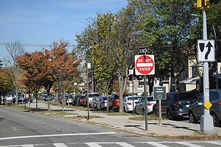
Reverend Lawrence E. Lynch Memorial Triangle is a 0.138 acres park located at the intersection of Rockaway Boulevard, Atlantic Avenue, and 81st Street in Ozone Park, Queens, New York City. The neighborhood's streets were laid out in a grid of streets and avenues at the turn of the 20th century while Rockaway Boulevard cuts diagonally through the grid on its route between Cypress Hills and Woodmere. Triangular intersections that were too small to be developed were designated as public plazas, including this one. In 1949, the city designated this triangle in memory of Lynch, a Woodhaven resident who served as a chaplain in the Pacific Theater during World War Two.

Tribute Park is a 0.83-acre (0.34 ha) public green space in the Rockaway Park neighborhood of Queens, New York City. It is located at the corner of Beach Channel Drive and Beach 116th Street, facing Jamaica Bay.
References
- ↑ Virtual Vietnam Veterans Wall http://www.vvmf.org/Wall-of-Faces/55441/WALTER-J-WETZEL
- ↑ Local Law 17 of 1977 http://www.steinway.lagcc.cuny.edu/FILES_DOC/Microfilms/05/009/0000/00001/050316/05.009.0000.00001.050316.10171977.pdf
- ↑ Kadinsky, Sergey "Howard Beach Honoree" Forgotten-NY Nov. 10, 2017 http://forgotten-ny.com/2017/11/walter-j-wetzel-triangle-howard-beach/