
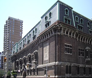
Highbridge is a residential neighborhood geographically located in the central-west section of the Bronx, New York City. Its boundaries, starting from the north and moving clockwise, are the Cross-Bronx Expressway to the north, Jerome Avenue to the east, Macombs Dam Bridge to the south, and the Harlem River to the west. Ogden Avenue is the primary thoroughfare through Highbridge.

The Croton Aqueduct or Old Croton Aqueduct was a large and complex water distribution system constructed for New York City between 1837 and 1842. The great aqueducts, which were among the first in the United States, carried water by gravity 41 miles (66 km) from the Croton River in Westchester County to reservoirs in Manhattan. It was built because local water resources had become polluted and inadequate for the growing population of the city. Although the aqueduct was largely superseded by the New Croton Aqueduct, which was built in 1890, the Old Croton Aqueduct remained in service until 1955.

Hamilton Heights is a neighborhood in the northern part of Manhattan in New York City. It is the northernmost part of the West Harlem area, along with Manhattanville and Morningside Heights to its south, and it contains the sub-neighborhood and historic district of Sugar Hill. Washington Heights lies to Hamilton Heights' north, and to its east is Central Harlem.

A combination of aqueducts, reservoirs, and tunnels supplies fresh water to New York City. With three major water systems stretching up to 125 miles (201 km) away from the city, its water supply system is one of the most extensive municipal water systems in the world.

St. Nicholas Avenue is a major street that runs obliquely north-south through several blocks between 111th and 193rd Streets in the New York City borough of Manhattan. The route, which follows a course that is much older than the grid pattern of the Commissioners' Plan of 1811, passes through the neighborhoods of Harlem, Hamilton Heights, and Washington Heights. It is believed to follow the course of an old Indian trail that became an important road in the 17th century between the Dutch settlement of New Amsterdam and the British New England Colonies. In the post colonial era, it became the western end of the Boston Post Road. The road became a street when row housing was being built in Harlem during its rapid urban expansion following the end of the American Civil War.

Sugar Hill is a National Historic District in the Harlem and Hamilton Heights neighborhoods of Manhattan, New York City, bounded by West 155th Street to the north, West 145th Street to the south, Edgecombe Avenue to the east, and Amsterdam Avenue to the west. The equivalent New York City Historic Districts are:

The Croton Distributing Reservoir, also known as the Murray Hill Reservoir, was an above-ground reservoir at 42nd Street and Fifth Avenue in the New York City borough of Manhattan. Covering 4-acre (16,000 m2) and holding 20 million US gallons (76,000 m3), it supplied the city with drinking water during the 19th century. Its massive 50-foot-high (15 m) granite walls, which presented a vaguely Egyptian-style facade, were 25 feet (7.6 m) thick. Atop the walls was a public promenade offering panoramic views; Edgar Allan Poe enjoyed walking there.
Rose Hill is a neighborhood in the New York City borough of Manhattan, between the neighborhoods of Murray Hill to the north and Gramercy Park to the south, Kips Bay to the east, the Flatiron District to the southwest, and NoMad to the northwest. The formerly unnamed area is sometimes considered to be a part of NoMad, because the name "Rose Hill" was chiefly used for the area in the 18th and 19th centuries, and is not very commonly used to refer to the area in the 2010s.

Dyckman Street, occasionally called West 200th Street, is a street in the Inwood neighborhood of Manhattan, New York City. It is commonly considered to be a crosstown street because it runs from the Hudson River to the Harlem River and intersects Broadway. However, in its true geographical orientation, Dyckman Street runs roughly from north-northwest to south-southeast, and the majority of the street that lies southeast of Broadway runs closer to a north-south direction than east-west.

145th Street is a major crosstown street in the Harlem neighborhood, in the New York City borough of Manhattan. It is one of the 15 crosstown streets mapped out in the Commissioner's Plan of 1811 that established the numbered street grid in Manhattan. It forms the northern border of the Sugar Hill neighborhood within Harlem.

Isham Park is a 20-acre (81,000 m2) historic park located in Inwood, Manhattan, New York City. The park was created in large part through gifts to the city from the Isham family of land from the William Bradley Isham estate. It sits roughly between Broadway, Isham Street, Seaman Avenue, and West 214th and 215th Streets.

The St. Nicholas Rink, also called the St. Nicholas Arena, was an indoor ice rink, and later a boxing arena in New York City from 1896 until 1962. The rink was one of the earliest indoor ice rinks made of mechanically frozen ice in North America, enabling a longer season for skating sports. It was demolished in the 1980s.

Highbridge Reservoir was a reservoir in the New York City water supply system, which received water from a portion of the Croton Aqueduct system. It was located on Amsterdam Avenue between 172nd Street and 174th Street, in Upper Manhattan adjacent to the High Bridge Water Tower and the High Bridge across the Harlem River Valley. The reservoir covered about 7 acres (28,000 m2), was 16 feet (4.9 m) deep, and had a total capacity of 10,794,000 US gallons (40,860,000 L).

The West Side Community Garden is a privately owned park in Manhattan, New York City, United States. It is located between West 89th Street and West 90th Street in the middle of the block between Amsterdam Avenue and Columbus Avenue.
The congregation of North Presbyterian Church, at 525 West 155th Street in Manhattan, New York City, is a combination of three former congregations: North Presbyterian Church, Washington Heights Presbyterian Church, and St. Nicholas Avenue Presbyterian Church.
Carolyn Wade Cassady Kent was an American historical preservationist and activist who lived most of her life in New York City on Riverside Drive, one block west of her alma mater Columbia University. As founder of Manhattan Community Board 9's Parks and Landmarks Committee and co-founder of the Morningside Heights Historic District Committee she worked to advocate for the architectures and communities of Morningside Heights, Manhattanville and Hamilton Heights in close collaboration with community, city and state organizations and agencies, to effect landmark designations, restorations and interventions that have preserved and protected buildings and entire neighborhoods. In 2007, she was given the first Preservation Angel Award. In addition, Kent served as Secretary of the Renaissance English Text Society.
Taqwa Community Farm is a half-acre park operated as a community garden in the Highbridge neighborhood of the Bronx, New York City.
St. Nick's Jazz Pub located at 773 St. Nicholas Avenue, in New York City, in the area of Harlem known as Sugar Hill, Manhattan. It was one of the oldest continuous operating jazz club in Harlem specializing in Jazz and Blues. In the 30s it was known as Poosepahtuck. In the 40s it was known as Lucky's Rendezvous and owned by Luckey Roberts. Luckey was Duke Ellington's and George Gershwin's teacher and mentor. Artists such as Art Tatum, Donald Lambert, known as Donald “The Jersey Rocket” Lambert, Marlowe Morris, Duke Ellington, Clifton Webb, performed at the Rendezvous.
Sugar Hill Children's Museum, officially the Sugar Hill Children's Museum of Art & Storytelling, is a children's museum located in the Sugar Hill neighborhood of Upper Manhattan. The building, which also includes a pre school and affordable housing under the auspices of Broadway Housing Communities, is known as the Sugar Hill Development, and is located at 155th Street and St. Nicholas Avenue. The museum was designed by David Adjaye and opened in September 2015.