Zalipie is a village in Poland, in Gmina Olesno, Dąbrowa County, Lesser Poland Voivodeship. It is approximately 7 kilometres (4 mi) west of Olesno, 13 km (8 mi) north-west of Dąbrowa Tarnowska, and 68 km (42 mi) east of the regional capital Kraków.
Gmina Bolesław is a rural gmina in Dąbrowa County, Lesser Poland Voivodeship, in southern Poland. Its seat is the village of Bolesław, which lies approximately 15 kilometres (9 mi) north-west of Dąbrowa Tarnowska and 73 km (45 mi) east of the regional capital Kraków.
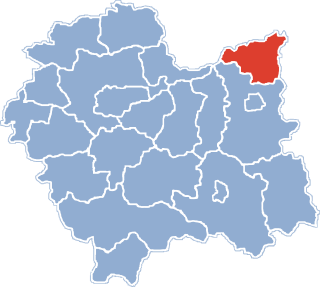
Gmina Gręboszów is a rural gmina in Dąbrowa County, Lesser Poland Voivodeship, in southern Poland. Its seat is the village of Gręboszów, which lies approximately 18 kilometres (11 mi) north-west of Dąbrowa Tarnowska and 64 km (40 mi) east of the regional capital Kraków.

Słończ is a village in the administrative district of Gmina Dąbrowa Chełmińska, within Bydgoszcz County, Kuyavian-Pomeranian Voivodeship, in north-central Poland. It lies 7 kilometres (4 mi) north-west of Dąbrowa Chełmińska, 22 km (14 mi) north-east of Bydgoszcz, and 34 km (21 mi) north-west of Toruń.
Dąbrowa-Bór is a village in the administrative district of Gmina Kraśnik, within Kraśnik County, Lublin Voivodeship, in eastern Poland. It lies approximately 6 kilometres (4 mi) north of Kraśnik and 40 km (25 mi) south-west of the regional capital Lublin.
Bagny is a village in the administrative district of Gmina Dąbrowa Białostocka, within Sokółka County, Podlaskie Voivodeship, in north-eastern Poland. It lies approximately 8 kilometres (5 mi) west of Dąbrowa Białostocka, 32 km (20 mi) north-west of Sokółka, and 58 km (36 mi) north of the regional capital Białystok.
Smęgorzów is a village in the administrative district of Gmina Dąbrowa Tarnowska, within Dąbrowa County, Lesser Poland Voivodeship, in southern Poland. It lies approximately 8 kilometres (5 mi) north of Dąbrowa Tarnowska and 80 km (50 mi) east of the regional capital Kraków.
Sutków is a village in the administrative district of Gmina Dąbrowa Tarnowska, within Dąbrowa County, Lesser Poland Voivodeship, in southern Poland. It lies approximately 9 kilometres (6 mi) north-east of Dąbrowa Tarnowska and 82 km (51 mi) east of the regional capital Kraków.
Strojców is a village in the administrative district of Gmina Bolesław, within Dąbrowa County, Lesser Poland Voivodeship, in southern Poland. It lies approximately 16 kilometres (10 mi) north of Dąbrowa Tarnowska and 74 km (46 mi) east of the regional capital Kraków.
Adamierz is a village in the administrative district of Gmina Olesno, within Dąbrowa County, Lesser Poland Voivodeship, in southern Poland. It lies approximately 3 kilometres (2 mi) south-west of Olesno, 8 km (5 mi) north-west of Dąbrowa Tarnowska, and 71 km (44 mi) east of the regional capital Kraków.
Dąbrówki Breńskie is a village in the administrative district of Gmina Olesno, within Dąbrowa County, Lesser Poland Voivodeship, in southern Poland. It lies approximately 4 kilometres (2 mi) north of Olesno, 10 km (6 mi) north of Dąbrowa Tarnowska, and 76 km (47 mi) east of the regional capital Kraków.
Niwki is a village in the administrative district of Gmina Olesno, within Dąbrowa County, Lesser Poland Voivodeship, in southern Poland. It lies approximately 6 kilometres (4 mi) west of Olesno, 12 km (7 mi) north-west of Dąbrowa Tarnowska, and 68 km (42 mi) east of the regional capital Kraków.
Oleśnica is a village in the administrative district of Gmina Olesno, within Dąbrowa County, Lesser Poland Voivodeship, in southern Poland. It lies approximately 6 kilometres (4 mi) south of Olesno, 4 km (2 mi) west of Dąbrowa Tarnowska, and 72 km (45 mi) east of the regional capital Kraków.

Olesno is a village in Dąbrowa County, Lesser Poland Voivodeship, in southern Poland. It is the seat of the gmina called Gmina Olesno. It lies approximately 7 kilometres (4 mi) north-west of Dąbrowa Tarnowska and 74 km (46 mi) east of the regional capital Kraków.
Pilcza Żelichowska is a village in the administrative district of Gmina Olesno, within Dąbrowa County, Lesser Poland Voivodeship, in southern Poland. It lies approximately 5 kilometres (3 mi) west of Olesno, 10 km (6 mi) north-west of Dąbrowa Tarnowska, and 69 km (43 mi) east of the regional capital Kraków.
Podborze is a village in the administrative district of Gmina Olesno, within Dąbrowa County, Lesser Poland Voivodeship, in southern Poland. It lies approximately 2 kilometres (1 mi) east of Olesno, 7 km (4 mi) north-west of Dąbrowa Tarnowska, and 75 km (47 mi) east of the regional capital Kraków.
Swarzów is a village in the administrative district of Gmina Olesno, within Dąbrowa County, Lesser Poland Voivodeship, in southern Poland. It lies approximately 3 kilometres (2 mi) south-east of Olesno, 5 km (3 mi) north-west of Dąbrowa Tarnowska, and 74 km (46 mi) east of the regional capital Kraków.
Oleszno is a village in the administrative district of Gmina Krasocin, within Włoszczowa County, Świętokrzyskie Voivodeship, in south-central Poland. It lies approximately 8 kilometres (5 mi) north-west of Krasocin, 12 km (7 mi) north-east of Włoszczowa, and 41 km (25 mi) west of the regional capital Kielce.
Prusków is a village in the administrative district of Gmina Zębowice, within Olesno County, Opole Voivodeship, in south-western Poland. It lies approximately 3 kilometres (2 mi) north of Zębowice, 12 km (7 mi) south-west of Olesno, and 32 km (20 mi) north-east of the regional capital Opole.