Kępa is a village in the administrative district of Gmina Długołęka, within Wrocław County, Lower Silesian Voivodeship, in south-western Poland. Prior to 1945 it was in Germany.
Lipniki is a village in the administrative district of Gmina Białe Błota, within Bydgoszcz County, Kuyavian-Pomeranian Voivodeship, in north-central Poland. It lies 4 kilometres (2 mi) west of Białe Błota and 10 km (6 mi) west of Bydgoszcz.
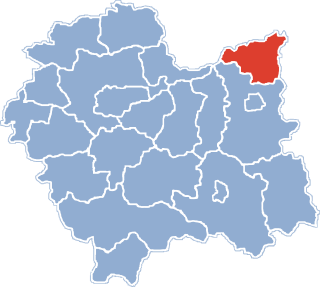
Aleksandrowo is a village in the administrative district of Gmina Brześć Kujawski, within Włocławek County, Kuyavian-Pomeranian Voivodeship, in north-central Poland. It lies approximately 8 kilometres (5 mi) north of Brześć Kujawski, 13 km (8 mi) west of Włocławek, and 44 km (27 mi) south-east of Toruń.
Kobło-Kolonia is a village in the administrative district of Gmina Horodło, within Hrubieszów County, Lublin Voivodeship, in eastern Poland, close to the border with Ukraine.
Franki Wroczyńskie is a village in the administrative district of Gmina Kutno, within Kutno County, Łódź Voivodeship, in central Poland. It lies approximately 7 kilometres (4 mi) south-west of Kutno and 49 km (30 mi) north of the regional capital Łódź.
Kruplin-Parcela is a village in the administrative district of Gmina Nowa Brzeźnica, within Pajęczno County, Łódź Voivodeship, in central Poland.
Strzeszyn is a village in the administrative district of Gmina Biecz, within Gorlice County, Lesser Poland Voivodeship, in southern Poland. It lies approximately 5 kilometres (3 mi) west of Biecz, 9 km (6 mi) north of Gorlice, and 99 km (62 mi) south-east of the regional capital Kraków.
Rebizanty is a village in the administrative district of Gmina Susiec, within Tomaszów Lubelski County, Lublin Voivodeship, in eastern Poland. It lies approximately 17 kilometres (11 mi) south-west of Tomaszów Lubelski and 105 km (65 mi) south-east of the regional capital Lublin.
Krajno Drugie is a village in the administrative district of Gmina Górno, within Kielce County, Świętokrzyskie Voivodeship, in south-central Poland. It lies approximately 4 kilometres (2 mi) north-east of Górno and 17 km (11 mi) east of the regional capital Kielce.

Majdan is a hamlet, a part of Cisna village, in the administrative district of Gmina Cisna, within Lesko County, Subcarpathian Voivodeship, in south-eastern Poland, close to the border with Slovakia. It lies approximately 3 kilometres (2 mi) west of Cisna, 30 km (19 mi) south of Lesko, and 95 km (59 mi) south of the regional capital Rzeszów.
Krzywdy is a village in the administrative district of Gmina Jeżowe, within Nisko County, Subcarpathian Voivodeship, in south-eastern Poland. It lies approximately 5 kilometres (3 mi) south-east of Jeżowe, 21 km (13 mi) south of Nisko, and 39 km (24 mi) north of the regional capital Rzeszów.
Niedziałka Druga is a village in the administrative district of Gmina Mińsk Mazowiecki, within Mińsk County, Masovian Voivodeship, in east-central Poland.
Choromany-Witnice is a village in the administrative district of Gmina Czerwin, within Ostrołęka County, Masovian Voivodeship, in east-central Poland. It lies approximately 8 kilometres (5 mi) east of Czerwin, 24 km (15 mi) south-east of Ostrołęka, and 103 km (64 mi) north-east of Warsaw.
Bieniewo-Parcela is a village in the administrative district of Gmina Błonie, within Warsaw West County, Masovian Voivodeship, in east-central Poland.
Brzezie is a village in the administrative district of Gmina Gostyń, within Gostyń County, Greater Poland Voivodeship, in west-central Poland. It lies approximately 2 kilometres (1 mi) south-west of Gostyń and 59 km (37 mi) south of the regional capital Poznań.
Gęzyn is a village in the administrative district of Gmina Poraj, within Myszków County, Silesian Voivodeship, in southern Poland. It lies approximately 5 kilometres (3 mi) south of Poraj, 10 km (6 mi) north-west of Myszków, and 46 km (29 mi) north of the regional capital Katowice.
Miłachowo is a settlement in the administrative district of Gmina Debrzno, within Człuchów County, Pomeranian Voivodeship, in northern Poland.
Nowy Dwór is a village in the administrative district of Gmina Kwidzyn, within Kwidzyn County, Pomeranian Voivodeship, in northern Poland. It lies approximately 5 kilometres (3 mi) south-west of Kwidzyn and 74 km (46 mi) south of the regional capital Gdańsk.

Dargobądz is a village in the administrative district of Gmina Wolin, within Kamień County, West Pomeranian Voivodeship, in north-western Poland. It lies approximately 7 kilometres (4 mi) north-west of Wolin, 20 km (12 mi) south-west of Kamień Pomorski, and 51 km (32 mi) north of the regional capital Szczecin.
Kierzkowo is a settlement in the administrative district of Gmina Biały Bór, within Szczecinek County, West Pomeranian Voivodeship, in north-western Poland. It lies approximately 9 kilometres (6 mi) north of Biały Bór, 31 km (19 mi) north-east of Szczecinek, and 163 km (101 mi) east of the regional capital Szczecin.