Bielawa(listen), population 31,988 (2010), is a town in southwestern Poland. Since 1999, it has been situated in Dzierżoniów County, Lower Silesian Voivodeship. From 1975–1998, it was part of the Wałbrzych Voivodeship, and from the 13th century up to 1945 was inside of Germany territory.

Wola is a district in western Warsaw, Poland, formerly the village of Wielka Wola, incorporated into Warsaw in 1916. An industrial area with traditions reaching back to the early 19th century, it is slowly changing into an office and residential district. Several museums are located in Wola.
Muhammad Maarifi Mosque is a historical mosque in Kartal district of Istanbul, Turkey, which was once a Rifa'i Tekke.
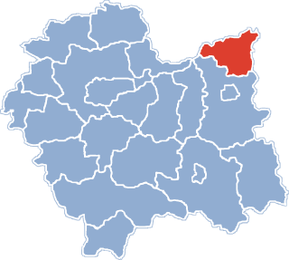
Kazimierza Wielka is a town in Poland, in Świętokrzyskie Voivodeship, about 45 kilometres northeast of Kraków. It is the administrative seat of Kazimierza County. With a population of 5,848 (2005), it is the smallest county seat in Poland. Kazimierza Wielka is located in Lesser Poland Upland and historically belongs to the province of Lesser Poland. For most of its history, it was a village, and did not receive its town charter until 1959.
Widnica is a village in Miechów County, Lesser Poland Voivodeship, Poland.
Piątek is a village in Łęczyca County, Łódź Voivodeship, in central Poland. It is the seat of the gmina called Gmina Piątek. It lies approximately 20 kilometres (12 mi) east of Łęczyca and 32 km (20 mi) north of the regional capital Łódź.
Żytno is a village in Radomsko County, Łódź Voivodeship, in central Poland. It is the seat of the Gmina called Gmina Żytno. It lies approximately 20 kilometres (12 mi) south-east of Radomsko and 96 km (60 mi) south of the regional capital Łódź.

Glinica is a village in the administrative district of Gmina Miechów, within Miechów County, Lesser Poland Voivodeship, in southern Poland. It lies approximately 7 kilometres (4 mi) south-east of Miechów and 29 km (18 mi) north of the regional capital Kraków.
Kalina-Rędziny is a village in the administrative district of Gmina Miechów, within Miechów County, Lesser Poland Voivodeship, in southern Poland. It lies approximately 6 kilometres (4 mi) east of Miechów and 35 km (22 mi) north of the regional capital Kraków.
Kamieńczyce is a village in the administrative district of Gmina Miechów, within Miechów County, Lesser Poland Voivodeship, in southern Poland. It lies approximately 4 kilometres (2 mi) south-west of Miechów and 31 km (19 mi) north of the regional capital Kraków.
Komorów is a village in the administrative district of Gmina Miechów, within Miechów County, Lesser Poland Voivodeship, in southern Poland. It lies approximately 2 kilometres (1 mi) south-west of Miechów and 33 km (21 mi) north of the regional capital Kraków.
Nasiechowice is a village in the administrative district of Gmina Miechów, within Miechów County, Lesser Poland Voivodeship, in southern Poland. It lies approximately 10 kilometres (6 mi) south-east of Miechów and 32 km (20 mi) north-east of the regional capital Kraków.
Poradów is a village in the administrative district of Gmina Miechów, within Miechów County, Lesser Poland Voivodeship, in southern Poland. It lies approximately 3 kilometres (2 mi) south of Miechów and 32 km (20 mi) north of the regional capital Kraków.
Przesławice is a village in the administrative district of Gmina Miechów, within Miechów County, Lesser Poland Voivodeship, in southern Poland. It lies approximately 6 kilometres (4 mi) south of Miechów and 29 km (18 mi) north of the regional capital Kraków.
Zarogów is a village in the administrative district of Gmina Miechów, within Miechów County, Lesser Poland Voivodeship, in southern Poland. It lies approximately 6 kilometres (4 mi) east of Miechów and 34 km (21 mi) north of the regional capital Kraków.
Niedźwiedź is a village in the administrative district of Gmina Barczewo, within Olsztyn County, Warmian-Masurian Voivodeship, in northern Poland. It lies approximately 10 kilometres (6 mi) east of Barczewo and 23 km (14 mi) east of the regional capital Olsztyn.
Skwary is a village in the administrative district of Gmina Łukta, within Ostróda County, Warmian-Masurian Voivodeship, in northern Poland.
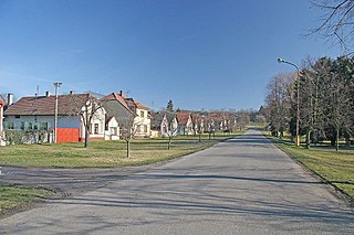
Vrbice is a village and municipality in Nymburk District in the Central Bohemian Region of the Czech Republic.
El Hadaik is a town and commune in Skikda Province in north-eastern Algeria.

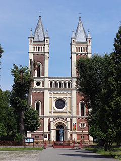
The Our Lady of Grace Cathedral also called Setúbal Cathedral is the name given to a religious building affiliated with the Catholic Church that works as the Cathedral of Setúbal, a city in Portugal. It is located in the heart of the primitive medieval town of Setúbal, around which the most important medieval district of the city as well as the religious and administrative center developed.