Gjorče Petrov Stadium is a multi-use stadium in Skopje, North Macedonia. It is currently used mostly for football matches and is the home of FK Makedonija Gjorče Petrov. The stadium seats 3,000 people.

Langli is a small marsh island in the Ho Bugt near Esbjerg on the Danish North Sea Coast.

The SNCF Class BB 36000 locomotives are a class of triple voltage 4 axle twin bogie electric locomotives built by GEC-Alsthom between 1996 and 2001 for SNCF.

Budai Township is an urban township in Chiayi County, Taiwan.

Bab al-Salam is one of the seven ancient city-gates of Damascus, Syria. During the Roman era, it was also known as "Gate of the Moon".
Turowszczyzna is a settlement in the administrative district of Gmina Czeremcha, within Hajnówka County, Podlaskie Voivodeship, in north-eastern Poland, close to the border with Belarus.
Stare Moczydły is a village in the administrative district of Gmina Siemiatycze, within Siemiatycze County, Podlaskie Voivodeship, in north-eastern Poland.

Wiktorzyn is a village in the administrative district of Gmina Klukowo, within Wysokie Mazowieckie County, Podlaskie Voivodeship, in north-eastern Poland. It lies approximately 21 kilometres (13 mi) south of Wysokie Mazowieckie and 61 km (38 mi) south-west of the regional capital Białystok.

Taxtabaşı is a village in the Kalbajar Rayon of Azerbaijan.
Stary Machnów is a village in the administrative district of Gmina Lubycza Królewska, within Tomaszów Lubelski County, Lublin Voivodeship, in eastern Poland, close to the border with Ukraine.
Rogóźno-Kolonia is a village in the administrative district of Gmina Tomaszów Lubelski, within Tomaszów Lubelski County, Lublin Voivodeship, in eastern Poland.
Wymysłów is a village in the administrative district of Gmina Mszczonów, within Żyrardów County, Masovian Voivodeship, in east-central Poland.
Nowy Świętów is a village in the administrative district of Gmina Głuchołazy, within Nysa County, Opole Voivodeship, in south-western Poland, close to the Czech border. It lies approximately 7 kilometres (4 mi) north of Głuchołazy, 12 km (7 mi) south of Nysa, and 52 km (32 mi) south-west of the regional capital Opole.
Wartule is a village in the administrative district of Gmina Stary Dzierzgoń, within Sztum County, Pomeranian Voivodeship, in northern Poland. It lies approximately 3 kilometres (2 mi) west of Stary Dzierzgoń, 24 km (15 mi) east of Sztum, and 75 km (47 mi) south-east of the regional capital Gdańsk.
Gąsiorowo Olsztyneckie is a village in the administrative district of Gmina Olsztynek, within Olsztyn County, Warmian-Masurian Voivodeship, in northern Poland.
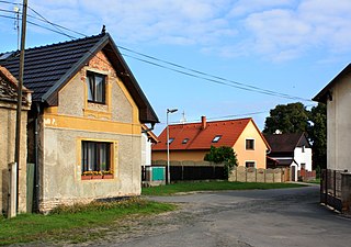
Písková Lhota is a village and municipality in Mladá Boleslav District in the Central Bohemian Region of the Czech Republic. It is located 6 kilometres (3.7 mi) south of Mladá Boleslav and 46 kilometres (29 mi) northeast of Prague.
Songevatnet is a lake in Vinje municipality in Telemark county, Norway. Its coordinates are 59°51′05″N07°30′51″E. It has a surface area of 29.95 km² and lies at an altitude of 974 m.
Kopli is a village in Saaremaa Parish, Saare County in western Estonia.
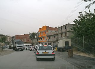
Tizi N'Bechar is a town and commune in Sétif Province in north-eastern Algeria.
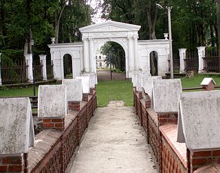
Švėkšna Manor is a former residential manor in Švėkšna, Šilutė district. Currently it is occupied by Laimė Felicija Platerienė.


