Gneisenaustraße is a station on the U7 U-Bahn in Berlin, Germany. The station was opened in 1924 and created by Alfred Grenander. 1945 it was closed for a few months, 1967/68 the platform was elongated. Due to this the station has lost its appearance as it was when Grenander has planned it.

Bogdanki is a village in the administrative district of Gmina Łasin, within Grudziądz County, Kuyavian-Pomeranian Voivodeship, in north-central Poland. It lies approximately 3 kilometres (2 mi) south of Łasin, 21 km (13 mi) east of Grudziądz, and 60 km (37 mi) north-east of Toruń.

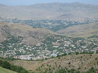
Movses ; also known as Mosesgegh, is a village in the Tavush Province of Armenia.
Kozi Las is a settlement in the administrative district of Gmina Gródek, within Białystok County, Podlaskie Voivodeship, in north-eastern Poland, close to the border with Belarus.
Gołąb-Kolonia is a village in the administrative district of Gmina Michów, within Lubartów County, Lublin Voivodeship, in eastern Poland.
Przesieka is a settlement in the administrative district of Gmina Drohiczyn, within Siemiatycze County, Podlaskie Voivodeship, in north-eastern Poland.

Ożary Wielkie is a village in the administrative district of Gmina Rutki, within Zambrów County, Podlaskie Voivodeship, in north-eastern Poland. It lies approximately 23 kilometres (14 mi) north-east of Zambrów and 46 km (29 mi) west of the regional capital Białystok.

Nord-Ost-Kultuk is a village in the Neftchala Rayon of Azerbaijan.

Chalagan-Gyuney is a village in the Lachin Rayon of Azerbaijan. The Battle of Chalagan was fought here in 1412.

Chełmce is a village in the administrative district of Gmina Strawczyn, within Kielce County, Świętokrzyskie Voivodeship, in south-central Poland. It lies approximately 6 kilometres (4 mi) east of Strawczyn and 11 km (7 mi) north-west of the regional capital Kielce.

Zaorze is a village in the administrative district of Gmina Goworowo, within Ostrołęka County, Masovian Voivodeship, in east-central Poland. It lies approximately 7 kilometres (4 mi) south-west of Goworowo, 25 km (16 mi) south of Ostrołęka, and 78 km (48 mi) north-east of Warsaw.
Helenowo is a village in the administrative district of Gmina Wierzbinek, within Konin County, Greater Poland Voivodeship, in west-central Poland.

Strzyżyno is a village in the administrative district of Gmina Damnica, within Słupsk County, Pomeranian Voivodeship, in northern Poland. It lies approximately 7 kilometres (4 mi) east of Damnica, 23 km (14 mi) east of Słupsk, and 83 km (52 mi) west of the regional capital Gdańsk.
Vecpils parish is an administrative unit of the Durbe Municipality, Latvia. The parish has a population of 529 and covers an area of 80.2 km2.

The Pars Stadium is a multi-use stadium in Shiraz, Iran. It is mostly used for football matches. The stadium hold 50,000 people and will be all-seater.

Kworatem is a former Karok settlement in Humboldt County, California. It was located at the confluence of the Klamath and Salmon Rivers, at an elevation of 515 feet.
Ouled Chamekh is a town and commune in the Mahdia Governorate, Tunisia. As of 2004 it had a population of 5,093.

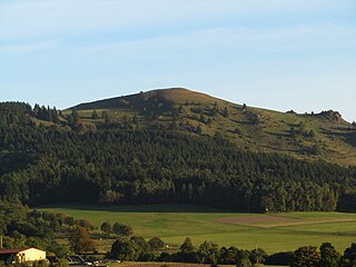
Pferdskopf is a mountain of Hesse, Germany, in the vicinity of the Wasserkuppe in the Rhön Mountains.
The canton of Saint-Léonard-de-Noblat is a French canton located in the department of Haute-Vienne and in the region of Nouvelle Aquitaine.
Troitsky Administrative Okrug is one of the twelve administrative okrugs of Moscow. The okrug was founded on July 1, 2012.


