Rudnik is a village in the administrative district of Gmina Będków, within Tomaszów Mazowiecki County, Łódź Voivodeship, in central Poland. It lies approximately 5 kilometres (3 mi) east of Będków, 16 km (10 mi) north-west of Tomaszów Mazowiecki, and 33 km (21 mi) south-east of the regional capital Łódź.
Adamów is a village in the administrative district of Gmina Budziszewice, within Tomaszów Mazowiecki County, Łódź Voivodeship, in central Poland. It lies approximately 2 kilometres (1 mi) east of Budziszewice, 17 km (11 mi) north of Tomaszów Mazowiecki, and 37 km (23 mi) east of the regional capital Łódź.
Antolin is a village in the administrative district of Gmina Budziszewice, within Tomaszów Mazowiecki County, Łódź Voivodeship, in central Poland. It lies approximately 2 kilometres (1 mi) east of Budziszewice, 18 km (11 mi) north of Tomaszów Mazowiecki, and 36 km (22 mi) east of the regional capital Łódź.
Budziszewice is a village in Tomaszów Mazowiecki County, Łódź Voivodeship, in central Poland. It is the seat of the gmina called Gmina Budziszewice. It lies approximately 18 kilometres (11 mi) north of Tomaszów Mazowiecki and 35 km (22 mi) east of the regional capital Łódź.
Teodorów is a village in the administrative district of Gmina Budziszewice, within Tomaszów Mazowiecki County, Łódź Voivodeship, in central Poland. It lies approximately 2 kilometres (1 mi) north of Budziszewice, 20 km (12 mi) north of Tomaszów Mazowiecki, and 35 km (22 mi) east of the regional capital Łódź.
Chociw is a village in the administrative district of Gmina Czerniewice, within Tomaszów Mazowiecki County, Łódź Voivodeship, in central Poland. It lies approximately 8 kilometres (5 mi) east of Czerniewice, 25 km (16 mi) north-east of Tomaszów Mazowiecki, and 56 km (35 mi) east of the regional capital Łódź.
Wale is a village in the administrative district of Gmina Czerniewice, within Tomaszów Mazowiecki County, Łódź Voivodeship, in central Poland. It lies approximately 9 kilometres (6 mi) north-east of Czerniewice, 27 km (17 mi) north-east of Tomaszów Mazowiecki, and 56 km (35 mi) east of the regional capital Łódź.
Dąbrowa is a village in the administrative district of Gmina Lubochnia, within Tomaszów Mazowiecki County, Łódź Voivodeship, in central Poland. It lies approximately 8 kilometres (5 mi) north-east of Lubochnia, 16 km (10 mi) north-east of Tomaszów Mazowiecki, and 50 km (31 mi) east of the regional capital Łódź.
Godaszewice is a village in the administrative district of Gmina Tomaszów Mazowiecki, within Tomaszów Mazowiecki County, Łódź Voivodeship, in central Poland. It lies approximately 9 kilometres (6 mi) west of Tomaszów Mazowiecki and 42 km (26 mi) south-east of the regional capital Łódź.
Karolinów is a village in the administrative district of Gmina Tomaszów Mazowiecki, within Tomaszów Mazowiecki County, Łódź Voivodeship, in central Poland. It lies approximately 9 kilometres (6 mi) south of Tomaszów Mazowiecki and 53 km (33 mi) south-east of the regional capital Łódź.
Niebrów is a village in the administrative district of Gmina Tomaszów Mazowiecki, within Tomaszów Mazowiecki County, Łódź Voivodeship, in central Poland. It lies approximately 5 kilometres (3 mi) north-west of Tomaszów Mazowiecki and 45 km (28 mi) south-east of the regional capital Łódź.
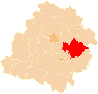
Sługocice is a village in the administrative district of Gmina Tomaszów Mazowiecki, within Tomaszów Mazowiecki County, Łódź Voivodeship, in central Poland. It lies approximately 8 kilometres (5 mi) east of Tomaszów Mazowiecki and 56 km (35 mi) south-east of the regional capital Łódź.
Wiaderno is a village in the administrative district of Gmina Tomaszów Mazowiecki, within Tomaszów Mazowiecki County, Łódź Voivodeship, in central Poland. It lies approximately 5 kilometres (3 mi) west of Tomaszów Mazowiecki and 46 km (29 mi) south-east of the regional capital Łódź.
Zawada is a village in the administrative district of Gmina Tomaszów Mazowiecki, within Tomaszów Mazowiecki County, Łódź Voivodeship, in central Poland. It lies approximately 6 kilometres (4 mi) west of Tomaszów Mazowiecki and 44 km (27 mi) south-east of the regional capital Łódź.
Kolonia Zawada is a village in the administrative district of Gmina Tomaszów Mazowiecki, within Tomaszów Mazowiecki County, Łódź Voivodeship, in central Poland. It lies approximately 5 kilometres (3 mi) west of Tomaszów Mazowiecki and 45 km (28 mi) south-east of the regional capital Łódź.
Sangrodz is a village in the administrative district of Gmina Ujazd, within Tomaszów Mazowiecki County, Łódź Voivodeship, in central Poland. It lies approximately 3 kilometres (2 mi) south-east of Ujazd, 9 km (6 mi) north-west of Tomaszów Mazowiecki, and 41 km (25 mi) south-east of the regional capital Łódź.
Skrzynki is a village in the administrative district of Gmina Ujazd, within Tomaszów Mazowiecki County, Łódź Voivodeship, in central Poland. It lies approximately 3 kilometres (2 mi) east of Ujazd, 11 km (7 mi) north of Tomaszów Mazowiecki, and 40 km (25 mi) south-east of the regional capital Łódź.
Zaosie is a village in the administrative district of Gmina Ujazd, within Tomaszów Mazowiecki County, Łódź Voivodeship, in central Poland. It lies approximately 5 kilometres (3 mi) north of Ujazd, 14 km (9 mi) north-west of Tomaszów Mazowiecki, and 37 km (23 mi) south-east of the regional capital Łódź.
Ignatów is a village in the administrative district of Gmina Żelechlinek, within Tomaszów Mazowiecki County, Łódź Voivodeship, in central Poland. It lies approximately 4 kilometres (2 mi) north-west of Żelechlinek, 25 km (16 mi) north of Tomaszów Mazowiecki, and 37 km (23 mi) east of the regional capital Łódź.
Naropna is a village in the administrative district of Gmina Żelechlinek, within Tomaszów Mazowiecki County, Łódź Voivodeship, in central Poland. It lies approximately 2 kilometres (1 mi) north of Żelechlinek, 24 km (15 mi) north of Tomaszów Mazowiecki, and 41 km (25 mi) east of the regional capital Łódź.