Glinnik is a village in the administrative district of Gmina Lubochnia, within Tomaszów Mazowiecki County, Łódź Voivodeship, in central Poland. It lies approximately 7 kilometres (4 mi) south-east of Lubochnia, 9 km (6 mi) north-east of Tomaszów Mazowiecki, and 51 km (32 mi) south-east of the regional capital Łódź.
Wolica is a village in the administrative district of Gmina Żelechlinek, within Tomaszów Mazowiecki County, Łódź Voivodeship, in central Poland. It lies approximately 5 kilometres (3 mi) east of Żelechlinek, 24 km (15 mi) north of Tomaszów Mazowiecki, and 45 km (28 mi) east of the regional capital Łódź.
Dąbrówka is a village in the administrative district of Gmina Czerniewice, within Tomaszów Mazowiecki County, Łódź Voivodeship, in central Poland. It lies approximately 3 kilometres (2 mi) south of Czerniewice, 16 km (10 mi) north-east of Tomaszów Mazowiecki, and 50 km (31 mi) east of the regional capital Łódź.
Gaj is a village in the administrative district of Gmina Czerniewice, within Tomaszów Mazowiecki County, Łódź Voivodeship, in central Poland. It lies approximately 6 kilometres (4 mi) south-east of Czerniewice, 18 km (11 mi) north-east of Tomaszów Mazowiecki, and 55 km (34 mi) east of the regional capital Łódź.
Józefów is a village in the administrative district of Gmina Czerniewice, within Tomaszów Mazowiecki County, Łódź Voivodeship, in central Poland. It lies approximately 2 kilometres (1 mi) east of Czerniewice, 19 km (12 mi) north-east of Tomaszów Mazowiecki, and 51 km (32 mi) east of the regional capital Łódź.
Krzemienica is a village in the administrative district of Gmina Czerniewice, within Tomaszów Mazowiecki County, Łódź Voivodeship, in central Poland. It lies approximately 5 kilometres (3 mi) north-east of Czerniewice, 23 km (14 mi) north-east of Tomaszów Mazowiecki, and 53 km (33 mi) east of the regional capital Łódź.
Mała Wola is a village in the administrative district of Gmina Czerniewice, within Tomaszów Mazowiecki County, Łódź Voivodeship, in central Poland. It lies approximately 5 kilometres (3 mi) south-east of Czerniewice, 19 km (12 mi) north-east of Tomaszów Mazowiecki, and 55 km (34 mi) east of the regional capital Łódź.
Podkonice Duże is a village in the administrative district of Gmina Czerniewice, within Tomaszów Mazowiecki County, Łódź Voivodeship, in central Poland. It lies approximately 8 kilometres (5 mi) north-east of Czerniewice, 27 km (17 mi) north-east of Tomaszów Mazowiecki, and 53 km (33 mi) east of the regional capital Łódź.
Podkonice Małe is a village in the administrative district of Gmina Czerniewice, within Tomaszów Mazowiecki County, Łódź Voivodeship, in central Poland. It lies approximately 6 kilometres (4 mi) north-east of Czerniewice, 24 km (15 mi) north-east of Tomaszów Mazowiecki, and 52 km (32 mi) east of the regional capital Łódź.
Strzemeszna Pierwsza is a village in the administrative district of Gmina Czerniewice, within Tomaszów Mazowiecki County, Łódź Voivodeship, in central Poland. It lies approximately 5 kilometres (3 mi) east of Czerniewice, 22 km (14 mi) north-east of Tomaszów Mazowiecki, and 54 km (34 mi) east of the regional capital Łódź.
Zubki Duże is a village in the administrative district of Gmina Czerniewice, within Tomaszów Mazowiecki County, Łódź Voivodeship, in central Poland. It lies approximately 6 kilometres (4 mi) north-east of Czerniewice, 24 km (15 mi) north-east of Tomaszów Mazowiecki, and 52 km (32 mi) east of the regional capital Łódź.
Godaszewice is a village in the administrative district of Gmina Tomaszów Mazowiecki, within Tomaszów Mazowiecki County, Łódź Voivodeship, in central Poland. It lies approximately 9 kilometres (6 mi) west of Tomaszów Mazowiecki and 42 km (26 mi) south-east of the regional capital Łódź.
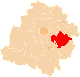
Jeleń is a village in the administrative district of Gmina Tomaszów Mazowiecki, within Tomaszów Mazowiecki County, Łódź Voivodeship, in central Poland. It lies in a wooded area on Local Road No. 793, approximately 5 kilometres (3 mi) east of Tomaszów Mazowiecki and 53 km (33 mi) south-east of the regional capital Łódź.
Sługocice is a village in the administrative district of Gmina Tomaszów Mazowiecki, within Tomaszów Mazowiecki County, Łódź Voivodeship, in central Poland. It lies approximately 8 kilometres (5 mi) east of Tomaszów Mazowiecki and 56 km (35 mi) south-east of the regional capital Łódź.
Smardzewice is a village in the administrative district of Gmina Tomaszów Mazowiecki, within Tomaszów Mazowiecki County, Łódź Voivodeship, in central Poland. It lies approximately 4 kilometres (2 mi) south of Tomaszów Mazowiecki and 52 km (32 mi) south-east of the regional capital Łódź.
Wąwał is a village in the administrative district of Gmina Tomaszów Mazowiecki, within Tomaszów Mazowiecki County, Łódź Voivodeship, in central Poland. It lies approximately 4 kilometres (2 mi) south-east of Tomaszów Mazowiecki and 53 km (33 mi) south-east of the regional capital Łódź.
Chociszew is a village in the administrative district of Gmina Żelechlinek, within Tomaszów Mazowiecki County, Łódź Voivodeship, in central Poland. It lies approximately 6 kilometres (4 mi) south-east of Żelechlinek, 19 km (12 mi) north of Tomaszów Mazowiecki, and 44 km (27 mi) east of the regional capital Łódź.
Czerwonka is a village in the administrative district of Gmina Żelechlinek, within Tomaszów Mazowiecki County, Łódź Voivodeship, in central Poland. It lies approximately 8 kilometres (5 mi) east of Żelechlinek, 22 km (14 mi) north of Tomaszów Mazowiecki, and 47 km (29 mi) east of the regional capital Łódź.
Feliksów is a village in the administrative district of Gmina Żelechlinek, within Tomaszów Mazowiecki County, Łódź Voivodeship, in central Poland. It lies approximately 3 kilometres (2 mi) north-east of Żelechlinek, 24 km (15 mi) north of Tomaszów Mazowiecki, and 43 km (27 mi) east of the regional capital Łódź.
Łochów Stary is a village in the administrative district of Gmina Żelechlinek, within Tomaszów Mazowiecki County, Łódź Voivodeship, in central Poland. It lies approximately 6 kilometres (4 mi) north-east of Żelechlinek, 26 km (16 mi) north of Tomaszów Mazowiecki, and 45 km (28 mi) east of the regional capital Łódź.