
Tomaszowice is a village in the administrative district of Gmina Jastków, within Lublin County, Lublin Voivodeship, in eastern Poland. It was formerly known as Thomaszenicze. It lies approximately 8 kilometres (5 mi) south-west of Jastków and 15 km (9 mi) west of the regional capital Lublin.
Krupy is a village in the administrative district of Gmina Michów, within Lubartów County, Lublin Voivodeship, in eastern Poland. It lies approximately 7 kilometres (4 mi) north of Michów, 22 km (14 mi) north-west of Lubartów, and 41 km (25 mi) north of the regional capital Lublin.
Leśce is a village in the administrative district of Gmina Garbów, within Lublin County, Lublin Voivodeship, in eastern Poland. It lies approximately 5 kilometres (3 mi) east of Garbów and 17 km (11 mi) north-west of the regional capital Lublin.
Barak is a village in the administrative district of Gmina Jastków, within Lublin County, Lublin Voivodeship, in eastern Poland. It lies approximately 4 kilometres (2 mi) south of Jastków and 9 km (6 mi) north-west of the regional capital Lublin.
Dąbrowica is a village in the administrative district of Gmina Jastków, within Lublin County, Lublin Voivodeship, in eastern Poland. It lies approximately 6 kilometres (4 mi) south of Jastków and 9 km (6 mi) west of the regional capital Lublin.

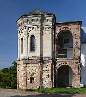
Jastków is a village in Lublin County, Lublin Voivodeship, in eastern Poland. It is the seat of the gmina called Gmina Jastków. It lies approximately 11 kilometres (7 mi) north-west of the regional capital Lublin.
Józefów is a village in the administrative district of Gmina Jastków, within Lublin County, Lublin Voivodeship, in eastern Poland. It lies approximately 15 km (9 mi) north-west of the regional capital Lublin.
Moszenki is a village in the administrative district of Gmina Jastków, within Lublin County, Lublin Voivodeship, in eastern Poland. It lies approximately 9 kilometres (6 mi) west of Jastków and 17 km (11 mi) west of the regional capital Lublin.
Moszna is a village in the administrative district of Gmina Jastków, within Lublin County, Lublin Voivodeship, in eastern Poland. It lies approximately 13 kilometres (8 mi) west of Jastków and 20 km (12 mi) west of the regional capital Lublin.
Natalin is a village in the administrative district of Gmina Jastków, within Lublin County, Lublin Voivodeship, in eastern Poland. It lies approximately 3 kilometres (2 mi) south-east of Jastków and 9 km (6 mi) north-west of the regional capital Lublin.
Sieprawice is a village in the administrative district of Gmina Jastków, within Lublin County, Lublin Voivodeship, in eastern Poland. It lies approximately 14 km (9 mi) north-west of the regional capital Lublin.
Sieprawki is a village in the administrative district of Gmina Jastków, within Lublin County, Lublin Voivodeship, in eastern Poland. It lies approximately 15 km (9 mi) north-west of the regional capital Lublin.
Sługocin is a village in the administrative district of Gmina Jastków, within Lublin County, Lublin Voivodeship, in eastern Poland. It lies approximately 7 kilometres (4 mi) west of Jastków and 17 km (11 mi) north-west of the regional capital Lublin.
Smugi is a village in the administrative district of Gmina Jastków, within Lublin County, Lublin Voivodeship, in eastern Poland. It lies approximately 4 kilometres (2 mi) east of Jastków and 9 km (6 mi) north-west of the regional capital Lublin.
Snopków is a village in the administrative district of Gmina Jastków, within Lublin County, Lublin Voivodeship, in eastern Poland. It lies approximately 10 km (6 mi) north-west of the regional capital Lublin. The population of Snopków was 928 in 2011.
Majdan Sobieszczański is a village in the administrative district of Gmina Niedrzwica Duża, within Lublin County, Lublin Voivodeship, in eastern Poland. It lies approximately 8 kilometres (5 mi) south of Niedrzwica Duża and 27 km (17 mi) south-west of the regional capital Lublin.
Januszówka is a village in the administrative district of Gmina Spiczyn, within Łęczna County, Lublin Voivodeship, in eastern Poland. It lies approximately 3 kilometres (2 mi) east of Spiczyn, 9 km (6 mi) north-west of Łęczna, and 20 km (12 mi) north-east of the regional capital Lublin.
Klementowice is a village in the administrative district of Gmina Kurów, within Puławy County, Lublin Voivodeship, in eastern Poland. It lies approximately 7 kilometres (4 mi) south-west of Kurów, 15 km (9 mi) south-east of Puławy, and 32 km (20 mi) west of the regional capital Lublin.
Bronice is a village in the administrative district of Gmina Nałęczów, within Puławy County, Lublin Voivodeship, in eastern Poland. It lies approximately 8 kilometres (5 mi) north of Nałęczów, 20 km (12 mi) east of Puławy, and 27 km (17 mi) north-west of the regional capital Lublin.
Karmanowice is a village in the administrative district of Gmina Wąwolnica, within Puławy County, Lublin Voivodeship, in eastern Poland. It lies approximately 7 kilometres (4 mi) north of Wąwolnica, 13 km (8 mi) south-east of Puławy, and 34 km (21 mi) west of the regional capital Lublin.


