
Majdan Kozłowiecki is a village in the administrative district of Gmina Lubartów, within Lubartów County, Lublin Voivodeship, in eastern Poland. It lies approximately 6 kilometres (4 mi) south of Lubartów and 19 km (12 mi) north of the regional capital Lublin.
Wólka Rokicka is a village in the administrative district of Gmina Lubartów, within Lubartów County, Lublin Voivodeship, in eastern Poland. It lies approximately 10 kilometres (6 mi) south-east of Lubartów and 19 km (12 mi) north-east of the regional capital Lublin.

Lublin Voivodeship was a unit of administrative division of the Second Polish Republic between the two world wars, in the years 1919–1939. The province's capital and biggest city was Lublin.
Talczyn is a village in the administrative district of Gmina Kock, within Lubartów County, Lublin Voivodeship, in eastern Poland. It lies approximately 6 kilometres (4 mi) north-west of Kock, 28 km (17 mi) north-west of Lubartów, and 50 km (31 mi) north of the regional capital Lublin.
Dobrowola is a village in the administrative district of Gmina Borzechów, within Lublin County, Lublin Voivodeship, in eastern Poland. It lies approximately 6 kilometres (4 mi) south of Borzechów and 29 km (18 mi) south-west of the regional capital Lublin.
Wola Przybysławska is a village in the administrative district of Gmina Garbów, within Lublin County, Lublin Voivodeship, in eastern Poland. It lies approximately 24 km (15 mi) north-west of the regional capital Lublin.
Sieprawki is a village in the administrative district of Gmina Jastków, within Lublin County, Lublin Voivodeship, in eastern Poland. It lies approximately 15 km (9 mi) north-west of the regional capital Lublin.
Radawiec Duży is a village in the administrative district of Gmina Konopnica, within Lublin County, Lublin Voivodeship, in eastern Poland. It lies approximately 9 kilometres (6 mi) east of Konopnica and 14 km (9 mi) south-west of the regional capital Lublin.
Radawiec Mały is a village in the administrative district of Gmina Konopnica, within Lublin County, Lublin Voivodeship, in eastern Poland. It lies approximately 9 kilometres (6 mi) south-east of Konopnica and 14 km (9 mi) south-west of the regional capital Lublin.
Marianka is a village in the administrative district of Gmina Niedrzwica Duża, within Lublin County, Lublin Voivodeship, in eastern Poland. It lies approximately 4 kilometres (2 mi) south of Niedrzwica Duża and 22 km (14 mi) south-west of the regional capital Lublin.
Strzeszkowice Duże is a village in the administrative district of Gmina Niedrzwica Duża, within Lublin County, Lublin Voivodeship, in eastern Poland. It lies approximately 5 kilometres (3 mi) north of Niedrzwica Duża and 17 km (11 mi) south-west of the regional capital Lublin.
Pryszczowa Góra is a village in the administrative district of Gmina Niemce, within Lublin County, Lublin Voivodeship, in eastern Poland. It lies approximately 14 kilometres (9 mi) west of Niemce and 19 km (12 mi) north-west of the regional capital Lublin.
Pliszczyn is a village in the administrative district of Gmina Wólka, within Lublin County, Lublin Voivodeship, in eastern Poland. It lies approximately 9 km (6 mi) north-east of the regional capital Lublin.
Sobianowice is a village in the administrative district of Gmina Wólka, within Lublin County, Lublin Voivodeship, in eastern Poland. It lies approximately 10 km (6 mi) north-east of the regional capital Lublin.
Puchaczów is a village in Łęczna County, Lublin Voivodeship, in eastern Poland. It is the seat of the gmina called Gmina Puchaczów. It lies approximately 6 kilometres (4 mi) east of Łęczna and 29 km (18 mi) east of the regional capital Lublin.
Czerśl is a village in the administrative district of Gmina Łuków, within Łuków County, Lublin Voivodeship, in eastern Poland. It lies approximately 7 kilometres (4 mi) west of Łuków and 75 km (47 mi) north of the regional capital Lublin.
Sięciaszka Druga is a village in the administrative district of Gmina Łuków, within Łuków County, Lublin Voivodeship, in eastern Poland. It lies approximately 6 kilometres (4 mi) west of Łuków and 77 km (48 mi) north of the regional capital Lublin.
Wólka Świątkowa is a village in the administrative district of Gmina Łuków, within Łuków County, Lublin Voivodeship, in eastern Poland. It lies approximately 6 kilometres (4 mi) north of Łuków and 81 km (50 mi) north of the regional capital Lublin.
Opoka is a village in the administrative district of Gmina Końskowola, within Puławy County, Lublin Voivodeship, in eastern Poland. It lies approximately 3 kilometres (2 mi) south-east of Końskowola, 8 km (5 mi) east of Puławy, and 39 km (24 mi) north-west of the regional capital Lublin.
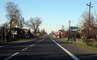
Brzozowa Gać is a village in the administrative district of Gmina Kurów, within Puławy County, Lublin Voivodeship, in eastern Poland. It lies approximately 16 km (10 mi) east of Puławy and 32 km (20 mi) north-west of the regional capital Lublin.


