Škrilj, Semič

Last updated
Škrilj
Slovenia location map.svg
Red pog.svg
Škrilj
Location in Slovenia
Coordinates: 45°38′9.53″N15°6′42.15″E / 45.6359806°N 15.1117083°E / 45.6359806; 15.1117083 Coordinates: 45°38′9.53″N15°6′42.15″E / 45.6359806°N 15.1117083°E / 45.6359806; 15.1117083
Country Flag of Slovenia.svg Slovenia
Traditional region Lower Carniola
Statistical region Southeast Slovenia
Municipality Semič
Elevation 876.3 m (2,875.0 ft)
Population (2002)
  Total none

Škrilj (pronounced  [ˈʃkɾiːl] ; German : Skrill [1] [2] ) is a remote former settlement in the Municipality of Semič in southern Slovenia. The area is part of the traditional region of Lower Carniola and is now included in the Southeast Slovenia Statistical Region. [3] Its territory is now part of the village of Planina.

German language West Germanic language

German is a West Germanic language that is mainly spoken in Central Europe. It is the most widely spoken and official or co-official language in Germany, Austria, Switzerland, South Tyrol (Italy), the German-speaking Community of Belgium, and Liechtenstein. It is also one of the three official languages of Luxembourg and a co-official language in the Opole Voivodeship in Poland. The languages which are most similar to German are the other members of the West Germanic language branch: Afrikaans, Dutch, English, the Frisian languages, Low German/Low Saxon, Luxembourgish, and Yiddish. There are also strong similarities in vocabulary with Danish, Norwegian and Swedish, although those belong to the North Germanic group. German is the second most widely spoken Germanic language, after English.

Municipality of Semič Municipality in Slovenia

The Municipality of Semič is a municipality in Slovenia in the traditional region of White Carniola in southeastern Slovenia. The municipality is included in the Southeast Slovenia Statistical Region. Its seat is the settlement Semič.

Slovenia republic in Central Europe

Slovenia, officially the Republic of Slovenia, is a sovereign state located in southern Central Europe at a crossroads of important European cultural and trade routes. It is bordered by Italy to the west, Austria to the north, Hungary to the northeast, Croatia to the southeast, and the Adriatic Sea to the southwest. It covers 20,273 square kilometers (7,827 sq mi) and has a population of 2.07 million. One of the successor states of the former Yugoslavia, Slovenia is a parliamentary republic and a member of the United Nations, of the European Union, and of NATO. The capital and largest city is Ljubljana.

Contents

Name

Gottschee German gravestone with the toponym Skril Skrilj Semic Slovenia - gravestone.jpg
Gottschee German gravestone with the toponym Skril

The name Škrilj comes from the dialect word škril, corresponding to standard Slovene skril 'slate', referring to the local lithology. [4] [5] [6] Similar place names with the same root include Škrilje , Skrilje , Škrljevo , and Škrlovica . [4]

Slate A fine-grained, foliated, homogeneous, weakly metamorphic rock

Slate is a fine-grained, foliated, homogeneous metamorphic rock derived from an original shale-type sedimentary rock composed of clay or volcanic ash through low-grade regional metamorphism. It is the finest grained foliated metamorphic rock. Foliation may not correspond to the original sedimentary layering, but instead is in planes perpendicular to the direction of metamorphic compression.

Škrilje, Metlika in White Carniola, Slovenia

Škrilje is a small settlement on the left bank of the Kolpa River south of Podzemelj in the Municipality of Metlika in the White Carniola area of southeastern Slovenia. The area is part of the traditional region of Lower Carniola and is now included in the Southeast Slovenia Statistical Region.

Skrilje in Littoral, Slovenia

Skrilje is a village in the Vipava Valley in the Municipality of Ajdovščina in the Littoral region of Slovenia. It is divided into three smaller hamlets: Valiči, Ruštji, and Bajči.

History

Škrilj was a Gottschee German village. In 1931 the village had six houses. The original residents were expelled in the fall of 1941. Italian troops burned the village during the Rog Offensive in the summer of 1942 and it was not rebuilt after the war. [7]

Gottscheers ethnic group

Gottscheers are the German settlers of the Kočevje region of Slovenia, formerly Gottschee County. Until the Second World War, their main language of communication was Gottscheerish, a Bavarian dialect.

Related Research Articles

Brezovica pri Črmošnjicah in Lower Carniola, Slovenia

Brezovica pri Črmošnjicah is a small settlement in the Municipality of Semič in Slovenia. The area is part of the historical region of Lower Carniola. The municipality is now included in the Southeast Slovenia Statistical Region.

Sredgora Place in Lower Carniola, Slovenia

Sredgora is a settlement in the Municipality of Semič in Slovenia. The area is part of the historical region of Lower Carniola. The municipality is now included in the Southeast Slovenia Statistical Region.

Gaber pri Črmošnjicah in Lower Carniola, Slovenia

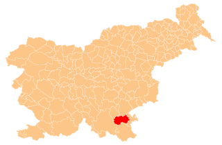
Gaber pri Črmošnjicah is a small settlement in the hills west of Semič in southeastern Slovenia. The area is part of the historical region of Lower Carniola and is now included in the Southeast Slovenia Statistical Region.

Ašelice in Lower Carniola, Slovenia

Ašelice is a remote abandoned settlement in the Municipality of Semič in southern Slovenia. The area is part of the traditional region of Lower Carniola and is now included in the Southeast Slovenia Statistical Region. Its territory is now part of the village of Mašelj. Ašelice lies high on a slope alongside an unpaved road east of Črmošnjice.

Stari Tabor in Lower Carniola, Slovenia

Stari Tabor is a remote abandoned settlement in the Municipality of Semič in southern Slovenia. The area is part of the traditional region of Lower Carniola and is now included in the Southeast Slovenia Statistical Region. Its territory is now part of the village of Brezovica pri Črmošnjicah.

Gače in Lower Carniola, Slovenia

Gače is a remote abandoned settlement in the Municipality of Semič in southern Slovenia. The area is part of the traditional region of Lower Carniola and is now included in the Southeast Slovenia Statistical Region. Its territory is now part of the village of Komarna Vas and it is registered as a cultural heritage site.

Kleč, Kočevje in Lower Carniola, Slovenia

Kleč is a settlement in the Municipality of Kočevje in southern Slovenia. The area is part of the traditional region of Lower Carniola and is now part of the Southeast Slovenia Statistical Region. It no longer has any permanent residents.

Lahinja, Semič in Lower Carniola, Slovenia

Lahinja is a remote abandoned settlement in the Municipality of Semič in southern Slovenia. The area is part of the traditional region of Lower Carniola and is now included in the Southeast Slovenia Statistical Region. Its territory is now part of the village of Planina.

Srednja Bukova Gora in Lower Carniola, Slovenia

Srednja Bukova Gora is a remote abandoned settlement in the Municipality of Kočevje in southern Slovenia. The area is part of the traditional region of Lower Carniola and is now included in the Southeast Slovenia Statistical Region. Its territory is now part of the village of Bukova Gora.

Spodnja Bukova Gora in Lower Carniola, Slovenia

Spodnja Bukova Gora is a remote abandoned settlement in the Municipality of Kočevje in southern Slovenia. The area is part of the traditional region of Lower Carniola and is now included in the Southeast Slovenia Statistical Region. Its territory is now part of the village of Bukova Gora.

Lapinje in Lower Carniola, Slovenia

Lapinje is a former village in the Municipality of Kočevje in southern Slovenia. The area is part of the traditional region of Lower Carniola and is now included in the Southeast Slovenia Statistical Region. Its territory is now part of the village of Podlesje.

Novi Tabor in Lower Carniola, Slovenia

Novi Tabor is an abandoned settlement in the Municipality of Semič in southern Slovenia. The area is part of the traditional region of Lower Carniola and is now included in the Southeast Slovenia Statistical Region. Its territory is now part of the village of Črmošnjice.

Zgornji Pokštajn in Lower Carniola, Slovenia

Zgornji Pokštajn is a former village in the Municipality of Kočevje in southern Slovenia. The area is part of the traditional region of Lower Carniola and is now included in the Southeast Slovenia Statistical Region. Its territory is now part of the village of Podlesje.

Prežulje in Lower Carniola, Slovenia

Prežulje is a remote abandoned former settlement in the Municipality of Kočevje in southern Slovenia. The area is part of the traditional region of Lower Carniola and is now included in the Southeast Slovenia Statistical Region. Its territory is now part of the village of Gornja Briga.

Resa in Lower Carniola, Slovenia

Resa is a remote abandoned settlement in the Municipality of Semič in southern Slovenia. The area is part of the traditional region of Lower Carniola and is now included in the Southeast Slovenia Statistical Region. Its territory is now part of the village of Komarna Vas.

Konjski Hrib in Lower Carniola, Slovenia

Konjski Hrib is a remote abandoned settlement in the Municipality of Semič in southern Slovenia. The area is part of the traditional region of Lower Carniola and is now included in the Southeast Slovenia Statistical Region. Its territory is now part of the village of Planina.

Ponikve, Semič Place in Lower Carniola, Slovenia

Ponikve is a remote abandoned settlement in the Municipality of Semič in southern Slovenia. The area is part of the traditional region of Lower Carniola and is now included in the Southeast Slovenia Statistical Region. Its territory is now part of the village of Planina.

Golobinjek in Lower Carniola, Slovenia

Golobinjek is a remote former settlement in the Municipality of Semič in southern Slovenia. The area is part of the traditional region of Lower Carniola and is now included in the Southeast Slovenia Statistical Region. Its territory is now part of the village of Planina.

Topličice, Semič in Lower Carniola, Slovenia

Topličice is a remote abandoned settlement in the Municipality of Semič in southern Slovenia. The area is part of the traditional region of Lower Carniola and is now included in the Southeast Slovenia Statistical Region. Its territory is now part of the village of Sredgora. It lies in a narrow dry valley 1 km east of Sredgora.

Verderb in Lower Carniola, Slovenia

Verderb is a former village in the Municipality of Kočevje in southern Slovenia. The area is part of the traditional region of Lower Carniola and is now included in the Southeast Slovenia Statistical Region. Its territory is now part of the village of Podlesje.

References

  1. Leksikon občin kraljestev in dežel zastopanih v državnem zboru, vol. 6: Kranjsko. 1906. Vienna: C. Kr. Dvorna in Državna Tiskarna, p. 6.
  2. Ferenc, Mitja. 2007. Nekdanji nemški jezikovni otok na kočevskem. Kočevje: Pokrajinski muzej, p. 4.
  3. Semič municipal site
  4. 1 2 Snoj, Marko (2009). Etimološki slovar slovenskih zemljepisnih imen. Ljubljana: Modrijan. p. 414.
  5. Simonič, Ivan (1935). "Kočevarji v luči krajevnih in ledinskih imen". Glasnik Muzejskega društva za Slovenijo. 16: 61–81, 106–123.
  6. Ferenc, Mitja; Zupan, Gojko (2013). Izgubljene kočevske vasi, vol. 3 (R–Ž). Ljubljana: Znanstvena založba Filozofske fakultete Univerze v Ljubljani. pp. 150–151. ISBN   9789612375850.
  7. Savnik, Roman, ed. 1971. Krajevni leksikon Slovenije, vol. 2. Ljubljana: Državna založba Slovenije, p. 60.