
Chmielew is a village in the administrative district of Gmina Korytnica, within Węgrów County, Masovian Voivodeship, in east-central Poland. It lies approximately 4 kilometres (2 mi) east of Korytnica, 9 km (6 mi) west of Węgrów, and 66 km (41 mi) east of Warsaw.

Czaple is a village in the administrative district of Gmina Korytnica, within Węgrów County, Masovian Voivodeship, in east-central Poland. It lies approximately 4 kilometres (2 mi) south of Korytnica, 11 km (7 mi) west of Węgrów, and 62 km (39 mi) east of Warsaw.
Dąbrowa is a village in the administrative district of Gmina Korytnica, within Węgrów County, Masovian Voivodeship, in east-central Poland.
Górki Borze is a village in the administrative district of Gmina Korytnica, within Węgrów County, Masovian Voivodeship, in east-central Poland. It lies approximately 4 kilometres (2 mi) north of Korytnica, 13 km (8 mi) north-west of Węgrów, and 64 km (40 mi) north-east of Warsaw.
Górki Grubaki is a village in the administrative district of Gmina Korytnica, within Węgrów County, Masovian Voivodeship, in east-central Poland.
Jaczew is a village in the administrative district of Gmina Korytnica, within Węgrów County, Masovian Voivodeship, in east-central Poland. It lies approximately 6 kilometres (4 mi) north of Korytnica, 15 km (9 mi) north-west of Węgrów, and 64 km (40 mi) north-east of Warsaw.
Kąty is a village in the administrative district of Gmina Korytnica, within Węgrów County, Masovian Voivodeship, in east-central Poland. It lies approximately 8 kilometres (5 mi) north-west of Korytnica, 19 km (12 mi) north-west of Węgrów, and 60 km (37 mi) north-east of Warsaw.
Komory is a village in the administrative district of Gmina Korytnica, within Węgrów County, Masovian Voivodeship, in east-central Poland. It lies approximately 3 kilometres (2 mi) north-west of Korytnica, 13 km (8 mi) west of Węgrów, and 62 km (39 mi) north-east of Warsaw.
Korytnica is a village in Węgrów County, Masovian Voivodeship, in east-central Poland. It is the seat of the gmina called Gmina Korytnica. It lies approximately 12 kilometres (7 mi) west of Węgrów and 62 km (39 mi) east of Warsaw.
Kruszew is a village in the administrative district of Gmina Korytnica, within Węgrów County, Masovian Voivodeship, in east-central Poland. It lies approximately 3 kilometres (2 mi) east of Korytnica, 10 km (6 mi) west of Węgrów, and 65 km (40 mi) east of Warsaw.
Leśniki is a village in the administrative district of Gmina Korytnica, within Węgrów County, Masovian Voivodeship, in east-central Poland. It lies approximately 4 kilometres (2 mi) south-west of Korytnica, 15 km (9 mi) west of Węgrów, and 59 km (37 mi) east of Warsaw.
Lipniki is a village in the administrative district of Gmina Korytnica, within Węgrów County, Masovian Voivodeship, in east-central Poland. It lies approximately 4 kilometres (2 mi) north-west of Korytnica, 16 km (10 mi) west of Węgrów, and 60 km (37 mi) north-east of Warsaw.
Nojszew is a village in the administrative district of Gmina Korytnica, within Węgrów County, Masovian Voivodeship, in east-central Poland. It lies approximately 6 kilometres (4 mi) south of Korytnica, 15 km (9 mi) west of Węgrów, and 59 km (37 mi) east of Warsaw.
Paplin is a village in the administrative district of Gmina Korytnica, within Węgrów County, Masovian Voivodeship, in east-central Poland. It lies approximately 8 kilometres (5 mi) north of Korytnica, 13 km (8 mi) north-west of Węgrów, and 67 km (42 mi) north-east of Warsaw.

Roguszyn is a village in the administrative district of Gmina Korytnica, within Węgrów County, Masovian Voivodeship, in east-central Poland. It lies approximately 4 kilometres (2 mi) south of Korytnica, 12 km (7 mi) west of Węgrów, and 61 km (38 mi) east of Warsaw.
Rowiska is a village in the administrative district of Gmina Korytnica, within Węgrów County, Masovian Voivodeship, in east-central Poland. It lies approximately 7 kilometres (4 mi) north-west of Korytnica, 17 km (11 mi) north-west of Węgrów, and 62 km (39 mi) north-east of Warsaw.
Sewerynów is a village in the administrative district of Gmina Korytnica, within Węgrów County, Masovian Voivodeship, in east-central Poland. It lies approximately 8 kilometres (5 mi) west of Korytnica, 19 km (12 mi) west of Węgrów, and 57 km (35 mi) north-east of Warsaw.
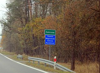
Zakrzew is a village in the administrative district of Gmina Korytnica, within Węgrów County, Masovian Voivodeship, in east-central Poland. It lies approximately 8 kilometres (5 mi) south-west of Korytnica, 18 km (11 mi) west of Węgrów, and 55 km (34 mi) east of Warsaw.
Turna is a village in the administrative district of Gmina Korytnica, within Węgrów County, Masovian Voivodeship, in east-central Poland. It lies approximately 6 kilometres (4 mi) north-east of Korytnica, 9 km (6 mi) north-west of Węgrów, and 68 km (42 mi) north-east of Warsaw.


