Gmina Korytnica is a rural gmina in Węgrów County, Masovian Voivodeship, in east-central Poland. Its seat is the village of Korytnica, which lies approximately 11 kilometres west of Węgrów and 60 km north-east of Warsaw.

Chmielew is a village in the administrative district of Gmina Korytnica, within Węgrów County, Masovian Voivodeship, in east-central Poland. It lies approximately 4 kilometres (2 mi) east of Korytnica, 9 km (6 mi) west of Węgrów, and 66 km (41 mi) east of Warsaw.

Czaple is a village in the administrative district of Gmina Korytnica, within Węgrów County, Masovian Voivodeship, in east-central Poland. It lies approximately 4 kilometres (2 mi) south of Korytnica, 11 km (7 mi) west of Węgrów, and 62 km (39 mi) east of Warsaw.
Górki Borze is a village in the administrative district of Gmina Korytnica, within Węgrów County, Masovian Voivodeship, in east-central Poland. It lies approximately 4 kilometres (2 mi) north of Korytnica, 13 km (8 mi) north-west of Węgrów, and 64 km (40 mi) north-east of Warsaw.
Jaczew is a village in the administrative district of Gmina Korytnica, within Węgrów County, Masovian Voivodeship, in east-central Poland. It lies approximately 6 kilometres (4 mi) north of Korytnica, 15 km (9 mi) north-west of Węgrów, and 64 km (40 mi) north-east of Warsaw.
Kąty is a village in the administrative district of Gmina Korytnica, within Węgrów County, Masovian Voivodeship, in east-central Poland. It lies approximately 8 kilometres (5 mi) north-west of Korytnica, 19 km (12 mi) north-west of Węgrów, and 60 km (37 mi) north-east of Warsaw.
Komory is a village in the administrative district of Gmina Korytnica, within Węgrów County, Masovian Voivodeship, in east-central Poland. It lies approximately 3 kilometres (2 mi) north-west of Korytnica, 13 km (8 mi) west of Węgrów, and 62 km (39 mi) north-east of Warsaw.
Kruszew is a village in the administrative district of Gmina Korytnica, within Węgrów County, Masovian Voivodeship, in east-central Poland. It lies approximately 3 kilometres (2 mi) east of Korytnica, 10 km (6 mi) west of Węgrów, and 65 km (40 mi) east of Warsaw.
Leśniki is a village in the administrative district of Gmina Korytnica, within Węgrów County, Masovian Voivodeship, in east-central Poland. It lies approximately 4 kilometres (2 mi) south-west of Korytnica, 15 km (9 mi) west of Węgrów, and 59 km (37 mi) east of Warsaw.
Lipniki is a village in the administrative district of Gmina Korytnica, within Węgrów County, Masovian Voivodeship, in east-central Poland. It lies approximately 4 kilometres (2 mi) north-west of Korytnica, 16 km (10 mi) west of Węgrów, and 60 km (37 mi) north-east of Warsaw.
Nojszew is a village in the administrative district of Gmina Korytnica, within Węgrów County, Masovian Voivodeship, in east-central Poland. It lies approximately 6 kilometres (4 mi) south of Korytnica, 15 km (9 mi) west of Węgrów, and 59 km (37 mi) east of Warsaw.
Paplin is a village in the administrative district of Gmina Korytnica, within Węgrów County, Masovian Voivodeship, in east-central Poland. It lies approximately 8 kilometres (5 mi) north of Korytnica, 13 km (8 mi) north-west of Węgrów, and 67 km (42 mi) north-east of Warsaw.

Roguszyn is a village in the administrative district of Gmina Korytnica, within Węgrów County, Masovian Voivodeship, in east-central Poland. It lies approximately 4 kilometres (2 mi) south of Korytnica, 12 km (7 mi) west of Węgrów, and 61 km (38 mi) east of Warsaw.
Rowiska is a village in the administrative district of Gmina Korytnica, within Węgrów County, Masovian Voivodeship, in east-central Poland. It lies approximately 7 kilometres (4 mi) north-west of Korytnica, 17 km (11 mi) north-west of Węgrów, and 62 km (39 mi) north-east of Warsaw.
Sewerynów is a village in the administrative district of Gmina Korytnica, within Węgrów County, Masovian Voivodeship, in east-central Poland. It lies approximately 8 kilometres (5 mi) west of Korytnica, 19 km (12 mi) west of Węgrów, and 57 km (35 mi) north-east of Warsaw.

Żabokliki is a village in the administrative district of Gmina Korytnica, within Węgrów County, Masovian Voivodeship, in east-central Poland. It lies approximately 6 kilometres (4 mi) south of Korytnica, 10 km (6 mi) west of Węgrów, and 63 km (39 mi) east of Warsaw.
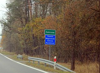
Zakrzew is a village in the administrative district of Gmina Korytnica, within Węgrów County, Masovian Voivodeship, in east-central Poland. It lies approximately 8 kilometres (5 mi) south-west of Korytnica, 18 km (11 mi) west of Węgrów, and 55 km (34 mi) east of Warsaw.
Żelazów is a village in the administrative district of Gmina Korytnica, within Węgrów County in Masovian Voivodeship, east-central Poland. It lies approximately 3 kilometres (2 mi) south-east of Korytnica, 10 km (6 mi) west of Węgrów, and 64 km (40 mi) east of Warsaw.
Popielów is a village in the administrative district of Gmina Liw, within Węgrów County, Masovian Voivodeship, in east-central Poland. It lies approximately 6 kilometres (4 mi) west of Węgrów and 68 km (42 mi) east of Warsaw.
Turna is a village in the administrative district of Gmina Korytnica, within Węgrów County, Masovian Voivodeship, in east-central Poland. It lies approximately 6 kilometres (4 mi) north-east of Korytnica, 9 km (6 mi) north-west of Węgrów, and 68 km (42 mi) north-east of Warsaw.


