
Braitling is an electoral division of the Legislative Assembly in Australia's Northern Territory. It was created in 1983, when the electorate of Alice Springs was abolished as part of an enlargement of the Assembly. Braitling is an almost entirely urban electorate, covering 60 km² in north-western Alice Springs. The electorate takes its name from the Braitling family, an early pioneering family in the district. There were 4,687 people enrolled in the electorate as of August 2012.

Nowinnik is a village in the administrative district of Gmina Narew, within Hajnówka County, Podlaskie Voivodeship, in north-eastern Poland. It lies approximately 5 kilometres (3 mi) south of Narew, 16 km (10 mi) north of Hajnówka, and 36 km (22 mi) south-east of the regional capital Białystok.
Zabłocie is a village in the administrative district of Gmina Narew, within Hajnówka County, Podlaskie Voivodeship, in north-eastern Poland. It lies approximately 5 kilometres (3 mi) south of Narew, 16 km (10 mi) north of Hajnówka, and 36 km (22 mi) south-east of the regional capital Białystok.

Cabanı is a village in the Shamakhi Rayon of Azerbaijan. The village forms part of the municipality of İkinci Cabanı.

Mikołajów is a settlement in the administrative district of Gmina Sulejów, within Piotrków County, Łódź Voivodeship, in central Poland.On Mikołajów lives 14 peoples.
Mogilno is a village in the administrative district of Gmina Warta, within Sieradz County, Łódź Voivodeship, in central Poland. It lies approximately 13 kilometres (8 mi) east of Warta, 12 km (7 mi) north-east of Sieradz, and 46 km (29 mi) west of the regional capital Łódź.
Żelizna is a village in the administrative district of Gmina Komarówka Podlaska, within Radzyń Podlaski County, Lublin Voivodeship, in eastern Poland. It lies approximately 8 kilometres (5 mi) north of Komarówka Podlaska, 25 km (16 mi) north-east of Radzyń Podlaski, and 74 km (46 mi) north of the regional capital Lublin.
Smolnik is a village in the administrative district of Gmina Lutowiska, within Bieszczady County, Subcarpathian Voivodeship, in south-eastern Poland, close to the border with Ukraine. It lies approximately 3 kilometres (2 mi) south of Lutowiska, 24 km (15 mi) south of Ustrzyki Dolne, and 103 km (64 mi) south-east of the regional capital Rzeszów.
Przeździecko-Jachy is a village in the administrative district of Gmina Andrzejewo, within Ostrów Mazowiecka County, Masovian Voivodeship, in east-central Poland. It lies approximately 5 kilometres (3 mi) north-east of Andrzejewo, 24 km (15 mi) east of Ostrów Mazowiecka, and 111 km (69 mi) north-east of Warsaw.
Janków is a village in the administrative district of Gmina Żelazków, within Kalisz County, Greater Poland Voivodeship, in west-central Poland.
Wólka Starzyńska is a village in the administrative district of Gmina Szczekociny, within Zawiercie County, Silesian Voivodeship, in southern Poland. It lies approximately 8 kilometres (5 mi) north of Szczekociny, 35 km (22 mi) north-east of Zawiercie, and 76 km (47 mi) north-east of the regional capital Katowice.
Dębianka is a settlement in the administrative district of Gmina Siedlisko, within Nowa Sól County, Lubusz Voivodeship, in western Poland.

Rzepcze, German Repsch, is a village in the administrative district of Gmina Głogówek, within Prudnik County, Opole Voivodeship, in south-western Poland, close to the Czech border. It lies approximately 5 kilometres (3 mi) north of Głogówek, 22 km (14 mi) east of Prudnik, and 32 km (20 mi) south of the regional capital Opole.

Pszczółki is a village in Gdańsk County, Pomeranian Voivodeship, in northern Poland. It is the seat of the gmina called Gmina Pszczółki. It lies approximately 12 kilometres (7 mi) south of Pruszcz Gdański and 22 km (14 mi) south of the regional capital Gdańsk.

The Fehmarnbelt Lightship was built in 1906-1908 at Brake on the River Weser and entered service in 1908 as the lightship Außeneider. Until 1945 it was moored at the position known as Außeneider guarding the estuary of the river Eider on the North Sea coast. In the years from 1956 to 1965 it was a reserve lighthouse in the Baltic Sea and then from 1965 to 1984 it was positioned under its present name in the Fehmarn Belt.
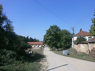
Čukljenik is a village in the municipality of Leskovac, Serbia. According to the 2002 census, the village has a population of 636 people.

Obravnje is a village in the municipality of Višegrad, Bosnia and Herzegovina.
Yenikənd is a village in the Ismayilli Rayon of Azerbaijan. The village forms part of the municipality of Kəlbənd.

Zhonglingjie Station, is a station of Line 2 of the Nanjing Metro. It started operations on 28 May 2010 along with the rest of Line 2. The theme of this station's decorations is the winter solstice.

Cortes is an administrative ward (barrio) of Madrid belonging to the district of Centro.


