Janowiczki is a village in the administrative district of Gmina Kondratowice, within Strzelin County, Lower Silesian Voivodeship, in south-western Poland. Prior to 1945 it was in Germany.
Lipowa is a village in the administrative district of Gmina Kondratowice, within Strzelin County, Lower Silesian Voivodeship, in south-western Poland. Prior to 1945 it was in Germany. It lies approximately 7 kilometres (4 mi) south-east of Kondratowice, 8 km (5 mi) south-west of Strzelin, and 44 km (27 mi) south of the regional capital Wrocław.
Skała is a village in the administrative district of Gmina Kondratowice, within Strzelin County, Lower Silesian Voivodeship, in south-western Poland. Prior to 1945 it was in Germany.
Samborowiczki is a village in the administrative district of Gmina Przeworno, within Strzelin County, Lower Silesian Voivodeship, in south-western Poland. Prior to 1945 it was in Germany.
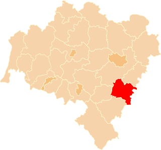
Biały Kościół is a village in the administrative district of Gmina Strzelin, within Strzelin County, Lower Silesian Voivodeship, in south-western Poland.
Bierzyn is a village in the administrative district of Gmina Strzelin, within Strzelin County, Lower Silesian Voivodeship, in south-western Poland. Prior to 1945 it was in Germany.
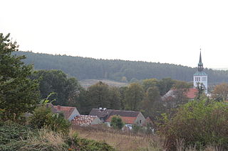
Chociwel is a village in the administrative district of Gmina Strzelin, within Strzelin County, Lower Silesian Voivodeship, in south-western Poland. It lies approximately 3 kilometres (2 mi) north-east of Strzelin, and 37 kilometres (23 mi) south of the regional capital Wrocław.
Dębniki is a village in the administrative district of Gmina Strzelin, within Strzelin County, Lower Silesian Voivodeship, in south-western Poland. Prior to 1945 it was in Germany.
Dobrogoszcz is a village in the administrative district of Gmina Strzelin, within Strzelin County, Lower Silesian Voivodeship, in south-western Poland. Prior to 1945 it was in Germany.
Karszówek is a village in the administrative district of Gmina Strzelin, within Strzelin County, Lower Silesian Voivodeship, in south-western Poland. Prior to 1945 it was in Germany.
Kazanów is a village in the administrative district of Gmina Strzelin, within Strzelin County, Lower Silesian Voivodeship, in south-western Poland.
Nowolesie is a village in the administrative district of Gmina Strzelin, within Strzelin County, Lower Silesian Voivodeship, in south-western Poland. Prior to 1945 it was in Germany. It lies approximately 10 kilometres (6 mi) south of Strzelin and 48 km (30 mi) south of the regional capital Wrocław.
Pęcz is a village in the administrative district of Gmina Strzelin, within Strzelin County, Lower Silesian Voivodeship, in south-western Poland. Prior to 1945, it was in Germany.
Piotrowice is a village in the administrative district of Gmina Strzelin, within Strzelin County, Lower Silesian Voivodeship, in south-western Poland. Prior to 1945 it was in Germany. It lies approximately 5 kilometres (3 mi) west of Strzelin and 39 km (24 mi) south of the regional capital Wrocław.
Skoroszowice is a village in the administrative district of Gmina Strzelin, within Strzelin County, Lower Silesian Voivodeship, in south-western Poland. Prior to 1945 it was in Germany.
Szczodrowice is a village in the administrative district of Gmina Strzelin, within Strzelin County, Lower Silesian Voivodeship, in south-western Poland. Prior to 1945 it was in Germany.
Kaczów is a village in the administrative district of Gmina Strzelin, within Strzelin County, Lower Silesian Voivodeship, in south-western Poland. Prior to 1945 it was in Germany.
Mojków is a village in the administrative district of Gmina Strzelin, within Strzelin County, Lower Silesian Voivodeship, in south-western Poland. Prior to 1945 it was in Germany.
Łojowice is a village in the administrative district of Gmina Wiązów, within Strzelin County, Lower Silesian Voivodeship, in south-western Poland. It lies approximately 10 kilometres (6 mi) south of Wiązów, 12 km (7 mi) south-east of Strzelin, and 46 km (29 mi) south of the regional capital Wrocław.