| |||||
| Decades: | |||||
|---|---|---|---|---|---|
| See also: | |||||

Events from the year 1989 in the British Virgin Islands.
| |||||
| Decades: | |||||
|---|---|---|---|---|---|
| See also: | |||||

Events from the year 1989 in the British Virgin Islands.

The British Virgin Islands (BVI), officially the Virgin Islands, is a British Overseas Territory in the Caribbean, to the east of Puerto Rico and the US Virgin Islands and north-west of Anguilla. The islands are geographically part of the Virgin Islands archipelago and are located in the Leeward Islands of the Lesser Antilles and part of the West Indies.

The United States Virgin Islands are a group of several dozen islands and cays located in the Caribbean, about 1,100 miles (1,770 km) southeast of Florida, 600 miles (966 km) north of Venezuela, 40 miles (64 km) east of Puerto Rico, and immediately west and south of the British Virgin Islands.

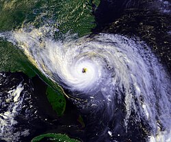
Hurricane Hugo was a powerful Cape Verde tropical cyclone that inflicted widespread damage across the northeastern Caribbean and the Southeastern United States in September 1989. Across its track, Hugo affected approximately 2 million people. Its direct effects killed 67 people and inflicted $11 billion in damage. The damage wrought by the storm was more costly than any Atlantic hurricane preceding it. At its peak strength east of the Lesser Antilles, Hugo was classified as a Category 5 hurricane—the highest rating on the Saffir–Simpson scale. Over the course of five days, Hugo made landfalls on Guadeloupe, Saint Croix, Puerto Rico, and South Carolina, bringing major hurricane conditions to these and surrounding areas. Lesser effects were felt along the periphery of the hurricane's path in the Lesser Antilles and across the Eastern United States into Eastern Canada. The scale of Hugo's impacts led to the retirement of the name Hugo from Atlantic hurricane names.

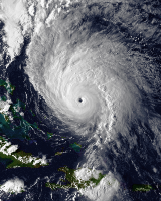
Hurricane Hortense was the first tropical cyclone to make landfall in Guadeloupe and Puerto Rico since Hurricane Hugo in 1989, and the second most intense hurricane during the 1996 Atlantic hurricane season. The eighth tropical cyclone, eighth named storm, and sixth hurricane of the season. Hortense developed on September 3 from a tropical wave in the central Atlantic Ocean. Initially a tropical depression, it headed westward without significant strengthening for four days due to unfavorable upper-level winds. While nearing the Lesser Antilles upper-level winds decreased, allowing the depression to become Tropical Storm Hortense on September 7. Hortense crossed Guadeloupe on September 8 and entered the Caribbean Sea. By on the following day, it was upgraded to a hurricane while curving northwestward. Hortense made landfall in Puerto Rico on September 9 and brushed the Dominican Republic shortly thereafter. After re-entering the Atlantic, Hortense began to substantially strengthen and peaked as a 140 mph (220 km/h) Category 4 hurricane early on September 13. Thereafter, the storm steadily weakened as it tracked rapidly north-northeastward. Early on September 15, Hortense made landfall in Nova Scotia as a minimal Category 1 hurricane. It quickly weakened further to a tropical storm before re-entering the Atlantic to the south of Newfoundland. Late on September 15, Hortense transitioned into an extratropical cyclone and subsequently merged with a frontal system about 24 hours later.

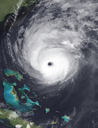
Hurricane Georges was a powerful and long-lived Cape Verde Category 4 hurricane which caused severe destruction as it traversed the Caribbean and Gulf of Mexico in September 1998, making seven landfalls along its path. Georges was the seventh tropical storm, fourth hurricane, and second major hurricane of the 1998 Atlantic hurricane season. It became the most destructive storm of the season, the costliest Atlantic hurricane since Hurricane Andrew in 1992 and remained the costliest until Hurricane Charley in 2004, and the deadliest since Hurricane Gordon in 1994. Georges killed 604 people, mainly on the island of Hispaniola, caused extensive damage resulting at just under $10 billion in damages and leaving nearly neatly 500,000 homeless in St. Kitts and Nevis, Puerto Rico, Hispaniola and Cuba.

The 1989 Atlantic hurricane season was an average hurricane season with 11 named storms. The season officially began on June 1, and ended on November 30. The first tropical cyclone, Tropical Depression One, developed on June 15, and dissipated two days later without any effects on land. Later that month, Tropical Storm Allison caused severe flooding, especially in Texas and Louisiana. Tropical Storm Barry, Tropical Depressions Six, Nine, and Thirteen, and Hurricanes Erin and Felix caused negligible impact. Hurricane Gabrielle and Tropical Storm Iris caused light effects on land, with the former resulting in nine fatalities from rip currents offshore the East Coast of the United States and Atlantic Canada, while the latter produced minor flooding in the United States Virgin Islands.

Hurricane Klaus was a minimal Atlantic hurricane that dropped heavy rainfall across the Lesser Antilles in October 1990. The eleventh tropical cyclone and sixth hurricane of the 1990 Atlantic hurricane season, Klaus developed from a tropical wave on October 3 a short distance east of Dominica. It drifted northwestward, and quickly intensified to attain hurricane status on October 5. Though its closest approach to the Lesser Antilles was within 12 miles (19 km), the strongest winds remained to its northeast due to strong wind shear, which caused Klaus to steadily weaken. After deteriorating into a tropical depression, Klaus briefly restrengthened over the Bahamas before dissipating on October 9 under the influence of developing tropical storm, Marco.

Hurricane Marilyn was the most powerful hurricane to strike the Virgin Islands since Hurricane Hugo of 1989, and the third such tropical cyclone in roughly a two-week time span to strike or impact the Leeward Islands, the others being Hurricane Iris and the much more powerful and destructive Hurricane Luis. The thirteenth named storm, seventh hurricane and third major hurricane of the extremely active 1995 Atlantic hurricane season, Marilyn formed on September 12 as a tropical depression from a tropical wave that moved off the coast of Africa on September 7. After formation, the storm quickly became a tropical storm, and steadily intensified into a hurricane by the time it struck the Lesser Antilles on September 14 at Category 1 strength. Entering the northeastern Caribbean Sea, rapid intensification ensued and it peaked on September 16 north of Puerto Rico as a Category 3 hurricane shortly after it had impacted the U.S. Virgin Islands. A Hurricane Hunter reconnaissance flight reported hail, which is unusual for tropical cyclones. After heading north past Bermuda, Marilyn weakened and became extratropical on September 22. The remnant circulation wandered the Atlantic Ocean from September 23 – October 1, just south of Nova Scotia.

Hurricane Erika was the strongest and longest-lasting tropical cyclone in the 1997 Atlantic hurricane season. It developed from a tropical wave on September 3 and moved west-northwestward across the tropical Atlantic Ocean, steadily intensifying until it attained hurricane status on September 4, becoming the fifth named storm and third hurricane of the season. Erika passed a short distance to the north of the Lesser Antilles, and later turned to the north in response to an approaching trough. The hurricane quickly strengthened to become the only major hurricane of the season, reaching maximum sustained winds of 125 mph (201 km/h) on September 8; after maintaining its peak strength for 24 hours, Erika began to weaken as it passed over cooler waters. It turned to the east, weakened to a tropical storm, and became extratropical after passing near the Azores archipelago.

Hurricane Dean was a strong tropical cyclone that brought minor effects the United States and Atlantic Canada offshore in early August 1989. The fourth named storm and second hurricane of the 1989 Atlantic hurricane season, Dean formed on July 31 and reached tropical storm status the following day east of the Leeward Islands. Dean brushed the northern Leeward Islands as a Category 1 hurricane on the Saffir–Simpson Hurricane Scale, bringing light rain but producing no damage, before turning northward and striking Bermuda as a Category 2 hurricane. It continued northward before making landfall in southeastern Newfoundland.

Hurricane Gabrielle was a powerful tropical cyclone that caused nine fatalities in the United States and Canada, despite remaining hundreds of miles offshore. The tenth tropical cyclone, seventh named storm, fifth hurricane, and first major hurricane of the 1989 Atlantic hurricane season, Gabrielle developed on August 30 from a tropical wave near the west coast of Africa. Under favorable conditions, the depression intensified and became Tropical Storm Gabrielle early on the following day. Rapid strengthening occurred thereafter, with Gabrielle reaching hurricane intensity early on September 1. After becoming a hurricane, further intensification was steady, though by September 5, Gabrielle peaked as a moderate Category 4 hurricane. On the following day, Gabrielle began to slowly level-off in intensity, while gradually curving northward. After weakening to a Category 2 hurricane, the storm passed east of Bermuda on September 8.

The 1932 San Ciprián hurricane was one of the strongest tropical cyclones in the history of Puerto Rico. The center of the storm traversed the island on an east-to-west path in late September 1932, killing 272 people and inflicting at least $35 million in damage. Winds in San Juan, Puerto Rico, were estimated to have reached at least 120 mph (190 km/h), causing extensive destruction. The storm's origins can be traced back to at least September 25, 1932, when it was a tropical storm east of the Windward Islands. Moving west as a compact tropical cyclone, it rapidly intensified as it moved across the Virgin Islands the following day before ultimately making landfall on September 27 in Ceiba, Puerto Rico, at a peak intensity equivalent to that of a Category 4 hurricane on the modern Saffir–Simpson scale. The hurricane diminished for the remainder of its duration, leaving Puerto Rico and brushing the southern coast of Hispaniola. The cyclone passed near Jamaica on September 29 and moved ashore British Honduras on October 1 as a tropical storm, dissipating the next day over southeastern Mexico.

Hurricane Earl was the first major hurricane to threaten New England since Hurricane Bob in 1991. The fifth named storm of the season, Earl originated from a tropical wave to west of the Cape Verde Islands on August 25, 2010. Tracking nearly due west, the system attained tropical storm intensity within hours of genesis. After maintaining winds of 50 mph (80 km/h) for nearly two days, Earl began to strengthen as it neared the Lesser Antilles. The storm intensified into a hurricane on August 29 and later a major hurricane on August 30 as it brushed the Leeward Islands. A temporary weakening trend took place as Earl moved northwestward, contributed to moderate southwesterly wind shear, but intensification later resumed by September 1. Once reorganized, Earl reached its peak winds of 145 mph (233 km/h). Executing a gradual curve to the northeast, the hurricane slowly weakened over decreasing sea surface temperatures; the storm's center passed roughly 85 mi (137 km) east of Cape Hatteras, North Carolina on September 3. Accelerating northeastward, the system briefly weakened to a tropical storm before reattaining hurricane strength as it made landfall near Western Head, Nova Scotia. After traversing the peninsula, the hurricane became extratropical and was later absorbed by a larger low pressure area on September 6, while located north of Newfoundland.

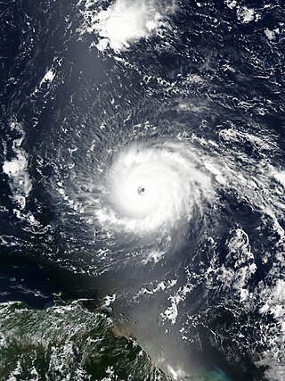
Hurricane Irma was an extremely powerful Cape Verde hurricane that caused widespread destruction across its path in September 2017. Irma was the first Category 5 hurricane to strike the Leeward Islands on record, followed by Maria two weeks later. At the time, it was considered the most powerful hurricane on record in the open Atlantic region, outside of the Caribbean Sea and Gulf of Mexico, until it was surpassed by Hurricane Dorian two years later. It was also the third-strongest Atlantic hurricane at landfall ever recorded, just behind the 1935 Labor Day Hurricane and Dorian.

The Virgin Islands are an archipelago in the Caribbean Sea. The islands fall into three different political jurisdictions:

The effects of Hurricane Irma in the British Virgin Islands were significant in terms of both human and socio-economic impact on the Territory. Hurricane Irma struck the British Virgin Islands as a Category 5 hurricane during the daylight hours of Wednesday, 6 September 2017. It caused widespread destruction, and killed a total of four people. The eye of the hurricane traveled over the three major islands in the group: Virgin Gorda, Tortola and Jost Van Dyke.

Hurricane Lorenzo, also known as Storm Lorenzo for Ireland and the United Kingdom while extratropical, was the easternmost Category 5 Atlantic hurricane on record. Lorenzo was the twelfth named storm, fifth hurricane, third major hurricane and second Category 5 hurricane of the 2019 Atlantic hurricane season. The storm formed from a tropical wave that moved off the west coast of Africa on 22 September, growing larger in size over the course of its development. It strengthened into a hurricane on 25 September, and rapidly intensified into a Category 4 hurricane the following day before weakening due to an eyewall replacement cycle. After completing the cycle, Lorenzo rapidly restrengthened, peaking at Category 5 intensity on 29 September with 1-minute sustained winds of 160 mph. Steady weakening followed as the storm moved through unfavorable atmospheric conditions. Accelerating northeastward, Lorenzo skirted the western Azores on 2 October, and transitioned into an extratropical cyclone. The extratropical cyclone moved quickly towards Ireland and the United Kingdom and became the first named storm of the 2019–20 European windstorm season, before eventually dissipating on 7 October.

Hurricane Dorian caused relatively minor damage across the eastern Caribbean in late August 2019. Originating from a westward moving tropical wave, Dorian organized into a tropical cyclone on August 24 and reached the Lesser Antilles on August 26 as a tropical storm. Turning northwest, the system unexpectedly intensified to a hurricane as it struck the Virgin Islands on August 27. Antecedent to the storm's arrival, local governments across the archipelago issued tropical cyclone warnings and watches, readied public shelters, closed airports, and placed emergency crews on standby. Many of the threatened islands were still reeling from the devastation wrought by Hurricane Irma and Hurricane Maria in September 2017 and fears arose over embattled power grids. In the areas first affected, impacts were limited to gusty winds and modest rainfall. Effects were greater in the Virgin Islands where wind gusts reached 111 mph (179 km/h); however, damage was light. Multiple landslides occurred across the islands and Puerto Rico with only a handful of structures suffering damage. One person died in Puerto Rico while preparing for the storm.