Related Research Articles

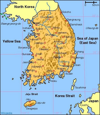
South Korea is located in East Asia,on the southern portion of the Korean Peninsula located out from the far east of the Asian landmass. The only country that shares a land border with South Korea is North Korea,lying to the north with 238 kilometres (148 mi) of the border running along the Korean Demilitarized Zone. South Korea is mostly surrounded by water and has 2,413 kilometres (1,499 mi) of coast line along three seas;to the west is the Yellow Sea,to the south is the East China Sea,and to the east is the East Sea. Geographically,South Korea's landmass is approximately 100,364 square kilometres (38,751 sq mi). 290 square kilometres (110 sq mi) of South Korea are occupied by water. The approximate coordinates are 37°North,128°East.

Hurricane Michelle was the fifth costliest tropical cyclone in Cuban history and the strongest hurricane of the 2001 Atlantic hurricane season. The thirteenth named storm and seventh hurricane that year,Michelle developed from a tropical wave that had traversed into the western Caribbean Sea on October 29;the wave had initially moved off the coast of Africa 13 days prior. In its early developmental stages,the depression meandered over Nicaragua,later paralleling the Mosquito Coast before intensifying into tropical storm intensity on November 1;Michelle was upgraded to hurricane strength the following day. Shortly after,rapid intensification ensued within favorable conditions,with the storm's central barometric pressure dropping 51 mbar in 29 hours. After a slight fluctuation in strength,Michelle reached its peak intensity as a Category 4 hurricane with winds of 140 mph (230 km/h) and a minimum pressure of 933 mbar. This tied Michelle with 1999's Lenny as the fourth most powerful November hurricane on record in the Atlantic Basin,behind only the 1932 Cuba hurricane and 2020 Hurricanes Iota and Eta. At roughly the same time,the hurricane began to accelerate northeastward;this brought the intense hurricane to a Cuban landfall within the Bay of Pigs later that day. Crossing over the island,Michelle was weakened significantly,and was only a Category 1 hurricane upon reentry into the Atlantic Ocean. The hurricane later transitioned into an extratropical cyclone over The Bahamas on November 5,before being absorbed by a cold front the following day.

Typhoon Rusa was the most powerful typhoon to strike South Korea in 43 years. It was the 21st JTWC tropical depression,the 15th named storm,and the 10th typhoon of the 2002 Pacific typhoon season. It developed on August 22 from the monsoon trough in the northwestern Pacific Ocean,well to the southeast of Japan. For several days,Rusa moved to the northwest,eventually intensifying into a powerful typhoon. On August 26,the storm moved across the Amami Islands of Japan,where Rusa left 20,000 people without power and caused two fatalities. Across Japan,the typhoon dropped torrential rainfall peaking at 902 mm (35.5 in) in Tokushima Prefecture.

Typhoon Chataan,known in the Philippines as Typhoon Gloria,was the deadliest natural disaster in the history of Chuuk,a state in the Federated States of Micronesia (FSM). The typhoon formed on June 28,2002,near the FSM,and for several days it meandered while producing heavy rainfall across the region. On Chuuk,the highest 24-hour precipitation total was 506 mm (19.9 in),which was greater than the average monthly total. The rain produced floods up to 1.5 m (4.9 ft) deep,causing landslides across the island that killed 47 people. There was also one death on nearby Pohnpei,and damage in the FSM totaled over $100 million.
The North Korean famine,also known as the Arduous March,was a period of mass starvation together with a general economic crisis from 1994 to 1998 in North Korea. During this time there was an increase in defection from North Korea which peaked towards the end of the famine period.

Typhoon Xangsane,known in the Philippines as Typhoon Milenyo,was a typhoon that affected the Philippines,Vietnam,and Thailand during the 2006 Pacific typhoon season. The name Xangsane was submitted by Laos and means elephant.

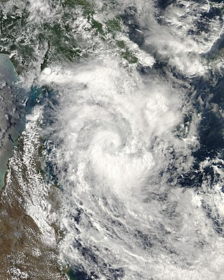
Severe Tropical Cyclone Guba was the most recent tropical cyclone to form in the Port Moresby area of responsibility. The storm resulted in 149 fatalities and severe damage across southeastern Papua New Guinea in November 2007. The firstly-named cyclone of the 2007–08 Australian region cyclone season,Guba formed on 13 November 2007 close to the island of New Guinea,and reached tropical cyclone intensity the next day by the Tropical Cyclone Warning Centre (TCWC) in Brisbane,with the TCWC in Port Moresby assigning the name Guba. It meandered in the northern Coral Sea for the next week,strengthening to a Category 3 severe tropical cyclone on 16 November. It posed a threat to the Australian Cape York Peninsula,but remained offshore,and finally dissipated on 20 November.

The October 2008 Central America floods were caused by a series of low-pressure areas including Tropical Depression Sixteen,a short-lived tropical cyclone in the 2008 Atlantic hurricane season that made landfall in Honduras. Heavy rainfall began in early October 2008 while a tropical wave passed through the region. On October 14,Tropical Depression Sixteen formed just off the northeast coast of Honduras,and at the same time a low-pressure system was on the Pacific coast. Both systems increased rainfall across the region,although the depression dropped heavy rainfall close to its center when it moved ashore on October 15. Although Tropical Depression Sixteen quickly dissipated over land,its remnants persisted for several days. Another low-pressure area interacted with a cold front on October 21,adding to the rainfall in the region.

Typhoon Wipha,known in the Philippines as Super Typhoon Goring,was the strongest typhoon to threaten the Chinese coastline since Typhoon Saomai in August 2006. Forming out of a tropical disturbance on September 15,2007,it quickly developed into a tropical storm,and intensified into a typhoon the following day with the appearance of an eye feature. After a period of rapid intensification,Wipha attained its peak intensity on September 18,with winds of 185 km/h (115 mph) and a barometric pressure of 925 mbar (hPa),according to the Japan Meteorological Agency. Later that day,the storm began to weaken as it interacted with the mountainous terrain of Taiwan before brushing the northern edge of the island. Wipha subsequently made landfall near Fuding along the Fujian–Zhejiang provincial border with winds estimated at 185 km/h (115 mph) by the JTWC. Shortly thereafter,the typhoon weakened as it moved inland,weakening to a tropical storm within 18 hours of moving over land.

The effects of Hurricane Georges in Cuba included $305.8 million in damages and six deaths. Forming out of a tropical wave over the Atlantic Ocean,Georges attained a peak intensity of 155 mph (249 km/h) on September 20,1998. On September 23,the storm made landfall in southeastern Cuba as a minimal Category 1 hurricane. The storm tracked over the county for the following two days before emerging into the Gulf of Mexico on September 25 and later making landfall in the United States as a Category 2 hurricane. Before the storm's landfall in Cuba,officials reported that 200,000 people were evacuated to shelters;however,later reports indicated that upwards 711,000 people evacuated. A state of emergency was declared for much of eastern Cuba and most of the country was placed under a tropical storm or hurricane warning during the storm's passage.

The 2012 North Korean floods began in mid-July 2012 when Tropical Storm Khanun affected parts of the country,killing at least 88 people and leaving more than 62,000 people homeless. Torrential rains on 29 and 30 July 2012 worsened the situation,causing additional damage and casualties and forcing the government to request international assistance. Severe rainfall also affected the southern region of North Korea in August,killing at least six.

Severe Tropical Storm Cecil in May of 1989 caused devastating floods in central Vietnam,killing 751 people. The storm developed as a tropical depression over the South China Sea on May 22. Tracking north-northwestward,the system steadily intensified,attaining peak winds of 110 km/h (68 mph). The Joint Typhoon Warning Center (JTWC) assessed Cecil to have been slightly stronger with one-minute sustained winds of 140 km/h (87 mph). The storm made landfall near Hoi An,Vietnam early on May 25 and quickly weakened. The system later dissipated over Laos on May 26.

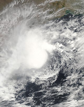
In May 2003,a tropical cyclone officially called Very Severe Cyclonic Storm BOB 01 produced the worst flooding in Sri Lanka in 56 years. The first storm of the 2003 North Indian Ocean cyclone season,it developed over the Bay of Bengal on May 10. Favorable environmental conditions allowed the system to intensify steadily while moving northwestward. The storm reached peak maximum sustained winds of 140 km/h (85 mph) on May 13,making it a very severe cyclonic storm according to the India Meteorological Department (IMD),which is the official Regional Specialized Meteorological Center for the basin. The cyclone drifted north over the central Bay of Bengal,gradually weakening due to heightened wind shear. Turning eastward,the storm deteriorated to a deep depression on May 16 before it curved northeastward and re-intensified into a cyclonic storm. It came ashore in western Myanmar and dissipated over land the following day.

The Red Cross Society of the Democratic People's Republic of Korea is the national Red Cross Society of North Korea. It was founded as the Red Cross Society of North Korea on 18 October 1946 by the Soviet-backed occupational government.

Cyclonic Storm Komen was an unusual tropical cyclone that originated near the southern coast of Bangladesh and later struck the same country while drifting over the northern Bay of Bengal. The second named storm of the 2015 season,Komen brought several days of heavy rainfall to Myanmar,Bangladesh,and India. It formed as a depression on July 26 over the Ganges delta and moved in a circular motion around the northern Bay of Bengal. Komen intensified into a 75 km/h (45 mph) cyclonic storm and moved ashore southeastern Bangladesh on July 30. The system turned westward over land and was last noted over eastern India on August 2.

Typhoon Lionrock,known in the Philippines as Typhoon Dindo,was a large,powerful,long-lived and erratic tropical cyclone which caused significant flooding and casualties in North Korea and Japan in late August 2016. It was the tenth named storm and was the third typhoon of the 2016 Pacific typhoon season. Damages recorded after the season were recorded about US$3.93 billion.

The 2016 North Korean floods began in late-August 2016 as a consequence of Typhoon Lionrock,killing at least 525 people,destroying more than 35,000 homes,and leaving over 100,000 people homeless,mainly in the North Hamgyong Province. The floods occurred when the Tumen River,near the borders with China and Russia,broke its banks,according to the United Nations Office for the Coordination of Humanitarian Affairs and Red Cross.
The 2020 Yemen flood was a flash flood that killed at least 172 people in Yemen and damaged homes and UNESCO-listed world heritage sites across the country,officials said.

In September 2020,profuse and continuous rainfall in Sudan caused a devastating flood across 17 out of the 18 states Sudanese states with the Blue Nile reaching water levels not seen for nearly a century. It ranks among the most severe floods recorded in the region. A state of emergency was declared,and teams have worked to prevent damage to threatened archaeological sites. The flood affected more than 3,000,000 people,destroyed more than 100,000 homes,and left more than 100 people dead.
Korea has historically suffered several floods due to heavy rains,typhoons,and heavy snowfalls. Most of the flood damage was caused by storms and tsunamis caused by typhoons,and floods.
References
- ↑ "North Korean tally of flood deaths doubles to 600". Associated Press. 25 August 2007. Retrieved 1 August 2012.
- ↑ Jennifer Veale (2007-08-15). "North Korea Opens Up Over Flooding". Time. Archived from the original on August 17, 2007. Retrieved 2013-05-29.
- ↑ "North Korea halts showcase mass games due to flood". Uk.reuters.com. 2007-08-27. Archived from the original on August 29, 2007. Retrieved 2013-05-29.
- ↑ "NKorea reports recovery from floods". Afp.google.com. 2007-08-29. Archived from the original on 2012-02-07. Retrieved 2013-05-29.
- ↑ "NKorea's Kim says thanks for flood aid, but not to SKorea". Afp.google.com. 2007-09-10. Archived from the original on 2012-02-07. Retrieved 2013-05-29.
- ↑ "Floods destroy 11 per cent of North Korean farmland". TheSpec.com. 2007-08-15. Archived from the original on 2019-07-24. Retrieved 2013-05-29.
- ↑ "Report: North Korea Loses 11 Percent of Crops in Floods". Fox News. 2007-08-15. Retrieved 2013-05-29.
- ↑ "N.Korea Loses 450,000 Tons of Crops". The Chosun Ilbo (English Edition). Retrieved 7 June 2014.
- ↑ Flood Toll in N.Korea at 454 Dead, 156 Missing, Korean Information Service, August 27, 2007, retrieved June 7, 2014
- ↑ "South Korea sends aid to flood-ravaged North". Reuters. 2007-08-23. Archived from the original on 2007-08-26. Retrieved 2013-05-29.
- ↑ "Emergency appeal for DPRK flood survivors". International Red Cross and Red Crescent Societies. 2007-08-20. Retrieved 2013-05-29.
- ↑ "Japan eyes North Korea flood aid". BBC News. 2007-08-29. Retrieved 2013-05-29.
- ↑ "U.S. medical aid arrives in North Korea". The Hankyoreh. 2007-08-31. Retrieved 2013-05-29.