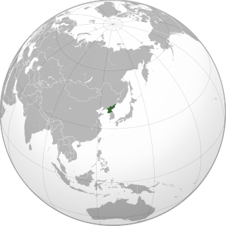
South Pyongan Province is a province of North Korea. The province was formed in 1896 from the southern half of the former Pyongan Province, remained a province of Korea until 1945, then became a province of North Korea. Its capital is Pyongsong.

The 1989 Pacific typhoon season was the first of six consecutive years of above-average activity in the Western Pacific. It was an extremely active season spawning 32 tropical storms, 20 typhoons and five super typhoons. It has no official bounds; it ran year-round in 1989, but most tropical cyclones tend to form in the northwestern Pacific Ocean between May and November. These dates conventionally delimit the period of each year when most tropical cyclones form in the northwestern Pacific Ocean. The first storm, Winona, formed on January 15, while the final storm, Jack, dissipated on December 27. This season was also quite a deadly season that were caused by a few notable storms such as Tropical Storm Cecil, which was the worst storm to impact Vietnam in over 50 years, and Typhoon Gay, which directly impacted the Malay Peninsula as the worst typhoon in 35 years. Both of these storms make up around half of the total fatalities of the entire season alone.

Typhoon Rusa was the most powerful typhoon to strike South Korea in 43 years. It was the 21st JTWC tropical depression, the 15th named storm, and the 10th typhoon of the 2002 Pacific typhoon season. It developed on August 22 from the monsoon trough in the northwestern Pacific Ocean, well to the southeast of Japan. For several days, Rusa moved to the northwest, eventually intensifying into a powerful typhoon. On August 26, the storm moved across the Amami Islands of Japan, where Rusa left 20,000 people without power and caused two fatalities. Across Japan, the typhoon dropped torrential rainfall peaking at 902 mm (35.5 in) in Tokushima Prefecture.

Flooding in North Korea in July 2006 caused extensive damage and loss of life, although reports differ about its extent.
Flooding in North Korea in August 2007 caused extensive damage and loss of life. The flooding affected most of the southern half of the country including the capital and some of its most productive agricultural regions. Aid officials feared the loss of crop land could seriously hinder the North's ability to feed its people, causing widespread famine.

The 1989 North Indian Ocean cyclone season was a below-average season in annual cycle of tropical cyclone formation. Despite this, the season had the second highest Accumulated Cyclone Energy in the basin on record behind only 2019 and 2023. The season has no official bounds but cyclones tend to form between April and December. These dates conventionally delimit the period of each year when most tropical cyclones form in the northern Indian Ocean. There are two main seas in the North Indian Ocean—the Bay of Bengal to the east of the Indian subcontinent and the Arabian Sea to the west of India. The official Regional Specialized Meteorological Centre in this basin is the India Meteorological Department (IMD), while the Joint Typhoon Warning Center (JTWC) releases unofficial advisories. An average of five tropical cyclones form in the North Indian Ocean every season with peaks in May and November. Cyclones occurring between the meridians 45°E and 100°E are included in the season by the IMD.

Severe Tropical Storm Meari, known in the Philippines as Severe Tropical Storm Falcon, was an unusually large tropical cyclone that caused significant damage from the Philippines to the Korean Peninsula in June 2011.

The 2010 China floods began in early May 2010. Three hundred and ninety-two people died, and a further 232 people were reported missing as of June 30, 2010, including 57 people in a landslide in Guizhou. Fifty-three of the deaths occurred from the flooding and landslides between May 31 and June 3, and 266 deaths occurred between June 13 and June 29. Four hundred and twenty four people were killed by the end of June, including 42 from the Guizhou landslide; 277 more were killed and 147 were missing in the first two weeks of July, bringing the death toll as of August 5 to 1,072. A landslide in early August in Gansu killed at least 1,471 people and left 294 missing. In total, the flooding and landslides killed at least 3,185 people in China by August 31. More than 230 million people in 28 provinces, municipalities, and regions, especially the southern and central provinces and regions of Zhejiang, Fujian, Jiangxi, Hubei, Hunan, Guangdong, Guangxi, Chongqing Municipality, Gansu, Sichuan, and Guizhou, and the northeastern province of Jilin were affected, while at least 4.66 million people were evacuated because of the risk of flooding and landslides in the latter half of June. By early August, over 12 million people were evacuated, and that number rose to 15.2 million by August 31.

Typhoon Kompasu, known in the Philippines as Typhoon Glenda, was a strong tropical cyclone that moved along Okinawa, Japan and west coast of the Korean Peninsula before striking the Seoul Metropolitan Area in early-September 2010. It was the first significant system to directly strike the Seoul Metropolitan since Typhoon Prapiroon in 2000 and the strongest typhoon to directly impact the area since Tropical Storm Janis in 1995.

Typhoon Judy of July 1989 was a strong tropical cyclone that caused extensive damage and loss of life in Japan, South Korea and the eastern Soviet Union. Originating from a monsoon trough on July 21, Judy began as a tropical depression west of the Northern Mariana Islands. Tracking west-northwest, the system gradually intensified into a tropical storm and was given the name Judy on July 23. By this time, the storm had turned due north. Two days later, Judy attained typhoon status as it began a gradual turn to the west-northwest. Late on July 25, the storm peaked with winds of 165 km/h (105 mph). Striking Kyushu on July 27, interaction with the island's mountainous terrain caused Judy to quickly weaken as it neared South Korea. The weakened storm struck the country west of Pusan the following day before losing its identity near the border with North Korea. The remnants of Judy were last noted over the Sea of Japan.

Severe Tropical Storm Khanun, known in the Philippines as Tropical Storm Enteng, was the first tropical cyclone to directly impact Korea in two years. It is the 8th named storm, the 3rd severe tropical storm, and overall, the 13th tropical cyclone to be monitored by the Japan Meteorological Agency (JMA) during 2012. Khanun was also the first tropical storm to make a landfall over Korea in 2012. Khanun means "jack fruit" in Thai.

Typhoon Bolaven, known in the Philippines as Typhoon Julian, was regarded as the most powerful storm to strike the Korean Peninsula in nearly a decade, with wind gusts measured up to 186 km/h (116 mph). Forming as a tropical depression on August 19, 2012, to the southwest of the Mariana Islands, Bolaven steadily intensified as it slowly moved west-northwestward in a region favoring tropical development. The system was soon upgraded to a tropical storm less than a day after formation and further to a typhoon by August 21. Strengthening became more gradual thereafter as Bolaven grew in size. On August 24, the system attained its peak intensity, with winds of 185 km/h (115 mph) and a barometric pressure of 910 mbar. Weakening only slightly, the storm passed directly over Okinawa on August 26 as it began accelerating toward the north. Steady weakening continued as Bolaven approached the Korean Peninsula and it eventually made landfall in North Korea late on August 28 before transitioning into an extratropical cyclone. The remnants rapidly tracked northeastward over the Russian Far East before turning eastward and were last noted on September 1 crossing the International Dateline.

Typhoon Olga, also known in the Philippines as Typhoon Ising, was a destructive and deadly typhoon that hit Korean Peninsula in 1999. Olga killed 106 people in Korea and caused $657 million in damages.

Severe Tropical Storm Gladys in August 1991 was a large tropical cyclone that affected Japan and South Korea. An area of disturbed weather first formed within the Western Pacific monsoon trough on August 15. Slowly organizing, the disturbance developed into a tropical depression on August 15. Heading northwest, Gladys became a tropical storm the following day. Despite forecasts of significant strengthening, its large size only enabled slow intensification. After turning west, Gladys attained peak intensity on August 21 near Okinawa. After turning north and bypassing Kyushu, Gladys began to encounter significant wind shear, which caused weakening. Gladys veered west, interacting with land. Gladys weakened to a tropical depression on August 24, and dissipated the next day.

The 2018 North Korean floods began on 28 August 2018, killing at least 76 people, leaving around 75 more missing, destroying more than 800 buildings, and causing about 10,700 people to become homeless. It was in part caused by Tropical Storm Soulik.
Between June and August 2020, floods severely impacted large areas of both North and South Korea due to heavy rains of the regional rainy season, primarily in the far southern parts of the Korean Peninsula. These floods are closely related to ones across China and in Kyushu, Japan. As of 9 August 2020, 30 people have died in South Korea as a result.

The Korean Peninsula is a peninsula region located over Eastern Asia. The region is divided into North Korea and South Korea.
Korea has historically suffered several floods due to heavy rains, typhoons, and heavy snowfalls. Most of the flood damage was caused by storms and tsunamis caused by typhoons, and floods.

Typhoon Khanun, known in the Philippines as Typhoon Falcon, was a powerful, erratic and long-lived tropical cyclone that moved along Okinawa, Japan and the west coast of the Korean Peninsula in August 2023. It was the sixth named storm and fourth typhoon of the 2023 Pacific typhoon season. Khanun started as a low-pressure area in the Pacific Ocean. It rapidly intensified into a Category 4-equivalent typhoon on the Saffir–Simpson scale over the Philippine Sea on August 1, before undergoing an eyewall replacement cycle. Khanun weakened slightly as it moved closer to the Ryukyu Islands, battering them with heavy rain and strong winds. Khanun began to degrade its eye on satellite imagery due to quasi-stationary and warming cloud tops. Steady weakening continued as Khanun approached the Korean Peninsula and it eventually made landfall on Geojedo in South Korea. The storm dissipated shortly thereafter.


