Galar is a town and municipality located in the province and autonomous community of Navarre, northern Spain.

Hawaiian Paradise Park, also referred to as Paradise Park and known by many as HPP, is a census-designated place (CDP) in Hawaiʻi County, Hawaiʻi, United States, located in the District of Puna. The population was 11,404 at the 2010 census, up from 7,051 at the 2000 census.

Strongs Prairie is a town in Adams County in the U.S. state of Wisconsin. The population was 1,150 at the 2010 census. The unincorporated communities of Arkdale, Dellwood, and Strongs Prairie are located within the town.

Mount Olivet Cemetery is a Roman Catholic cemetery located in Halifax, Nova Scotia, Canada at which 19 bodies recovered from the RMS Titanic are buried.

CIRV-FM is a Canadian radio station, broadcasting at 88.9 FM in Toronto, Ontario. The station airs a multicultural programming format. CIRV's studios are located on Dundas Street West in the Trinity-Bellwoods neighbourhood of Toronto, while its transmitter is located atop First Canadian Place in Toronto's Financial District.
Partridge Brook is a 7.5-mile (12.1 km) long stream located in southwestern New Hampshire in the United States. It is a tributary of the Connecticut River, which flows to Long Island Sound.

Inskip is an unincorporated community in Butte County, California. It lies at an elevation of 4,777 feet in the northern Sierra Nevada.
Podor Department is one of the 45 departments of Senegal and one of the three in the Saint-Louis Region in the far north-west of the country.

Ball Township is located in Sangamon County, Illinois. As of the 2010 census, its population was 6,701 and it contained 2,403 housing units.

Jackson Demonstration State Forest is the largest demonstration forest operated by the State of California. The forest is entirely located within Mendocino County on land formerly owned by Caspar Lumber Company along California State Highway 20 between Willits and the coastal city of Fort Bragg. It is managed by the California Department of Forestry and Fire Protection. Logging of the area began in 1862, and intense industrial logging has taken place for many decades. There have been several generations of harvests and replantings. The 48,652 acres (196.89 km2) that make up the forest were purchased in 1947 and the demonstration forest was created in 1949. Coast redwood is the most common type of tree in the forest, but there is also Douglas fir, grand fir, hemlock, bishop pine, tanoak, alder, madrone and bay myrtle. The elevation of the land varies from 80 to 2,200 feet (670 m). Precipitation near the coast averages 39 inches (990 mm) per year, but the average is 70 inches (1,800 mm) per year inland. The temperature reaches a low of 25 °F (−4 °C) and a high of 100 °F (38 °C).

Popcorn is an unincorporated community in Perry Township, Lawrence County, Indiana.

Roseland is an unincorporated community in Nelson County, Virginia, United States. It was among the communities severely affected by flash flooding from Hurricane Camille in 1969.

Motoyama Station is a railway station operated by Shin-Keisei Electric Railway's Shin-Keisei Line located in Matsudo, Chiba Prefecture Japan. It is 8.7 kilometers from the terminus of the Shin-Keisei Line at Matsudo Station.
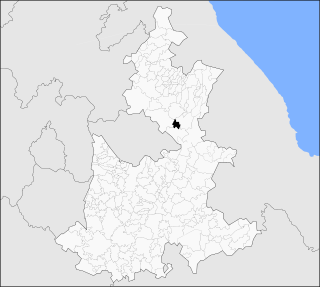
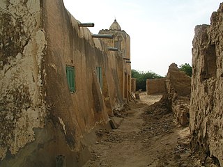
Ocotepec (municipality) is a town and municipality in Puebla in south-eastern Mexico.

Tignor is an unincorporated community in Caroline County, in the U.S. state of Virginia. The main highway leading into it is State Route 630. Tignor, VA is at the intersection of Sparta Road and Tignor Road.
Baskerville Mill is an unincorporated community located in Brunswick County, in the U.S. state of Virginia.
Michaux is an unincorporated community in Powhatan County, in the U.S. state of Virginia.
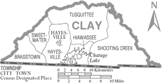
Shooting Creek Township is the easternmost township and one of the six townships of Clay County, North Carolina, United States. The other five are Brasstown, Hayesville, Sweetwater, Hiawassee, and Tusquittee.
Cookville is an extinct town in southwestern Pulaski County, in the U.S. state of Missouri. The GNIS classifies it as a populated place. The town site is along Roubidoux Creek within the southern part of Fort Leonard Wood. The community of Greenview is located two miles to the west on Missouri Route 17 along the western boundary of the military reservation and adjacent to the Pulaski-Laclede county line.

Randolph is an unincorporated community in Ward Township, Randolph County, in the U.S. state of Indiana.


