Bethioua District

Last updated
Bethioua District
دائرة بطيوة
Algeria 31 Wilaya locator map-2009.svg
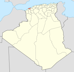
Map of Algeria highlighting Oran Province
DZ 31 Bethioua District.svg
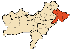
Map of Oran Province highlighting Bethioua District
Country Flag of Algeria.svg  Algeria
Province Oran
District seat Bethioua
Area
  Total197.01 km2 (76.07 sq mi)
Population
 (1998)
  Total51,275
  Density260/km2 (670/sq mi)
Time zone UTC+01 (CET)
Municipalities 3

Bethioua is a district in Oran Province, Algeria, [1] on the Mediterranean Sea. It was named after its capital, Bethioua.

Municipalities

The district is further divided into 3 municipalities:

Related Research Articles

<span class="mw-page-title-main">All India Kisan Sabha</span> Farmers wing of Communist Pary of India

All India Kisan Sabha, is the peasant or farmers' wing of the Communist Party of India, an important peasant movement formed by Sahajanand Saraswati in 1936.

<span class="mw-page-title-main">Oran Province</span> Province of Algeria

Oran Province is a province (wilayah) in Algeria whose seat is the city of the same name.

The Battle of Monroe's Crossroads was a battle during the Carolinas Campaign of the American Civil War in Cumberland County, North Carolina, on the grounds of the present day Fort Bragg Military Reservation. Involving about 4,500 men, it pitted mounted Confederate cavalry against dismounted Union cavalry. It was one of the last all-cavalry battles of the Civil War. The inconclusive fighting lasted for several hours early on the morning of March 10, 1865. The Confederate attack delayed the Federal cavalry's movement toward Fayetteville, denying Brevet Maj. Gen. Hugh Judson Kilpatrick the honor of entering the town first.

Northampton College is a further education college in Northampton, England, which opened in 1973, following building work which started in 1970.

<span class="mw-page-title-main">Parkland, Detroit</span> Neighborhood located in Detroit, Michigan, United States

Parkland is a neighborhood located in the far western section of Detroit, Michigan. The neighborhood is often thought to be part of the neighboring Warrendale neighborhood, which it borders to the east.

Eastbrook School is a coeducational primary school, secondary school and sixth form located in Barking and Dagenham, London, England.

Rancho Quesesosi was an 8,894-acre (35.99 km2) Mexican land grant in present-day Yolo County, California given in 1843 by Governor Manuel Micheltorena to William Gordon. The grant, west of Woodland, extended 2 leagues along both sides of Rio de Jesús María, now known as Cache Creek. The grant was between Rancho Cañada de Capay on the west and Rancho Rio de Jesus Maria on the east.

<span class="mw-page-title-main">Bethioua</span>

Bethioua is a town and region in the wilaya of Oran in the west of Algeria. It has a gas port, petrochemical facilities and desalination plant.

Rancho Santa Rosa was a 13,184-acre (53.35 km2) Mexican land grant in present-day San Luis Obispo County, California.

Rancho San Simeon was a 4,469-acre (18.09 km2) Mexican land grant in present-day San Luis Obispo County, California given in 1842 by Governor Juan Alvarado to José Ramón Estrada. The grant extended along the Pacific Coast from Rancho Piedra Blanca at Pico Creek, south along the coast to San Simeon Creek, and includes the present-day townsite of San Simeon Acres.

Rancho San Francisquito was a 8,813-acre (35.66 km2) Mexican land grant in present-day Monterey County, California given in 1835 by Governor José Castro to Catalina Manzanelli de Munrás. The grant was located in the upper Carmel Valley. As of current day, it is part of The Santa Lucia Preserve, a gated community and nature preserve.

Rancho San Miguelito was a 14,198-acre (57.46 km2) Mexican land grant in present-day San Luis Obispo County, California given in 1842 by Governor Juan Alvarado to Miguel Ávila, and an addition granted in 1846 by Governor Pio Pico. The grant extended along the Pacific coast, and included Point San Luis, San Luis Obispo Bay, and present day Avila Beach.

Rancho Arroyo Grande was a 4,437-acre (17.96 km2) Mexican land grant in present day San Luis Obispo County, California given in 1842 by Governor Juan Alvarado to Zeferino Carlón. The grant extended along Arroyo Grande Creek east of present day Arroyo Grande. Much of the grant is now covered by Lopez Lake.

Rancho Santa Manuela was a 16,955-acre (68.61 km2) Mexican land grant in present-day San Luis Obispo County, California given in 1837 by Governor Juan B. Alvarado to Francis Ziba Branch. The grant encompassed present-day Arroyo Grande.

Rancho Pleyto was a 13,299-acre (53.82 km2) Mexican land grant in the Santa Lucia Range, in present-day southern Monterey County, California.

Rancho Cholame was a 26,622-acre (107.74 km2) Mexican land grant in present-day Monterey County and San Luis Obispo County, California given in 1844 by Governor Manuel Micheltorena to Mauricio Gonzales. The grant extended along the Cholame Valley, and encompassed present day Cholame.

Rancho Huerta de Romualdo was a 117-acre (0.47 km2) Mexican land grant in present-day San Luis Obispo County, California given in 1842 by Governor Juan B. Alvarado and in 1846 by Governor Pío Pico to Romualdo. The name means Romualdo's vegetable garden. The grant between Morro Bay and San Luis Obispo, extended along Chorro Creek and encompassed Cerro Romauldo.

Rancho Atascadero was a 4,348-acre (17.60 km2) Mexican land grant in present-day San Luis Obispo County, California.

<span class="mw-page-title-main">Mers El Hadjadj</span> Commune and town in Mascara Province, Algeria

Mers El Hadjadj is a town and commune in mascara Province, Algeria. According to the 1998 census it has a population of 14,167.

<span class="mw-page-title-main">Gdyel</span> Commune and town in Oran Province, Algeria

Gdyel, former Saint-Cloud, is a town and commune in District Gdyel, Oran Province, Algeria, about 15 miles to the east of Oran. Under French rule, it was the centre of a wine-growing district and was called St. Cloud.

References

  1. "Bethioua". frontend. Retrieved 2022-04-29.{{cite web}}: Check |url= value (help)[ permanent dead link ]

35°48′17″N0°15′35″W / 35.8047°N 0.2596°W / 35.8047; -0.2596