Arzew

Last updated • 2 min readFrom Wikipedia, The Free Encyclopedia
Arzew
أرزيو
Arzew
Arzew31.jpg
View of Arzew with municipality sign
DZ 31 Arzew.svg
Location of Arzew within Oran Province
Algeria location map.svg
Red pog.svg
Arzew
Location of Arzew within Algeria
Coordinates: 35°51′N0°19′W / 35.850°N 0.317°W / 35.850; -0.317
Country Flag of Algeria.svg  Algeria
Province Oran
District Arzew (seat)
Government
   PMA Seats 15
Area
  Total64 km2 (25 sq mi)
Elevation
72 m (236 ft)
Population
 (2006)
  Total91,400
  Density1,400/km2 (3,700/sq mi)
Time zone UTC+01 (CET)
Postal code
31200
ONS code3106
U.S. Rangers train on the terrain of the 8 November 1942 assault at Arzew Arzew torch battle 1942.png
U.S. Rangers train on the terrain of the 8 November 1942 assault at Arzew
Arzew inhabitants meet U.S. troops during Operation Torch (November 1942) The Royal Navy during the Second World War- Operation Torch, North Africa, November 1942 A12662.jpg
Arzew inhabitants meet U.S. troops during Operation Torch (November 1942)

Arzew or Arzeu (Arabic : أرزيو, ʾArzyu) is a port city in Algeria, 25 miles (40 km) from Oran. It is the capital of Arzew District, Oran Province.

Contents

History

Antiquity

Like the rest of the Maghreb, the site of modern-day Arzew was originally inhabited by the Berbers. Arzew's original Berber population came mainly from the nearby town of Bethioua, families from nearby Mostaganem, Kabyles, that were deported there.[ citation needed ][ when? ][ clarification needed ]

Nearby Bethioua was the Portus Magnus ("Great Port") under the Roman Empire, although the name was used on Arzew's coat of arms under French colonial rule. Portus Magnus was a Roman colony or otherwise received citizen status [1] and exported grain and salt. Arsenaria was a nearby settlement 3 Roman miles (c.4.4 km) inland from the sea. [1] Portus Magnus was destroyed during the Vandal conquest of northwest Africa in AD 429 or 430 but saw some use by the Byzantines after their 6th-century recovery of the area, leaving some Christian remains. After the 7th-century Islamic conquest, the site seems to have been entirely abandoned, El Bekri describing "Arzao" as having only empty Roman ruins c.1068. The Almohads refounded the port as Bethioua in 1162. Under the Ziyanids, this port near Tlemcen was renamed Marsa Ben Zian ("Port of the Sons of Zian"). The Roman relics remaining at Bethioua into the early modern period were mostly removed to the provincial museum at Oran during the 19th and 20th centuries.

French Algeria

During the French conquest of Algeria, a French force from Oran marched east to capture Marsa on 10 July 1833. The French army then used the area as a logistics hub, including during the Battle of Macta.

Upon the Treaty of Desmichels, Arzew was organized as part of French Algeria, initially under the spelling Arzowe.[ citation needed ] King Louis-Philippe ordered the establishment of the port of Arzew (Arzew Le Port)[ citation needed ] on 12 August 1845. French colonists settled the area, which was declared a commune on 31 December 1856. Many Spanish immigrants also came, and Arzew became a hub for the production and export of esparto, a kind of grass used for cording. [2] The town was badly damaged by an earthquake in 1912. [3] The area was important during Operation Torch, the Allied invasion of North Africa during World War II.

During the Algerian War of Independence, the city hosted one of the two SDECE French intelligence CIPCGs (Centre d'instruction à la pacification et à la contre-guérilla[ fr ]), bases used for counter-guerilla and pacification work. [4]

Modern Algeria

After the independence of Algeria in 1962, Arzew became an important port and industrial area, home to a refinery exporting LNG (liquified natural gas), as well as a fleet of small fishing boats to work the local waters.

Demography

Historical population
YearPop.±%
1901 5,600    
1954 10,500+87.5%
1966 11,500+9.5%
1987 35,800+211.3%
1998 56,200+57.0%
Source: Populstat [5]

Culture

During the French colonial era, the settlers introduced a Roman Catholic celebration on August 15 -Assumption of Mary day- known as the "Procession of the Virgin" (la Procession de la Vierge). [6]

Notes

    Related Research Articles

    <span class="mw-page-title-main">Algeria</span> Country in North Africa

    Algeria, officially the People's Democratic Republic of Algeria, is a country in the Maghreb region of North Africa. It is bordered to the northeast by Tunisia; to the east by Libya; to the southeast by Niger; to the southwest by Mali, Mauritania, and Western Sahara; to the west by Morocco; and to the north by the Mediterranean Sea. The capital and largest city is Algiers, located in the far north on the Mediterranean coast.

    <span class="mw-page-title-main">Oran</span> City in Oran Province, Algeria

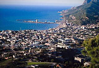
    Oran is a major coastal city located in the northwest of Algeria. It is considered the second most important city of Algeria, after the capital, Algiers, because of its population and commercial, industrial and cultural importance. It is 432 km (268 mi) west-southwest from Algiers. The total population of the city was 803,329 in 2008, while the metropolitan area has a population of approximately 1,500,000, making it the second-largest city in Algeria.

    <span class="mw-page-title-main">Tlemcen</span> City in Algeria

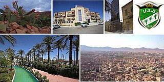
    Tlemcen is the second-largest city in northwestern Algeria after Oran and is the capital of Tlemcen Province. The city has developed leather, carpet, and textile industries, which it exports through the port of Rachgoun. It had a population of 140,158, as of the 2008 census.

    <span class="mw-page-title-main">Languages of Algeria</span>

    Arabic, particularly the Algerian Arabic dialect, is the most widely spoken language in Algeria, but a number of regional and foreign languages are also spoken. The official languages of Algeria are Arabic and Berber, as specified in its constitution since 1963 for the former and since 2016 for the latter. Berber has been recognized as a "national language" by constitutional amendment since 8 May 2002. In February 2016, a constitutional resolution was passed making Berber an official language alongside Arabic. Arabic is spoken by about 81% of Algerians, while Berber languages are spoken by 27%. French, though it has no official status, is still used in media and education due to Algeria's colonial history. Kabyle, with 3 million speakers, is the most spoken Berber language in the country, is taught and partially co-official in parts of Kabylie.

    <span class="mw-page-title-main">Mers El Kébir</span> Municipality in Oran, Algeria

    Mers El Kébir is a port on the Mediterranean Sea, near Oran in Oran Province, northwest Algeria. It is famous for the attack on the French fleet in 1940, in the Second World War.

    <span class="mw-page-title-main">Biskra</span> City in Biskra Province, Algeria

    Biskra is the capital city of Biskra Province, Algeria. In 2007, its population was recorded as 307,987. Biskra is located in northeastern Algeria, about 248 miles (399 km) from Algiers, 71 miles (114 km) southwest of Batna and 137 miles (220 km) north of Touggourt. It is nicknamed "The Queen of the Zibans", "The Door of the Desert" or "The Saharan Nice" because of its location at the beginning of the Sahara Desert. Due to its geographical location, its climate and natural resources, particularly farming, Biskra has always been a crossroad between the cities in the north and south. It has seen the passage of several civilizations, from the Romans and the Arabs to the French.

    <span class="mw-page-title-main">Béjaïa</span> City and commune in Béjaïa Province, Algeria

    Béjaïa formerly Bougie and Bugia, is a Mediterranean port city and commune on the Gulf of Béjaïa in Algeria; it is the capital of Béjaïa Province.

    <span class="mw-page-title-main">Oran Province</span> Province of Algeria

    Oran Province is a province (wilayah) in Algeria whose seat is the city of the same name.

    <span class="mw-page-title-main">Kabyle people</span> Berber ethnic group

    The Kabyle people are a Berber ethnic group indigenous to Kabylia in the north of Algeria, spread across the Atlas Mountains, 160 kilometres (100 mi) east of Algiers. They represent the largest Berber population of Algeria and the second largest in North Africa.

    <span class="mw-page-title-main">Ténès</span> Place in Chlef Province, Algeria

    Ténès is a town in Algeria located around 200 kilometers west of the capital Algiers. As of 2000, it has a population of 65,000 people.

    <span class="mw-page-title-main">Chetaïbi</span> City in Annaba, Algeria

    Chetaïbi is a small fishing port in Annaba Province, Algeria located on a peninsula west of Annaba.

    <span class="mw-page-title-main">Berber calendar</span> Agricultural calendar traditionally used by Berbers

    The Berber calendar is the agricultural calendar traditionally used by Berbers. The calendar is utilized to regulate the seasonal agricultural works.

    <span class="mw-page-title-main">Rusadir</span> Ancient Punic and Roman town

    Rusadir was an ancient Punic and Roman town at what is now Melilla, Spain, in northwest Africa. Under the Roman Empire, it was a colony in the province of Mauretania Tingitana.

    <span class="mw-page-title-main">French conquest of Algeria</span> Conquest of Algeria by France, 1830-1903

    The French conquest of Algeria took place between 1830 and 1903. In 1827, an argument between Hussein Dey, the ruler of the Regency of Algiers, and the French consul escalated into a blockade, following which the July Monarchy of France invaded and quickly seized Algiers in 1830, and seized other coastal communities. Amid internal political strife in France, decisions were repeatedly taken to retain control of the territory, and additional military forces were brought in over the following years to quell resistance in the interior of the country.

    <span class="mw-page-title-main">Bethioua</span>

    Bethioua, formerly Arsenaria, Portus Magnus, Arzew, Vieil Arzew, and Saint Leu, is a port town and district near Arzew in Oran Province in northwestern Algeria. It has a gas port, petrochemical facilities and desalination plant.

    <span class="mw-page-title-main">Mers El Hadjadj</span> Commune and town in Oran Province, Algeria

    Mers El Hadjadj is a town and commune in mascara Province, Algeria. According to the 1998 census it has a population of 14,167.

    <span class="mw-page-title-main">Pacification of Algeria</span> Series of military operations after the French conquest of the Regency of Algiers

    The pacification of Algeria, also known as the Algerian genocide, refers to violent military operations between 1830 to 1875 during the French conquest of Algeria, that often involved ethnic cleansing, massacres and forced displacement, aimed at repressing various tribal rebellions by the native Algerian population. Out of an estimated population of 3 million, between 500,000 and 1 million Algerians were killed. During this period, France formally annexed Algeria in 1834, and approximately 1 million European settlers moved to the Algerian colony. Various governments and scholars consider France's actions in Algeria as constituting a genocide.

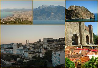
    The following is a timeline of the history of the city of Oran, Algeria.

    <span class="mw-page-title-main">Roman colonies in North Africa</span>

    Roman colonies in North Africa are the cities—populated by Roman citizens—created in North Africa by the Roman Empire, mainly in the period between the reigns of Augustus and Trajan.

    <span class="mw-page-title-main">Portus Magnus, Algeria</span>

    Portus Magnus was a Roman port and colony in western Mauretania Caesariensis near Portus Divinus. Its ruins are now under and around Bethioua in Algeria's Oran Province. In the early modern period, Bethioua still housed several notable Roman mosaics and other artwork, most of which have since been removed to the museum at the provincial capital Oran.

    References

    Citations
    1. 1 2 Pliny, Nat. Hist. , Book V, Ch. 1.
    2. "Arzew", Wikipédia (in French), 2023-07-09, retrieved 2023-11-10
    3. "Arzew", Wikipédia (in French), 2023-07-09, retrieved 2023-11-10
    4. Frédéric Guelton: The French Army 'Centre for Training and Preparation in Counter-Guerrilla Warfare' (CIPCG) at Arzew, Journal of Strategic Studies, vol. 22:2 (2002), pp.35-55.
    5. populstat.info Archived 2016-03-03 at the Wayback Machine
    6. Les Actualités Françaises (1950-08-31). "PROCESSION DE LA VIERGE DANS LES RUES ET DANS LA RADE D'ARZEW". INA. Retrieved 2010-01-03.
    General