
The Arctic Archipelago, also known as the Canadian Arctic Archipelago, is a group of islands north of the Canadian mainland.

Seamill is a village in North Ayrshire on the west coast of Scotland, about 5 miles north of Ardrossan and 8 miles south of Largs, on the east coast of the Firth of Clyde.

Dengkil is a mukim in Sepang District, Selangor, Malaysia.
George's Cove Labrador, is located on the north shore of Granby Island. The first postmaster was Berton Henry Penney.
Templenoe is a settlement in County Kerry, Ireland. It is situated four miles from Kenmare, on the N70 road to Sneem, which forms part of the Ring of Kerry.

Milam Township was a civil township in Macon County, Illinois. The population was 95 at the 2000 census. In 2009, it was merged into Mount Zion Township.
Las Omañas is a municipality located in the province of León, Castile and León, Spain. According to the 2004 census (INE), the municipality has a population of 382.
Berlangas de Roa is a municipality and town located in the province of Burgos, Castile and León, Spain. According to the 2004 census (INE), the municipality has a population of 226 inhabitants.
Neukloster-Warin is an Amt in the district of Nordwestmecklenburg, in Mecklenburg-Vorpommern, Germany. The seat of the Amt is in Neukloster.

The Zeppelin LZ 13 Hansa was a German civilian rigid airship first flown in 1912. It was built for DELAG to carry passengers and post and flew the first international passenger flight, visiting Denmark and Sweden in September 1912. In 1913 it was hired to the Imperial German Navy as a training craft, and at the outbreak of World War I it was requisitioned by the German military who used it for bombing, reconnaissance, and finally as a training airship.

Ochrymy is a village in the administrative district of Gmina Narewka, within Hajnówka County, Podlaskie Voivodeship, in north-eastern Poland, close to the border with Belarus. It lies approximately 7 kilometres (4 mi) north-west of Narewka, 17 km (11 mi) north-east of Hajnówka, and 45 km (28 mi) south-east of the regional capital Białystok.
This is a list of the extreme points and extreme elevations in Scotland.
The Findlay Group is a group of islands in the Canadian Arctic Archipelago in Qikiqtaaluk Region, Nunavut. This Arctic Ocean group consists of Lougheed Island, Stupart Island, Edmund Walker Island, Grosvenor Island and Patterson Island.
Paripiranga is a municipality in the state of Bahia in the Northeast Region of Brazil.
Mezőnyárád is a village in Borsod-Abaúj-Zemplén County in northeastern Hungary.
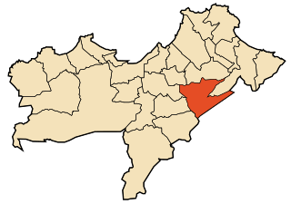
Boufatis is a town and commune in Oran Province, Algeria. According to the 1998 census it has a population of 9906.
Srirangam Island is a river island situated within the city of Tiruchirappalli in Tamil Nadu, India. It is formed by the river Kaveri and the Kollidam, a tributary of the Kaveri. The island is 19 miles (31 km) in length and 1.5 miles (2.4 km) wide. It is bounded by the Upper Anaicut to the west and the Grand Anaicut to the east. The town of Srirangam, a prominent Hindu Vaishnavite pilgrimage centre, is located at the centre of this island.
Ouled Bessem is a town and commune in Tissemsilt Province in northern Algeria.


