European route E19 is a 551-kilometre (342 mi) long European route. It connects the Netherlands to France via Belgium. The E19 is the busiest road in Europe. Among the places included in its itinerary are:
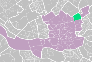
Ommoord is a neighbourhood in the former borough Prins Alexander, part of the municipality of Rotterdam, South Holland, the Netherlands. Ommoord is surrounded by the neighbourhoods Zevenkamp, Het Lage Land and Terbregge. It has around 25,000 inhabitants across 12,500 households. Ommoord shares postal codes 3068 and 3069 with Zevenkamp.

The A16 road is a principal road of Lincolnshire in the East Midlands region of England, connecting the port of Grimsby and Peterborough, where it meets the A1175, A47 & A1139 then on to the A1 and the A605; the latter, in turn, giving a through route to Northampton and the west, and south west of England. Its length is 78 miles (126 km). The road was "de-trunked", with responsibility largely returned to Lincolnshire County Council from the Highways Agency in 2002.

Bundesautobahn 61 is an autobahn in Germany that connects the border to the Netherlands near Venlo in the northwest to the interchange with A 6 near Hockenheim. In 1965, this required a redesign of the Hockenheimring.

The autoroute system in France consists largely of toll roads. It is a network of 11,882 km (7,383 mi) of motorways as of 2014. On road signs, autoroute destinations are shown in blue, while destinations reached through a combination of autoroutes are shown with an added autoroute logo. Toll autoroutes are signalled with the word péage.

The A18 is a road in England that links Doncaster in South Yorkshire with Ludborough in Lincolnshire, via Scunthorpe and Grimsby. Much of its route has been superseded by the M180 motorway.

Adinkerke is a village in the municipality of De Panne in western Belgium close to the French border. It forms a conurbation with the coastal town of De Panne, which in turn is part of the west Belgian coastal conurbation. Adinkerke railway station is also the western terminus of the Belgian coast tram line to De Panne; Nieuwpoort, Ostend and beyond. Near the city is Plopsaland, formerly Meli Park.

The A26 is a 357.6 km (222.2 mi) long French motorway connecting Calais and Troyes. It is also known as the Autoroute des Anglais as its length forms the first part of the main route from the Dover-Calais ferries and the Channel Tunnel towards Southern and Eastern France and the Cote d'Azur. The motorway is used by a high proportion of British cars, particularly during the summer holiday season. The A26 between Calais and Arras is part of one of the two main routes between London and Paris, the other being the A16.

The A16 autoroute – also known as L'Européenne and forming between Abbeville and Dunkirk a part of the larger Autoroute des estuaires – is a motorway in northern France.
The Route nationale 1 is a trunk road (nationale) in France between Paris and Calais. It is approximately 339 km (211 mi) long.

The A13 motorway is a motorway in the Netherlands, connecting the cities of The Hague and Rotterdam. The Rotterdam The Hague Airport is located next to the A13.

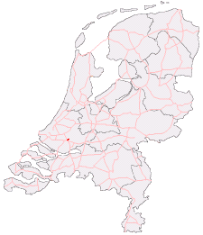
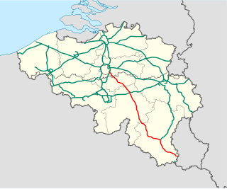
The A16 motorway is a motorway in the Netherlands. It runs from the interchange Terbregseplein in the northeastern part of Rotterdam, towards the Belgian border near Hazeldonk. The motorway has 19 exits including 7 interchanges.
The A38 motorway is a motorway in the Netherlands. With a total length of just 1.5 kilometers, it is one of the shortest motorways in the Netherlands.

The Autostrada A16 or Autostrada dei Due Mari is an autostrada 172.5 kilometres (107.2 mi) long in Italy located in the regions of Campania and Apulia connecting Naples to Canosa di Puglia, before merging with the Autostrada A14.

The A16, a motorway in north-central Switzerland, is a divided freeway connecting the border to France to the A5 motorway, 84 kilometres (52 mi) to the south on the Swiss plateau.
The A4 is a Belgian motorway connecting Brussels and the A6 in Luxembourg. The motorway is part of E411 between Brussels and Arlon. This motorway, the longest of Belgium (188 km), is also nicknamed the "Autoroute de la Nouvelle Belgique" as opposed to the structuring axis Liège-Tournai. Indeed, the A4 connects rapidly developing centers such as Brussels and the city of Luxembourg, and it crosses economic zones full of vitality: the south-eastern suburbs of Brussels, Walloon Brabant and in particular Ottignies-Louvain-la-Neuve, Namur the new capital of Wallonia since 1986, and the country of Arlon.
Terbregge is a neighborhood of Rotterdam, Netherlands.