Abana, Kastamonu

Last updated
Abana
Turkey adm location map.svg
Red pog.svg
Abana
Location in Turkey
Coordinates: 41°58′33″N34°00′41″E / 41.97583°N 34.01139°E / 41.97583; 34.01139
Country Turkey
Province Kastamonu
District Abana
Government
  MayorSeda OYAR (AKP)
Elevation
10 m (30 ft)
Population
 (2021) [1]
3,317
Time zone UTC+3 (TRT)
Area code 0366
Climate Cfa
Website www.abana.bel.tr

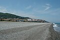
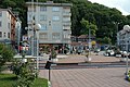
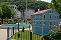
Abana is a town in the Kastamonu Province in the Black Sea region of Turkey. It is in the north-eastern part of the province, on the shore of the Black Sea. It is the seat of Abana District. [2] Its population is 3,317 (2021). [1]

Contents

History

Abana is the oldest town of Kastamonu,[ citation needed ] once a part of Paphlagonia, the town was ruled by the Danishmends, the Seljuk Turks, the Jandarid dynasty, and finally Ottomans. It was made a district of the Kastamonu province in 1945. The name might be connected to “Άβώνου τείχος”, Avonou Teichos, in greek.

Transportation

Abana can be easily reached from Kastamonu via Devrakani and Bozkurt.

References

  1. 1 2 "Address-based population registration system (ADNKS) results dated 31 December 2021" (XLS) (in Turkish). TÜİK . Retrieved 1 March 2023.
  2. İlçe Belediyesi Archived 2015-07-06 at the Wayback Machine , Turkey Civil Administration Departments Inventory. Retrieved 1 March 2023.