
Kuwait is a country in West Asia, bordering the Persian Gulf, between Iraq and Saudi Arabia. Kuwait is located at the far northwestern corner of the Persian Gulf. Kuwait is 17,820 square kilometres in size. At its most distant points, it is about 200 km (120 mi) north to south, and 170 km (110 mi) east to west. Kuwait has 10 islands. Kuwait's area consists mostly of desert.

Kuwait has a petroleum-based economy that is classified as emerging and high-income. By various per-capita measures of economic output, Kuwait is one of the wealthiest countries in the world.

Salem is the capital city of the U.S. state of Oregon, and the county seat of Marion County. It is located in the center of the Willamette Valley alongside the Willamette River, which runs north through the city. The river forms the boundary between Marion and Polk counties, and the city neighborhood of West Salem is in Polk County. Salem was founded in 1842, became the capital of the Oregon Territory in 1851, and was incorporated in 1857.

Arturo Merino Benítez International Airport, also known as Santiago International Airport and Nuevo Pudahuel Airport, located in Pudahuel, 15 km (9.3 mi) north-west of central Santiago, is Chile's largest aviation facility and busiest international airport.

Salem is the county seat of Fulton County, Arkansas, United States. Salem was first incorporated in 1900. As of the 2010 census the population stood at 1,635.

Winston-Salem is a city in and the county seat of Forsyth County, North Carolina, United States. At the 2020 census, the population was 249,545, making it the fifth-most populous city in North Carolina and the 91st-most populous city in the United States. The population of the Winston-Salem metropolitan area was estimated to be 695,630 in 2023. It is the second-most populous city in North Carolina's Piedmont Triad region, home to about 1.7 million residents.
Salem is a city in Harrison County, West Virginia, United States. The population was 1,485 at the 2020 census. It is located at the junction of U.S. Route 50 and West Virginia Route 23; the North Bend Rail Trail passes through the city. Salem University is located in Salem.

The Syrian Desert, also known as the North Arabian Desert, the Jordanian steppe, or the Badiya, is a region of desert, semi-desert, and steppe, covering about 500,000 square kilometers of West Asia, including parts of northern Saudi Arabia, eastern Jordan, southern Syria, and western Iraq. It accounts for about 85% of the land area of Jordan and 55% of Syria. To the south, it borders and merges into the Arabian Desert. The land is open, rocky or gravelly desert pavement, cut with occasional wadis, or river valleys, generally dry riverbeds.

Allegheny Center is a neighborhood on Pittsburgh's North Side. Its zip code is 15212, and it has representation on Pittsburgh City Council by both council members for District 6 and District 1 (Northside).
Sabah Al-Salem is an area in the Mubarak Al-Kabeer Governorate of Kuwait. As of 2022, its population is 139,163, spread out over 13 blocks. Sabah Al-Salem is an area of mixed development with residential, commercial, educational and entertainment facilities.

Bidhannagar, also known as Salt Lake City is a city and a municipal corporation of North 24 Parganas district in the Indian state of West Bengal. It is the headquarters of the Bidhannagar subdivision. It is a part of the area covered by Kolkata Metropolitan Development Authority (KMDA) and is located on the north-east side of Kolkata.
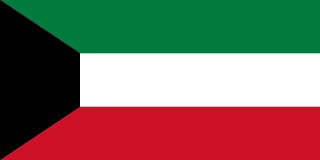
Kuwait, officially the State of Kuwait, is a country in West Asia and the geopolitical region known as the Middle East. It is situated in the northern edge of the Arabian Peninsula at the head of the Persian Gulf, bordering Iraq to the north and Saudi Arabia to the south. With a coastline of approximately 500 km (311 mi), Kuwait also shares a maritime border with Iran, across the Persian Gulf. Most of the country's population reside in the urban agglomeration of Kuwait City, the capital and largest city. As of 2024, Kuwait has a population of 4.82 million, of which 1.53 million are Kuwaiti citizens while the remaining 3.29 million are foreign nationals from over 100 countries. Kuwait has the third largest foreign-born population in the world.
Bnaid Al-Gar is an area in the Capital Governorate of Kuwait and an immediate suburb of Kuwait City. It has a total area of approximately 1,320,220 square metres. The area is served by many main roads in Kuwait, including Gulf Road, Independence Road, and Kuwait's 2nd Ring Road with easy access to the 1st Ring Road.
Adailiya is an area and a suburb of Kuwait City; it is located in the Capital Governorate in Kuwait. It had a population of 21,996 in 2022. Adailiya houses a campus of Kuwait's Public Authority for Applied Education and Training (PAAET) and, temporarily, the colleges of Architecture and Life Sciences at Kuwait University as well as the Kazma Sport Club and religious, cultural, and commercial places. It also has a Water Towers Park.
Khalidiya is an area in Kuwait City; it is located in the governorate of Al Asimah in Kuwait.

El Chal is a pre-Columbian Maya archaeological site located in the upper San Juan River valley of the southeastern Petén Basin region, Guatemala. The site is situated in the municipality of El Chal, lying some 600 metres (2,000 ft) to the south of the municipal seat also called El Chal.
The 2012 WAFF Championship was the 7th WAFF Championship, an international tournament for member nations of the West Asian Football Federation. It was hosted by Kuwait from 8 to 20 December 2012. The defending champions were Kuwait. However, they did not get past the group stage. The tournament was won by Syria for the first time.

Yagan Square is a public space and a component of the Perth City Link in Perth, Western Australia. It is situated between the Horseshoe Bridge and the Perth Busport in the eastern part of the Perth City Link precinct, occupying 1.1 hectares. Construction of the square began in February 2016, and it was opened on 3 March 2018. It is named after the Aboriginal warrior Yagan.

Kuwait is divided into six governorates, and in each there are several areas. They are much less commonly called by other names such as districts or towns. However, they are commonly known inside the English-speaking community in Kuwait and are officially translated to as areas. The Arabic word for area, Mintaqah, means both area and region. Areas are further sub-divided into blocks, each of which is referred by a number. All blocks are divided into streetsšāriʿ. Then some areas may be further sub-divided into Jadda, which is translated to avenue or lane.

Rawda is an area located within the Capital Governorate of Kuwait and is considered a suburb of Kuwait's capital city, Kuwait City. It comprises five residential blocks. The area is served by the Rawda and Hawally Cooperative Society. It neighbors five other areas. Going clockwise, they are Adailiya, Nuzha, Hawally, and Surra. The area falls between, and is served by, Kuwait's 3rd Ring Road and 4th Ring Road from east to west. Kuwait's Route 40 located to the east of the area, and serves it from the north to the south.
